Map of Pomeroy city, Washington
Pomeroy is a city in Garfield County, Washington, United States. The population was 1,425 at the 2010 census. It is the county seat of and only incorporated city in Garfield County. Pomeroy city overview: Name: Pomeroy city LSAD Code: 25 LSAD Description: city (suffix) State: Washington County: Garfield County Elevation: 1,857 ft (566 m) Total Area: 1.78 sq mi ... Read more
Map of Pomeroy city, Washington
Map of Outlook CDP, Washington
Outlook is a census-designated place and unincorporated community in Yakima County, Washington, United States. Outlook is located along Interstate 82 and U.S. Route 12 4 miles (6.4 km) west of Sunnyside. Outlook has a post office with ZIP code 98938. Outlook CDP overview: Name: Outlook CDP LSAD Code: 57 LSAD Description: CDP (suffix) State: Washington County: ... Read more
Map of Outlook CDP, Washington
Map of Point Roberts CDP
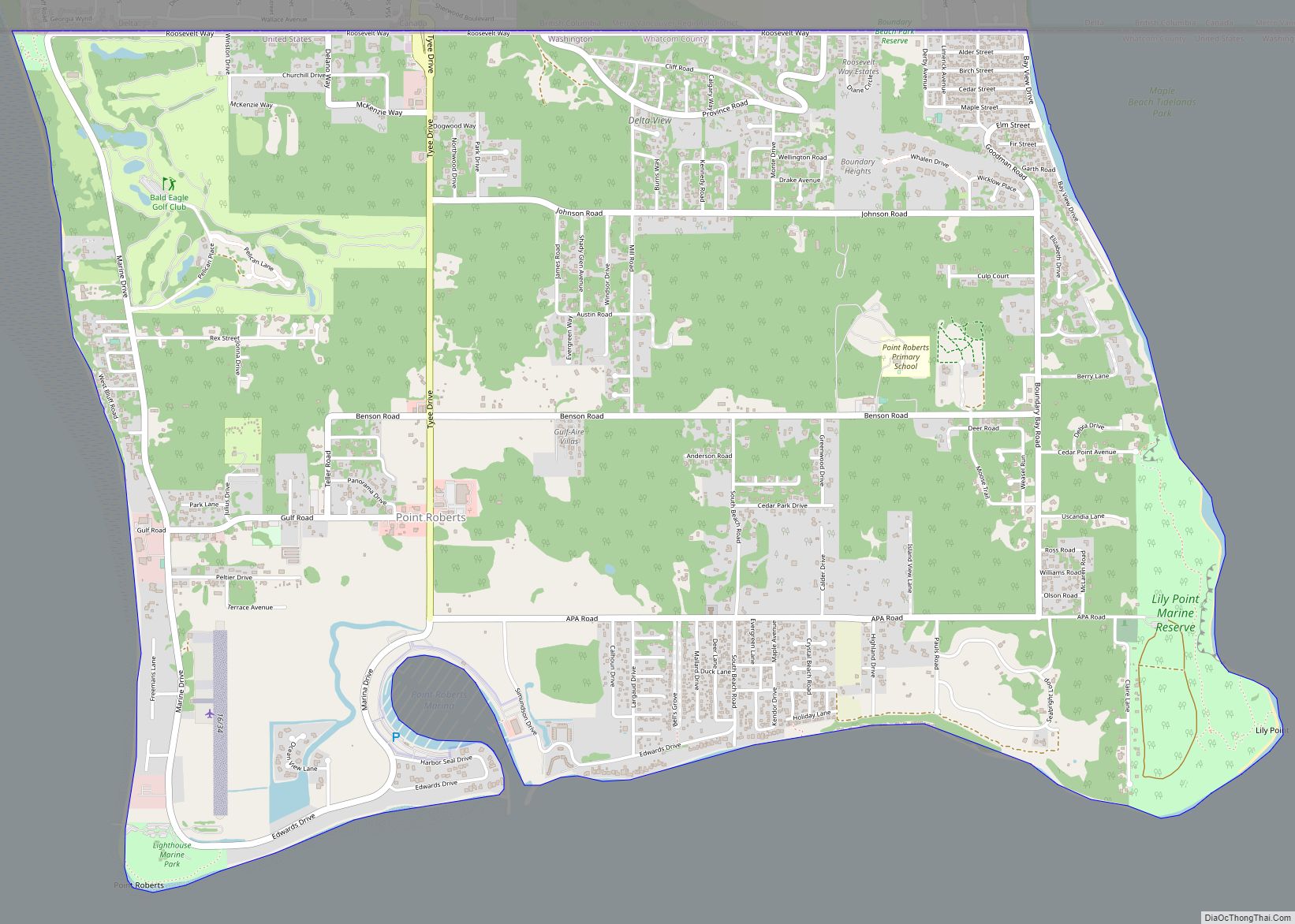
Point Roberts is a pene-exclave of Washington on the southernmost tip of the Tsawwassen peninsula, south of Vancouver, British Columbia. The area, which had a population of 1,191 at the 2020 census, is reached by land from the rest of the United States by traveling 25 mi (40 km) through Canada. It is a census-designated place in ... Read more
Map of Point Roberts CDP
Map of Otis Orchards-East Farms CDP
Otis Orchards-East Farms is a census-designated place (CDP) in Spokane County, Washington, United States, near the county’s border with Idaho. The population was 6,299 at the 2020 census. The CDP includes the unincorporated communities of Otis Orchards and East Farms. Otis Orchards contains the bulk of the businesses of the community. Otis Orchards-East Farms is ... Read more
Map of Otis Orchards-East Farms CDP
Map of Pine Grove CDP, Washington
Pine Grove is a census-designated place located in Ferry County, Washington, United States. Pine Grove CDP overview: Name: Pine Grove CDP LSAD Code: 57 LSAD Description: CDP (suffix) State: Washington County: Ferry County Elevation: 2,579 ft (786 m) Total Area: 0.49 sq mi (1.27 km²) Land Area: 0.49 sq mi (1.27 km²) Water Area: 0.0 sq mi (0.0 km²) Total Population: 145 Population Density: 300/sq mi (110/km²) ... Read more
Map of Pine Grove CDP, Washington
Map of Picnic Point CDP
Picnic Point is a census-designated place (CDP) located in Snohomish County, Washington. The population was 8,809 at the 2010 census. It was formerly part of the Picnic Point-North Lynnwood CDP. Picnic Point CDP overview: Name: Picnic Point CDP LSAD Code: 57 LSAD Description: CDP (suffix) State: Washington County: Snohomish County Elevation: 79 ft (24 m) Total Area: ... Read more
Map of Picnic Point CDP
Map of Peaceful Valley CDP
Peaceful Valley is a census-designated place (CDP) in Whatcom County, Washington, United States, near Kendall. The population was 3,324 at the 2010 census. Peaceful Valley CDP overview: Name: Peaceful Valley CDP LSAD Code: 57 LSAD Description: CDP (suffix) State: Washington County: Whatcom County Total Area: 17.0 sq mi (44.0 km²) Land Area: 16.9 sq mi (43.9 km²) Water Area: 0.0 sq mi (0.1 km²) ... Read more
Map of Peaceful Valley CDP
Map of Prairie Ridge CDP
Prairie Ridge is a census-designated place (CDP) in Pierce County, Washington, United States. The population was 12,288 at the 2020 census. Prairie Ridge CDP overview: Name: Prairie Ridge CDP LSAD Code: 57 LSAD Description: CDP (suffix) State: Washington County: Pierce County Elevation: 686 ft (209 m) Total Area: 4.3 sq mi (11.1 km²) Land Area: 4.3 sq mi (11.0 km²) Water Area: 0.0 sq mi ... Read more
Map of Prairie Ridge CDP
Map of Prairie Heights CDP
Prairie Heights is a census-designated place (CDP) located in Pierce County, Washington. Prairie Heights CDP overview: Name: Prairie Heights CDP LSAD Code: 57 LSAD Description: CDP (suffix) State: Washington County: Pierce County Elevation: 666 ft (203 m) Total Area: 3.74 sq mi (9.7 km²) Total Population: 4,405 Population Density: 1,200/sq mi (450/km²) Area code: 360 FIPS code: 5356150 Online Interactive Map ... Read more
Map of Prairie Heights CDP
Map of Poulsbo city
Poulsbo (/ˈpɔːlzboʊ/ PAWLZ-boh) is a city on Liberty Bay in Kitsap County, Washington, United States. It is the smallest of the four cities in Kitsap County. The population was 9,200 at the 2010 census and an estimated 10,927 in 2018. The area was historically inhabited by the Suquamish people, many of whom moved to the ... Read more
Map of Poulsbo city
Map of Porter CDP, Washington
Porter is an unincorporated community and census-designated place (CDP) in Grays Harbor County, Washington, United States. The population was 207 at the 2010 census. Prior to 2010 it was part of the Malone-Porter CDP; Malone and Porter are now separate CDPs. They are located just off U.S. Route 12, southeast of Elma and northwest of ... Read more
Map of Porter CDP, Washington
Map of Port Townsend city
Port Townsend /ˈtaʊnzənd/ is a city on the Quimper Peninsula in Jefferson County, Washington, United States. The population was 10,148 at the 2020 United States Census. It is the county seat and only incorporated city of Jefferson County. In addition to its natural scenery at the northeast tip of the Olympic Peninsula, the city is ... Read more
Map of Port Townsend city