Pomeroy is a city in Garfield County, Washington, United States. The population was 1,425 at the 2010 census. It is the county seat of and only incorporated city in Garfield County.
| Name: | Pomeroy city |
|---|---|
| LSAD Code: | 25 |
| LSAD Description: | city (suffix) |
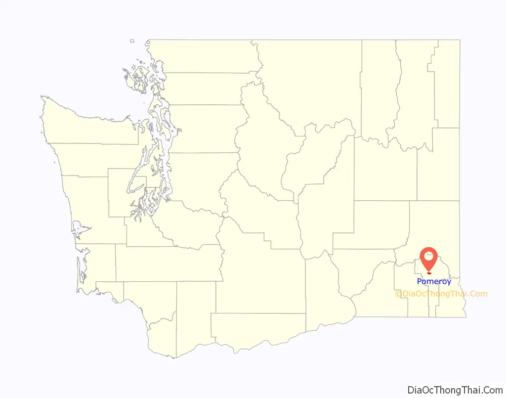
| State: | Washington |
| County: | Garfield County |
| Elevation: | 1,857 ft (566 m) |
| Total Area: | 1.78 sq mi (4.60 km²) |
| Land Area: | 1.78 sq mi (4.60 km²) |
| Water Area: | 0.00 sq mi (0.00 km²) |
| Total Population: | 1,425 |
| Population Density: | 785.47/sq mi (303.21/km²) |
| ZIP code: | 99347 |
| Area code: | 509 |
| FIPS code: | 5355120 |
| GNISfeature ID: | 1512575 |
| Website: | cityofpomeroy1.com |
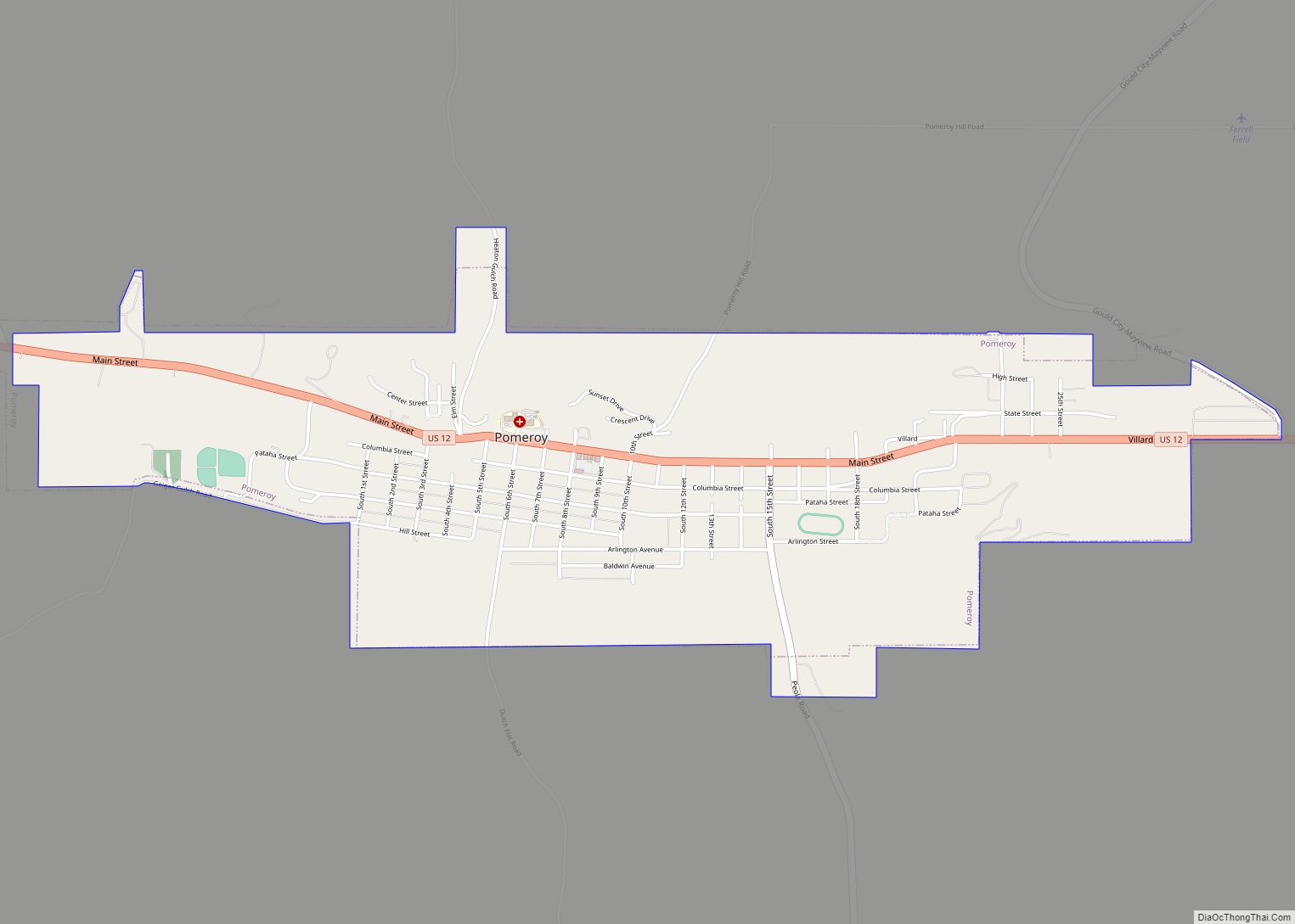
Online Interactive Map
Click on ![]() to view map in "full screen" mode.
to view map in "full screen" mode.
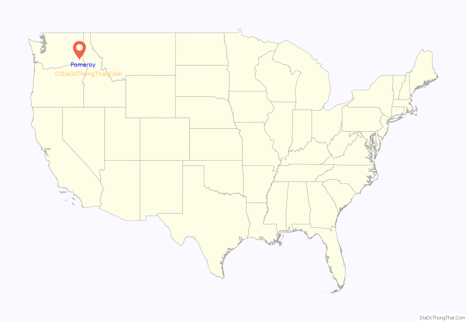
Pomeroy location map. Where is Pomeroy city?
History
The Nez Perce trail existed in the area before history was recorded, and the first written record of caucasians passing through the area were Lewis and Clark in 1805. Captain Benjamin Bonneville also passed through the future site of the town while he was surveying for the US government in 1834. In 1860, an Irish settler named Parson Quinn settled just east of present-day Pomeroy, and lived there for the next 40 years. Rancher Joseph M. Pomeroy purchased the land in 1864, and platted the town’s site in May 1878.
Pomeroy was officially incorporated on February 3, 1886. The town has been the seat of Garfield County since 1882, despite fierce competition in the 1880s with neighboring towns Pataha and Asotin. The county was split in October 1883, and the city of Asotin was named the county seat of the new Asotin County, Washington, leaving the debate about Pomeroy’s status as county seat for Garfield County to continue. The debate continued through both houses of the Washington Territorial Legislature in for the remainder of 1883 to Governor William A. Newell of the Washington Territory, and eventually reached the United States Congress in 1884.
On July 18, 1900 (despite a city ordinance which mandated fire-proof materials for downtown buildings; there had been fires in 1890 and 1898 as well) fire destroyed half of the small town’s business district. The recovery took two years as the destroyed buildings were rebuilt using brick – a building boom for the small community. In 1912, the City voted to outlaw the manufacture or sale of alcohol. This prohibition quickly led to rampant bootlegging and corruption which lasted until the 21st Amendment passed in 1933.
On August 21, 2003, following efforts by the Pomeroy Historic Committee, a 10-block section of Pomeroy’s downtown was placed on the National Historic Register.
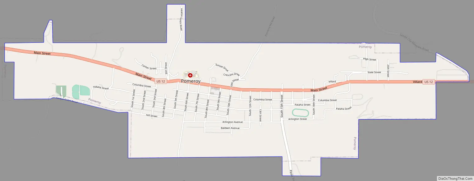
Pomeroy Road Map
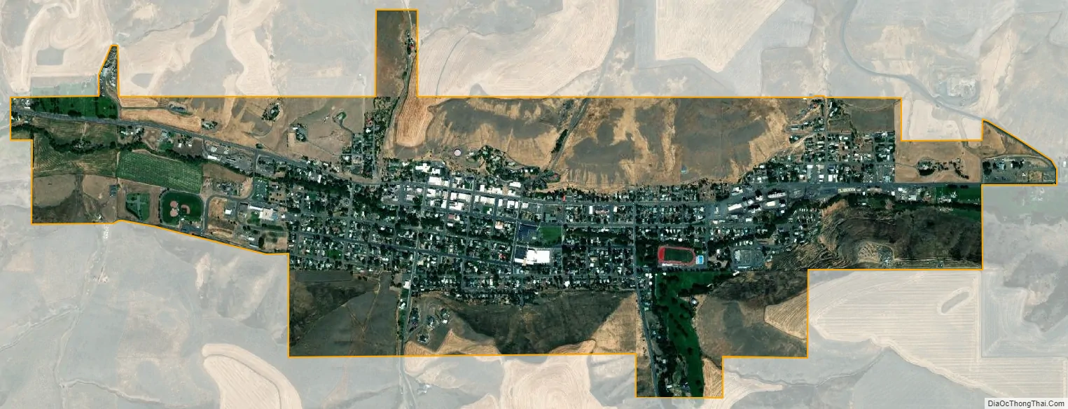
Pomeroy city Satellite Map
Geography
Pomeroy is located at 46°28′24″N 117°35′53″W / 46.47333°N 117.59806°W / 46.47333; -117.59806 (46.473334, -117.598119).
According to the United States Census Bureau, the city has a total area of 1.78 square miles (4.61 km), all of it land.
U.S. Route 12 in Washington serves as the primary highway through town, connecting Pomeroy with the Lewiston–Clarkston metropolitan area (to the east) and the Tri-Cities metro area/Walla Walla area (to the west). The city is 1,857 ft above sea level in the very hilly region between the Blue Mountains (to the south) and the Palouse region (to the north). The primary highway through town passes over Alpowa Summit (2,785 ft) only a few miles east of town.
See also
Map of Washington State and its subdivision:- Adams
- Asotin
- Benton
- Chelan
- Clallam
- Clark
- Columbia
- Cowlitz
- Douglas
- Ferry
- Franklin
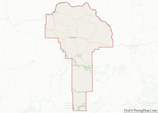
- Garfield
- Grant
- Grays Harbor
- Island
- Jefferson
- King
- Kitsap
- Kittitas
- Klickitat
- Lewis
- Lincoln
- Mason
- Okanogan
- Pacific
- Pend Oreille
- Pierce
- San Juan
- Skagit
- Skamania
- Snohomish
- Spokane
- Stevens
- Thurston
- Wahkiakum
- Walla Walla
- Whatcom
- Whitman
- Yakima
- Alabama
- Alaska
- Arizona
- Arkansas
- California
- Colorado
- Connecticut
- Delaware
- District of Columbia
- Florida
- Georgia
- Hawaii
- Idaho
- Illinois
- Indiana
- Iowa
- Kansas
- Kentucky
- Louisiana
- Maine
- Maryland
- Massachusetts
- Michigan
- Minnesota
- Mississippi
- Missouri
- Montana
- Nebraska
- Nevada
- New Hampshire
- New Jersey
- New Mexico
- New York
- North Carolina
- North Dakota
- Ohio
- Oklahoma
- Oregon
- Pennsylvania
- Rhode Island
- South Carolina
- South Dakota
- Tennessee
- Texas
- Utah
- Vermont
- Virginia
- Washington
- West Virginia
- Wisconsin
- Wyoming