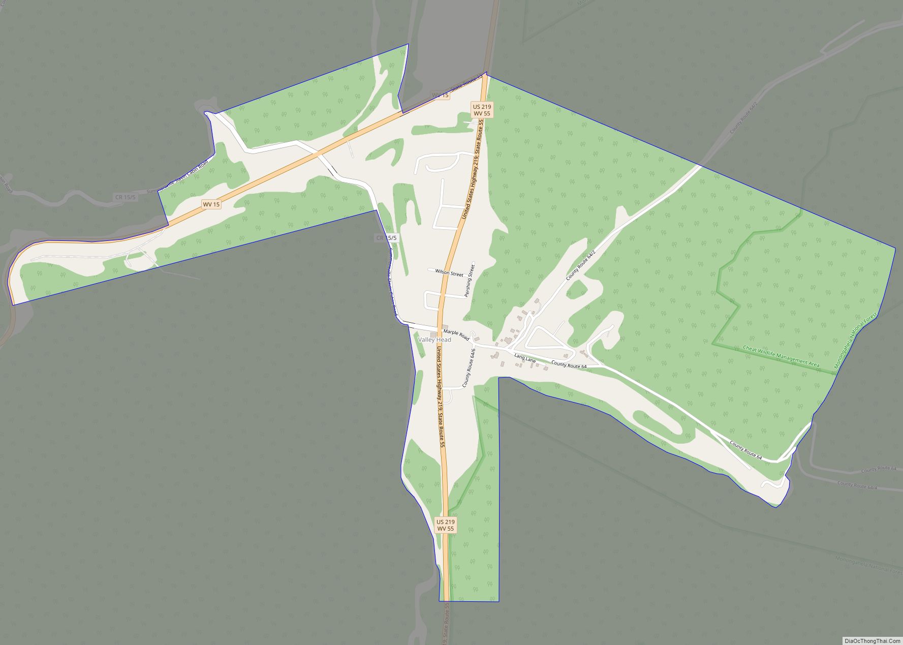
Map of Thomas city, West Virginia
Thomas is a city and former coal town in Tucker County, West Virginia, United States. The population was 623 at the 2020 census. Thomas city overview: Name: Thomas city LSAD Code: 25 LSAD Description: city (suffix) State: West Virginia County: Tucker County Elevation: 3,035 ft (925 m) Total Area: 4.51 sq mi (11.67 km²) Land Area: 4.46 sq mi (11.55 km²) Water Area: ... Read more
Map of Thomas city, West Virginia
Map of Wallace CDP, West Virginia
Wallace CDP overview: Name: Wallace CDP LSAD Code: 57 LSAD Description: CDP (suffix) State: West Virginia FIPS code: 5484172 Online Interactive Map Wallace online map. Source: Basemap layers from Google Map, Open Street Map (OSM), Arcgisonline, Wmflabs. Boundary Data from Database of Global Administrative Areas. Wallace location map. Where is Wallace CDP? Wallace Road Map ... Read more
Map of Wallace CDP, West Virginia
Map of Terra Alta town
Terra Alta is a town in eastern Preston County, West Virginia, United States. The population was 1,415 at the 2020 census. It is part of the Morgantown metropolitan area. Terra Alta town overview: Name: Terra Alta town LSAD Code: 43 LSAD Description: town (suffix) State: West Virginia County: Preston County Elevation: 2,582 ft (787 m) Total Area: ... Read more
Map of Terra Alta town
Map of Vivian CDP, West Virginia
Vivian is a census-designated place (CDP) in McDowell County, West Virginia, United States. Vivian is located along U.S. Route 52, 1 mile (1.6 km) southeast of Kimball. As of the 2010 census, its population was 82. An old variant name was Clausen. The Peerless Coal Company Store was listed on the National Register of Historic Places ... Read more
Map of Vivian CDP, West Virginia
Map of Verdunville CDP
Verdunville is an unincorporated community and census-designated place (CDP) in Logan County, West Virginia, United States. It is 3.5 miles (5.6 km) west of Logan, the county seat. Verdunville has a post office with ZIP code 25649. The Verdunville CDP includes the neighboring community of Shegon. As of the 2010 census, the total CDP population was ... Read more
Map of Verdunville CDP
Map of West Milford town
West Milford is a town in Harrison County, West Virginia, United States. The population was 452 at the 2020 census. West Milford was named on account of there being a mill on the ford of the West Fork River. West Milford town overview: Name: West Milford town LSAD Code: 43 LSAD Description: town (suffix) State: ... Read more
Map of West Milford town
Map of West Logan town
West Logan is a town along the Guyandotte River in Logan County, West Virginia, United States. The population was 400 at the 2020 census. For unknown reasons, some sources report West Logan to lay west of the county seat at Logan, attributing to this fact the name. West Logan town overview: Name: West Logan town ... Read more
Map of West Logan town
Map of West Liberty town, West Virginia
West Liberty is a town in Ohio County, West Virginia, United States. The population was 1,557 at the 2020 census. It is part of the Wheeling metropolitan area. West Liberty town overview: Name: West Liberty town LSAD Code: 43 LSAD Description: town (suffix) State: West Virginia County: Ohio County Elevation: 1,224 ft (373 m) Total Area: 1.09 sq mi ... Read more
Map of West Liberty town, West Virginia
Map of West Hamlin town
West Hamlin is a town in Lincoln County, West Virginia, United States, along the Guyandotte River. The population was 519 at the 2020 census, and is now down to 509, according to the 2021 census. West Hamlin is a part of the Huntington-Ashland, WV-KY-OH, Metropolitan Statistical Area (MSA). West Hamlin is west of the county ... Read more
Map of West Hamlin town
Map of Wellsburg city, West Virginia
Wellsburg is a city in and the county seat of Brooke County, West Virginia, United States. The 2020 census recorded a population of 2,455. It is a part of the Weirton–Steubenville metropolitan area. The city’s economy includes several telemarketing facilities, and a factory that does metal fabrication and plastics molding. Wellsburg city overview: Name: Wellsburg ... Read more
Map of Wellsburg city, West Virginia
Map of Windsor Heights village, West Virginia
Windsor Heights is a village in Brooke County, West Virginia, United States. It is part of the Wheeling, West Virginia Metropolitan Statistical Area. The population was 423 at the 2010 census. Grace Davis was the mayor as of June, 2017. Windsor Heights village overview: Name: Windsor Heights village LSAD Code: 47 LSAD Description: village (suffix) ... Read more
Map of Windsor Heights village, West Virginia
Map of Welch city, West Virginia
Welch is a city in and the county seat of McDowell County, West Virginia, United States. The population was 3,590 at the 2020 census, however the 2021 census estimate put the population at 1,914, due to the Federal Correctional Institution, McDowell leaving city limits. Welch was incorporated as a city in 1893. Welch city overview: ... Read more
Map of Welch city, West Virginia