Wayne is a town in and the county seat of Wayne County, West Virginia, United States. The population was 1,441 at the 2020 census. It is part of the Huntington–Ashland metropolitan area.
| Name: | Wayne town |
|---|---|
| LSAD Code: | 43 |
| LSAD Description: | town (suffix) |
| State: | West Virginia |
| County: | Wayne County |
| Elevation: | 696 ft (212 m) |
| Total Area: | 1.18 sq mi (3.06 km²) |
| Land Area: | 1.18 sq mi (3.06 km²) |
| Water Area: | 0.00 sq mi (0.00 km²) |
| Total Population: | 1,441 |
| Population Density: | 1,335.59/sq mi (515.66/km²) |
| ZIP code: | 25570 |
| Area code: | 304 |
| FIPS code: | 5484940 |
| GNISfeature ID: | 1548850 |
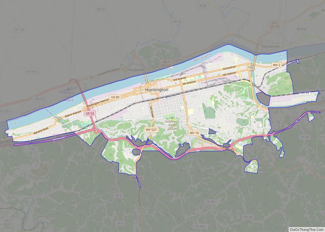
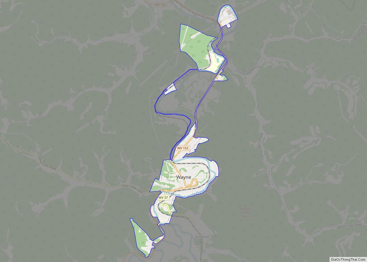
Online Interactive Map
Click on ![]() to view map in "full screen" mode.
to view map in "full screen" mode.
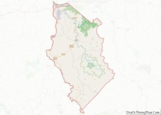
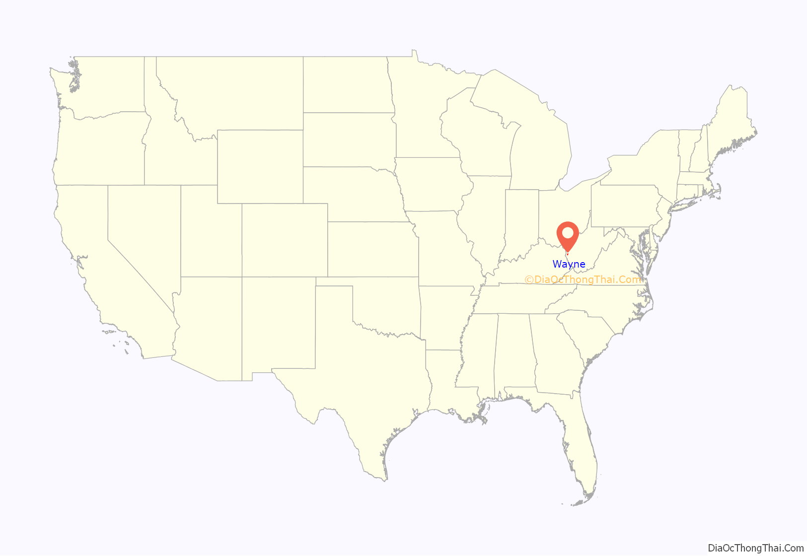
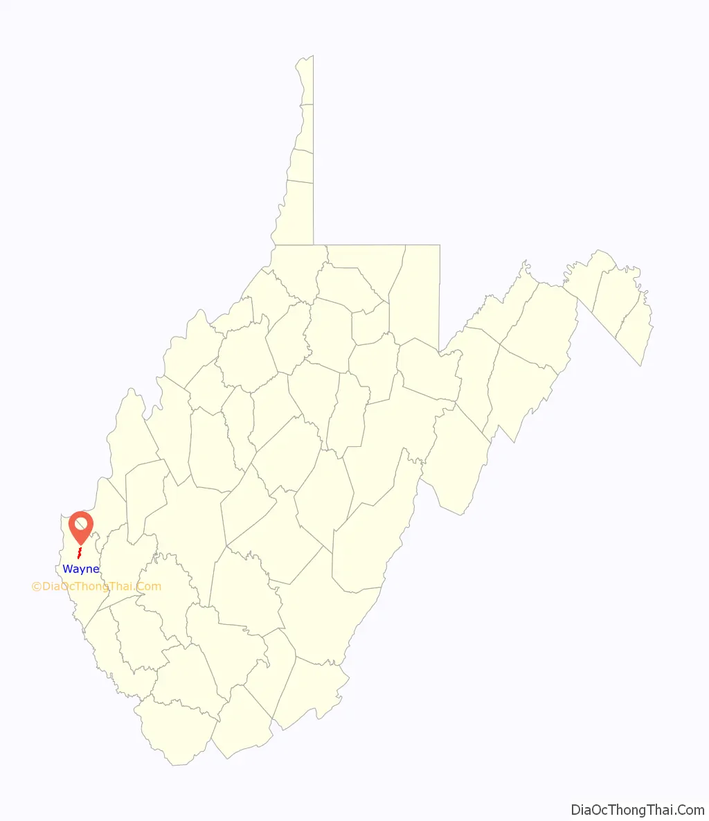
Wayne location map. Where is Wayne town?
History
Settlers arrived near the town of Wayne in the early 1800s. Abraham Trout began operating a mill where the town now stands in 1828 at a waterfall on Twelve Pole Creek. Later on, he built a mill dam.
By the 1830s, the population in western Cabell County was growing, and it became necessary to form a new county in the area. Initially, a group of men from the Big Sandy River attempted to get a county created in 1840 with the county seat at the forks of the Big Sandy River where present Fort Gay is now located but it failed. A year later, men from Twelve Pole began working toward a new county with the county seat near the forks of Twelve Pole Creek. They were successful, and the new county was established on January 18, 1842 and named after General Anthony Wayne.
The county seat was located on the farm of Abraham Trout, who donated land for the town square and government buildings. He then began dividing up the land around the square and selling it. The town was known as Trout’s Hill and Wayne Courthouse once a post office was established.
In 1860, it was incorporated and officially named Fairview, but the name was not very popular. Most still used the old names. In about 1860, a military unit called the Fairview Rifles was formed at Trout’s Hill and became part of the 8th Virginia Cavalry during the war.
When the Civil War erupted, celebration erupted in Trout’s Hill and the American flag was replaced by the Virginia flag. In late August 1861, a three-day skirmish raged in the streets of Trout’s Hill as Union troops from Ceredo tried to obtain the county records. The Union men camped in the courthouse, and local Rebels tried to force them out. Having accomplished their goal, the Yankees returned to Ceredo. Several more Union raids were launched against Trout’s Hill During the war.
After the war, Trout’s Hill was at the entrance to the vast timberlands and coal fields of southern Wayne County. The Norfolk & Western Railway built through the town in 1890 and established a station in town. Hearing the name Wayne Courthouse, the railroad shortened it to Wayne and the name has been used ever since. The name change was made official in 1911.
From the 1890s to the 1920s, the town of Wayne had to fight to keep the courthouse. The towns of Ceredo, Kenova and even Westmoreland wanted the county seat moved to their locations. During the courthouse wars, numerous buildings in the town of Wayne were burned including the courthouse in 1921. Much of the town, including the Wayne County Bank, was destroyed in 1905 when fire erupted during one of the most heated fights for the courthouse.
Wayne Road Map
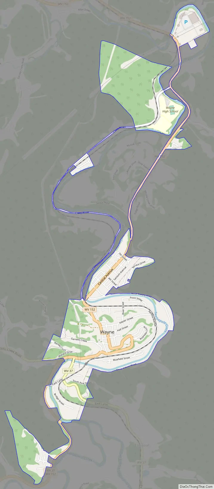
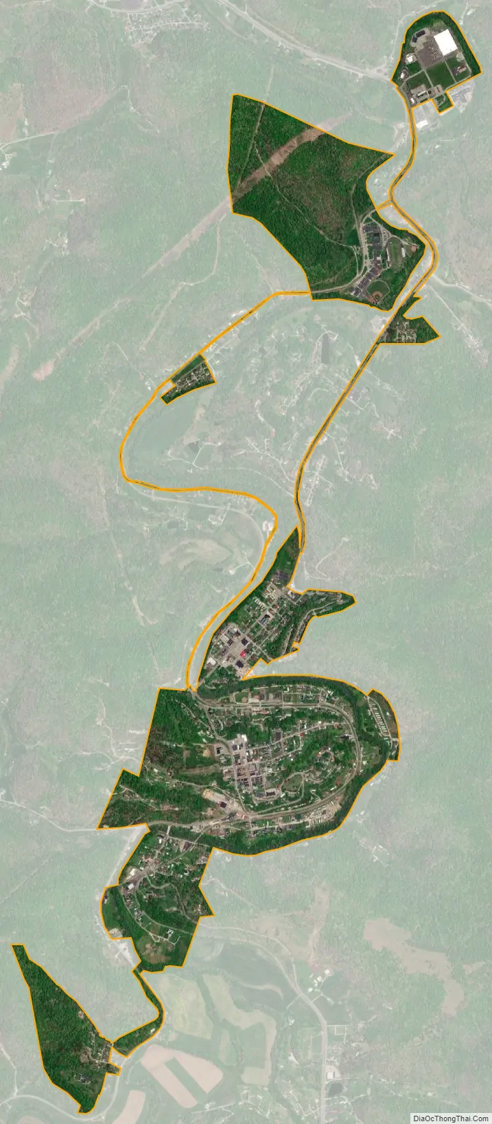
Wayne city Satellite Map
Geography
Wayne is located at 38°13′42″N 82°26′26″W / 38.22833°N 82.44056°W / 38.22833; -82.44056 (38.228417, -82.440577), along Twelvepole Creek, at an elevation of 707 feet (215 m).
According to the United States Census Bureau, the town has a total area of 0.72 square miles (1.86 km), all land.
Climate
The climate in this area is characterized by hot, humid summers and generally mild to cool winters. According to the Köppen Climate Classification system, Wayne has a humid subtropical climate, abbreviated “Cfa” on climate maps.
See also
Map of West Virginia State and its subdivision:- Barbour
- Berkeley
- Boone
- Braxton
- Brooke
- Cabell
- Calhoun
- Clay
- Doddridge
- Fayette
- Gilmer
- Grant
- Greenbrier
- Hampshire
- Hancock
- Hardy
- Harrison
- Jackson
- Jefferson
- Kanawha
- Lewis
- Lincoln
- Logan
- Marion
- Marshall
- Mason
- McDowell
- Mercer
- Mineral
- Mingo
- Monongalia
- Monroe
- Morgan
- Nicholas
- Ohio
- Pendleton
- Pleasants
- Pocahontas
- Preston
- Putnam
- Raleigh
- Randolph
- Ritchie
- Roane
- Summers
- Taylor
- Tucker
- Tyler
- Upshur
- Wayne
- Webster
- Wetzel
- Wirt
- Wood
- Wyoming
- Alabama
- Alaska
- Arizona
- Arkansas
- California
- Colorado
- Connecticut
- Delaware
- District of Columbia
- Florida
- Georgia
- Hawaii
- Idaho
- Illinois
- Indiana
- Iowa
- Kansas
- Kentucky
- Louisiana
- Maine
- Maryland
- Massachusetts
- Michigan
- Minnesota
- Mississippi
- Missouri
- Montana
- Nebraska
- Nevada
- New Hampshire
- New Jersey
- New Mexico
- New York
- North Carolina
- North Dakota
- Ohio
- Oklahoma
- Oregon
- Pennsylvania
- Rhode Island
- South Carolina
- South Dakota
- Tennessee
- Texas
- Utah
- Vermont
- Virginia
- Washington
- West Virginia
- Wisconsin
- Wyoming