Map of Falling Spring town
Falling Spring is a town in Greenbrier County, West Virginia, United States. It is also known as Renick from the name of its post office (ZIP Code 24966). The population was 171 at the 2020 census. Falling Spring town overview: Name: Falling Spring town LSAD Code: 43 LSAD Description: town (suffix) State: West Virginia County: ... Read more
Map of Falling Spring town
Map of Fairview town, West Virginia
Fairview is a town in Marion County, West Virginia, United States. The population was 374 at the 2020 census. The town took its name from the old Fairview Inn near the original town site. Fairview town overview: Name: Fairview town LSAD Code: 43 LSAD Description: town (suffix) State: West Virginia County: Marion County Elevation: 1,001 ft ... Read more
Map of Fairview town, West Virginia
Map of Fairmont city, West Virginia
Fairmont is a city in and county seat of Marion County, West Virginia, United States. The population was 18,313 at the 2020 census, making it the eighth-largest city in the state. It is the principal city of the Fairmont micropolitan area, which includes all of Marion County in North Central West Virginia, and is the ... Read more
Map of Fairmont city, West Virginia
Map of Enterprise CDP, West Virginia
Enterprise is a census-designated place (CDP) in Harrison County, West Virginia, United States, along the West Fork River. The population was 961 at the 2010 census. Enterprise CDP overview: Name: Enterprise CDP LSAD Code: 57 LSAD Description: CDP (suffix) State: West Virginia County: Harrison County Elevation: 951 ft (290 m) Total Area: 2.9 sq mi (7.6 km²) Land Area: 2.9 sq mi ... Read more
Map of Enterprise CDP, West Virginia
Map of Fort Ashby CDP
Fort Ashby is a census-designated place (CDP) in Mineral County, West Virginia, United States, along Patterson Creek. It is part of the Cumberland, MD–WV Metropolitan Statistical Area. The population was 1,380 at the 2010 census. The community was originally chartered as Frankfort and then known as Alaska before it took the name of its well-known ... Read more
Map of Fort Ashby CDP
Map of Elkins city, West Virginia
Elkins is a city in and the county seat of Randolph County, West Virginia, United States, along the Tygart Valley River. The community was incorporated in 1890 and named in honor of Stephen Benton Elkins, a U.S. Senator from West Virginia. The population was 6,950 at the 2020 census and estimated at 6,895 in 2021. ... Read more
Map of Elkins city, West Virginia
Map of Elk Garden town
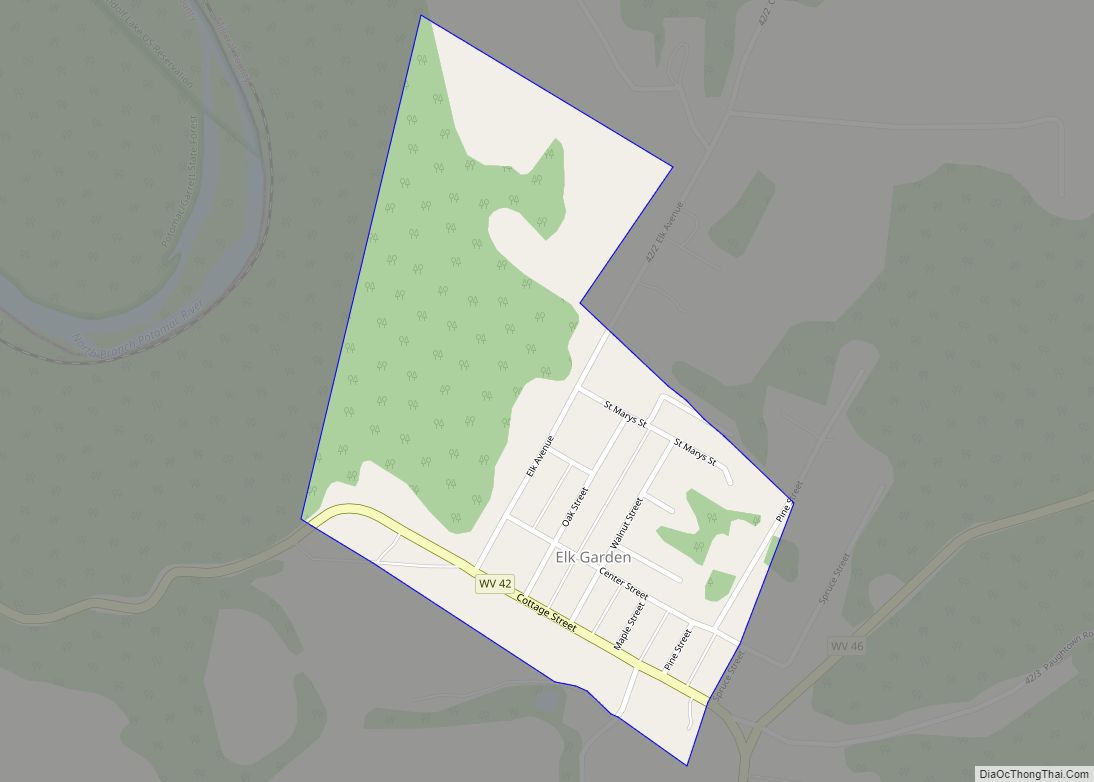
Elk Garden is a town in Mineral County, West Virginia, United States. It is part of the ‘Cumberland, MD–WV Metropolitan Statistical Area’. The population was 211 at the 2020 census. Elk Garden High School was consolidated into Keyser High School in 1997. However the Primary School is still in session, offering classes from Pre-Kindergarten through ... Read more
Map of Elk Garden town
Map of Fenwick CDP, West Virginia
Fenwick is a census-designated place (CDP) in eastern Nicholas County, West Virginia, United States, adjacent to and immediately west of Richwood. As of the 2010 census, its population was 116. The town is situated at the bottomland surrounding the mouth of the Big Laurel Creek at its confluence with the Cherry River and has an ... Read more
Map of Fenwick CDP, West Virginia
Map of Gilbert Creek CDP
Gilbert Creek is a census-designated place (CDP) in Mingo County, West Virginia, United States. The population was 1,090 at the 2010 census. The community takes its name from nearby Gilbert Creek. Gilbert Creek CDP overview: Name: Gilbert Creek CDP LSAD Code: 57 LSAD Description: CDP (suffix) State: West Virginia County: Mingo County Elevation: 1,106 ft (337 m) ... Read more
Map of Gilbert Creek CDP
Map of Ghent CDP, West Virginia
Ghent /ˈdʒɛnt/ is a census-designated place in Raleigh County in the U.S. state of West Virginia. As of the 2010 census, its population was 457. Ghent CDP overview: Name: Ghent CDP LSAD Code: 57 LSAD Description: CDP (suffix) State: West Virginia County: Raleigh County Elevation: 2,986 ft (910 m) Total Area: 1.612 sq mi (4.18 km²) Land Area: 1.281 sq mi (3.32 km²) ... Read more
Map of Ghent CDP, West Virginia
Map of Gauley Bridge town
Gauley Bridge is a town in Fayette County, West Virginia, United States. The population was 614 at the 2010 census. The Kanawha River is formed at Gauley Bridge by the confluence of the New and Gauley Rivers. Two miles to the southeast of Gauley Bridge, in Glen Ferris, is Kanawha Falls, a popular stopping point ... Read more
Map of Gauley Bridge town
Map of Gary city, West Virginia
Gary is a city located along the Tug Fork River in McDowell County, West Virginia, United States. According to the 2020 census, the city had a population of 762. It was named for Elbert Henry Gary, one of the founders of U.S. Steel. The former coal towns of Elbert, Filbert, Thorpe, and Wilcoe became part ... Read more
Map of Gary city, West Virginia