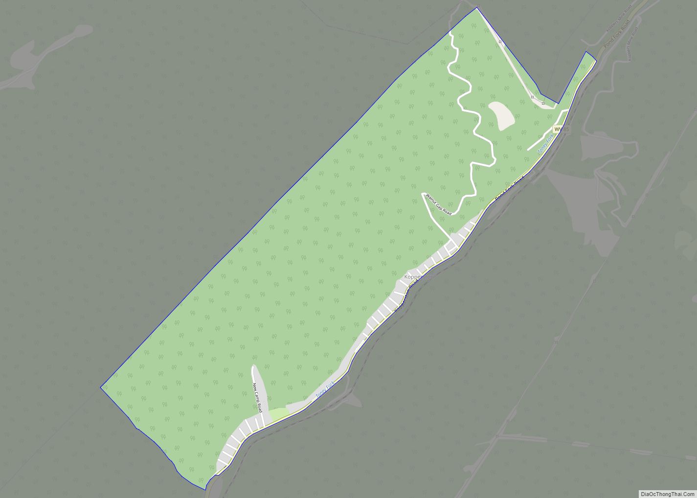
Map of Van CDP, West Virginia

Map of Van CDP, West Virginia

Van is a census-designated place (CDP) in Boone County, West Virginia, United States, along the Pond Fork of the Little Coal River. As of the 2010 census, its population was 211. Its ZIP code is 25206. Van was named after Van Linville, who established its post office and served as its first postmaster. Van CDP … Read more

Map of Valley Head CDP, West Virginia

Map of Valley Head CDP, West Virginia

Valley Head is a census-designated place (CDP) in Randolph County, West Virginia, United States. Valley Head is located on U.S. Route 219, 12 miles (19 km) south-southwest of Huttonsville. Valley Head has a post office with ZIP code 26294. As of the 2010 census, its population was 267. The community was named for the nearby headwaters … Read more

Map of Valley Grove village

Map of Valley Grove village

Valley Grove is a village in Ohio County, West Virginia, United States. It is part of the Wheeling, West Virginia Metropolitan Statistical Area. The population was 378 at the 2010 census. The village was named from a nearby recreational area at a grove in a valley. Valley Grove village overview: Name: Valley Grove village LSAD … Read more

Map of Valley Bend CDP

Map of Valley Bend CDP

Valley Bend is a census-designated place (CDP) in Randolph County, West Virginia, United States. Valley Bend is located on U.S. routes 219 and 250, as well as state routes 55 and 92, 3.5 miles (5.6 km) northwest of Mill Creek. Valley Bend has a post office with ZIP code 26293. As of the 2010 census, its … Read more

Map of Union town, West Virginia

Map of Union town, West Virginia

Union is a town in Monroe County, West Virginia, United States. Union’s population is 427 as of 2020. It is the county seat of Monroe County. Union town overview: Name: Union town LSAD Code: 43 LSAD Description: town (suffix) State: West Virginia County: Monroe County Elevation: 2,073 ft (632 m) Total Area: 0.45 sq mi (1.16 km²) Land Area: 0.45 sq mi … Read more

Map of Twilight CDP, West Virginia

Map of Twilight CDP, West Virginia

Twilight is a census-designated place (CDP) in Boone County, West Virginia, United States. As of the 2010 census, its population was 90. Twilight is approximately 20 miles from Madison. Twilight is accessible from Boone County Route 26, which is located right off West Virginia Route 85 at the Van Bridge split. The name Twilight was … Read more

Map of Tunnelton town

Map of Tunnelton town

Tunnelton is a town in southwestern Preston County, West Virginia, United States. The population was 307 at the 2020 census. It is part of the Morgantown metropolitan area. Tunnelton town overview: Name: Tunnelton town LSAD Code: 43 LSAD Description: town (suffix) State: West Virginia County: Preston County Elevation: 1,824 ft (556 m) Total Area: 0.34 sq mi (0.87 km²) Land … Read more

Map of Triadelphia town

Map of Triadelphia town

Triadelphia is a town in Ohio County, West Virginia, United States. It is part of the Wheeling, West Virginia Metropolitan Statistical Area. The population was 669 at the 2020 census. Triadelphia town overview: Name: Triadelphia town LSAD Code: 43 LSAD Description: town (suffix) State: West Virginia County: Ohio County Elevation: 741 ft (226 m) Total Area: 0.68 sq mi … Read more

Map of Wiley Ford CDP

Map of Wiley Ford CDP

Wiley Ford is a census-designated place (CDP) in Mineral County, West Virginia, United States and part of the ‘Cumberland, MD-WV Metropolitan Statistical Area’. The population was 1,026 at the 2010 census. The community was named after Mr. Wiley, who settled at a nearby ford. Wiley Ford CDP overview: Name: Wiley Ford CDP LSAD Code: 57 … Read more

Map of Waverly CDP, West Virginia

Map of Waverly CDP, West Virginia

Waverly (also known as Bull Creek and Union School District) is a census-designated place (CDP) in northeastern Wood County, West Virginia, United States. As of the 2010 census, its population was 395. It lies along the Ohio River on West Virginia Route 2, northeast of the city of Parkersburg, the county seat of Wood County. … Read more

Map of Whitmer CDP

Map of Whitmer CDP

Whitmer is a census-designated place (CDP) in Randolph County, West Virginia, United States. It is 7.5 miles (12.1 km) south-southwest of Harman and is situated on the Dry Fork Cheat River. Whitmer had a post office, which closed on May 21, 2011. As of the 2010 census, its population was 106. Whitmer CDP overview: Name: Whitmer … Read more

Map of Whitesville town, West Virginia

Map of Whitesville town, West Virginia

Whitesville is a town and former coal town in Boone County, West Virginia, United States, along the Big Coal River. The population was 361 at the 2020 census. Whitesville was incorporated on August 15, 1935 by the Boone County Circuit Court. The town derives its name from B. W. White, a pioneer settler. Whitesville was … Read more