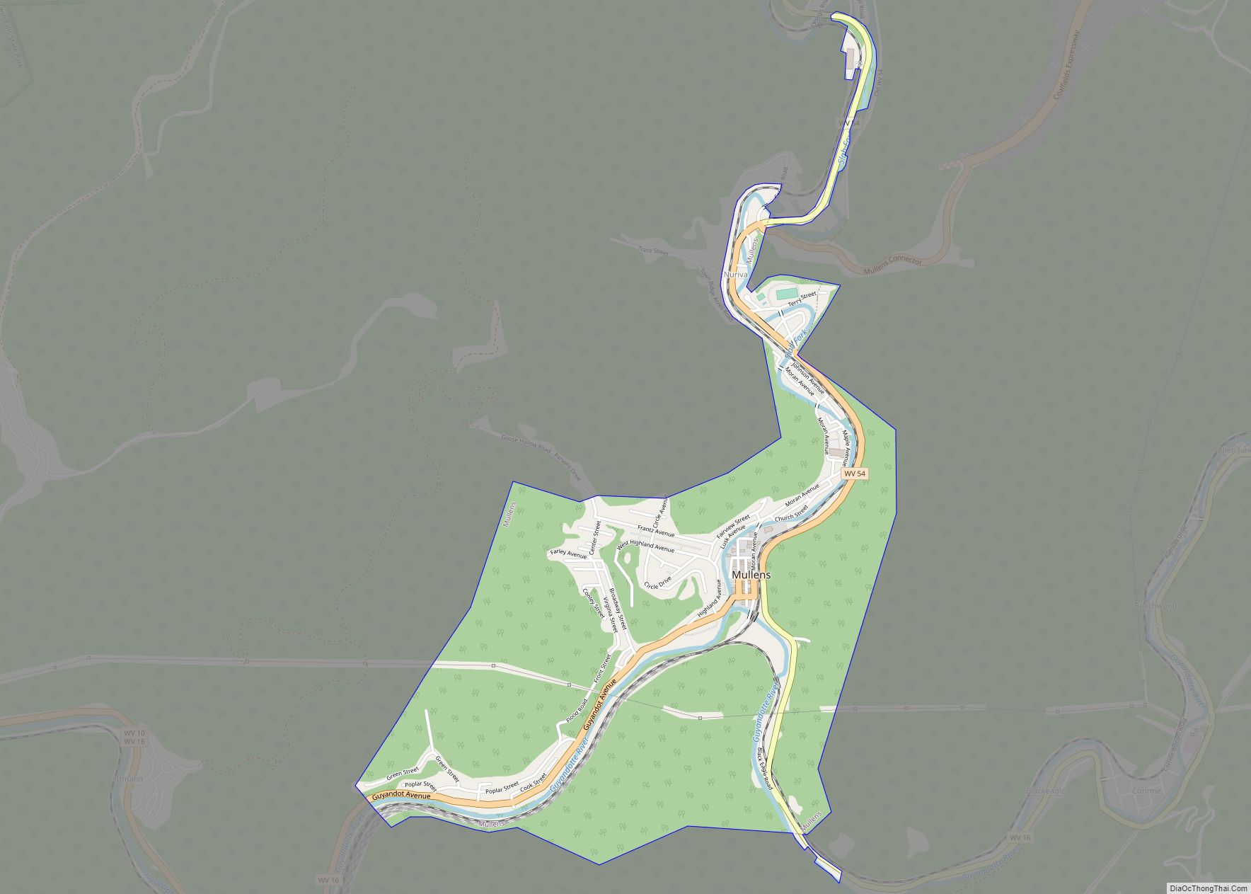
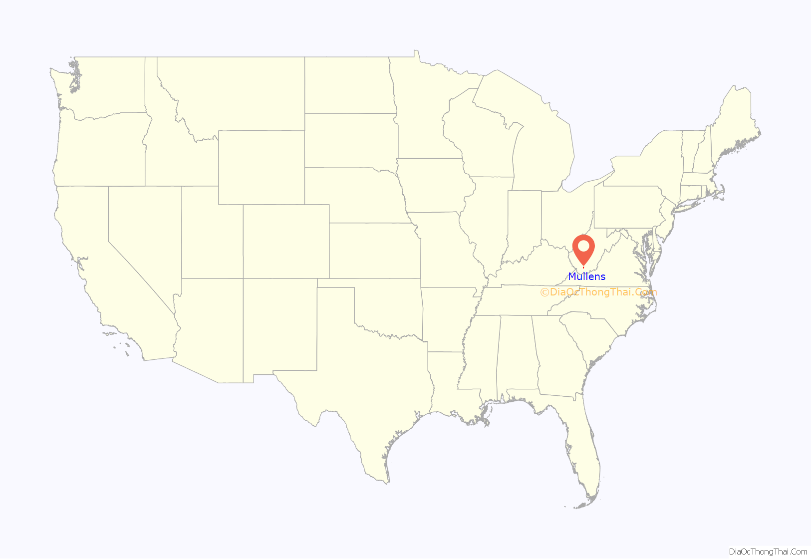
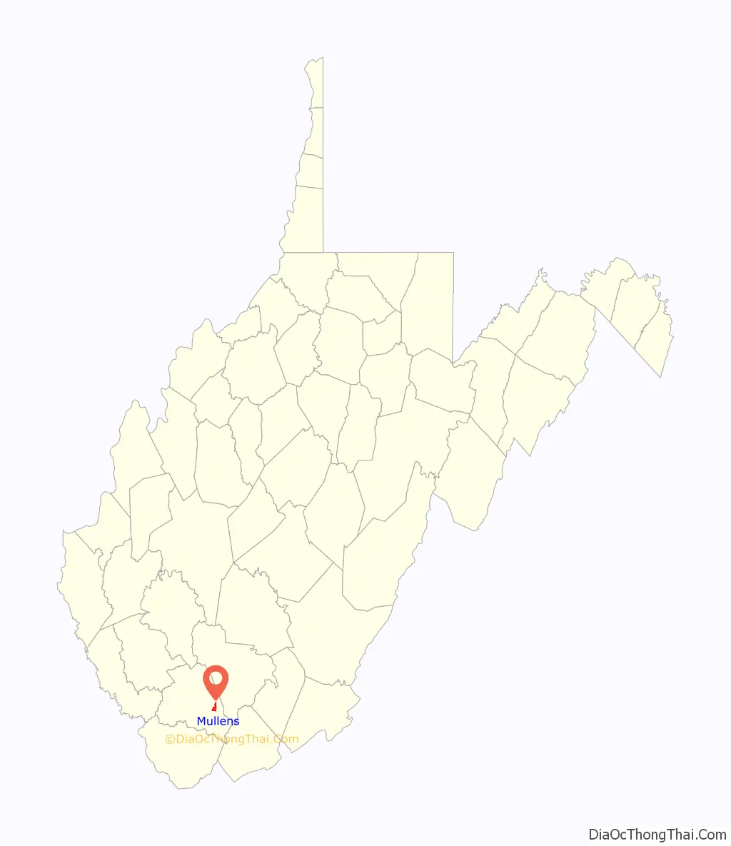
Mullens is a city in Wyoming County, West Virginia. The population was 1,475 at the time of the 2020 census. It is home to a highly rated railroad themed restaurant “Second Street”, and has a railroad crossing at the front entry of the town.
Located in a valley along the Guyandotte River within a mountainous region of southern West Virginia, the town was nearly destroyed by flash flooding in July 2001. While the town has attempted to redevelop with the aid of state and federal recovery money, many local businesses and residents have left the area permanently.
| Name: | Mullens city |
|---|---|
| LSAD Code: | 25 |
| LSAD Description: | city (suffix) |
| State: | West Virginia |
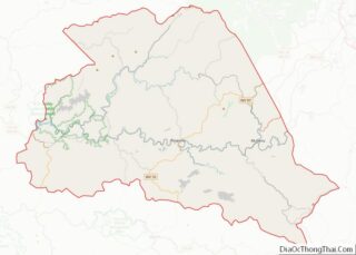
| County: | Wyoming County |
| Elevation: | 1,417 ft (432 m) |
| Total Area: | 1.90 sq mi (4.91 km²) |
| Land Area: | 1.84 sq mi (4.77 km²) |
| Water Area: | 0.05 sq mi (0.14 km²) |
| Total Population: | 1,475 |
| Population Density: | 719.33/sq mi (277.70/km²) |
| ZIP code: | 25882 |
| Area code: | 304 |
| FIPS code: | 5457148 |
| GNISfeature ID: | 1543986 |
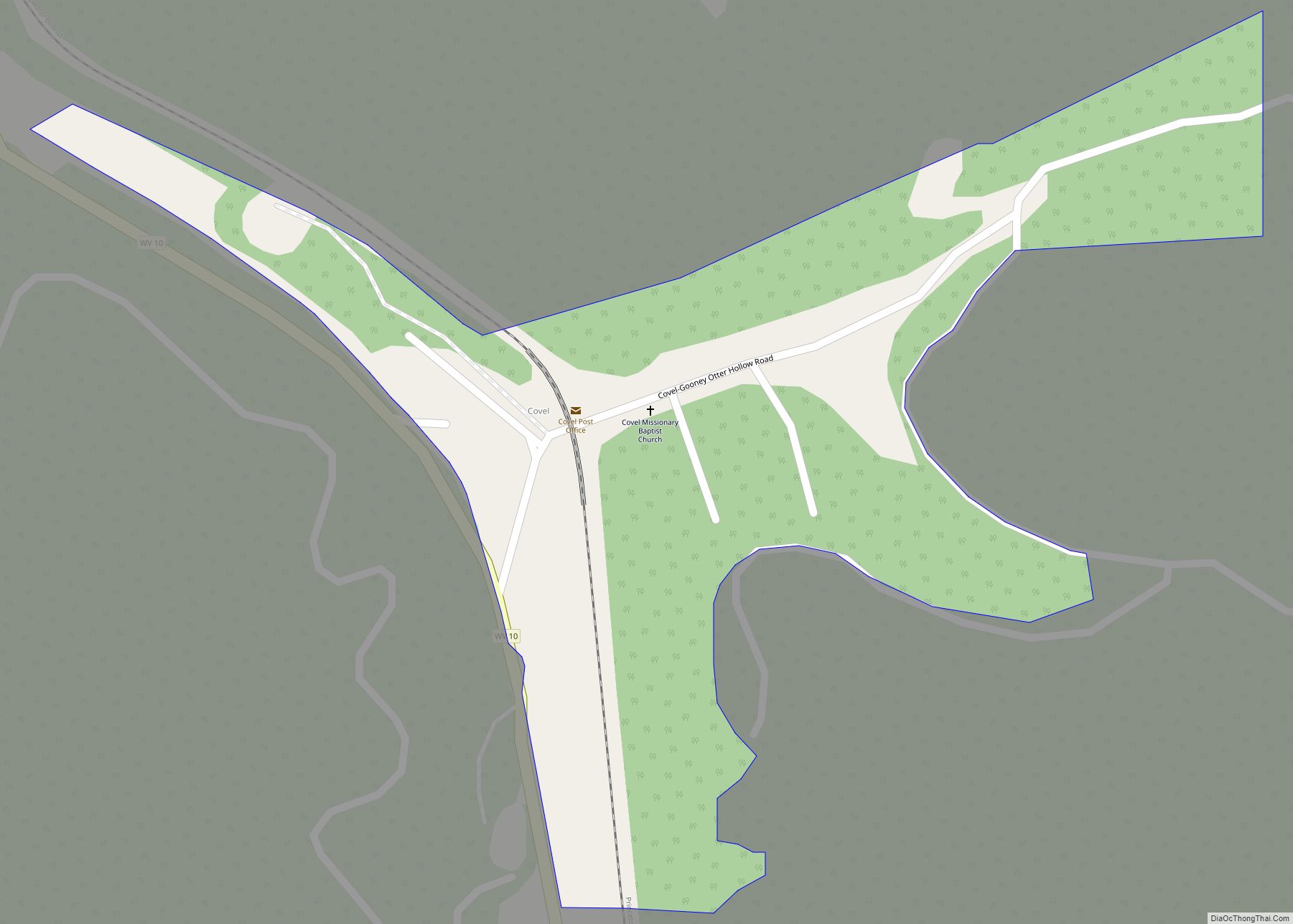
Online Interactive Map
Click on ![]() to view map in "full screen" mode.
to view map in "full screen" mode.
Mullens location map. Where is Mullens city?
History
Mullens was incorporated as a town on September 17, 1912 and operated under a charter issued by the Circuit Court of Wyoming County. It was named for A. J. Mullins, who owned the land upon which the town is built. The town’s original name was spelled with an “i”; a recording error accounts for the error in spelling, which was never corrected. An Act of the West Virginia Legislature granting a charter to the City of Mullens was passed February 22, 1929.
The early growth of the Mullens community came with development of the lumber and coal mining industries. In the early 20th century, coal-mining manager and developer William Nelson Page of Ansted helped open the Winding Gulf Coalfield with plans for the Deepwater Railway, a new short-line railroad. When Page ran into competitive collusion by the bigger railroads which would have wrecked his project, backed by his silent partner, wealthy industrialist Henry Huttleston Rogers, the plan was expanded in a secretive and massive way to build a line all the way east to the port of Hampton Roads.
Completed in 1909, the Virginian Railway (VGN) established engine terminal and yard facilities near Mullens which employed hundreds of workers during the first half of the 20th century. The VGN was merged with the Norfolk and Western Railway (N&W) in 1959, and both later became part of the Norfolk Southern Railway (NS). A caboose museum in Mullens celebrates the history of the railroad in the region.
The Mullens Historic District was listed on the National Register of Historic Places in 1993. The nearby Wyco Church was listed in 2010.
A Beckley to Mullens section of State Route 121, the Coalfields Expressway, was opened on October 1, 2020 and dedicated in a ceremony by the Governor.
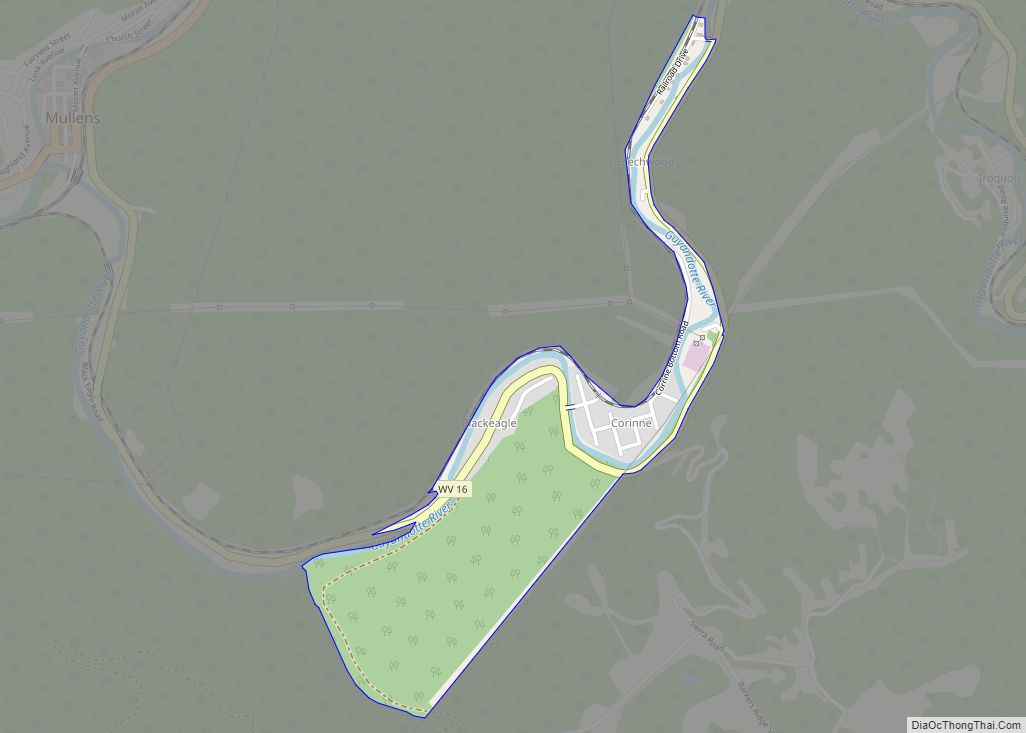
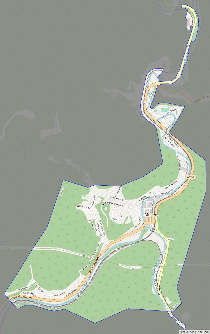
Mullens Road Map
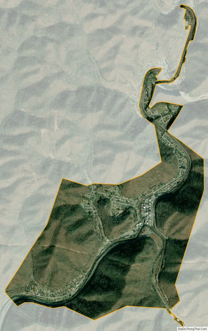
Mullens city Satellite Map
Geography
Mullens is located at 37°35′5″N 81°23′5″W / 37.58472°N 81.38472°W / 37.58472; -81.38472 (37.584678, -81.384736), at the confluence of the Guyandotte River and the Slab Fork.
According to the United States Census Bureau, the city has a total area of 1.85 square miles (4.79 km), of which 1.80 square miles (4.66 km) is land and 0.05 square miles (0.13 km) is water.
Climate
The climate in this area has mild differences between highs and lows, and there is adequate rainfall year-round. According to the Köppen Climate Classification system, Mullens has a marine west coast climate, abbreviated “Cfb” on climate maps.
See also
Map of West Virginia State and its subdivision:- Barbour
- Berkeley
- Boone
- Braxton
- Brooke
- Cabell
- Calhoun
- Clay
- Doddridge
- Fayette
- Gilmer
- Grant
- Greenbrier
- Hampshire
- Hancock
- Hardy
- Harrison
- Jackson
- Jefferson
- Kanawha
- Lewis
- Lincoln
- Logan
- Marion
- Marshall
- Mason
- McDowell
- Mercer
- Mineral
- Mingo
- Monongalia
- Monroe
- Morgan
- Nicholas
- Ohio
- Pendleton
- Pleasants
- Pocahontas
- Preston
- Putnam
- Raleigh
- Randolph
- Ritchie
- Roane
- Summers
- Taylor
- Tucker
- Tyler
- Upshur
- Wayne
- Webster
- Wetzel
- Wirt
- Wood
- Wyoming
- Alabama
- Alaska
- Arizona
- Arkansas
- California
- Colorado
- Connecticut
- Delaware
- District of Columbia
- Florida
- Georgia
- Hawaii
- Idaho
- Illinois
- Indiana
- Iowa
- Kansas
- Kentucky
- Louisiana
- Maine
- Maryland
- Massachusetts
- Michigan
- Minnesota
- Mississippi
- Missouri
- Montana
- Nebraska
- Nevada
- New Hampshire
- New Jersey
- New Mexico
- New York
- North Carolina
- North Dakota
- Ohio
- Oklahoma
- Oregon
- Pennsylvania
- Rhode Island
- South Carolina
- South Dakota
- Tennessee
- Texas
- Utah
- Vermont
- Virginia
- Washington
- West Virginia
- Wisconsin
- Wyoming