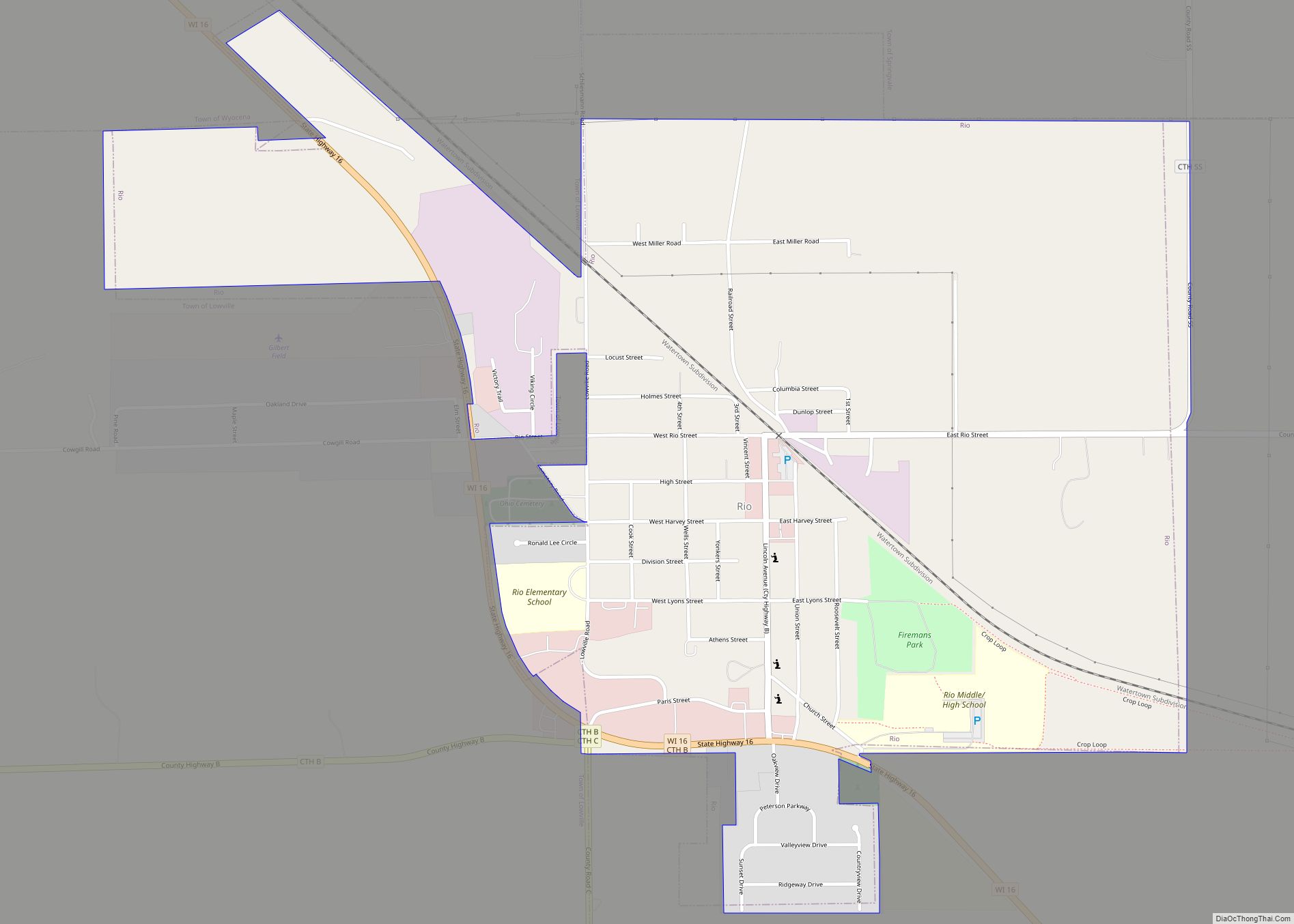
Map of Rome CDP, Wisconsin
Rome is a census-designated place (CDP) in the town of Sullivan in Jefferson County, Wisconsin, United States, along the Bark River. The population was 752 at the 2020 census. Rome CDP overview: Name: Rome CDP LSAD Code: 57 LSAD Description: CDP (suffix) State: Wisconsin County: Jefferson County Elevation: 840 ft (260 m) Total Area: 3.945 sq mi (10.22 km²) Land ... Read more
Map of Rome CDP, Wisconsin
Map of Sharon village, Wisconsin
Sharon is a village in Walworth County, Wisconsin, United States. The population was 1,586 at the 2020 census. The village is adjacent to the Town of Sharon. Sharon village overview: Name: Sharon village LSAD Code: 47 LSAD Description: village (suffix) State: Wisconsin County: Walworth County Total Area: 1.73 sq mi (4.47 km²) Land Area: 1.73 sq mi (4.47 km²) Water Area: ... Read more
Map of Sharon village, Wisconsin
Map of Seymour CDP, Wisconsin
Seymour is a census-designated place (CDP) in Eau Claire County, Wisconsin, United States. The population was 1,418 at the 2010 census. It is located within the town of Seymour and is part of the Eau Claire urban area. Seymour CDP overview: Name: Seymour CDP LSAD Code: 57 LSAD Description: CDP (suffix) State: Wisconsin County: Eau ... Read more
Map of Seymour CDP, Wisconsin
Map of Sextonville CDP
Sextonville is an unincorporated census-designated place located in the town of Buena Vista in Richland County, Wisconsin, United States. Sextonville is located on U.S. Route 14 southeast of Richland Center. Sextonville has a post office with ZIP code 53584. As of the 2020 census, its population was 476. Sextonville CDP overview: Name: Sextonville CDP LSAD ... Read more
Map of Sextonville CDP
Map of Schofield city
Schofield is a city in Marathon County, Wisconsin, United States. It is part of the Wausau, Wisconsin Metropolitan Statistical Area. The population was 2,157 at the 2020 census. The city was named for William Scholfield, who came to the area in the 1851 to open a sawmill. The city has since dropped the “L” from ... Read more
Map of Schofield city
Map of Scandinavia village
Scandinavia is a town in Waupaca County, Wisconsin, United States. The population was 1,075 at the 2000 census. The Village of Scandinavia is located within the town. Scandinavia village overview: Name: Scandinavia village LSAD Code: 47 LSAD Description: village (suffix) State: Wisconsin County: Waupaca County Total Area: 34.2 sq mi (88.7 km²) Land Area: 33.8 sq mi (87.5 km²) Water Area: ... Read more
Map of Scandinavia village
Map of Sayner CDP
Sayner is a census-designated place in the Town of Plum Lake in Vilas County, Wisconsin, United States. It is located at the intersection of Highway 155 and County N, about 15 miles northwest of Eagle River. As of the 2010 census, its population was 207. Sayner has an area of 1.828 square miles (4.73 km); 1.826 ... Read more
Map of Sayner CDP
Map of Saxon CDP, Wisconsin
Saxon is an unincorporated census-designated place located in the town of Saxon, Iron County, Wisconsin, United States. Saxon is located on Wisconsin Highway 122 11 miles (18 km) west-northwest of Hurley. Saxon has a post office with ZIP code 54559. As of the 2010 census, its population is 90. Saxon CDP overview: Name: Saxon CDP LSAD ... Read more
Map of Saxon CDP, Wisconsin
Map of Shorewood village, Wisconsin
Shorewood is a village in Milwaukee County, Wisconsin, United States. The population was 13,859 at the 2020 census. Shorewood village overview: Name: Shorewood village LSAD Code: 47 LSAD Description: village (suffix) State: Wisconsin County: Milwaukee County Elevation: 679 ft (207 m) Total Area: 1.59 sq mi (4.12 km²) Land Area: 1.59 sq mi (4.12 km²) Water Area: 0.00 sq mi (0.00 km²) Total Population: 13,859 Population ... Read more
Map of Shorewood village, Wisconsin
Map of Saukville village
Saukville is a town in Ozaukee County, Wisconsin, United States. The Village of Saukville is located in the town’s southeast quadrant. The population was 1,755 at the 2000 census. Menominee and Sauk Native Americans lived in the area until the 1830s when the U.S. Federal Government forced them to leave Wisconsin. The first white settlers ... Read more
Map of Saukville village
Map of Shorewood Hills village
Shorewood Hills is a village in Dane County, Wisconsin, United States. It was established in 1927. The population was 2,169 at the 2020 census. Entirely surrounded by the city of Madison and Lake Mendota, it is part of the Madison Metropolitan Statistical Area. Shorewood Hills village overview: Name: Shorewood Hills village LSAD Code: 47 LSAD ... Read more
Map of Shorewood Hills village
Map of Sauk City village
Sauk City is a village in Sauk County, Wisconsin, United States. The population was 3,518 as of the 2020 census. The first incorporated village in the state, the community was founded by Agoston Haraszthy and his business partner, Robert Bryant. The village is adjacent to Prairie du Sac; together, these twin villages are referred to ... Read more
Map of Sauk City village