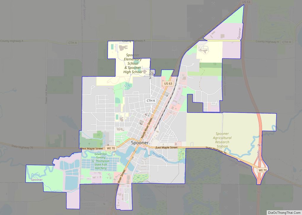
Shell Lake is a city in Washburn County, Wisconsin, United States. The population was 1,347 at the 2010 census. It is the county seat of Washburn County.
| Name: | Shell Lake city |
|---|---|
| LSAD Code: | 25 |
| LSAD Description: | city (suffix) |
| State: | Wisconsin |
| County: | Washburn County |
| Elevation: | 1,240 ft (380 m) |
| Total Area: | 10.24 sq mi (26.53 km²) |
| Land Area: | 5.85 sq mi (15.14 km²) |
| Water Area: | 4.40 sq mi (11.39 km²) |
| Total Population: | 1,347 |
| Population Density: | 224.08/sq mi (86.52/km²) |
| ZIP code: | 54871 |
| Area code: | 715 & 534 |
| FIPS code: | 5573200 |
| GNISfeature ID: | 1574007 |
| Website: | shelllake.org |
Online Interactive Map
Click on ![]() to view map in "full screen" mode.
to view map in "full screen" mode.
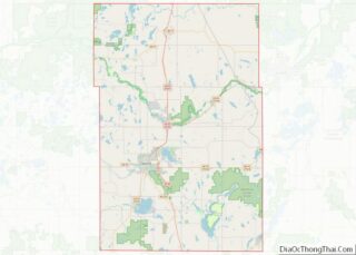
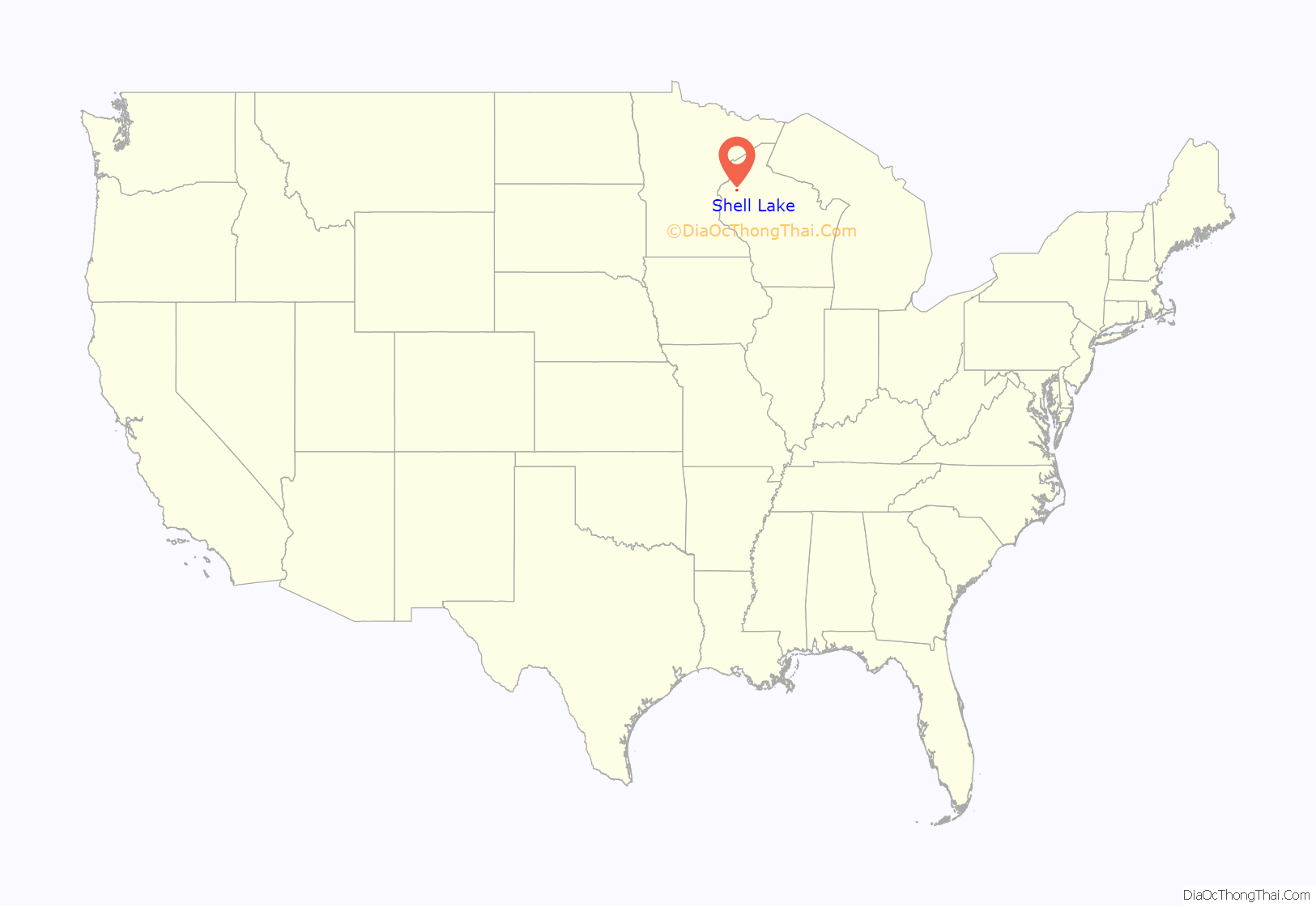
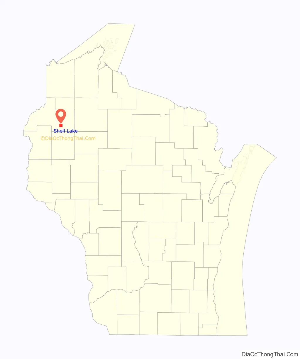
Shell Lake location map. Where is Shell Lake city?
History
A post office called Shell Lake has been in operation since 1880. The city took its name from nearby Shell Lake.
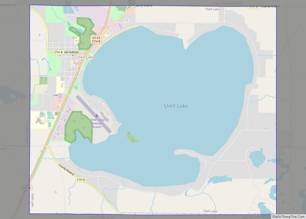
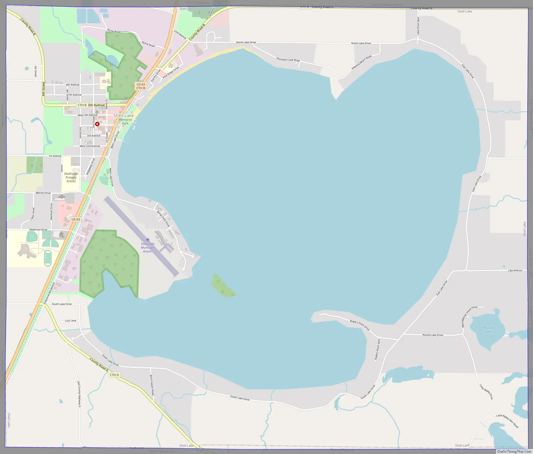
Shell Lake Road Map
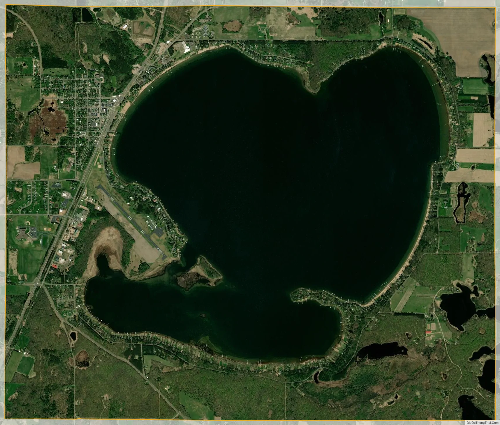
Shell Lake city Satellite Map
Geography
Shell Lake is located at 45°44′1″N 91°55′3″W / 45.73361°N 91.91750°W / 45.73361; -91.91750 (45.733590, -91.917368).
According to the United States Census Bureau, the city has a total area of 10.20 square miles (26.42 km), of which, 5.81 square miles (15.05 km) is land and 4.39 square miles (11.37 km) is water.
The primary geographical feature of the city is Shell Lake which occupies the geographic center of the city and lies completely within the city limits.
See also
Map of Wisconsin State and its subdivision:- Adams
- Ashland
- Barron
- Bayfield
- Brown
- Buffalo
- Burnett
- Calumet
- Chippewa
- Clark
- Columbia
- Crawford
- Dane
- Dodge
- Door
- Douglas
- Dunn
- Eau Claire
- Florence
- Fond du Lac
- Forest
- Grant
- Green
- Green Lake
- Iowa
- Iron
- Jackson
- Jefferson
- Juneau
- Kenosha
- Kewaunee
- La Crosse
- Lafayette
- Lake Michigan
- Lake Superior
- Langlade
- Lincoln
- Manitowoc
- Marathon
- Marinette
- Marquette
- Menominee
- Milwaukee
- Monroe
- Oconto
- Oneida
- Outagamie
- Ozaukee
- Pepin
- Pierce
- Polk
- Portage
- Price
- Racine
- Richland
- Rock
- Rusk
- Saint Croix
- Sauk
- Sawyer
- Shawano
- Sheboygan
- Taylor
- Trempealeau
- Vernon
- Vilas
- Walworth
- Washburn
- Washington
- Waukesha
- Waupaca
- Waushara
- Winnebago
- Wood
- Alabama
- Alaska
- Arizona
- Arkansas
- California
- Colorado
- Connecticut
- Delaware
- District of Columbia
- Florida
- Georgia
- Hawaii
- Idaho
- Illinois
- Indiana
- Iowa
- Kansas
- Kentucky
- Louisiana
- Maine
- Maryland
- Massachusetts
- Michigan
- Minnesota
- Mississippi
- Missouri
- Montana
- Nebraska
- Nevada
- New Hampshire
- New Jersey
- New Mexico
- New York
- North Carolina
- North Dakota
- Ohio
- Oklahoma
- Oregon
- Pennsylvania
- Rhode Island
- South Carolina
- South Dakota
- Tennessee
- Texas
- Utah
- Vermont
- Virginia
- Washington
- West Virginia
- Wisconsin
- Wyoming