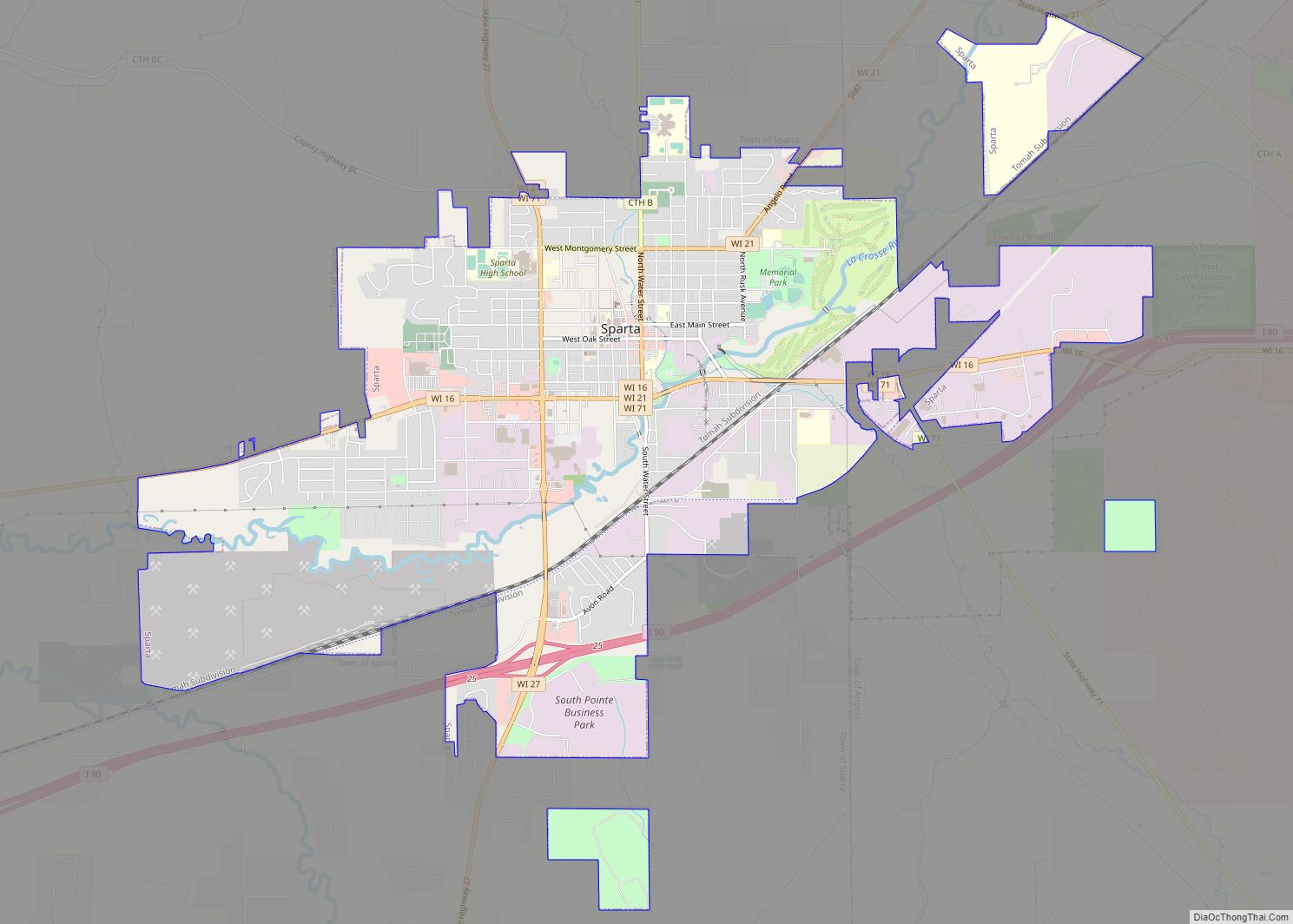
Map of Lewis CDP, Wisconsin

Map of Lewis CDP, Wisconsin

Lewis is an unincorporated census-designated place in the town of Clam Falls, Polk County, Wisconsin, United States. Lewis is located on Wisconsin Highway 35 4.5 miles (7.2 km) northeast of Frederic. As of the 2010 census, its population is 164. Lewis CDP overview: Name: Lewis CDP LSAD Code: 57 LSAD Description: CDP (suffix) State: Wisconsin County: … Read more

Map of Leopolis CDP

Map of Leopolis CDP

Leopolis is an unincorporated census-designated place in Shawano County, Wisconsin, United States. The community is located on County Highway D, between the towns of Herman, and Pella, Wisconsin. As of the 2010 census, its population is 87. Leopolis CDP overview: Name: Leopolis CDP LSAD Code: 57 LSAD Description: CDP (suffix) State: Wisconsin County: Shawano County … Read more

Map of Lena village, Wisconsin

Map of Lena village, Wisconsin

Lena is a town in Oconto County, Wisconsin, United States. The population was 769 at the 2000 census. The Village of Lena is adjacent to the town. Lena village overview: Name: Lena village LSAD Code: 47 LSAD Description: village (suffix) State: Wisconsin County: Oconto County FIPS code: 5543325 Online Interactive Map Lena online map. Source: … Read more

Map of Long Lake CDP, Wisconsin

Map of Long Lake CDP, Wisconsin

Long Lake is an unincorporated census-designated place in the town of Long Lake, Florence County, Wisconsin, United States. Long Lake is located on the eastern shore of Long Lake along Wisconsin Highway 139, 21 miles (34 km) west-southwest of Florence. As of the 2020 census, its population was 59. The community became a census-designated place in … Read more

Map of Legend Lake CDP

Map of Legend Lake CDP

Legend Lake is a census-designated place (CDP) in Menominee County, Wisconsin, Wisconsin, United States, on the Menominee Indian Reservation. The population was 1,670 at the 2020 census. Legend Lake CDP overview: Name: Legend Lake CDP LSAD Code: 57 LSAD Description: CDP (suffix) State: Wisconsin County: Menominee County Elevation: 458 ft (140 m) Total Area: 20.5 sq mi (53.1 km²) Land … Read more

Map of Lone Rock village, Wisconsin

Map of Lone Rock village, Wisconsin

Lone Rock is a village in Richland County, Wisconsin, United States. The population was 888 at the 2010 census. The village is named after a sandstone outcrop. Lone Rock village overview: Name: Lone Rock village LSAD Code: 47 LSAD Description: village (suffix) State: Wisconsin County: Richland County Elevation: 709 ft (216 m) Total Area: 1.00 sq mi (2.58 km²) Land … Read more

Map of Lebanon CDP, Wisconsin

Map of Lebanon CDP, Wisconsin

Lebanon is an unincorporated census-designated place located in the town of Lebanon, Dodge County, Wisconsin, United States. Lebanon is 6.5 miles (10.5 km) northeast of Watertown. Lebanon has a post office with ZIP code 53047. As of the 2010 census, its population was 204. Lebanon CDP overview: Name: Lebanon CDP LSAD Code: 57 LSAD Description: CDP … Read more

Map of Lomira village

Map of Lomira village

Lomira is a town in Dodge County, Wisconsin, United States. The population was 1,228 at the 2000 census. The Village of Lomira is located within the town. The unincorporated communities of Knowles and Nasbro are located in the town. Lomira village overview: Name: Lomira village LSAD Code: 47 LSAD Description: village (suffix) State: Wisconsin County: … Read more

Map of Lauderdale Lakes CDP, Wisconsin

Map of Lauderdale Lakes CDP, Wisconsin

Lauderdale Lakes is a census-designated place in the town of La Grange, Walworth County, Wisconsin, United States. Its population was 1,283 as of the 2020 census. Lauderdale Lakes CDP overview: Name: Lauderdale Lakes CDP LSAD Code: 57 LSAD Description: CDP (suffix) State: Wisconsin County: Walworth County Elevation: 889 ft (271 m) Total Area: 5.440 sq mi (14.09 km²) Land Area: … Read more

Map of Lohrville village, Wisconsin

Map of Lohrville village, Wisconsin

Lohrville is a village in Waushara County, Wisconsin, United States. The population was 402 at the 2010 census. Lohrville village overview: Name: Lohrville village LSAD Code: 47 LSAD Description: village (suffix) State: Wisconsin County: Waushara County Elevation: 804 ft (245 m) Total Area: 1.22 sq mi (3.17 km²) Land Area: 1.21 sq mi (3.14 km²) Water Area: 0.01 sq mi (0.03 km²) Total Population: 402 Population … Read more

Map of Laona CDP

Map of Laona CDP

Laona is an unincorporated census-designated place in the town of Laona in Forest County, Wisconsin, United States. U.S. Route 8 travels east–west through the community and Wisconsin Highway 32 travels south and west of the community. The community park has a sign stating that the community donated the 1979 Christmas tree at the nation’s capitol. … Read more

Map of Loganville village, Wisconsin

Map of Loganville village, Wisconsin

Loganville is a village in Sauk County, Wisconsin, United States. The population was 300 at the 2010 census. The village was named for Chauncey P. Logan who built the first house in 1853. Loganville village overview: Name: Loganville village LSAD Code: 47 LSAD Description: village (suffix) State: Wisconsin County: Sauk County Elevation: 935 ft (285 m) Total … Read more