Sparta is a city in and the county seat of Monroe County, Wisconsin, United States, along the La Crosse River. The population was 10,025 at the 2020 census.
| Name: | Sparta city |
|---|---|
| LSAD Code: | 25 |
| LSAD Description: | city (suffix) |
| State: | Wisconsin |
| County: | Monroe County |
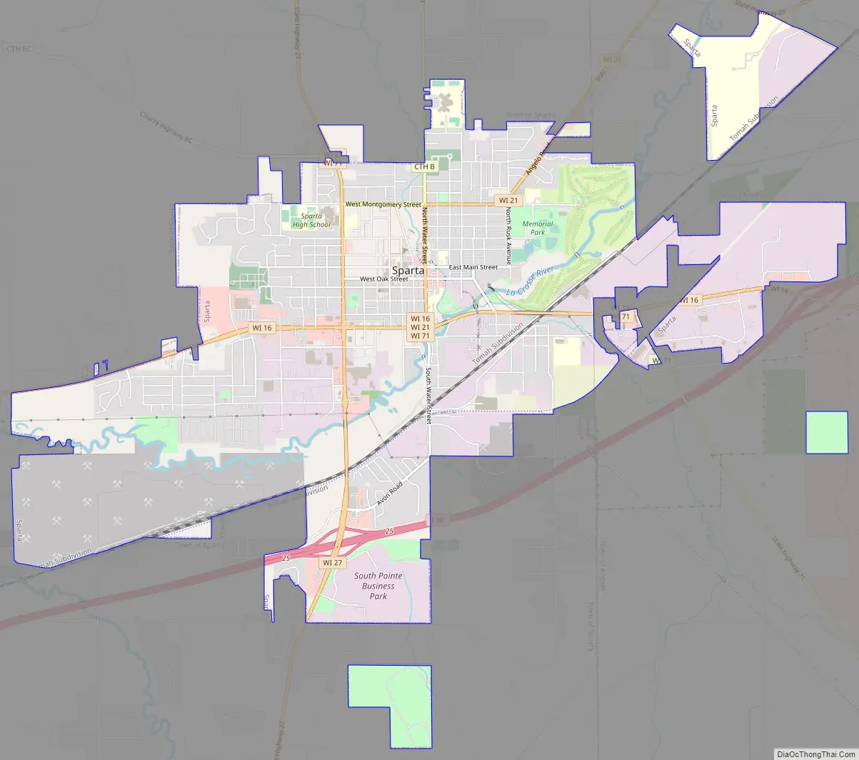
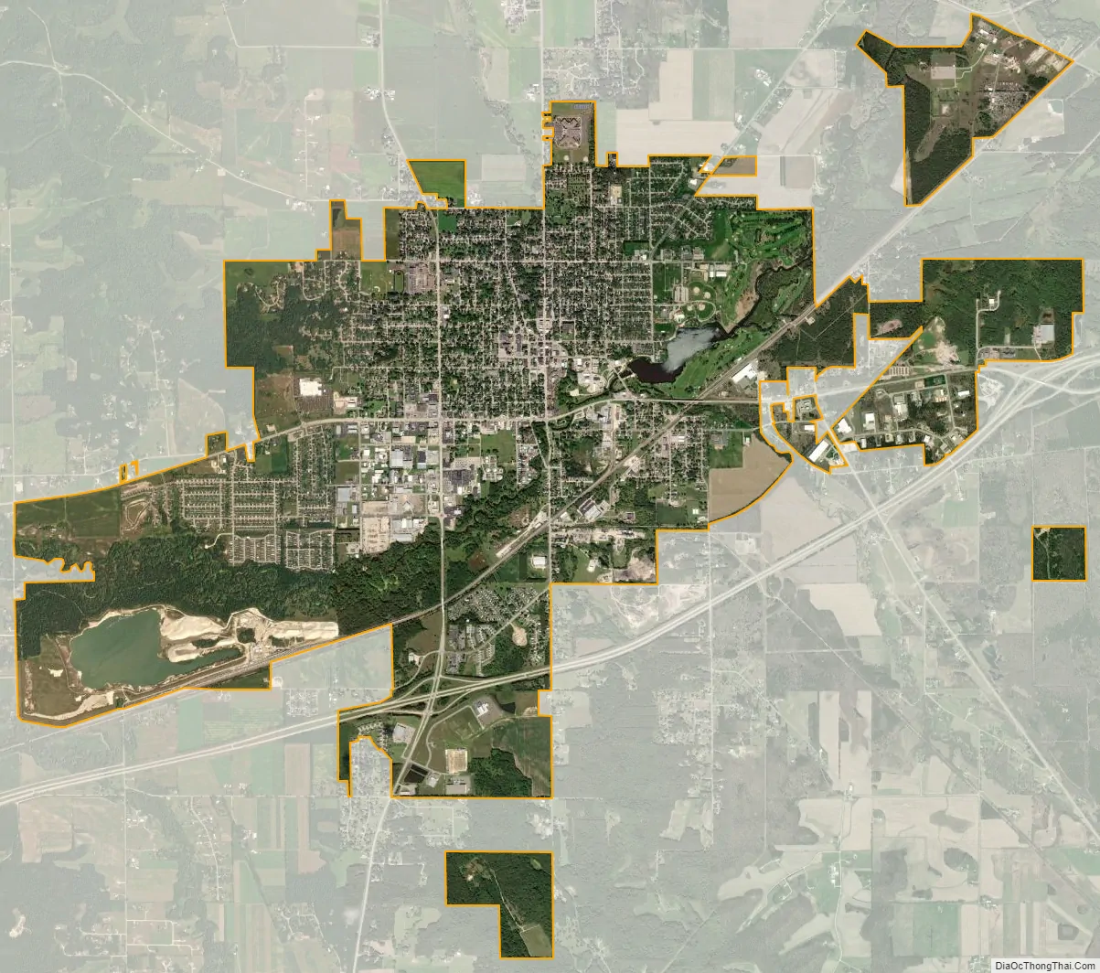
| Total Area: | 8.06 sq mi (20.88 km²) |
| Land Area: | 8.01 sq mi (20.74 km²) |
| Water Area: | 0.06 sq mi (0.15 km²) |
| Total Population: | 10,025 |
| Population Density: | 1,252.0/sq mi (483.4/km²) |
| ZIP code: | 54656 |
| FIPS code: | 5575325 |
| Website: | www.spartawisconsin.org |
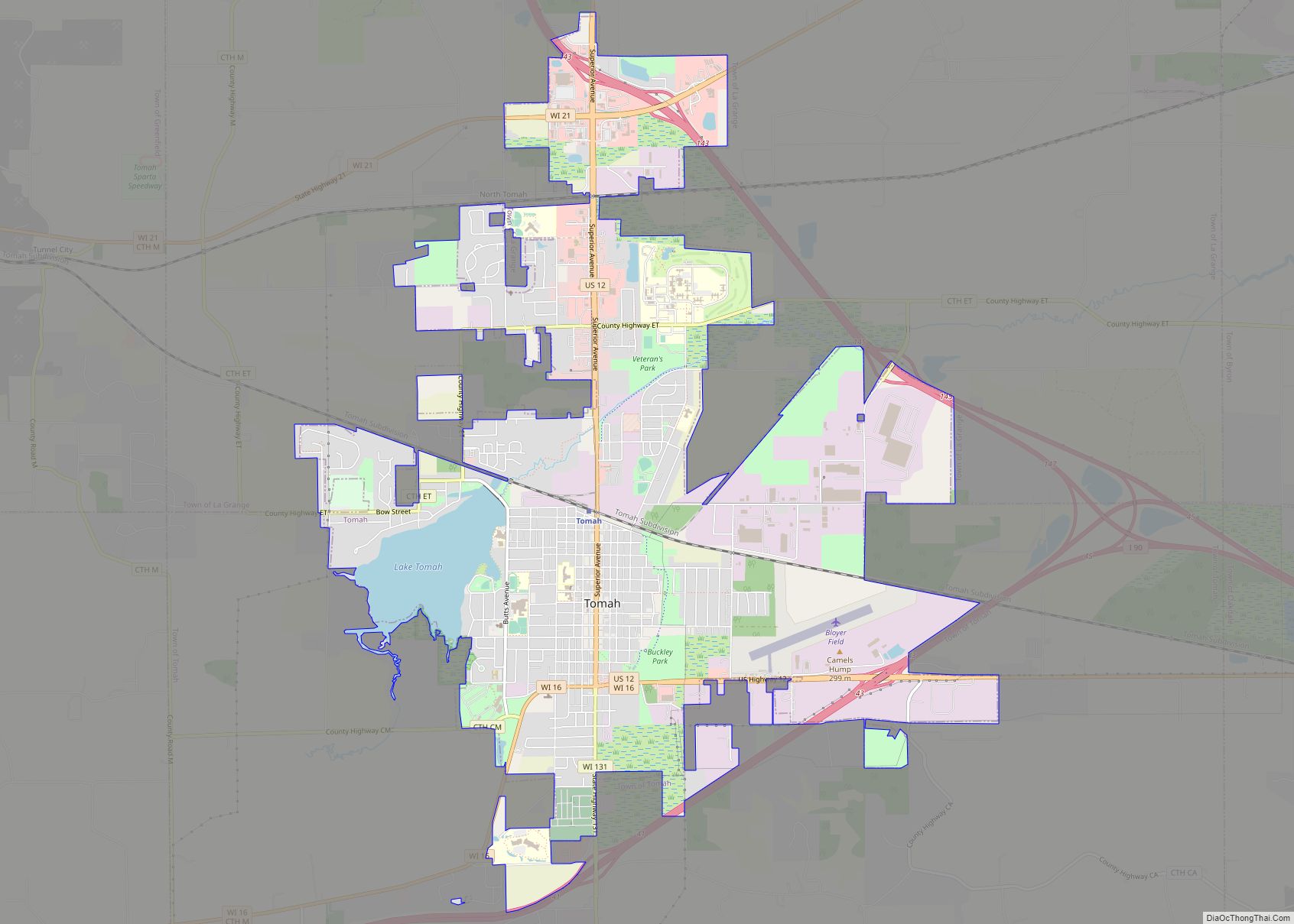
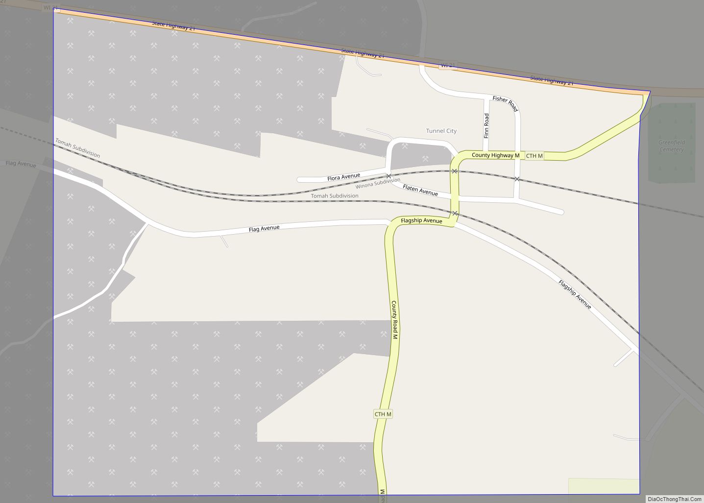
Online Interactive Map
Click on ![]() to view map in "full screen" mode.
to view map in "full screen" mode.
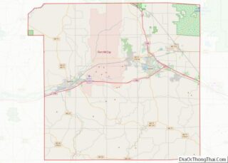
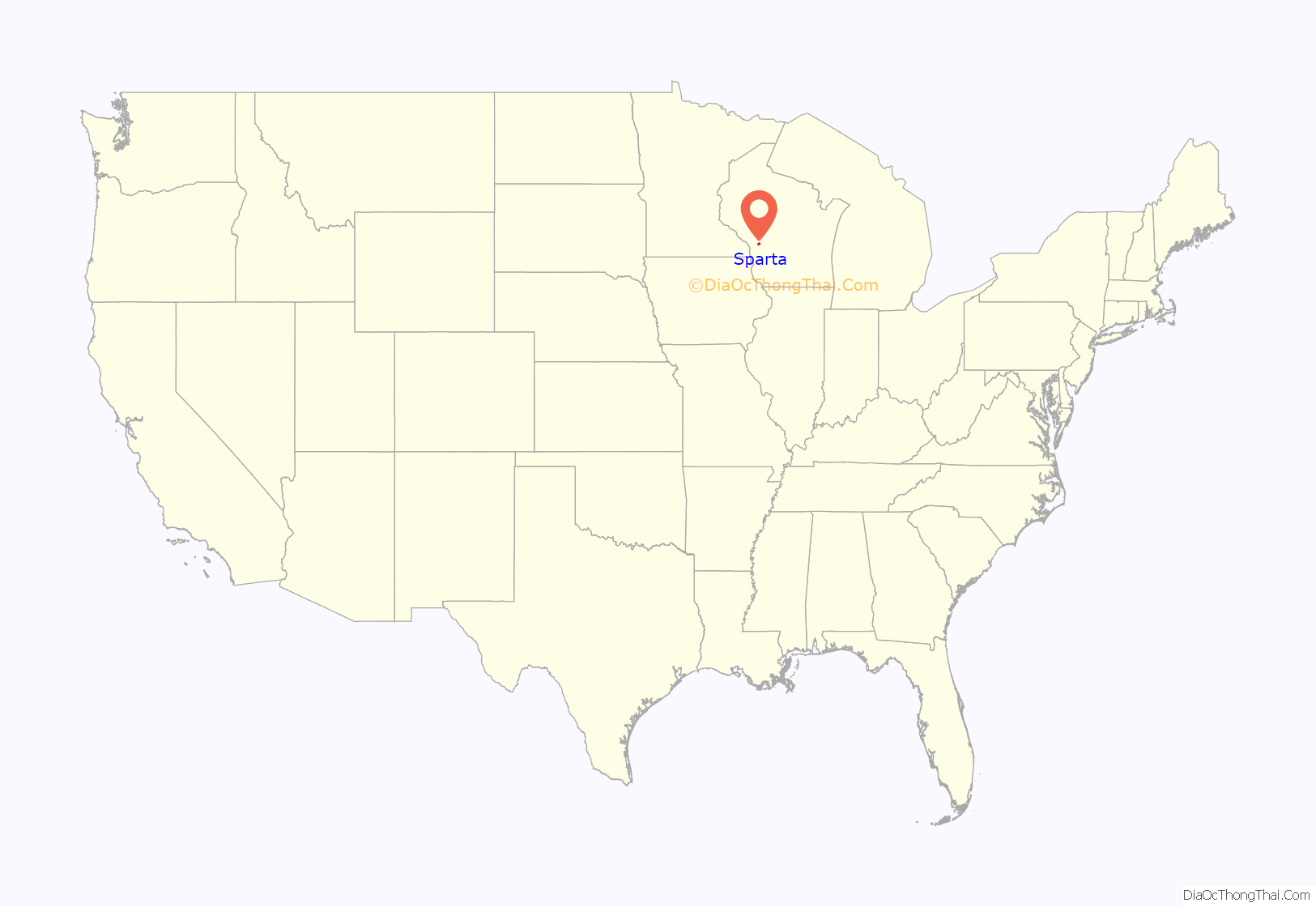
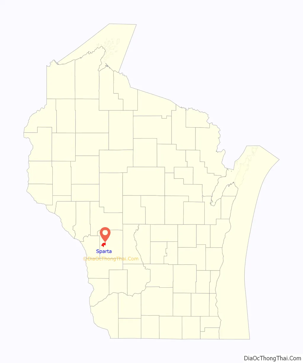
Sparta location map. Where is Sparta city?
History
Sparta is located on former Ho-Chunk territory acquired by the United States in 1837. White settlement began after the government surveyed the land in 1849 and created a crossroads by building early state roads from Prairie du Chien to Hudson in 1849 and from Portage to La Crosse in 1851. The first recorded settlers were brothers Frank and William Petit, who opened a tavern near the crossroads in 1851. Their mother, recorded only as Mrs. Petit, named the settlement after the ancient Greek city-state of Sparta. A post office has been in operation at Sparta since 1852.
In 1854, the Wisconsin Legislature named Sparta the county seat for the newly organized Monroe County. The settlement grew with the arrival of the La Crosse and Milwaukee Railroad in 1858 and the Chicago and North Western Railroad in 1873. The La Crosse River and area creeks provided water power for early sawmills and gristmills, and the town attracted a variety of small manufacturers in the late nineteenth century. Residents also promoted Sparta as a health resort after drilling artesian wells for mineral water in the 1860s. The current Monroe County Courthouse was built in Sparta in 1895, replacing an 1863 structure.
The United States Army began to acquire land for training grounds near Sparta in 1905 and 1909. The training camp developed into Fort McCoy, named for Sparta resident Robert Bruce McCoy, and became a significant contributor to the city’s economy.
In 1967, the former route of the Chicago and North Western Railroad into Sparta was converted into the Elroy-Sparta State Trail, considered the nation’s first rail trail conversion.
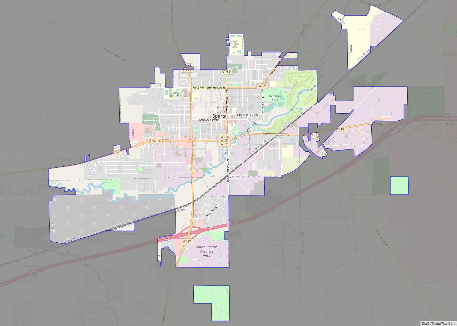
Sparta Road Map
Sparta city Satellite Map
Geography
According to the United States Census Bureau, the city has a total area of 8.06 square miles (20.88 km), of which 8.01 square miles (20.75 km) is land and 0.06 square miles (0.16 km) is water.
Climate
Sparta’s location in the United States’ upper midwest gives the area a temperate, continental climate. The warmest month of the year is July, with an average high temperature of 85 °F (29 °C), with overnight low temperatures averaging 63 °F (18 °C). January is the coldest month, with high temperatures averaging 26 °F (−4 °C), with the overnight low temperatures around 6 °F (−14 °C).
Transportation
Commuter bus service towards La Crosse or Tomah is provided three times daily per direction by Scenic Mississippi Regional Transit. In addition, there is a daily intercity bus from Minneapolis to Milwaukee, which stops in Sparta. (See: List of intercity bus stops in Wisconsin)
The Sparta/Fort McCoy Airport serves general aviation for the area.
Railroad tracks owned by Canadian Pacific Railway (CPR) pass through Sparta, providing freight service.
The city is served by several major highways, including Interstate 90, Wisconsin State Highway 16, Wisconsin State Highway 21, Wisconsin State Highway 27, and Wisconsin State Highway 71.
Sparta is at one end of the Elroy-Sparta State Trail. Opened in 1967, this is considered to be the first rail trail conversion. It is a 32-mile (51 km) bike trail that was redeveloped from an abandoned railway and passes through rural scenery and three tunnels. It is part of the larger Wisconsin bike trail system operated by the state of Wisconsin. Based on this, Sparta dubs itself the “Bicycling Capital of America”; the entrance to the town is marked by an oversized sculpture of a bicyclist on an old-fashioned penny farthing high-wheel bicycle. The statue, named Ben Bikin’, has been given the title of “World’s Largest Bicyclist.” An annual bike ride held annually in October and called the “Will to Ben” runs between the Ben Bikin’ statue with another from the same mold, named Will B. Rolling, which is located in Port Byron, Illinois.
See also
Map of Wisconsin State and its subdivision:- Adams
- Ashland
- Barron
- Bayfield
- Brown
- Buffalo
- Burnett
- Calumet
- Chippewa
- Clark
- Columbia
- Crawford
- Dane
- Dodge
- Door
- Douglas
- Dunn
- Eau Claire
- Florence
- Fond du Lac
- Forest
- Grant
- Green
- Green Lake
- Iowa
- Iron
- Jackson
- Jefferson
- Juneau
- Kenosha
- Kewaunee
- La Crosse
- Lafayette
- Lake Michigan
- Lake Superior
- Langlade
- Lincoln
- Manitowoc
- Marathon
- Marinette
- Marquette
- Menominee
- Milwaukee
- Monroe
- Oconto
- Oneida
- Outagamie
- Ozaukee
- Pepin
- Pierce
- Polk
- Portage
- Price
- Racine
- Richland
- Rock
- Rusk
- Saint Croix
- Sauk
- Sawyer
- Shawano
- Sheboygan
- Taylor
- Trempealeau
- Vernon
- Vilas
- Walworth
- Washburn
- Washington
- Waukesha
- Waupaca
- Waushara
- Winnebago
- Wood
- Alabama
- Alaska
- Arizona
- Arkansas
- California
- Colorado
- Connecticut
- Delaware
- District of Columbia
- Florida
- Georgia
- Hawaii
- Idaho
- Illinois
- Indiana
- Iowa
- Kansas
- Kentucky
- Louisiana
- Maine
- Maryland
- Massachusetts
- Michigan
- Minnesota
- Mississippi
- Missouri
- Montana
- Nebraska
- Nevada
- New Hampshire
- New Jersey
- New Mexico
- New York
- North Carolina
- North Dakota
- Ohio
- Oklahoma
- Oregon
- Pennsylvania
- Rhode Island
- South Carolina
- South Dakota
- Tennessee
- Texas
- Utah
- Vermont
- Virginia
- Washington
- West Virginia
- Wisconsin
- Wyoming