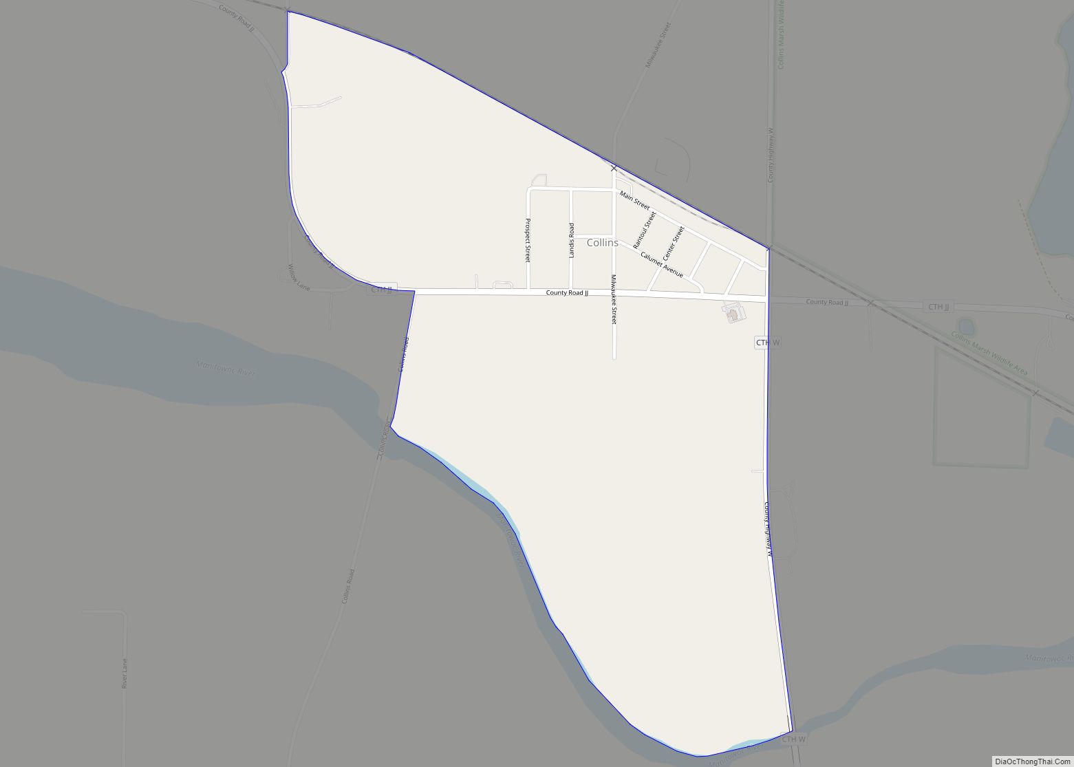
Map of Shorewood Hills village

Map of Shorewood Hills village

Shorewood Hills is a village in Dane County, Wisconsin, United States. It was established in 1927. The population was 2,169 at the 2020 census. Entirely surrounded by the city of Madison and Lake Mendota, it is part of the Madison Metropolitan Statistical Area. Shorewood Hills village overview: Name: Shorewood Hills village LSAD Code: 47 LSAD … Read more

Map of Sauk City village

Map of Sauk City village

Sauk City is a village in Sauk County, Wisconsin, United States. The population was 3,518 as of the 2020 census. The first incorporated village in the state, the community was founded by Agoston Haraszthy and his business partner, Robert Bryant. The village is adjacent to Prairie du Sac; together, these twin villages are referred to … Read more

Map of Shiocton village

Map of Shiocton village

Shiocton is a village in Outagamie County, Wisconsin, United States. The population was 921 at the 2010 census. It is wholly surrounded by the Town of Bovina. Shiocton village overview: Name: Shiocton village LSAD Code: 47 LSAD Description: village (suffix) State: Wisconsin County: Outagamie County Founded: 1850 Incorporated: 1903 Elevation: 768 ft (234 m) Total Area: 1.67 sq mi … Read more

Map of Sandy Hook CDP, Wisconsin

Map of Sandy Hook CDP, Wisconsin

Sandy Hook is a census-designated place in the town of Jamestown, Grant County, Wisconsin, United States. Its population was 185 as of the 2010 census. Sandy Hook CDP overview: Name: Sandy Hook CDP LSAD Code: 57 LSAD Description: CDP (suffix) State: Wisconsin County: Grant County Elevation: 879 ft (268 m) Total Area: 1.398 sq mi (3.62 km²) Land Area: 1.398 sq mi … Read more

Map of Sherwood village, Wisconsin

Map of Sherwood village, Wisconsin

Sherwood is a village in Calumet County, Wisconsin, United States. The population was 2,713 at the 2010 census. The former historical unincorporated community of High Cliff is located within present-day Sherwood. The village began as a named unincorporated community within the Town of Harrison, and is named for a Civil War veteran veteran stagecoach driver, … Read more

Map of Salem Lakes village

Map of Salem Lakes village

Salem Lakes, formerly the town of Salem and the village of Silver Lake, is a village in Kenosha County, Wisconsin, United States. The village was created by a municipal merger on February 14, 2017. The population was 14,601 at the 2020 census. The communities of Benet Lake, Camp Lake, Cross Lake, Fox River, Lake Shangrila, … Read more

Map of Shell Lake city

Map of Shell Lake city

Shell Lake is a city in Washburn County, Wisconsin, United States. The population was 1,347 at the 2010 census. It is the county seat of Washburn County. Shell Lake city overview: Name: Shell Lake city LSAD Code: 25 LSAD Description: city (suffix) State: Wisconsin County: Washburn County Elevation: 1,240 ft (380 m) Total Area: 10.24 sq mi (26.53 km²) Land … Read more

Map of Sheldon village, Wisconsin

Map of Sheldon village, Wisconsin

Sheldon is a village in Rusk County, Wisconsin, United States. The population was 237 at the 2010 census. Sheldon village overview: Name: Sheldon village LSAD Code: 47 LSAD Description: village (suffix) State: Wisconsin County: Rusk County Elevation: 1,122 ft (342 m) Total Area: 0.66 sq mi (1.72 km²) Land Area: 0.66 sq mi (1.72 km²) Water Area: 0.00 sq mi (0.00 km²) Total Population: 237 Population … Read more

Map of Sheboygan city

Map of Sheboygan city

Sheboygan (/ʃɪˈbɔɪɡən/) is a city in and the county seat of Sheboygan County, Wisconsin, United States. The population was 49,929 at the 2020 census. It is the principal city of the Sheboygan, Wisconsin Metropolitan Statistical Area, which has a population of 118,034. The city is located on the western shore of Lake Michigan at the … Read more

Map of Sheboygan Falls city

Map of Sheboygan Falls city

Sheboygan Falls is a city in Sheboygan County, Wisconsin, United States. Its population was 8,210 at the 2020 census. The city’s downtown is listed on the National Register of Historic Places and is the first Main Street Community in Wisconsin. The city is part of the Sheboygan, Wisconsin Metropolitan Statistical Area. Sheboygan Falls city overview: … Read more

Map of Shawano city

Map of Shawano city

Shawano (pronounced SHAW-no) is a city in Shawano County, Wisconsin, United States. The population was 9,305 at the 2010 census. It is the county seat of Shawano County. Shawano city overview: Name: Shawano city LSAD Code: 25 LSAD Description: city (suffix) State: Wisconsin County: Shawano County Elevation: 817 ft (249 m) Total Area: 6.94 sq mi (17.96 km²) Land Area: … Read more

Map of Sharon village, Wisconsin

Map of Sharon village, Wisconsin

Sharon is a village in Walworth County, Wisconsin, United States. The population was 1,586 at the 2020 census. The village is adjacent to the Town of Sharon. Sharon village overview: Name: Sharon village LSAD Code: 47 LSAD Description: village (suffix) State: Wisconsin County: Walworth County Total Area: 1.73 sq mi (4.47 km²) Land Area: 1.73 sq mi (4.47 km²) Water Area: … Read more