Darlington is a city in and the county seat of Lafayette County in the U.S. state of Wisconsin. The population was 2,462 at the 2020 census. The city is surrounded by the Town of Darlington.
| Name: | Darlington city |
|---|---|
| LSAD Code: | 25 |
| LSAD Description: | city (suffix) |
| State: | Wisconsin |
| County: | Lafayette County |
| Elevation: | 869 ft (265 m) |
| Total Area: | 1.65 sq mi (4.27 km²) |
| Land Area: | 1.65 sq mi (4.27 km²) |
| Water Area: | 0.00 sq mi (0.00 km²) |
| Total Population: | 2,462 |
| Population Density: | 1,494.8/sq mi (577.1/km²) |
| ZIP code: | 53530 |
| Area code: | 608 |
| FIPS code: | 5518875 |
| GNISfeature ID: | 1563718 |
| Website: | darlingtonwi.org |
Online Interactive Map
Click on ![]() to view map in "full screen" mode.
to view map in "full screen" mode.
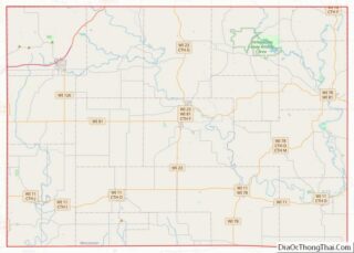
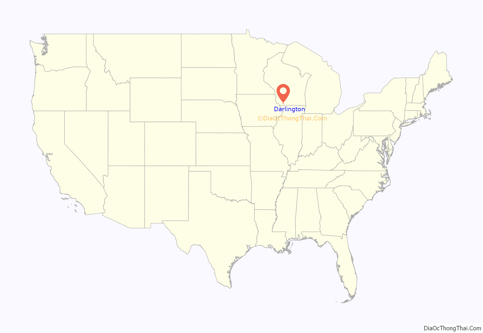
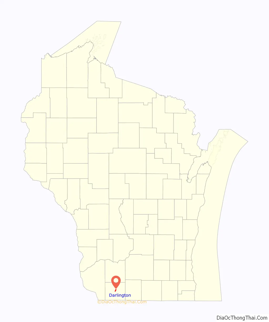
Darlington location map. Where is Darlington city?
History
The first residence within the city limits of Darlington was a log house owned by Jamison Hamilton in 1836. He laid out the village of Avon, or Centre, in 1847. Darlington was first organized in 1849, but was known for a long time as the town of Centre. The first town meeting was held on April 3, 1849, with 82 votes being cast.
The first store was built in 1848. Two more were started in 1851, a millinery shop run by Miss Graham and a store run by Mr. Driver. The first hardware store was opened in 1852 by the Willett Brothers, and the first drug store was opened by J. Collins and Dr. Blair, who was the first resident physician in the city. The first school was opened in the winter of 1850, with 15 students. The first religious services were held some time in 1851 in the barn of Jamison Hamilton. The Mineral Point Railroad reached the town in the fall of 1856, and the citizens were very pleased that their dream of expanding their “village” was finally coming true.
In 1857, the county seat was moved from Shullsburg to Darlington, and the courthouse was built using county funds (Other reports assert this county court house is the only one in Wisconsin, paid for with a charitable gift. The donor has been described as a successful mineral miner in the county.). The courthouse was also moved to Darlington in 1861, and in 1869 the town of Centre became known as Darlington. The name was changed because Joshua Darling purchased the land in 1850 with the help of J.M. Keep and J.B. Lynde. The survey of the original streets and blocks of the community took place in June 1850 by Josiah Richardson and H. H. Gray, assisted by an Indian named January.
The streets of the town were named after the wives of the planners and prominent men of the town, such as Minerva, Mary, Harriet, Lucy, Louisa, and Cornelia. “Minerva was the wife of James G. Knight, the first president of the village, and Mary was the wife of Josepheus Driver, one of the first businessmen of Darlington. Harriet was the wife of Hamilton Gray, and Lucy was the wife of William K. Jackman. Louisa was the wife of Isaah Stockwell, and Cornelia was the wife of James M. Keep, one of the original founders of the community.” He also aided Joshua Darling in the purchase of the land.
The Ringling Brothers Circus and Darlington
Alfred T. Ringling established himself in Darlington, Wisconsin at the age of 20, working as a harness maker in his own shop. He gave little shows for the students in schools and citizens of Darlington and the surrounding towns, with an act that included having four strong farmers lift up a plow, with Alfred lying beneath it. They positioned the plow so Alfred could balance it on his chin. It was a major crowd pleaser.
The Parson Brothers, Joe and Alfred E. “Butch” Parson, from Darlington were also interested in the circus. Joe Parson, the older of the two, worked in a lumber camp in the winter months in the 1870s. It was said that he bought a bison that he saw grazing in a field one spring when he was returning from the lumber camp. He made a deal with the farmer that owned it, and Joe gave the farmer his horse in exchange for the bison. Joe started showing his bison at carnivals and festivals, and he purchased a few more animals to form a show he called “The Great Palace Show”. Alfred Ringling, or Al, worked in the Parson Brother’s show as a ropewalker in 1881 and most likely 1882. He also worked in Parson’s “Great Grecian Show” in 1883.
When the Ringling Brothers (Alfred T., John, Charles, and Otto) were planning their own circus, they invited the Parson Brothers to join them in 1884. The Ringlings had their own band, with Al playing the bass drum, John the cornet, and Charles and Otto the trombone and tuba. John was the leader of their band. The Parsons joined the Ringlings in 1887. Joe Parson did horseback-riding stunts and also performed on the high wire. Butch Parson ran the concession wagon, selling items such as pink lemonade, peanuts, popcorn, Cracker Jacks, cigars, and paper fans. Butch managed the stand and paid a monthly sum to the Ringlings, hired his own help. The Ringlings stored and took care of his concession wagon for him.
Both sets of brothers worked well with each other for a time until the Ringling Brothers felt that the Parson Brothers were making more than them with the concession wagon. In 1906, the Parsons cleared around $30,000, for a 44% profit. The Ringlings wanted to run the concessions by themselves so they could clear more of a profit. Through a series of letters, Otto Ringling tried to sever the ties to the Parsons in December 1907. At first, the letters were formal, requesting that the Parsons allow the Ringlings to run the stand. By November 1908, Otto Ringling wrote to Butch Parson completely ending the relationship between the two families. In the letter, he said that the Ringlings could no longer store the concession wagon because of lack of space. Although their relationship with the Ringlings ended, the Parsons had become very wealthy from the concession wagon.
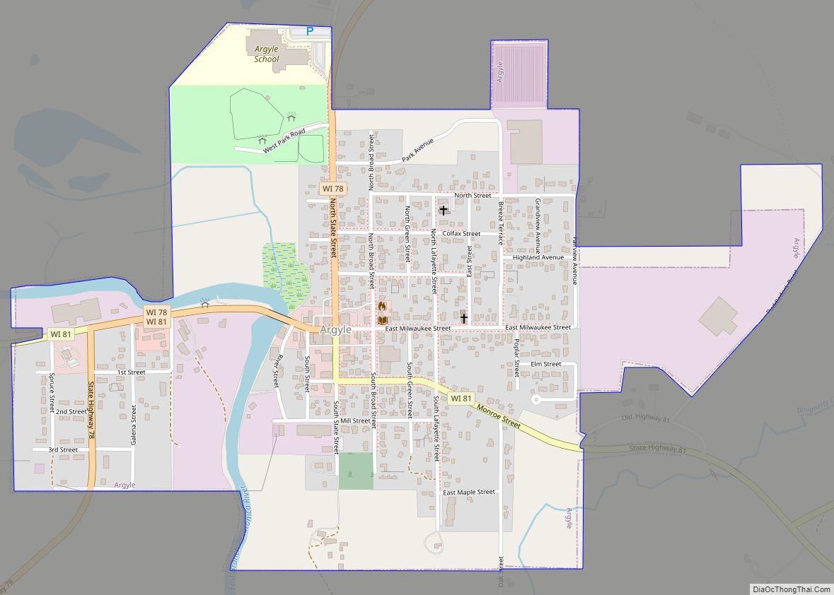
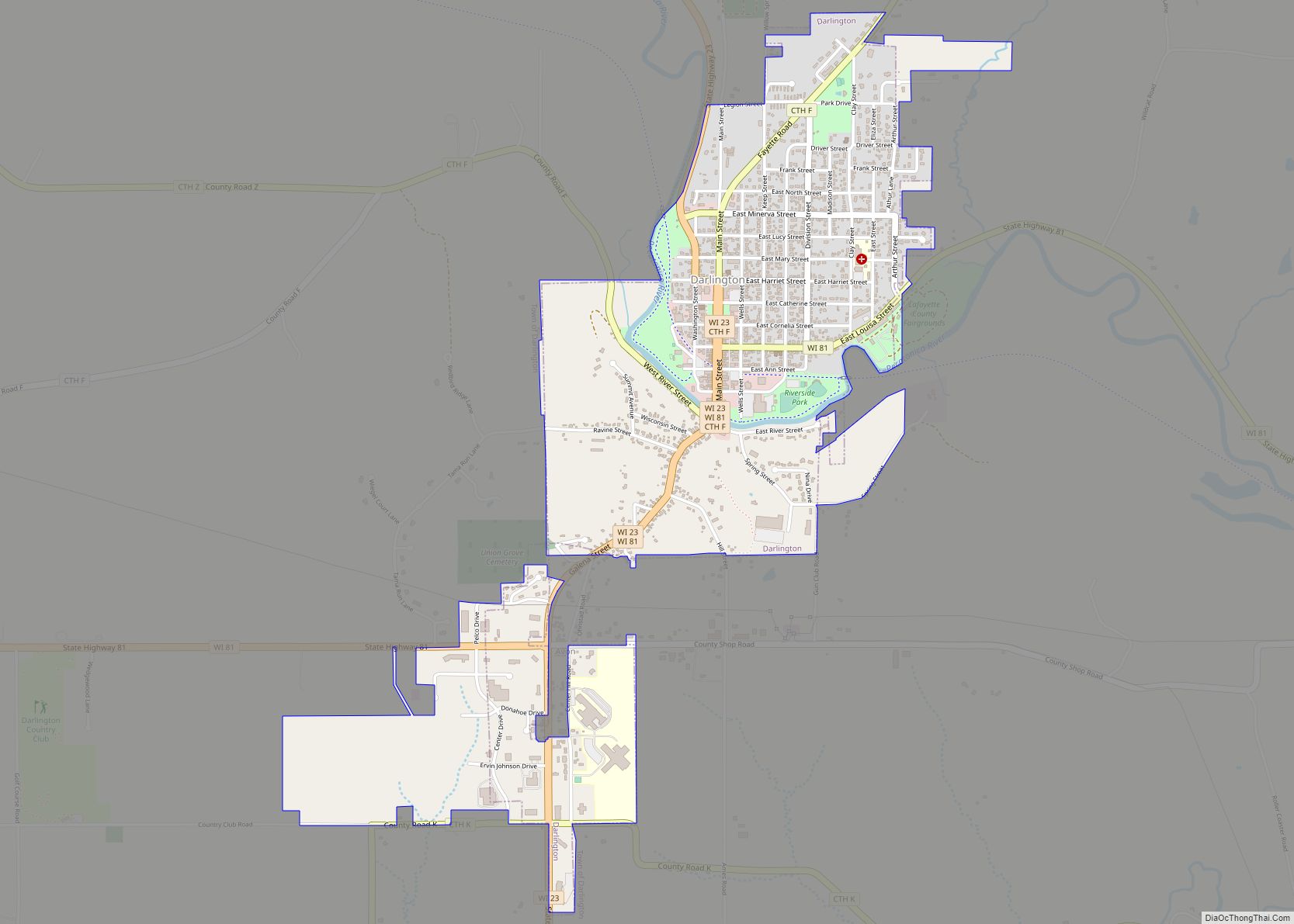
Darlington Road Map
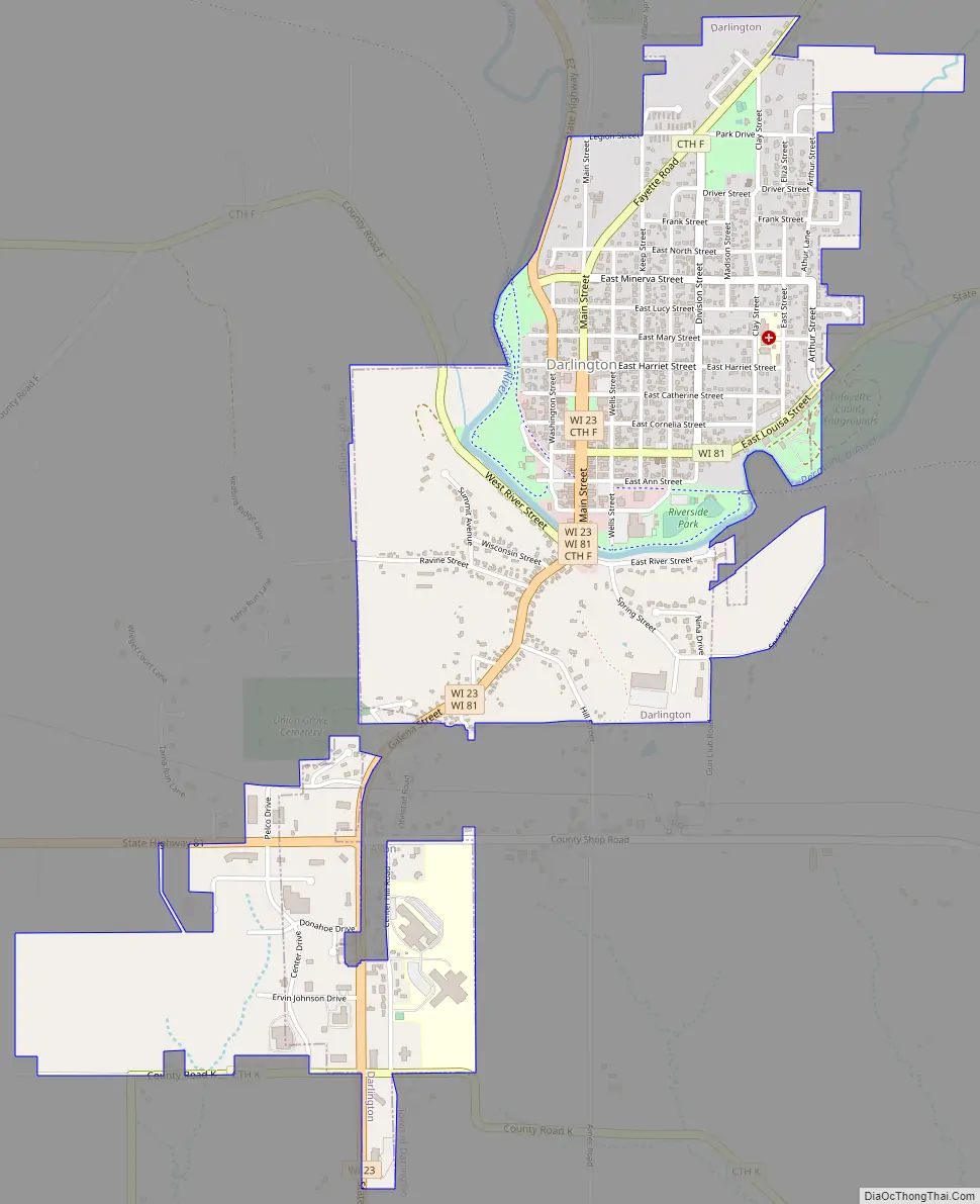
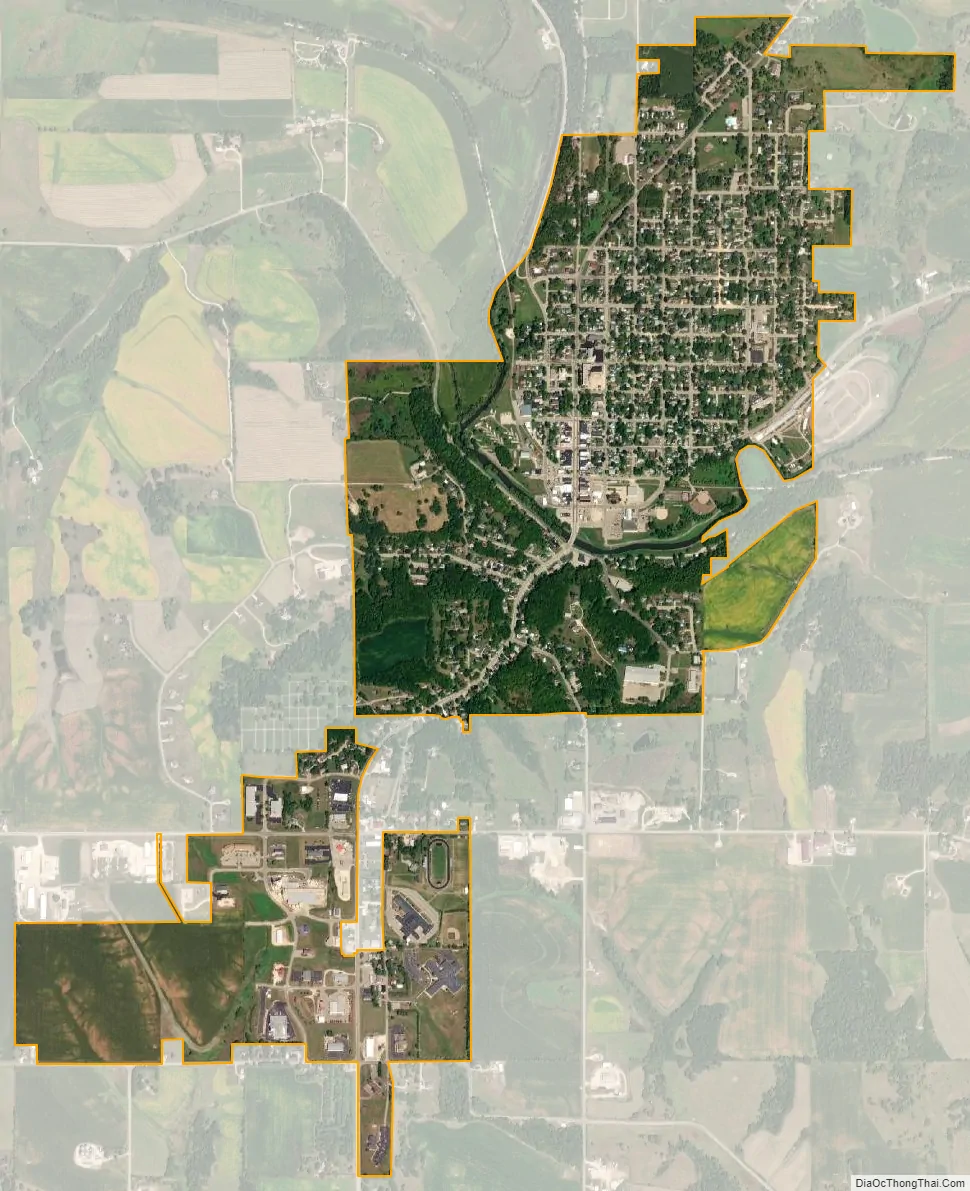
Darlington city Satellite Map
Geography
According to the United States Census Bureau, the city has a total area of 1.34 square miles (3.47 km), all of it land.
See also
Map of Wisconsin State and its subdivision:- Adams
- Ashland
- Barron
- Bayfield
- Brown
- Buffalo
- Burnett
- Calumet
- Chippewa
- Clark
- Columbia
- Crawford
- Dane
- Dodge
- Door
- Douglas
- Dunn
- Eau Claire
- Florence
- Fond du Lac
- Forest
- Grant
- Green
- Green Lake
- Iowa
- Iron
- Jackson
- Jefferson
- Juneau
- Kenosha
- Kewaunee
- La Crosse
- Lafayette
- Lake Michigan
- Lake Superior
- Langlade
- Lincoln
- Manitowoc
- Marathon
- Marinette
- Marquette
- Menominee
- Milwaukee
- Monroe
- Oconto
- Oneida
- Outagamie
- Ozaukee
- Pepin
- Pierce
- Polk
- Portage
- Price
- Racine
- Richland
- Rock
- Rusk
- Saint Croix
- Sauk
- Sawyer
- Shawano
- Sheboygan
- Taylor
- Trempealeau
- Vernon
- Vilas
- Walworth
- Washburn
- Washington
- Waukesha
- Waupaca
- Waushara
- Winnebago
- Wood
- Alabama
- Alaska
- Arizona
- Arkansas
- California
- Colorado
- Connecticut
- Delaware
- District of Columbia
- Florida
- Georgia
- Hawaii
- Idaho
- Illinois
- Indiana
- Iowa
- Kansas
- Kentucky
- Louisiana
- Maine
- Maryland
- Massachusetts
- Michigan
- Minnesota
- Mississippi
- Missouri
- Montana
- Nebraska
- Nevada
- New Hampshire
- New Jersey
- New Mexico
- New York
- North Carolina
- North Dakota
- Ohio
- Oklahoma
- Oregon
- Pennsylvania
- Rhode Island
- South Carolina
- South Dakota
- Tennessee
- Texas
- Utah
- Vermont
- Virginia
- Washington
- West Virginia
- Wisconsin
- Wyoming