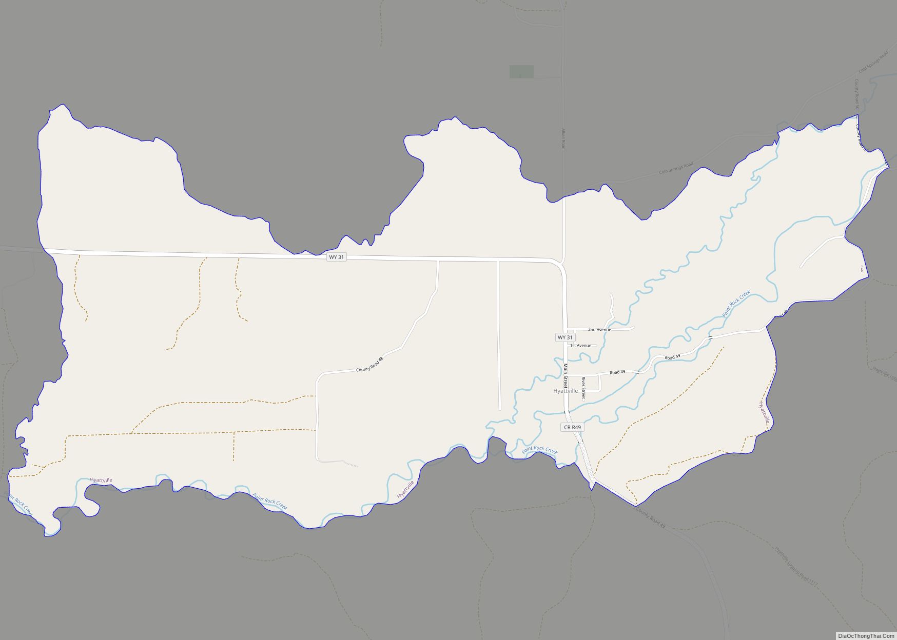
Map of Homa Hills CDP
Homa Hills is a census-designated place (CDP) in Natrona County, Wyoming, United States. It is part of the Casper, Wyoming Metropolitan Statistical Area. The population was 278 at the 2010 census. Homa Hills CDP overview: Name: Homa Hills CDP LSAD Code: 57 LSAD Description: CDP (suffix) State: Wyoming County: Natrona County Elevation: 5,299 ft (1,615 m) Total ... Read more
Map of Homa Hills CDP
Map of Hoback CDP
Hoback is a census-designated place (CDP) in Teton County, Wyoming, United States. The population was 1,176 at the 2010 census. It is part of the Jackson, WY–ID Micropolitan Statistical Area. The town is named for John Hoback, a mountain man who guided the Astor party through the area in 1811. Hoback CDP overview: Name: Hoback ... Read more
Map of Hoback CDP
Map of Hillsdale CDP, Wyoming
Hillsdale is an unincorporated community and census-designated place in southeastern Laramie County, Wyoming, United States. As of the 2010 census, it had a population of 47. It lies along local roads east of the city of Cheyenne, the county seat of Laramie County. Its elevation is 5,640 feet (1,720 m) above sea level. Although Hillsdale is ... Read more
Map of Hillsdale CDP, Wyoming
Map of Hill View Heights CDP
Hill View Heights is a census-designated place (CDP) in Weston County, Wyoming, United States. The population was 170 at the 2010 census. Hill View Heights CDP overview: Name: Hill View Heights CDP LSAD Code: 57 LSAD Description: CDP (suffix) State: Wyoming County: Weston County Elevation: 4,344 ft (1,324 m) Total Area: 2.2 sq mi (5.7 km²) Land Area: 2.2 sq mi (5.7 km²) ... Read more
Map of Hill View Heights CDP
Map of Hawk Springs CDP
Hawk Springs is a census-designated place (CDP) in Goshen County, Wyoming, United States. The population was 45 at the 2010 census. Hawk Springs State Recreation Area is located 6 miles (9.7 km) southeast of Hawk Springs. Hawk Springs CDP overview: Name: Hawk Springs CDP LSAD Code: 57 LSAD Description: CDP (suffix) State: Wyoming County: Goshen County ... Read more
Map of Hawk Springs CDP
Map of Kemmerer city
Kemmerer is the largest city in and the county seat of Lincoln County, Wyoming, United States. Its population was 2,415 at the 2020 census. Kemmerer city overview: Name: Kemmerer city LSAD Code: 25 LSAD Description: city (suffix) State: Wyoming County: Lincoln County Elevation: 6,949 ft (2,118 m) Total Area: 7.81 sq mi (20.22 km²) Land Area: 7.80 sq mi (20.20 km²) Water Area: ... Read more
Map of Kemmerer city
Map of Mammoth CDP, Wyoming
Mammoth is a census-designated place in Park County, Wyoming, United States, comprising Fort Yellowstone and Mammoth Hot Springs in Yellowstone National Park. As of the 2010 census, its population was 263. Some students from Mammoth attend Gardiner Public Schools in Gardiner, Montana. Mammoth CDP overview: Name: Mammoth CDP LSAD Code: 57 LSAD Description: CDP (suffix) ... Read more
Map of Mammoth CDP, Wyoming
Map of Lyman town, Wyoming
Lyman is a town in Uinta County, Wyoming, United States. The population was 2,115 at the 2010 census. Lyman town overview: Name: Lyman town LSAD Code: 43 LSAD Description: town (suffix) State: Wyoming County: Uinta County Elevation: 6,706 ft (2,044 m) Total Area: 1.55 sq mi (4.03 km²) Land Area: 1.55 sq mi (4.03 km²) Water Area: 0.00 sq mi (0.00 km²) Total Population: 2,115 Population ... Read more
Map of Lyman town, Wyoming
Map of Kaycee town
Kaycee is a town in Johnson County, Wyoming, United States. The population was 247 at the 2020 census. It is home to a museum that preserves the cattle ranching heritage of the area, especially the history of the Johnson County War. Kaycee was incorporated in 1906 after the establishment of a small post office and ... Read more
Map of Kaycee town
Map of Lusk town
Lusk is a high-plains town in the eastern part of the U.S. state of Wyoming. The town is the seat of Niobrara County. The town was founded in July 1886, by Frank S. Lusk, a renowned Wyoming rancher, partner in the Western Live Stock Company, and stockholder in the Wyoming Central Railway. Cattle ranching remains ... Read more
Map of Lusk town
Map of Johnstown CDP, Wyoming
Johnstown is a census-designated place (CDP) in Fremont County, Wyoming, United States. The population was 242 at the 2010 census. Johnstown CDP overview: Name: Johnstown CDP LSAD Code: 57 LSAD Description: CDP (suffix) State: Wyoming County: Fremont County Elevation: 5,259 ft (1,603 m) Total Area: 32.1 sq mi (83.2 km²) Land Area: 31.5 sq mi (81.5 km²) Water Area: 0.7 sq mi (1.8 km²) Total Population: ... Read more
Map of Johnstown CDP, Wyoming
Map of Lucerne CDP, Wyoming
Lucerne is a census-designated place (CDP) in Hot Springs County, Wyoming, United States. The population was 535 at the 2010 census. Lucerne CDP overview: Name: Lucerne CDP LSAD Code: 57 LSAD Description: CDP (suffix) State: Wyoming County: Hot Springs County Elevation: 4,315 ft (1,315 m) Total Area: 20.6 sq mi (53 km²) Land Area: 19.9 sq mi (52 km²) Water Area: 0.7 sq mi (2 km²) ... Read more
Map of Lucerne CDP, Wyoming