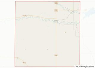
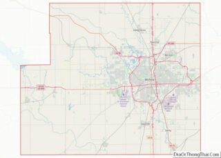
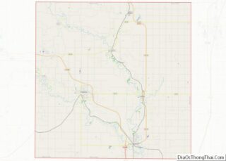
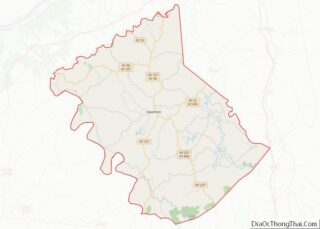
Map of Custer County, Colorado
Custer County is a county located in the U.S. state of Colorado. As of the 2020 census, the population was 4,704. The county seat is Westcliffe. Custer County overview: Name: Custer County FIPS code: 08-027 State: Colorado Founded: March 9, 1877 Named for: George Armstrong Custer Seat: Westcliffe Largest town: Silver Cliff Total Area: 740 sq mi ... Read more
Map of Custer County, Colorado
Map of Jefferson County, Colorado
Jefferson County is a county located in the U.S. state of Colorado. As of the 2020 census, the population was 582,910, making it the fourth-most populous county in Colorado. The county seat is Golden, and the most populous city is Lakewood. Jefferson County is included in the Denver–Aurora-Lakewood, CO Metropolitan Statistical Area. Located along the ... Read more
Map of Jefferson County, Colorado
Map of Ouray County, Colorado
Ouray County /ˈjʊəreɪ/ is a county located in the U.S. state of Colorado. As of the 2020 census, the population was 4,874. The county seat is Ouray. Because of its rugged mountain topography, Ouray County is also known as the Switzerland of America. Ouray County overview: Name: Ouray County FIPS code: 08-091 State: Colorado Founded: ... Read more
Map of Ouray County, Colorado
Map of Weld County, Colorado
Weld County is a county located in the U.S. state of Colorado. As of the 2020 census, the population was 328,981. The county seat is Greeley. Weld County comprises the Greeley, CO Metropolitan Statistical Area, which is included in the Denver–Aurora, CO Combined Statistical Area. Weld County overview: Name: Weld County FIPS code: 08-123 State: ... Read more
Map of Weld County, Colorado
Map of Bay County, Florida
Bay County is a county on the Emerald Coast in Northwest Florida. As of the 2020 census, the population was 175,216. Its county seat is Panama City. Bay County is included in the Panama City, Florida Metropolitan Statistical Area. Bay County overview: Name: Bay County FIPS code: 12-005 State: Florida Founded: April 24, 1913 Named ... Read more
Map of Bay County, Florida
Map of Gadsden County, Florida
Gadsden County is a county located in the panhandle of the U.S. state of Florida. As of the 2020 census, the population was 43,826. Its county seat is Quincy. Gadsden County is included in the Tallahassee, FL Metropolitan Statistical Area. Gadsden County is the only majority (over 50%) African-American county in Florida. Gadsden County overview: ... Read more
Map of Gadsden County, Florida
Map of Lee County, Florida
Lee County is located in southwestern Florida on the Gulf Coast. As of the 2020 census, the population was 760,822. The county seat is Fort Myers (with a population of 86,395 as of the 2020 census), and the largest city is Cape Coral with an estimated 2020 population of 194,016. The county comprises the Cape ... Read more
Map of Lee County, Florida
Map of Pasco County, Florida
Pasco County is located on the west central coast of the U.S. state of Florida. According to the 2020 census, the population was 561,691. Its county seat is Dade City, and its largest city is Zephyrhills. The county is named after Samuel Pasco. Pasco County is included in the Tampa Bay Area and is primarily ... Read more
Map of Pasco County, Florida
Map of Washington County, Florida
Washington County is a county located in the northwestern part of the U.S. state of Florida, in the Panhandle. As of the 2020 census, the population was 25,318. Its county seat is Chipley. Washington County overview: Name: Washington County FIPS code: 12-133 State: Florida Founded: December 9, 1825 Named for: George Washington Seat: Chipley Largest ... Read more
Map of Washington County, Florida
Map of Bulloch County, Georgia
Bulloch County is a county located in the southeastern part of the U.S. state of Georgia. As of the 2020 census, the population was 81,099, up from 70,217 in 2010. The county seat is Statesboro. Bulloch County comprises the Statesboro, GA Micropolitan Statistical Area, which is included in the Savannah–Hinesville–Statesboro Combined Statistical Area. The county ... Read more
Map of Bulloch County, Georgia
Map of Clinch County, Georgia
Clinch County is a county located in the southeastern part of the U.S. state of Georgia. As of the 2020 census, the population was 6,749. The county seat is Homerville. The county was created on February 14, 1850, named in honor of Duncan Lamont Clinch. Clinch County overview: Name: Clinch County FIPS code: 13-065 State: ... Read more
Map of Clinch County, Georgia
Map of Douglas County, Georgia
Douglas County is a county located in the north central portion of the U.S. state of Georgia. As of the 2020 U.S. Census, the population was 144,237, having more than doubled since 1990. The county seat is Douglasville. Douglas County is included in the Atlanta-Sandy Springs-Roswell, GA Metropolitan Statistical Area. It has attracted new residents ... Read more
Map of Douglas County, Georgia