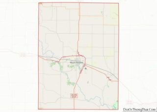
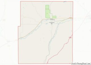
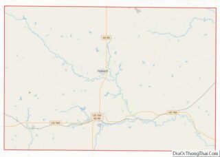
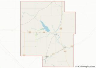
Map of Eau Claire County, Wisconsin
Eau Claire County overview: Name: Eau Claire County FIPS code: 55-035 State: Wisconsin Founded: 1856 Named for: Eau Claire River Seat: Eau Claire Largest city: Eau Claire Total Area: 645 sq mi (1,670 km²) Land Area: 638 sq mi (1,650 km²) Total Population: 105,710 Population Density: 165.7/sq mi (64.0/km²) Eau Claire County location map. Where is Eau Claire County? History Eau Claire ... Read more
Map of Eau Claire County, Wisconsin
Map of Lake Michigan Water body, Wisconsin
Lake Michigan Water body overview: Name: Lake Michigan Water body State: Wisconsin Lake Michigan Water body location map. Where is Lake Michigan Water body? Lake Michigan Water body Road Map Lake Michigan Water body Topographic Map Lake Michigan Water body Satellite Map Lake Michigan Water body Outline Map
Map of Lake Michigan Water body, Wisconsin
Map of Pierce County, Wisconsin
Pierce County is a county in the U.S. state of Wisconsin. As of the 2020 census, the population was 42,212. Its county seat is Ellsworth. Pierce County is part of the Minneapolis–St. Paul–Bloomington, MN-WI Metropolitan Statistical Area. Pierce County overview: Name: Pierce County FIPS code: 55-093 State: Wisconsin Founded: 1853 Named for: Franklin Pierce Seat: ... Read more
Map of Pierce County, Wisconsin
Map of Vilas County, Wisconsin
Vilas County (/vaɪləs/ VYE-ləss) is a county in the state of Wisconsin, United States. As of the 2020 census, the population was 23,047. Its county seat is Eagle River. The county partly overlaps the reservation of the Lac du Flambeau Band of Lake Superior Chippewa. Vilas County overview: Name: Vilas County FIPS code: 55-125 State: ... Read more
Map of Vilas County, Wisconsin
Map of Goshen County, Wyoming
Goshen County is a county in the U.S. state of Wyoming. As of the 2020 United States Census, the population was 12,498. Its county seat is Torrington. The eastern boundary of the County borders the Nebraska state line. Goshen County produces more cattle than any other Wyoming county. In 1997, the county had a total ... Read more
Map of Goshen County, Wyoming
Map of Clarke County, Alabama
Clarke County is a county located in the southwestern part of the U.S. state of Alabama. As of the 2020 census, the population was 23,087. The county seat is Grove Hill. The county’s largest city is Jackson. The county was created by the legislature of the Mississippi Territory in 1812. It is named in honor ... Read more
Map of Clarke County, Alabama
Map of Fayette County, Alabama
Fayette County is a county located in the U.S. state of Alabama. As of the 2020 census, the population was 16,321. Its county seat is Fayette. Its name is in honor of the Marquis de Lafayette (or de la Fayette), who aided General George Washington in the American Revolutionary War. Fayette County overview: Name: Fayette ... Read more
Map of Fayette County, Alabama
Map of Madison County, Alabama
Madison County is located in the north central portion of the U.S. state of Alabama. As of the 2020 Census, the population was 388,153, making it the third-most populous county in Alabama. Its county seat is Huntsville. Since the mid-20th century it has become an area of defense and space research and industry. The county ... Read more
Map of Madison County, Alabama
Map of Talladega County, Alabama
Talladega County (pronounced Talla-dig-a) is one of the sixty-seven counties located in the east central portion of the U.S. state of Alabama. As of the 2020 census, the population was 82,149. Its county seat is Talladega. Talladega County is included in the Talladega-Sylacauga, AL Micropolitan Statistical Area, which is also included in the Birmingham–Hoover-Talladega, AL ... Read more
Map of Talladega County, Alabama
Map of Juneau City and Borough, Alaska
The City and Borough of Juneau, more commonly known simply as Juneau (/ˈdʒuːnoʊ/ JOO-noh; Tlingit: Dzánti K’ihéeni [ˈtsʌ́ntʰɪ̀ kʼɪ̀ˈhíːnɪ̀]), is the capital city of the U.S. state of Alaska. Located in the Gastineau Channel and the Alaskan panhandle, it is a unified municipality and the second-largest city in the United States by area. Juneau was ... Read more
Map of Juneau City and Borough, Alaska
Map of Yukon-Koyukuk Census Area, Alaska
Yukon–Koyukuk Census Area (/ˈjuːkɒn ˈkaɪjəkək/) is a census area in the U.S. state of Alaska. As of the 2020 census, the population was 5,343, down from 5,588 in 2010. With an area of 147,842.51 sq mi (382,910.3 km), it is the largest of any county or county-equivalent in the United States, or about the same size as the ... Read more
Map of Yukon-Koyukuk Census Area, Alaska
Map of Arkansas County, Arkansas
Arkansas County is a county located in the U.S. state of Arkansas. As of the 2020 census, the population was 17,149. Located in the Arkansas Delta, the county has two county seats, DeWitt and Stuttgart. The first of the state’s 75 present-day counties to be created, Arkansas County was formed on December 13, 1813, when ... Read more
Map of Arkansas County, Arkansas