Henry County is a county located in the U.S. state of Iowa. As of the 2020 census, the population was 20,482. The county seat is Mount Pleasant. The county was named for General Henry Dodge, governor of Wisconsin Territory.
| Name: | Henry County |
|---|---|
| FIPS code: | 19-087 |
| State: | Iowa |
| Founded: | December 7, 1836 |
| Named for: | Henry Dodge |
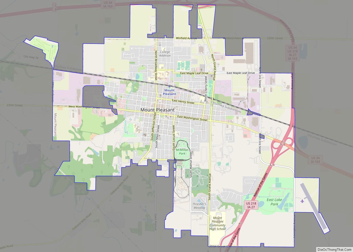
| Seat: | Mount Pleasant |
| Largest city: | Mount Pleasant |
| Total Area: | 437 sq mi (1,130 km²) |
| Land Area: | 434 sq mi (1,120 km²) |
| Total Population: | 20,482 |
| Population Density: | 47/sq mi (18/km²) |
| Time zone: | UTC−6 (Central) |
| Summer Time Zone (DST): | UTC−5 (CDT) |
| Website: | henrycounty.iowa.gov |
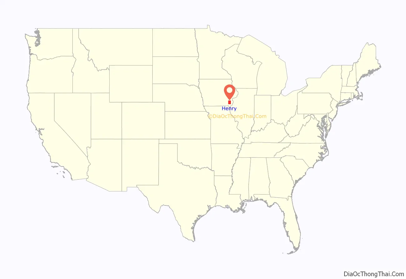
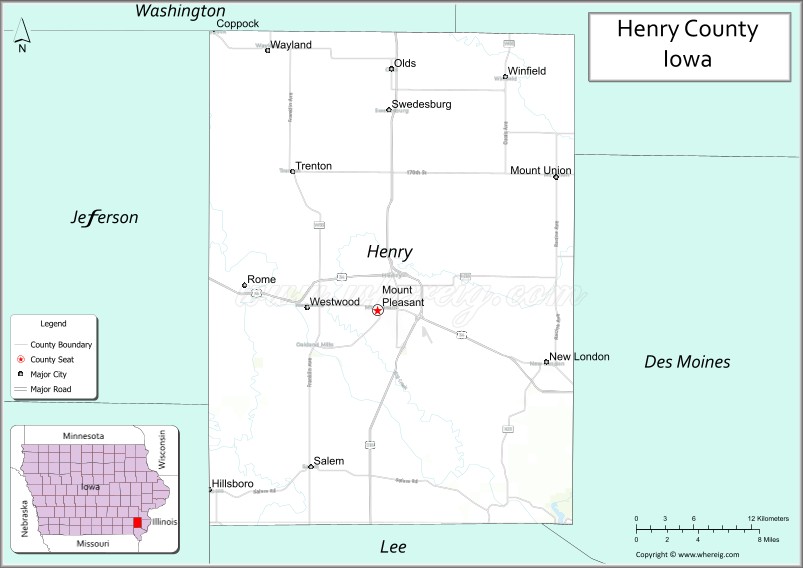
Henry County location map. Where is Henry County?

History
Henry County was formed on December 7, 1836, under the jurisdiction of Wisconsin Territory, and became a part of Iowa Territory when the Iowa Territory was formed on July 4, 1838. It was named for General Henry Dodge.
The county’s first courthouse was built in 1839–1840. A larger courthouse was built in 1871, and the present courthouse was raised in the twentieth century, being placed into service on August 4, 1914.
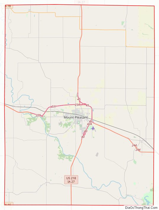
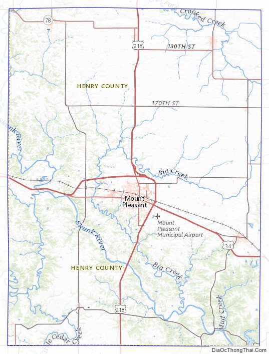
Henry County Road Map
Geography
According to the U.S. Census Bureau, the county has a total area of 437 square miles (1,130 km), of which 434 square miles (1,120 km) is land and 2.2 square miles (5.7 km) (0.5%) is water.
Major highways
- U.S. Highway 34
- U.S. Highway 218/Iowa Highway 27
- Iowa Highway 16
- Iowa Highway 78
Transit
- Mount Pleasant station
- List of intercity bus stops in Iowa
Adjacent counties
- Washington County (north)
- Louisa County (northeast)
- Des Moines County (east)
- Lee County (south)
- Van Buren County (southwest)
- Jefferson County (west)
Henry County Topographic Map
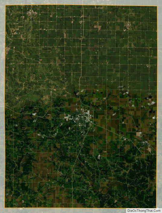
Henry County Satellite Map
Henry County Outline Map