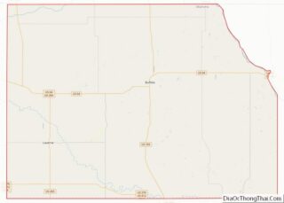
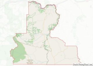
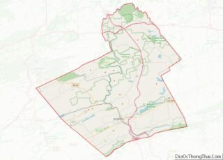
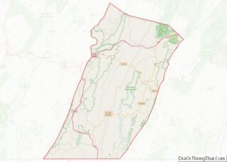
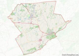
Map of Clarke County, Virginia
Clarke County is a county in the Commonwealth of Virginia. As of the 2020 census, the population was 14,783. Its county seat is Berryville. Clarke County is included in the Washington-Arlington-Alexandria, DC-VA-MD-WV Metropolitan Statistical Area. Clarke County overview: Name: Clarke County FIPS code: 51-043 State: Virginia Founded: 1836 Named for: George Rogers Clark Seat: Berryville ... Read more
Map of Clarke County, Virginia
Map of Floyd County, Virginia
Floyd County is a county located in the Commonwealth of Virginia. As of the 2020 census, the population was 15,476. Its county seat is the town of Floyd. Floyd County is included in the Blacksburg–Christiansburg, VA Metropolitan Statistical Area. Named after Virginia politician John Floyd, the county was established in 1831. The county is located ... Read more
Map of Floyd County, Virginia
Map of Henrico County, Virginia
Henrico County /hɛnˈraɪkoʊ/, officially the County of Henrico, is located in the Commonwealth of Virginia in the United States. As of the 2020 census, the population was 334,389 making it the fifth-most populous county in Virginia. Henrico County is included in the Greater Richmond Region. There is no incorporated community within Henrico County; therefore, there ... Read more
Map of Henrico County, Virginia
Map of Madison County, Virginia
Madison County is a county located in the Commonwealth of Virginia. As of the 2020 census, the population was 13,837. Its county seat is Madison. Madison County overview: Name: Madison County FIPS code: 51-113 State: Virginia Founded: 1792 Named for: Madison family Seat: Madison Largest town: Madison Total Area: 322 sq mi (830 km²) Land Area: 321 sq mi (830 km²) ... Read more
Map of Madison County, Virginia
Map of Orange County, Virginia
Orange County is a county located in the Central Piedmont region of the Commonwealth of Virginia. At the 2020 census, the population was 36,254. Its county seat is Orange. Orange County includes Montpelier, the 2,700-acre (1,100 ha) estate of James Madison, the 4th President of the United States and often known as the “Father of the ... Read more
Map of Orange County, Virginia
Map of Roanoke City, Virginia
Roanoke (/ˈroʊ.əˌnoʊk/ ROH-ə-nohk) is an independent city in the U.S. state of Virginia. At the 2020 census, the population was 100,011, making it the 8th most populous city in the Commonwealth of Virginia and the largest city in Virginia west of Richmond. It is located in the Roanoke Valley of the Roanoke Region of Virginia. ... Read more
Map of Roanoke City, Virginia
Map of Virginia Beach City, Virginia
Virginia Beach is an independent city located on the southeastern coast of the Commonwealth of Virginia in the United States. The population was 459,470 at the 2020 census. Although mostly suburban in character, it is the most populous city in the Commonwealth of Virginia, fifth-most populous city in the Mid-Atlantic, ninth-most populous city in the ... Read more
Map of Virginia Beach City, Virginia
Map of Columbia County, Washington
Columbia County is a county located in the U.S. state of Washington. As of the 2020 census, the population was 3,952, making it the second-least populous county in Washington. The county seat and largest city is Dayton. The county was created out of Walla Walla County on November 11, 1875, and is named after the ... Read more
Map of Columbia County, Washington
Map of Mason County, Washington
Mason County is a county located in the U.S. state of Washington. As of the 2020 census, the population was 65,726. The county seat and only incorporated city is Shelton. The county was formed out of Thurston County on March 13, 1854. Originally named Sawamish County, it took its present name in 1864 in honor ... Read more
Map of Mason County, Washington
Map of Yakima County, Washington
Yakima County is a county in the U.S. state of Washington. As of the 2020 census, its population was 256,728. The county seat and largest city is Yakima. The county was formed out of Ferguson County in January 1865 and is named for the Yakama tribe of Native Americans. Yakima County comprises the Yakima, WA ... Read more
Map of Yakima County, Washington
Map of Hardy County, West Virginia
Hardy County is a county in the U.S. state of West Virginia. As of the 2020 census, the population was 14,299. Its county seat is Moorefield. The county was created from Hampshire County in 1786 and named for Samuel Hardy, a distinguished Virginian. Hardy County overview: Name: Hardy County FIPS code: 54-031 State: West Virginia ... Read more
Map of Hardy County, West Virginia
Map of Monroe County, West Virginia
Monroe County is a county in the U.S. state of West Virginia. As of the 2020 census, the population was 12,376. Its county seat is Union. Monroe County was the home of Andrew Summers Rowan of Spanish–American War fame, who is immortalized in Elbert Hubbard’s classic A Message to Garcia. The county was also the ... Read more
Map of Monroe County, West Virginia