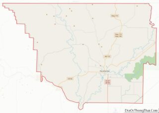
Map of Harrisonburg City, Virginia
Harrisonburg is an independent city in the Shenandoah Valley region of the Commonwealth of Virginia in the United States. It is also the county seat of the surrounding Rockingham County, although the two are separate jurisdictions. At the 2020 census, the population was 51,814. The Bureau of Economic Analysis combines the city of Harrisonburg with ... Read more
Map of Harrisonburg City, Virginia
Map of Lynchburg City, Virginia
Lynchburg is an independent city in the Commonwealth of Virginia in the United States. First settled in 1757 by ferry owner John Lynch, the city’s population was 79,009 at the 2020 census, making Lynchburg the 11th most populous city in Virginia. Located in the foothills of the Blue Ridge Mountains along the banks of the ... Read more
Map of Lynchburg City, Virginia
Map of Nottoway County, Virginia
Nottoway County is a county located in the Commonwealth of Virginia. As of the 2020 census, the population was 15,642. Its county seat is Nottoway. It is situated south of the James River, thus making it a part of the Southside Virginia Region. Nottoway County overview: Name: Nottoway County FIPS code: 51-135 State: Virginia Founded: ... Read more
Map of Nottoway County, Virginia
Map of Roanoke County, Virginia
Roanoke County (/ˈroʊ.əˌnoʊk/ ROH-ə-nohk) is a county located in the U.S. state of the Commonwealth of Virginia. As of the 2020 census, the population was 96,929. Its county seat is Salem, but the county administrative offices are located in the unincorporated Cave Spring area of the county. Roanoke County is part of the Roanoke, Virginia ... Read more
Map of Roanoke County, Virginia
Map of Tazewell County, Virginia
Tazewell County (/tæz.wɛl/) is a county located in the southwestern portion of the U.S. state of Virginia. As of the 2020 census, the population was 40,429. Its county seat is Tazewell. Tazewell County is part of the Bluefield, WV-VA Micropolitan Statistical Area. Its economy was dependent on coal and iron of the Pocahontas Fields from ... Read more
Map of Tazewell County, Virginia
Map of Clark County, Washington
Clark County is the southernmost county in the U.S. state of Washington. As of the 2020 census, the population was 503,311, making it Washington’s fifth-most populous county. Its county seat and largest city is Vancouver. It was the first county in Washington, first named Vancouver County in 1845 before being renamed for William Clark of ... Read more
Map of Clark County, Washington
Map of Lincoln County, Washington
Lincoln County is a county located in the U.S. state of Washington. As of the 2020 census, the population was 10,876, making it the fifth-least populous county in the state. The county seat and largest city is Davenport. Lincoln County was created out of Whitman County in November 1883. It is named for Abraham Lincoln, ... Read more
Map of Lincoln County, Washington
Map of Whitman County, Washington
Whitman County is a county located in the U.S. state of Washington. As of the 2020 census, the population was 47,973. The county seat is Colfax, and its largest city is Pullman. The county was formed from Stevens County in 1871. It is named after Marcus Whitman, a Presbyterian missionary who, with his wife Narcissa, ... Read more
Map of Whitman County, Washington
Map of Hancock County, West Virginia
Hancock County is a county in the U.S. state of West Virginia. As of the 2020 census, the population was 29,095. Its county seat is New Cumberland and its largest city is Weirton. The county was created from Brooke County in 1848 and named for John Hancock, first signer of the Declaration of Independence. Hancock ... Read more
Map of Hancock County, West Virginia
Map of Monongalia County, West Virginia
Monongalia County overview: Name: Monongalia County FIPS code: 54-061 State: West Virginia Founded: October 9, 1776 Seat: Morgantown Largest city: Morgantown Total Area: 366 sq mi (950 km²) Land Area: 360 sq mi (900 km²) Total Population: 105,822 Population Density: 296/sq mi (114/km²) Monongalia County location map. Where is Monongalia County? History Monongalia County takes its name from the Monongahela River. The ... Read more
Map of Monongalia County, West Virginia
Map of Tucker County, West Virginia
Tucker County is a county in the U.S. state of West Virginia. As of the 2020 census, the population was 6,762, making it West Virginia’s fourth-least populous county. Its county seat is Parsons. The county was created in 1856 from a part of Randolph County, then part of Virginia. In 1871, a small part of ... Read more
Map of Tucker County, West Virginia
Map of Calumet County, Wisconsin
Calumet County overview: Name: Calumet County FIPS code: 55-015 State: Wisconsin Founded: 1850 Seat: Chilton Largest city: Chilton Total Area: 397 sq mi (1,030 km²) Land Area: 318 sq mi (820 km²) Total Population: 52,442 Population Density: 164.8/sq mi (63.6/km²) Calumet County location map. Where is Calumet County? History The county’s name originated from the word calumet, the French name for the ... Read more
Map of Calumet County, Wisconsin