Broomfield is a consolidated city and county located in the U.S. state of Colorado. Broomfield has a consolidated government which operates under Article XX, Sections 10-13 of the Constitution of the State of Colorado. The Broomfield population was 74,112 at the 2020 United States Census, making it the 15th most populous municipality and the 12th most populous county in Colorado. Broomfield is a part of the Denver–Aurora–Lakewood, CO Metropolitan Statistical Area and the Front Range Urban Corridor.
| Name: | Broomfield County |
|---|---|
| FIPS code: | 08-014 |
| State: | Colorado |
| Named for: | The broomcorn once grown in the area. |
| Seat: | Broomfield |
| Total Area: | 33.548 sq mi (86.890 km²) |
| Land Area: | 32.968 sq mi (85.387 km²) |
| Total Population: | 74,112 |
| Population Density: | 2,248/sq mi (868/km²) |
| Time zone: | UTC−07:00 (MST) |
| Summer Time Zone (DST): | UTC−06:00 (MDT) |
| Website: | www.broomfield.org |
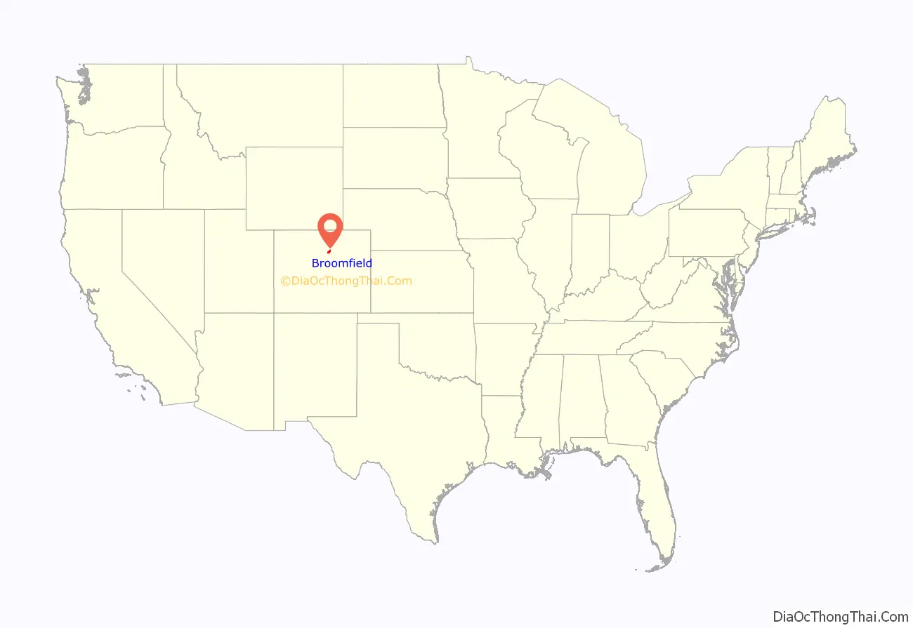
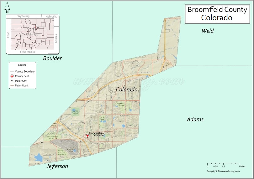
Broomfield County location map. Where is Broomfield County?
History
Several railroads figure in the development of this area. The Colorado Central Railroad built a narrow gauge line from Golden in 1873, the Denver, Utah and Pacific Railroad arrived in 1881, and the Denver, Marshall and Boulder Railway built a line through what would become Broomfield in 1886. The Denver, Utah and Pacific was widened to standard gauge in 1889. One of the early names for the area was Zang’s Spur, after the railroad spur serving Adolph Zang’s grain fields.
The municipality of Broomfield was incorporated in 1961 in the southeastern corner of Boulder County. While it is unsure how it received its name, most researchers guess it is from the broomcorn grown in the area, a tall sorghum that farmers sold for use as brooms and whisk brooms. Over the next three decades, the city grew through annexations. Eventually, Broomfield spilled into portions of four counties: Adams, Boulder, Jefferson and Weld.
In the 1990s, city leaders felt increasing chagrin with the need to deal with four separate court districts, four different county seats, and four separate county sales tax bases. They began pushing to make Broomfield a consolidated city-county similar to Denver, reasoning that they could provide services more responsively if it had its own county government. They sought an amendment to the Colorado State Constitution to create a new county. The amendment was passed in 1998, after which a three-year transition period followed. On November 15, 2001, Broomfield County became the 64th and smallest county of Colorado. It is the most recently created county in Colorado, and also in the United States as a whole if county equivalents are not included.
On February 20, 2021, United Airlines Flight 328 from Denver to Honolulu experienced an engine failure after takeoff from Denver International Airport and debris from the engine landed in parts of Broomfield. Multiple homes were damaged, but no injuries were reported, and the plane landed safely at DIA.
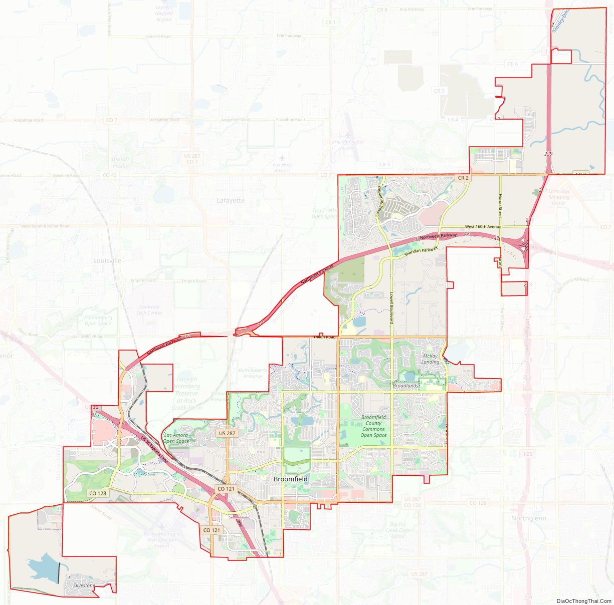
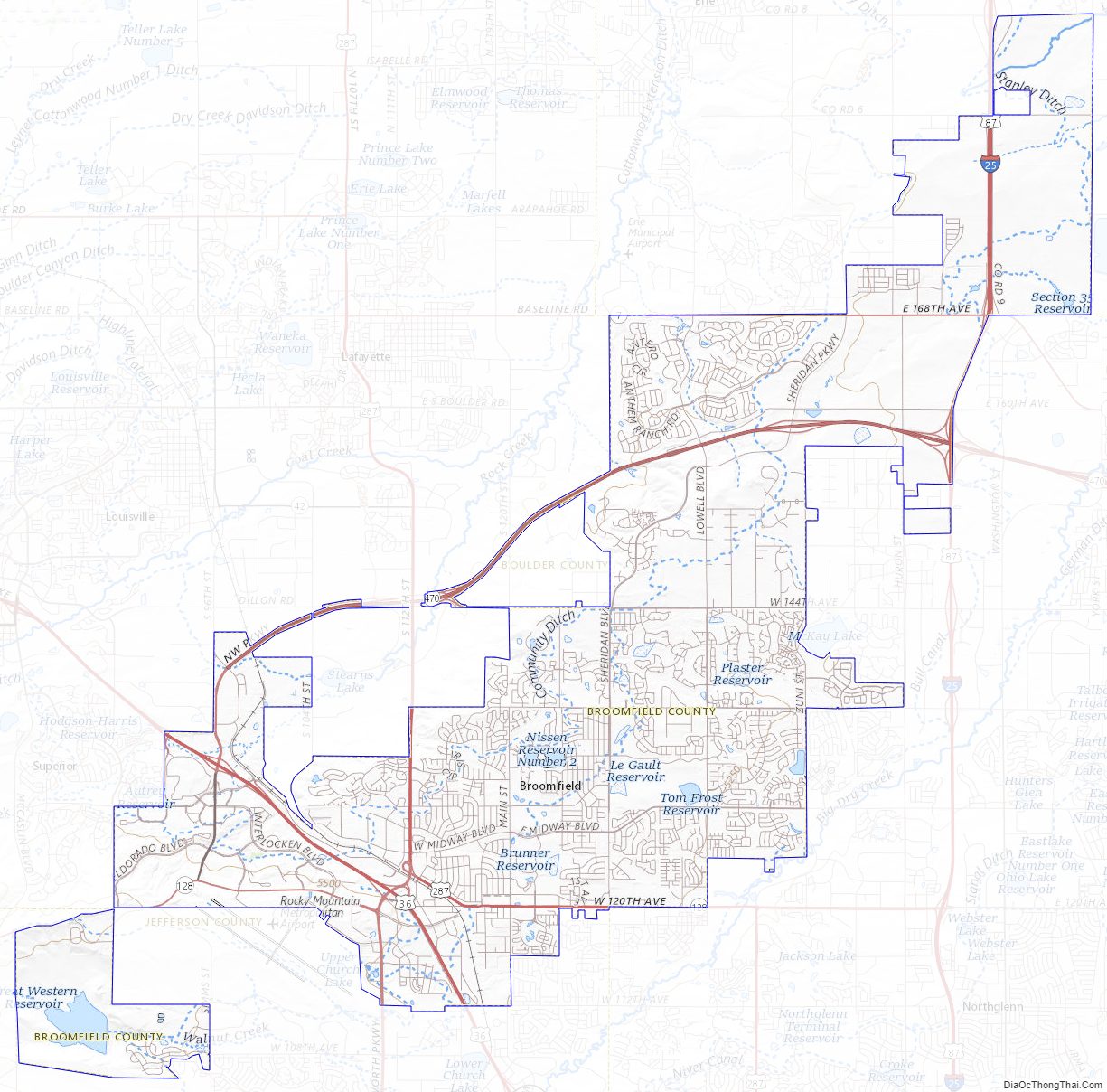
Broomfield County Road Map
Geography
Broomfield is located midway between downtown Denver and Boulder along U.S. Route 36. Its coordinates are 39°55′55″N 105°3′57″W / 39.93194°N 105.06583°W / 39.93194; -105.06583 (39.931817, -105.065919).
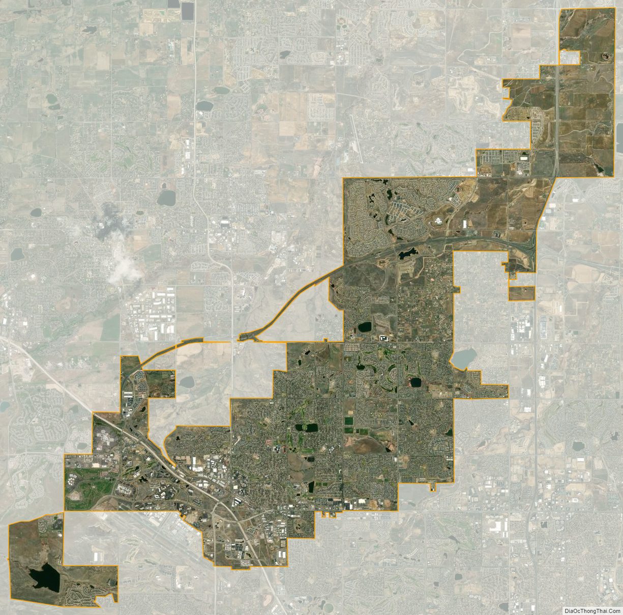
The elevation in Broomfield ranges from 5,096 to 5,856 feet. At the 2020 United States Census, Broomfield had a total area of 21,471 acres (86.890 km) including 371 acres (1.503 km) of water. It is the smallest county by area in Colorado and the 5th smallest in the United States. Broomfield is the second most densely populated county in Colorado behind Denver.
Airport
Rocky Mountain Metropolitan Airport formerly known as Jefferson County (Jeffco) Airport is located in Broomfield.
Major highways
- Interstate 25
- U.S. Highway 36 (Denver-Boulder Turnpike)
- U.S. Highway 85
- U.S. Highway 287
- State Highway 7
- State Highway 121
- State Highway 128
- E-470 (tollway)
- Northwest Parkway (tollway)
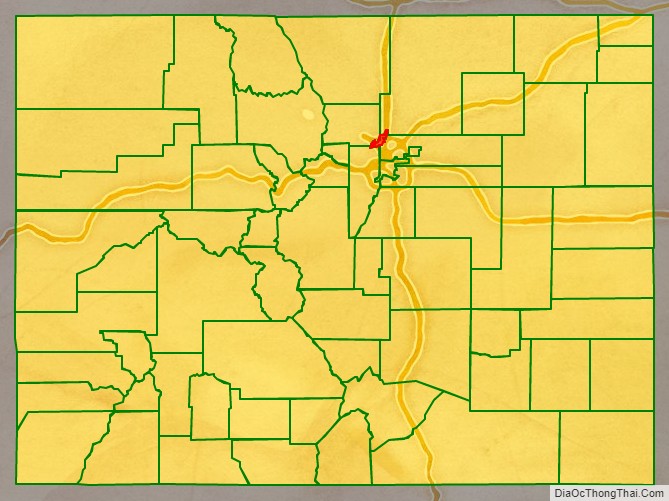
Adjacent counties
- Weld County – northeast
- Adams County – southeast
- Jefferson County – southwest
- Boulder County – northwest
Broomfield County Topographic Map
Broomfield County Satellite Map
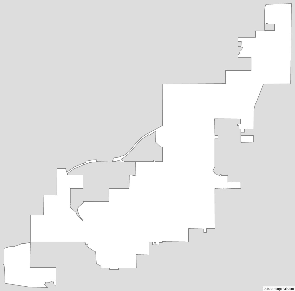
Broomfield County Outline Map