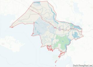
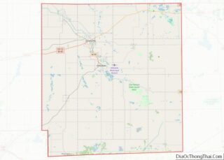
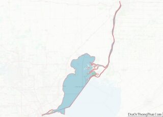
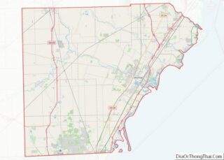
Map of Williamsburg City, Virginia
Williamsburg is an independent city in the Commonwealth of Virginia, United States. As of the 2020 census, it had a population of 15,425. Located on the Virginia Peninsula, Williamsburg is in the northern part of the Hampton Roads metropolitan area. It is bordered by James City County on the west and south and York County ... Read more
Map of Williamsburg City, Virginia
Map of Garfield County, Washington
Garfield County is a county located in the U.S. state of Washington. As of the 2020 census, the population was 2,286, making it the least populous county in Washington; with about 3.2 inhabitants per square mile (1.2/km), it is also the least densely populated county in Washington. The county seat and only city is Pomeroy. ... Read more
Map of Garfield County, Washington
Map of San Juan County, Washington
San Juan County (Spanish: Condado de San Juan) is a county located in the Salish Sea in the far northwestern corner of the U.S. state of Washington. As of the 2020 census, its population was 17,788. The county seat and only incorporated city is Friday Harbor, located on San Juan Island. The county was formed ... Read more
Map of San Juan County, Washington
Map of Brooke County, West Virginia
Brooke County is a county in the Northern Panhandle of the U.S. state of West Virginia. As of the 2020 census, the population was 22,559. Its county seat is Wellsburg. The county was created in 1797 from part of Ohio County and named in honor of Robert Brooke, Governor of Virginia from 1794 to 1796. ... Read more
Map of Brooke County, West Virginia
Map of Lewis County, West Virginia
Lewis County is a county in the U.S. state of West Virginia. As of the 2020 census, the population was 17,033. Its county seat is Weston. The county was formed in 1816 from Harrison County. Lewis County overview: Name: Lewis County FIPS code: 54-041 State: West Virginia Founded: December 18, 1816 Seat: Weston Largest city: ... Read more
Map of Lewis County, West Virginia
Map of Pleasants County, West Virginia
Pleasants County is a county located in the U.S. state of West Virginia. At the 2020 census, the population was 7,653. Its county seat is St. Marys. Pleasants County overview: Name: Pleasants County FIPS code: 54-073 State: West Virginia Founded: March 29, 1851 Named for: James Pleasants Seat: St. Marys Largest city: St. Marys Total ... Read more
Map of Pleasants County, West Virginia
Map of Wirt County, West Virginia
Wirt County is a county in the U.S. state of West Virginia. As of the 2020 census, the population was 5,194, making it the least populous county in West Virginia. Its county seat is Elizabeth. The county was created in 1848 by the Virginia General Assembly and named for U.S. Attorney General and presidential candidate ... Read more
Map of Wirt County, West Virginia
Map of Dodge County, Wisconsin
Dodge County is a county located in the U.S. state of Wisconsin. As of the 2020 census, the population was 89,396. Its county seat is Juneau. The county was created from the Wisconsin Territory in 1836 and organized in 1844. Dodge County comprises the Beaver Dam, WI Micropolitan Statistical Area, which is included in the ... Read more
Map of Dodge County, Wisconsin
Map of Kenosha County, Wisconsin
Kenosha County is located in the southeastern corner of the U.S. state of Wisconsin. The population was 169,151 as of the 2020 census, making it the eighth most populous county in Wisconsin. The county shares the same name as the city of Kenosha, the fourth largest city in Wisconsin. Kenosha County is part of the ... Read more
Map of Kenosha County, Wisconsin
Map of Oneida County, Wisconsin
Oneida County is a county in the state of Wisconsin, United States. At the 2020 census, the population was 37,845. Its county seat is Rhinelander. Oneida County overview: Name: Oneida County FIPS code: 55-085 State: Wisconsin Founded: 1887 Named for: Oneida people Seat: Rhinelander Largest city: Rhinelander Total Area: 1,236 sq mi (3,200 km²) Land Area: 1,113 sq mi (2,880 km²) ... Read more
Map of Oneida County, Wisconsin
Map of Sheboygan County, Wisconsin
Sheboygan County is a county in the U.S. state of Wisconsin. It is named after the Sheboygan River. As of the 2020 census, the population was 118,034. Its county seat is Sheboygan. The county was created in 1836 and organized in 1846. At the time, it was located in the Wisconsin Territory. Sheboygan County comprises ... Read more
Map of Sheboygan County, Wisconsin
Map of Carbon County, Wyoming
Carbon County overview: Name: Carbon County FIPS code: 56-007 State: Wyoming Founded: December 16, 1868 Named for: Coal deposits Seat: Rawlins Largest city: Rawlins Total Area: 7,964 sq mi (20,630 km²) Land Area: 7,898 sq mi (20,460 km²) Total Population: 14,537 Population Density: 1.8/sq mi (0.70/km²) Carbon County location map. Where is Carbon County? History Carbon County was organized in 1868, one ... Read more
Map of Carbon County, Wyoming