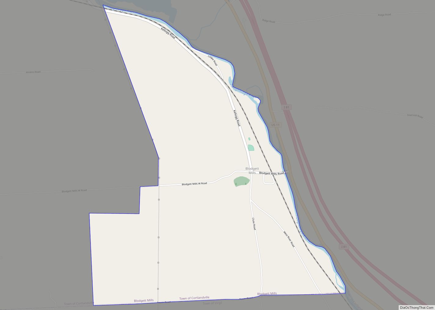
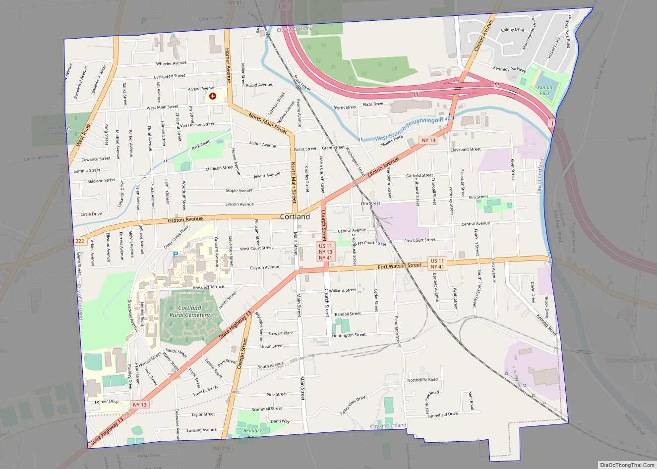
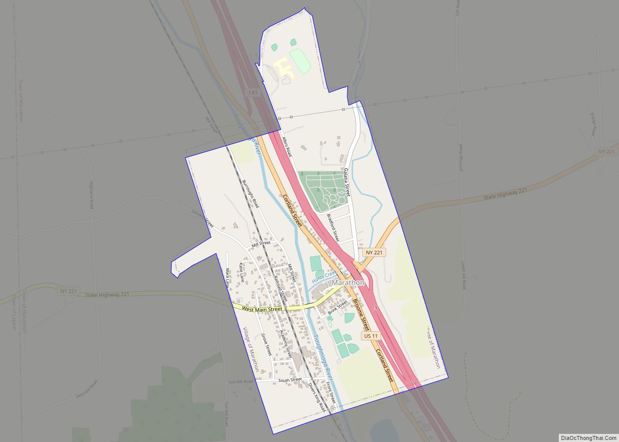
Cortland County is a county located in the U.S. state of New York. As of the 2020 census, the population of Cortland County was 46,809. The county seat is Cortland. The county is named after Pierre Van Cortlandt, president of the convention at Kingston that wrote the first New York State Constitution in 1777, and first lieutenant governor of the state.
Cortland County comprises the Cortland, NY Micropolitan Statistical Area, which is also included in the Ithaca-Cortland, NY Combined Statistical Area.
The Cortland apple is named for the county.
| Name: | Cortland County |
|---|---|
| FIPS code: | 36-023 |
| State: | New York |
| Founded: | 1808 |
| Named for: | Pierre Van Cortlandt |
| Seat: | Cortland |
| Largest city: | Cortland |
| Total Area: | 502 sq mi (1,300 km²) |
| Land Area: | 499 sq mi (1,290 km²) |
| Total Population: | 46,809 |
| Population Density: | 93.8/sq mi (36.2/km²) |
| Time zone: | UTC−5 (Eastern) |
| Summer Time Zone (DST): | UTC−4 (EDT) |
| Website: | www.cortland-co.org |
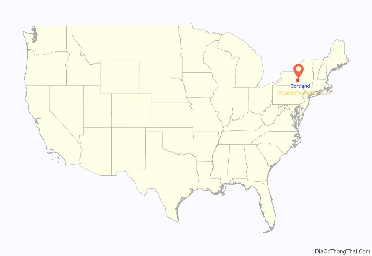
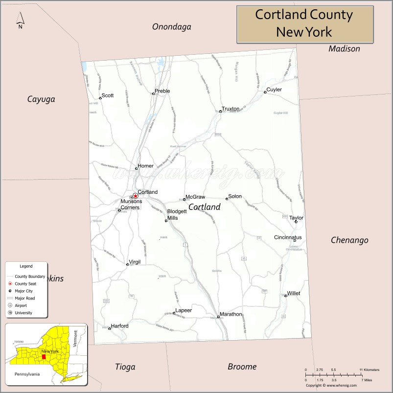
Cortland County location map. Where is Cortland County?
History
Early history
Located in the glaciated Appalachian Plateau area of Central New York, midway between Syracuse and Binghamton, this predominantly rural county is the southeastern gateway to the Finger Lakes Region. Scattered archaeological evidence indicates the Iroquois also known as the Haudenosaunee controlled the area beginning about AD 1500.
What was to become Cortland County remained within Indian territory until the American Revolution. It became part of the Military Tract, when, in 1781, more than 1¼ million acres (5,100 km) were set aside by the State’s Legislature to compensate two regiments formed to protect the State’s western section from the English and their Iroquois allies, at the close of the Revolution. To encourage settlement in the upstate isolated wilderness, the State constructed a road from Oxford through Cortland County to Cayuga Lake in 1792–94. This, and construction of privately financed roads, were the major impetus to settlement.
When counties were established in New York in 1683, the present Cortland County was part of Albany County, which encompassed the northern part of New York and all of the present State of Vermont, as well as indeterminate territory to west. On March 12, 1772, present day Cortland County became part of Tryon County, named for William Tryon, colonial governor of New York. In 1784, following the peace treaty that ended the American Revolutionary War, the name of the county was changed to honor General Richard Montgomery, who had captured several places in Canada and died attempting to capture the city of Quebec, thus replacing the name of the locally unpopular British governor. Present day Cortland County became part of Herkimer County in 1791, then became a part of Onondaga County when it split from Herkimer in 1794. Cortland County was formed by the splitting of Onondaga County in 1808.
Settlement of the county
Eastern New Yorkers and New Englanders, wanting new land to farm, welcomed the opening of this frontier. The first white settlement in the county was made in 1791 by Amos Todd, Joseph Beebe and Rhoda Todd Beebe, emigrants from Connecticut who paddled up the Tioughnioga River from Windsor, to live near the head of navigation in the Town of Homer. Following them came a flood of settlers who, in 1808, petitioned the State Legislature for county status. Thus, Cortland County was created from the southern half of Onondaga County as part of the Boston Ten Towns on April 8, 1808, and was named in honor of the Pierre Van Cortlandt family – Pierre, Sr. having been the first lieutenant governor of the state.
Nineteenth century
The 76th New York Volunteer Infantry was one of the most famous of the New York units in the Civil War. It was raised in 1861 primarily from Cortland County and the surrounding areas (about a third of the men were from the Cherry Valley area). The 76th was in most of the major battles the Army of the Potomac fought from Second Bull Run through Petersburg, at which time the three-year enlistment of most of the men ran out and the 300 or so men remaining from the 1,100 who left Cortland either returned home or transferred to other units.
At the Battle of Gettysburg, the 76th New York was one of the first infantry regiments on the field, holding down the extreme right of the Union line on the first day. The regiment took huge casualties in that battle – nearly one-third of its strength – including its commander Major Andrew J. Grover, the first infantry officer killed in the battle.
Modern Cortland County
Today, Cortland county is noted for the production of CNC milling machines, hospitality supplies, medical instruments and components, textiles, electronic components, plastic consumer goods, components for NASA, and a variety of other goods and services. International exporting is an integral part of many of the corporations in the area.
The county’s present reflects its past. Agribusiness flourishes, yet consistent with the pattern elsewhere in New York State, the number of farms has declined while farm size and yield have increased. Continued growth in the service and light industry sectors is contributing to the growing strength of the Central New York region and the Southern Tier region.
The loss of many of its local businesses has led to the current economic decline of the region. Cornell University, Syracuse University, Binghamton University, and Ithaca College are all within a 45-minute drive of the City of Cortland. The State University of New York College at Cortland and Tompkins Cortland Community College are located in the county.
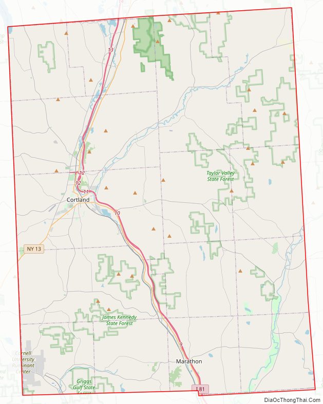
Cortland County Road Map
Geography
According to the U.S. Census Bureau, the county has a total area of 502 square miles (1,300 km), of which 499 square miles (1,290 km) is land and 2.8 square miles (7.3 km) (0.5%) is water.
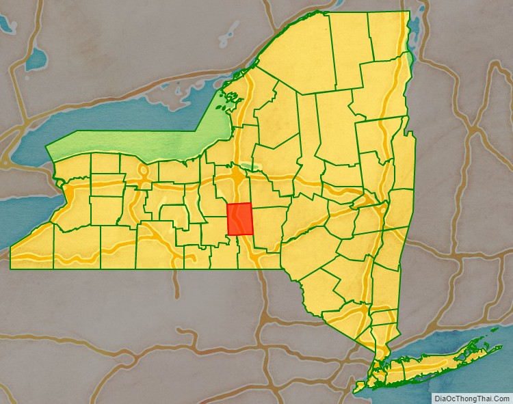
Cortland County is sometimes considered to be part of Central New York and Southern Tier regions of New York and is also somewhat to the southwest of the center of New York, south of Syracuse and north of Binghamton.
Adjacent counties
- Onondaga County – north
- Madison County – northeast
- Chenango County – east
- Broome County – south
- Tompkins County – west
- Tioga County – southwest
- Cayuga County – northwest
Major highways
- Interstate 81
- U.S. Route 11
- New York State Route 13
- New York State Route 41
- New York State Route 90
- New York State Route 392
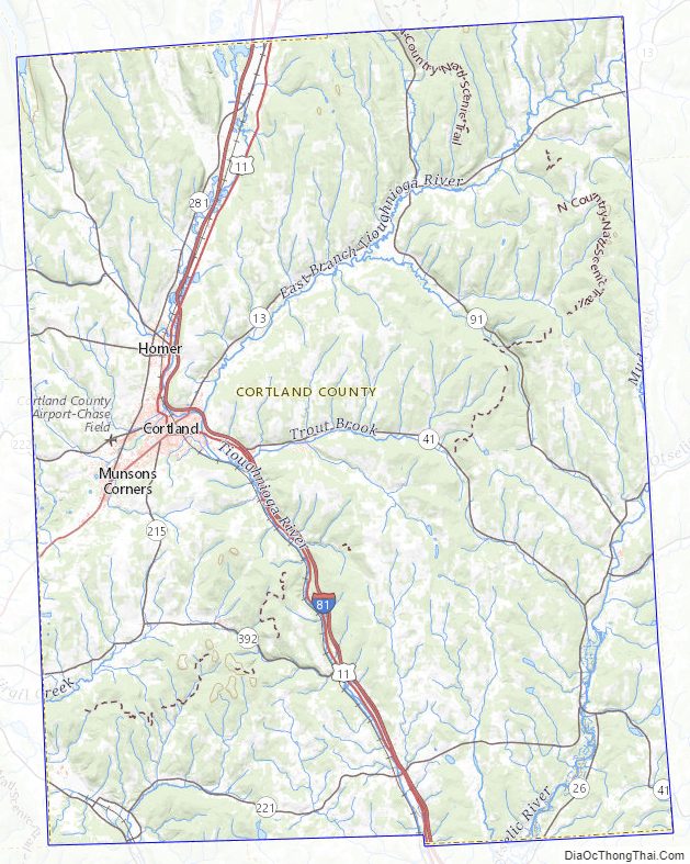
Cortland County Topographic Map
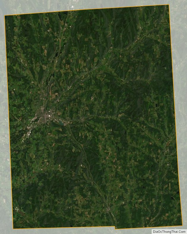
Cortland County Satellite Map
Cortland County Outline Map