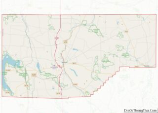
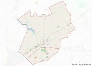
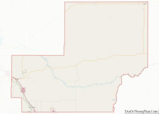
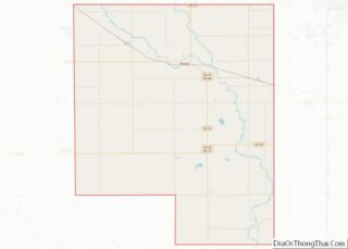
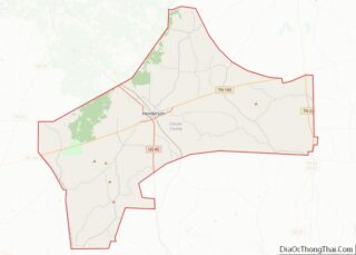
Map of Jones County, South Dakota
Jones County is a county in the U.S. state of South Dakota. As of the 2020 census, the population was 917, making it the least populous county in South Dakota. Its county seat is Murdo. Created in 1916 and organized in 1917, it is the most recently established county in South Dakota. It was named ... Read more
Map of Jones County, South Dakota
Map of Potter County, South Dakota
Potter County is a county in the U.S. state of South Dakota. As of the 2020 census, the population was 2,472. Its county seat is Gettysburg. The county was created in 1873 and organized in 1883. Potter County overview: Name: Potter County FIPS code: 46-107 State: South Dakota Founded: 1875 Named for: Joel A. Potter ... Read more
Map of Potter County, South Dakota
Map of Benton County, Tennessee
Benton County is a county located in the U.S. state of Tennessee. As of the 2020 census, the population was 15,864. Its county seat is Camden. The county was created in December 1835 and organized in 1836. Benton County is located in northwest Tennessee, bordering the western branch of the Tennessee River and 30 miles ... Read more
Map of Benton County, Tennessee
Map of Davidson County, Tennessee
Davidson County is a county in the U.S. state of Tennessee. It is located in the heart of Middle Tennessee. As of the 2020 census, the population was 715,884, making it the second most populous county in Tennessee. Its county seat is Nashville, the state capital and largest city. Since 1963, the city of Nashville ... Read more
Map of Davidson County, Tennessee
Map of Hardeman County, Tennessee
Hardeman County is a county located in the U.S. state of Tennessee. As of the 2020 census, the population was 25,462. Its county seat is Bolivar. Hardeman County overview: Name: Hardeman County FIPS code: 47-069 State: Tennessee Founded: 1823 Named for: Thomas J. Hardeman Seat: Bolivar Largest city: Bolivar Total Area: 670 sq mi (1,700 km²) Land Area: ... Read more
Map of Hardeman County, Tennessee
Map of Lewis County, Tennessee
Lewis County is a county located in the U.S. state of Tennessee. As of the 2020 census, the population was 12,582. Its county seat is Hohenwald. The county is named for explorer Meriwether Lewis, who died and was buried at Grinder’s Stand near Hohenwald in 1809. Lewis County overview: Name: Lewis County FIPS code: 47-101 ... Read more
Map of Lewis County, Tennessee
Map of Overton County, Tennessee
Overton County is a county located in the U.S. state of Tennessee. As of the 2020 census, the population was 22,511. Its county seat is Livingston. Overton County is part of the Cookeville, TN Micropolitan Statistical Area. Overton County overview: Name: Overton County FIPS code: 47-133 State: Tennessee Founded: September 1806 Named for: John Overton ... Read more
Map of Overton County, Tennessee
Map of Sumner County, Tennessee
Sumner County is a county located on the central northern border of the U.S. state of Tennessee, in what is called Middle Tennessee. As of the 2020 census, the population was 196,281. Its county seat is Gallatin, and its largest city is Hendersonville. The county is named for American Revolutionary War hero General Jethro Sumner. ... Read more
Map of Sumner County, Tennessee
Map of Aransas County, Texas
Aransas County (/əˈrænzəs/ ə-RAN-zəss) is a county located in the U.S. state of Texas. It is in South Texas and its county seat is Rockport. As of the 2020 census, the population was 23,830. Aransas County is part of the Corpus Christi Metropolitan Statistical Area. Aransas County overview: Name: Aransas County FIPS code: 48-007 State: ... Read more
Map of Aransas County, Texas
Map of Brazoria County, Texas
Brazoria County (/brəˈzɔːriə/ brə-ZOR-ee-ə) is a county in the U.S. state of Texas. As of the 2020 census, the population of the county was 372,031. The county seat is Angleton. Brazoria County is included in the Houston-The Woodlands-Sugar Land metropolitan statistical area. It is located in the Gulf Coast region of Texas. Regionally, parts of ... Read more
Map of Brazoria County, Texas
Map of Chambers County, Texas
Chambers County is a county in the U.S. state of Texas. As of the 2020 census, its population was 46,571. The county seat is Anahuac. Chambers County is one of the nine counties that comprise Greater Houston, the Houston–The Woodlands–Sugar Land metropolitan statistical area. Chambers County overview: Name: Chambers County FIPS code: 48-071 State: Texas ... Read more
Map of Chambers County, Texas
Map of Crane County, Texas
Crane County overview: Name: Crane County FIPS code: 48-103 State: Texas Founded: 1927 Named for: William Carey Crane Seat: Crane Largest city: Crane Total Area: 786 sq mi (2,040 km²) Land Area: 785 sq mi (2,030 km²) Total Population: 4,675 Population Density: 5.9/sq mi (2.3/km²) Time zone: UTC−6 (Central) Summer Time Zone (DST): UTC−5 (CDT) Website: www.co.crane.tx.us Crane County location map. Where ... Read more
Map of Crane County, Texas