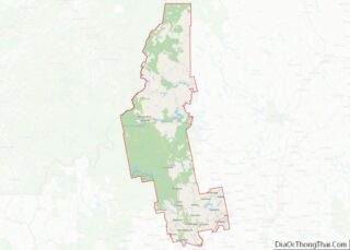
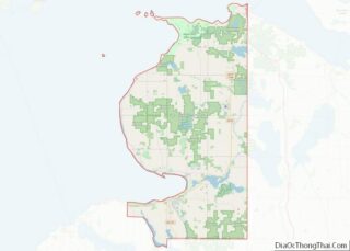
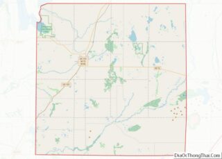
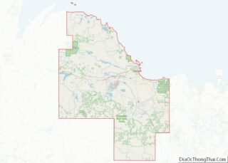
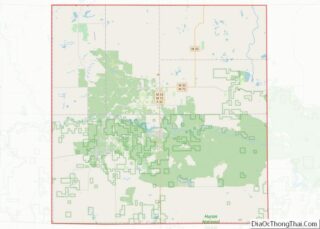
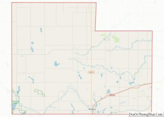
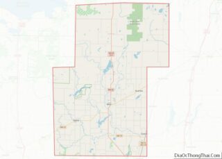
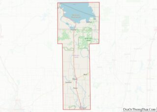
Map of Mobile County, Alabama
Mobile County (/moʊˈbiːl/ moh-BEEL) is located in the southwestern corner of the U.S. state of Alabama. It is the second most-populous county in the state after Jefferson County. As of the 2020 census, its population was 414,809. Its county seat is Mobile, which was founded as a deepwater port on the Mobile River. The only ... Read more
Map of Mobile County, Alabama
Map of Washington County, Alabama
Washington County is a county located in the southwestern part of the U.S. state of Alabama. As of the 2020 census, the population was 15,388. The county seat is Chatom. The county was named in honor of George Washington, the first President of the United States. It is a dry county, with the exception of ... Read more
Map of Washington County, Alabama
Map of Lake and Peninsula Borough, Alaska
Lake and Peninsula Borough (Russian: Лейк-энд-Пенинсула, Leyk-end-Peninsula) is a borough in the state of Alaska. As of the 2020 census, the population was 1,476, down from 1,631 in 2010. The borough seat of King Salmon is located in neighboring Bristol Bay Borough, although is not the seat of that borough. The most populous community in ... Read more
Map of Lake and Peninsula Borough, Alaska
Map of Gila County, Arizona
Gila County (/ˈhiːlə/ HEE-lə) is in the central part of the U.S. state of Arizona. As of the 2020 census, the population was 53,272. The county seat is Globe. Gila County comprises the Payson, Arizona Micropolitan Statistical Area. Gila County contains parts of Fort Apache Indian Reservation and San Carlos Indian Reservation. Gila County overview: ... Read more
Map of Gila County, Arizona
Map of Boone County, Arkansas
Boone County is located in the U.S. state of Arkansas, along the Missouri border. As of the 2020 census, the population was 37,373. The county seat is Harrison. It is Arkansas’s 62nd county, formed on April 9, 1869. Boone County is part of the Harrison, AR Micropolitan Statistical Area. Boone County overview: Name: Boone County ... Read more
Map of Boone County, Arkansas
Map of Desha County, Arkansas
Desha County (/dəˈʃeɪ/ duh-SHAY) is a county located in the southeast part of the U.S. state of Arkansas, with its eastern border the Mississippi River. At the 2020 census, the population was 11,395. The county seat is Arkansas City. Located in the Arkansas Delta, Desha County’s rivers and fertile soils became prosperous for planters under ... Read more
Map of Desha County, Arkansas
Map of Lafayette County, Arkansas
Lafayette County /lɑːˈfeɪɛt/ is a county located in the U.S. state of Arkansas. As of the 2020 census, the population was 6,308, making it the third-least populous county in Arkansas. The county seat is Lewisville. Lafayette County was formed on October 15, 1827, and named in honor of the Marquis de Lafayette, a French military ... Read more
Map of Lafayette County, Arkansas
Map of Perry County, Arkansas
Perry County is a county located in the U.S. state of Arkansas. Its population was 10,019 at the 2020 United States Census. The county seat is Perryville. The county was formed on December 18, 1840, and named for Commodore Oliver Hazard Perry, naval hero in the War of 1812. It is an alcohol prohibition or ... Read more
Map of Perry County, Arkansas
Map of Stone County, Arkansas
Stone County is located in the Ozark Mountains in the U.S. state of Arkansas. The county is named for rugged, rocky area terrain of the Ozarks. Created as Arkansas’s 74th county on April 21, 1873, Stone County has two incorporated cities: Mountain View, the county seat and most populous city, and Fifty-Six. The county is ... Read more
Map of Stone County, Arkansas
Map of Fresno County, California
Fresno County (/ˈfrɛznoʊ/ (listen)), officially the County of Fresno, is a county located in the central portion of the U.S. state of California. As of the 2020 Census, the population was 1,008,654. The county seat is Fresno, the fifth-most populous city in California. Fresno County comprises the Fresno, CA Metropolitan Statistical Area, which is part ... Read more
Map of Fresno County, California
Map of Mono County, California
Mono County (/ˈmoʊnoʊ/ MOH-noh) is a county located in the east central portion of the U.S. state of California. As of the 2020 census, the population was 13,195, making it the fourth-least populous county in California. The county seat is Bridgeport. The county is located east of the Sierra Nevada between Yosemite National Park and ... Read more
Map of Mono County, California
Map of Santa Barbara County, California
Santa Barbara County, officially the County of Santa Barbara (Spanish: Condado de Santa Bárbara), is located in Southern California. As of the 2020 census, the population was 448,229. The county seat is Santa Barbara, and the largest city is Santa Maria. Santa Barbara County comprises the Santa Maria-Santa Barbara, CA Metropolitan Statistical Area. Most of ... Read more
Map of Santa Barbara County, California