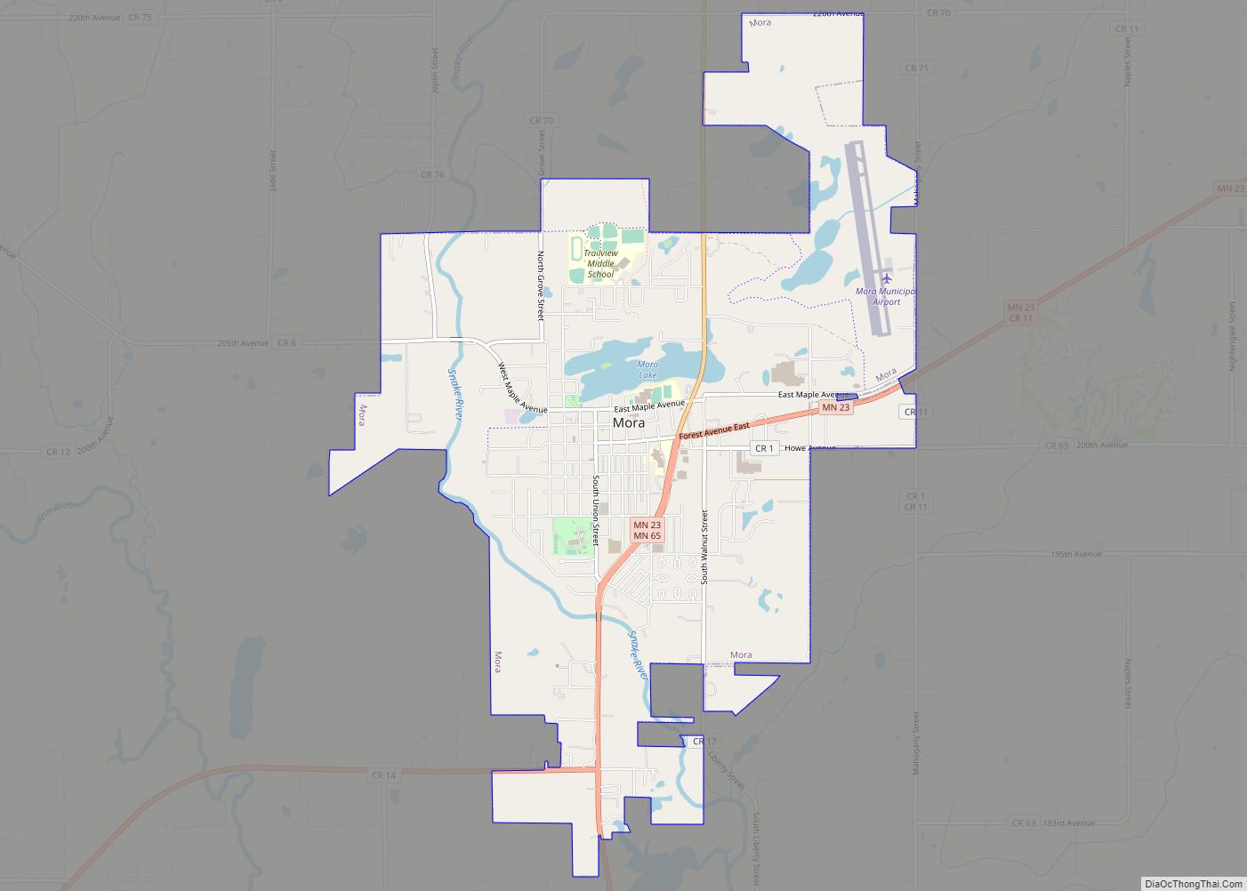
Kanabec County (/kəˈneɪbɪk/ kə-NAY-bik) is a county in the East Central part of U.S. state of Minnesota. As of the 2020 census, the population was 16,032. Its county seat is Mora.
| Name: | Kanabec County |
|---|---|
| FIPS code: | 27-065 |
| State: | Minnesota |
| Founded: | 1858 |
| Named for: | Snake River |
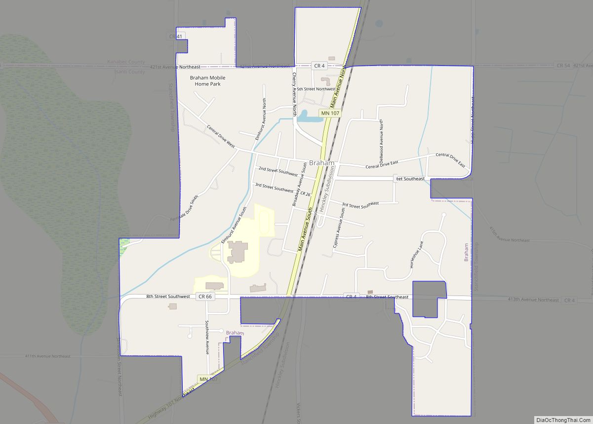
| Seat: | Mora |
| Largest city: | Mora |
| Total Area: | 534 sq mi (1,380 km²) |
| Land Area: | 522 sq mi (1,350 km²) |
| Total Population: | 16,032 |
| Population Density: | 30.7/sq mi (11.9/km²) |
| Time zone: | UTC−6 (Central) |
| Summer Time Zone (DST): | UTC−5 (CDT) |
| Website: | www.kanabeccounty.org |
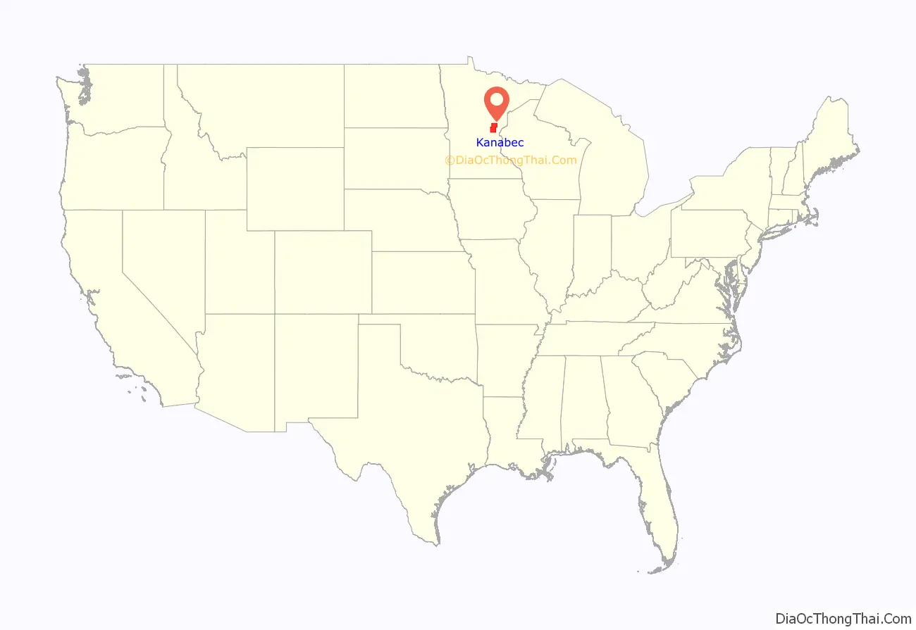
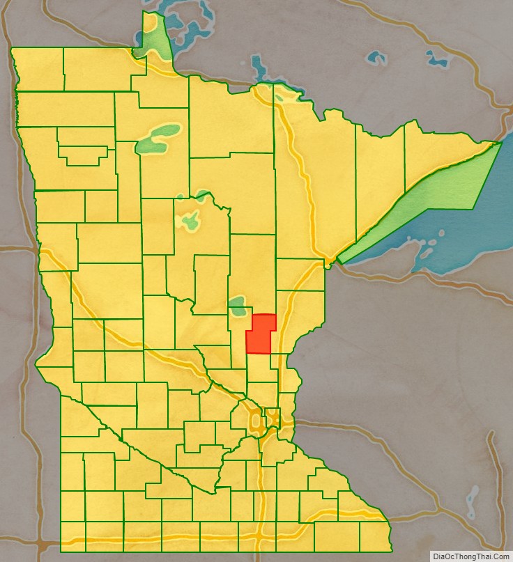
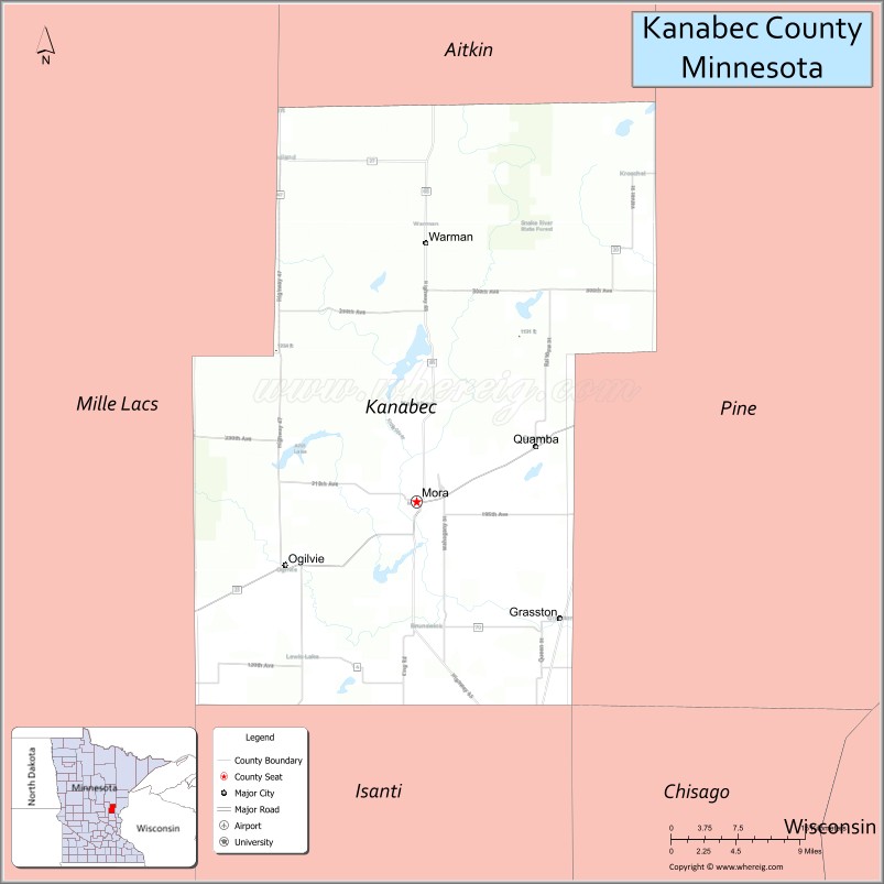
Kanabec County location map. Where is Kanabec County?
History
The Minnesota legislature authorized creation of Kanabec County on March 13, 1858, with territory partitioned from Pine County. No county seat was designated at that time, and the county organization was not effected at that time. The county name came from the Ojibwe term ginebig, meaning “snake,” after the Snake River — Kanabecosippi (Ginebigo-ziibi in the modern spelling) — which flows through the county.
The area of Kanabec County was attached to Chisago County for administrative and judicial purposes. What county business was handled locally was performed by part-time County Auditor and County Treasurer, in a single room in a stopping place operated by lumber-trader George Staples at Millet Rapids.
In 1871 the county was detached from Chisago, and assigned to Pine County. This assignment lasted through 1881.
The 1870 United States census listed 53 occupants of the Kanabec County area. However, an influx of settlers into its southern areas occurred in the early 1870s, and by 1876 an official county building was needed. A one-room wood building was erected at Millet Rapids, put into use in 1876. In 1881 the county was detached from Pine, and the government structure was finalized, with the county seat being designated at Brunswick. Only one court term was held at Brunswick; in the 1882 general election, a nearly-unanimous vote designated Mora as the county seat. The old courthouse building was sold to a local farmer, who moved it to his property to use as a home. The wood courthouse erected at Mora was used until 1894, when it burned and was replaced by a more fireproof building.
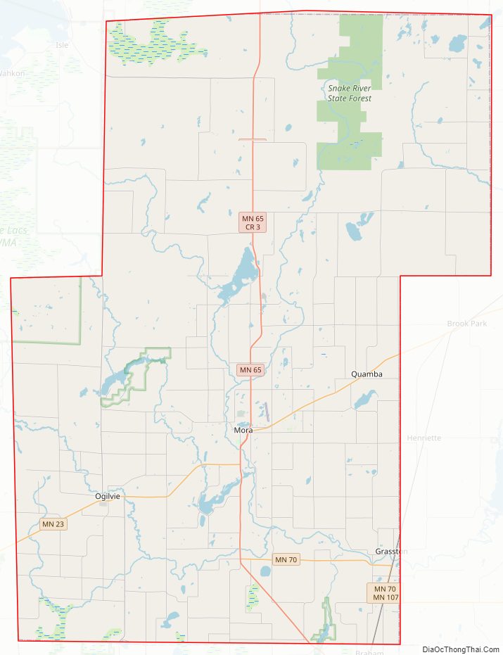
Kanabec County Road Map
Geography
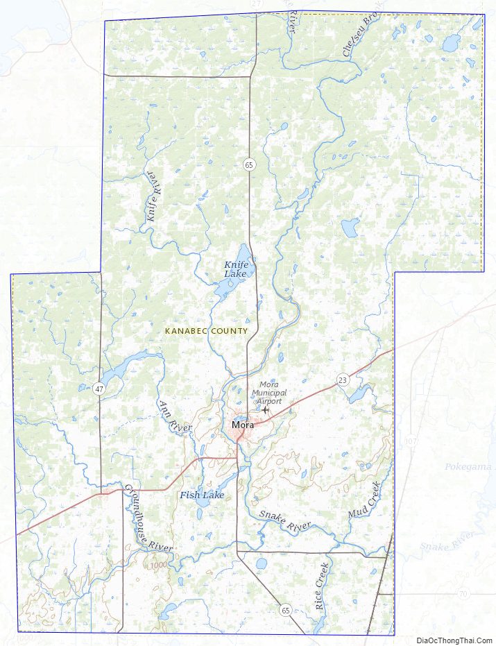
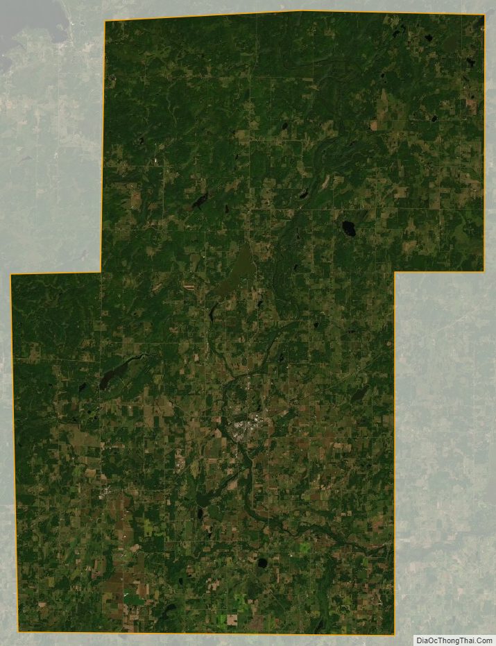
The Snake River flows south-southeasterly through the central part of the county, fed by Groundhouse River (flowing northeasterly from the county’s SW corner) and Red Creek and Mud Creek. The Snake continues easterly into Pine County. The county terrain consists of partly-wooded rolling hills, etched by drainages. It is largely devoted to agriculture. The terrain slopes to the south and east, with its highest point near the NW corner, at 1,309′ (399m) ASL. The county has a total area of 534 square miles (1,380 km), of which 522 square miles (1,350 km) is land and 12 square miles (31 km) (2.3%) is water.
Lakes
- Ann Lake
- Bachman Dam
- Bass Lake (part)
- Beauty Lake
- Featherbed Lake
- Fish Lake
- Knife Lake
- Lake Eleven
- Lake Five
- Lake Full of Fish
- Lewis Lake
- Long Lake
- Pennington Lake
- Pomroy Lake
- Rice Lake
- Thirteen Lake
- White Lily Lake
Major highways
- Minnesota State Highway 23
- Minnesota State Highway 27
- Minnesota State Highway 47
- Minnesota State Highway 65
- Minnesota State Highway 70
- Minnesota State Highway 107
- List of county roads
Adjacent counties
- Aitkin County – north
- Pine County – east
- Chisago County – southeast
- Isanti County – south
- Mille Lacs County – west
Protected areas
- Ann Lake State Wildlife Management Area
- Bean Dam State Wildlife Management Area
- Hay-Snake State Wildlife Management Area
- Rice Creek State Wildlife Management Area
- Rum River State Forest (part)
- Tosher Creek State Wildlife Management Area
- Whited State Wildlife Management Area
Kanabec County Topographic Map
Kanabec County Satellite Map
Kanabec County Outline Map