Cottonwood County is a county in the U.S. state of Minnesota. As of the 2020 census, the population was 11,517. Its county seat is Windom.
| Name: | Cottonwood County |
|---|---|
| FIPS code: | 27-033 |
| State: | Minnesota |
| Founded: | 1857 |
| Named for: | Cottonwood River |
| Seat: | Windom |
| Largest city: | Windom |
| Total Area: | 649 sq mi (1,680 km²) |
| Land Area: | 639 sq mi (1,660 km²) |
| Total Population: | 11,517 |
| Population Density: | 18.0/sq mi (6.9/km²) |
| Time zone: | UTC−6 (Central) |
| Summer Time Zone (DST): | UTC−5 (CDT) |
| Website: | www.co.cottonwood.mn.us |
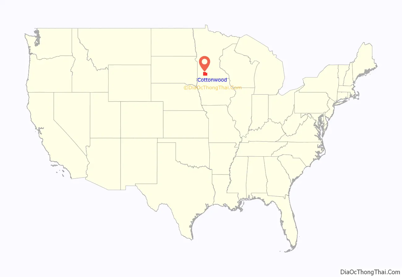
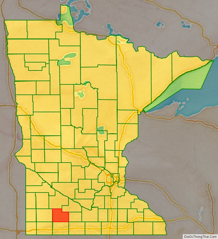
Cottonwood County location map. Where is Cottonwood County?
History
The county was created on May 23, 1857, named for the river in Germantown Township (“cottonwood” is the English meaning of the Dakota Sioux word “Waraju”). Minnesota Governor Horace Austin appointed three county commissioners when the county was established. They met at a home about six miles northwest of Windom on the Des Moines River at Big Bend. During this meeting, they designated the commissioners’ districts and changed various county officers. The county organization was completed on July 29, 1870. The first general election was held in the county that November. The first deed of record was filed on January 10, 1870. The first land assessments were made in 1871, and the first taxes were paid in 1872.
County NRHP listings
- The Cottonwood County Courthouse (1904), an example of Neoclassical architecture, is listed in the National Register of Historic Places.
- Mountain Park, southeast of Mountain Lake, has been listed on the National Register of Historic Places since 1973. A 1976 archeological dig unearthed evidence of a Fox Indian habitation there circa 500 B.C., the oldest human habitation to be discovered in Minnesota.
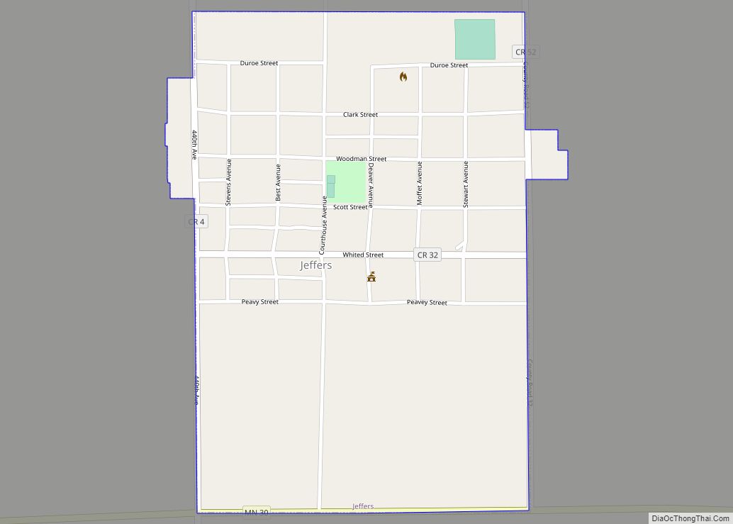
- The Jeffers Petroglyphs, near Jeffers, contain pre-European Native American rock carvings. Listed in the National Register of Historic Places.
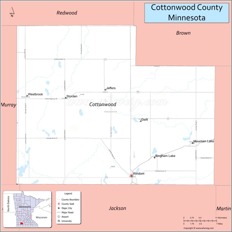
Cottonwood County Road Map

Geography
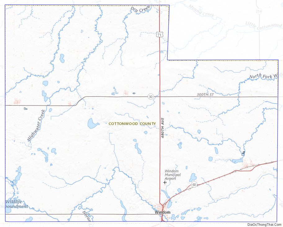
The Heron Lake Outflow flows east through the lower part of Cottonwood County. The county terrain consists of low rolling hills, devoted to agriculture. The terrain generally slopes to the east, with the northern portion also sloping north and the lower portion sloping south. The highest point is on the midpoint of the west border, at 1,535′ (468m) ASL. The county has an area of 649 square miles (1,680 km), of which 639 square miles (1,660 km) is land and 10 square miles (26 km) (1.5%) is water.
Watersheds
The northeastern part of the county drains north to the Minnesota River through numerous small creeks, the Cottonwood River and Watonwan River. The southwestern part drains south through the Des Moines River. These two watersheds come together at the Mississippi River near Keokuk, Iowa. Most wetlands in the county have been drained for agricultural use.
Lakes
Major highways
- U.S. Highway 71
- Minnesota State Highway 30
- Minnesota State Highway 60
- Minnesota State Highway 62
Adjacent counties
- Redwood County – north
- Brown County – northeast
- Watonwan County – east
- Jackson County – south
- Nobles County – southwest
- Murray County -west
Protected areas
- Delft State Wildlife Management Area
- Dynamite Park
- Lady Bird County Park
- Little Swan Lake State Wildlife Management Area
- Mound Creek County Park
- Mountain County Park
- Pats Grove County Park
- Regehr State Wildlife Management Area
- Red Rock Falls County Park
- Rock Ridge Prairie Scientific and Natural Area
- South Dutch Charlie County Park
- Talcot County Park
Cottonwood County Topographic Map
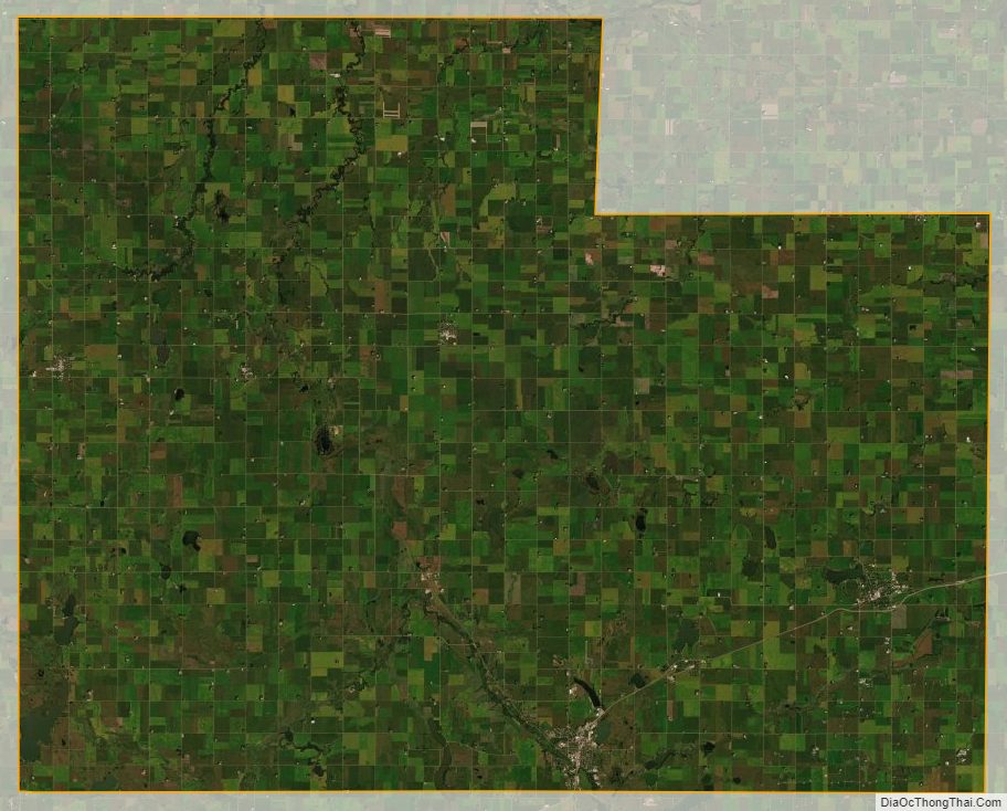
Cottonwood County Satellite Map
Cottonwood County Outline Map