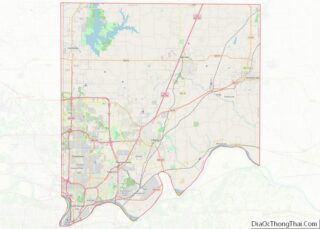
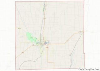
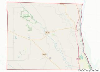
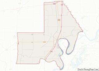
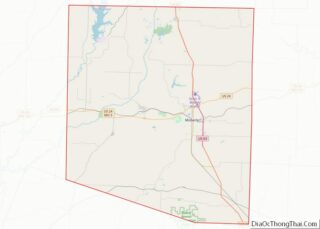
Map of Lauderdale County, Mississippi
Lauderdale County is a county located on the eastern border of the U.S. state of Mississippi. As of the 2020 census, the population was 72,984. The county seat is Meridian. The county is named for Colonel James Lauderdale, who was killed at the Battle of New Orleans in the War of 1812. Lauderdale County is ... Read more
Map of Lauderdale County, Mississippi
Map of Panola County, Mississippi
Panola County is a county located in the U.S. state of Mississippi. As of the 2020 census, the population was 33,208. Its county seats are Sardis and Batesville. The county is located just east of the Mississippi Delta in the northern part of the state. It is bisected by the Tallahatchie River flowing to the ... Read more
Map of Panola County, Mississippi
Map of Tippah County, Mississippi
Tippah County is a county located on the northern border of the U.S. state of Mississippi. As of the 2020 census, the population was 21,815. Its county seat is Ripley. The name “Tippah” is derived from a Chickasaw language word meaning “cut off.” It was taken from the creek of the same name that flows ... Read more
Map of Tippah County, Mississippi
Map of Audrain County, Missouri
Audrain County is a county located in the central part of the U.S. state of Missouri. As of the 2020 census, the population was 24,962. Its county seat is Mexico. The county was organized December 13, 1836, and named for Colonel James Hunter Audrain of the War of 1812 and who later was elected to ... Read more
Map of Audrain County, Missouri
Map of Cedar County, Missouri
Cedar County is a county located in the southwest portion of the U.S. state of Missouri. As of the 2020 census, the population was 14,188. Its county seat is Stockton. The county was founded February 14, 1845, and named after Cedar Creek, a tributary of the Sac River, which in turn is named from the ... Read more
Map of Cedar County, Missouri
Map of Franklin County, Missouri
Franklin County is located in the U.S. state of Missouri. At the 2020 census, the population was 104,682. Its county seat is Union. The county was organized in 1818 and is named after Founding Father Benjamin Franklin. Franklin County is part of the St. Louis, MO-IL Metropolitan Statistical Area and contains some of the city’s ... Read more
Map of Franklin County, Missouri
Map of Knox County, Missouri
Knox County is a county located in the northeast portion of the U.S. state of Missouri. As of the 2020 census, its population was 3,744, making it the third-least populous county in Missouri. Its county seat is Edina. The county was organized February 14, 1845 and named for U.S. Secretary of War General Henry Knox. ... Read more
Map of Knox County, Missouri
Map of Moniteau County, Missouri
Moniteau County is a county located in the U.S. state of Missouri. As of the 2020 United States census, the population was 15,473. Its county seat is California. The county was organized February 14, 1845 and named for the Moniteau Creek. ‘Moniteau’ is a French spelling of Manitou, Algonquian for the Great Spirit. Moniteau County ... Read more
Map of Moniteau County, Missouri
Map of Polk County, Missouri
Polk County is a county located in the southwestern portion of the U.S. state of Missouri. As of the 2010 census, the population was 31,137. Its county seat is Bolivar. The county was organized January 5, 1835, and named for Ezekiel Polk. Polk County is part of the Springfield, MO Metropolitan Statistical Area. Polk County ... Read more
Map of Polk County, Missouri
Map of Scott County, Missouri
Scott County is a county located in the southeastern portion of the U.S. state of Missouri. As of the 2020 census, the population was 38,059. Its county seat is Benton. The county was organized in 1821 and named for U.S. Representative John Scott, the first federal representative from Missouri. Scott County comprises the Sikeston, MO ... Read more
Map of Scott County, Missouri
Map of Big Horn County, Montana
Big Horn County is a county located in the U.S. state of Montana. As of the 2020 census, the population was 13,124. The county seat is Hardin. The county, like the river and the mountain range, is named after the bighorn sheep in the Rocky Mountains. The county was founded in 1913. It is located ... Read more
Map of Big Horn County, Montana
Map of Glacier County, Montana
Glacier County is located in the U.S. state of Montana. As of the 2020 census, the population was 13,778. The county is located in northwestern Montana between the Great Plains and the Rocky Mountains, known to the Blackfeet as the “Backbone of the World”. The county is geographically and culturally diverse and includes the Blackfeet ... Read more
Map of Glacier County, Montana