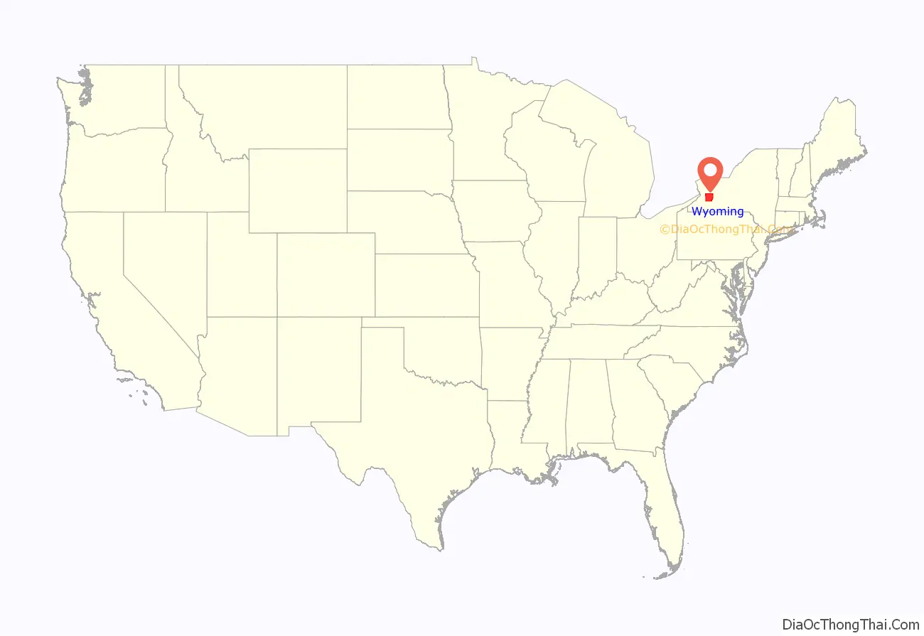
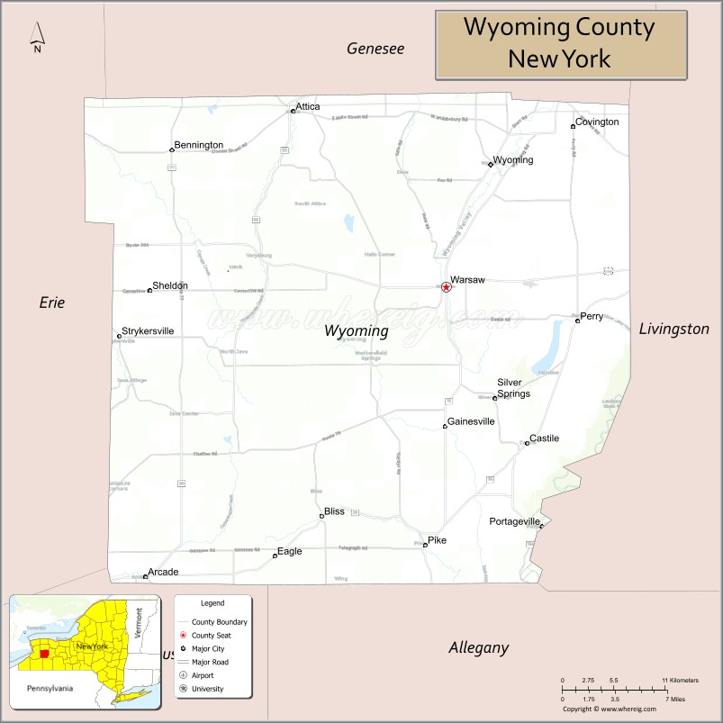
Wyoming County is a county in the U.S. state of New York in the state’s western area. As of the 2020 census, the population was 40,531. The county seat is Warsaw. The name is modified from a Lenape (Delaware) Native American word meaning “broad bottom lands”. Wyoming County was formed from Genesee County in 1841. Wyoming County is one of New York’s mostly agricultural counties. With an estimated 47,500 dairy cows in the county, there are more cattle in Wyoming County than people.
| Name: | Wyoming County |
|---|---|
| FIPS code: | 36-121 |
| State: | New York |
| Founded: | 1841 |
| Seat: | Warsaw |
| Total Area: | 596 sq mi (1,540 km²) |
| Land Area: | 593 sq mi (1,540 km²) |
| Total Population: | 40,531 |
| Population Density: | 68.4/sq mi (26.4/km²) |
| Time zone: | UTC−5 (Eastern) |
| Summer Time Zone (DST): | UTC−4 (EDT) |
| Website: | www.wyomingco.net |
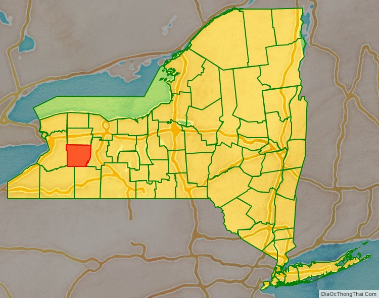
Wyoming County location map. Where is Wyoming County?
History
As with the rest of Western New York, Wyoming County was part of disputed territory throughout the 17th and 18th centuries, claimed by the Massachusetts Bay Colony, Connecticut Colony, Pennsylvania Colony, New York Colony, and New France. New York’s claims were not recognized until the Treaty of Hartford was ratified in 1786 and were not actively asserted until the Holland Purchase.
In regard to New York’s claim, as of 1683 the present Wyoming County was part of Albany County of the Province of New York. This was an enormous county, including the northern part of New York State as well as all of the present State of Vermont and, in theory, extending westward to the Pacific Ocean. This county was reduced in size on July 3, 1766, by the creation of Cumberland County, and further on March 16, 1770, by the creation of Gloucester County, both containing territory now in the state of Vermont.
On March 12, 1772, what was left of Albany County was split into three parts, one remaining under the name Albany County. One of the other pieces, Tryon County, contained the western portion (and thus, since no western boundary was specified, theoretically still extended west to the Pacific). The eastern boundary of Tryon County was approximately five miles west of the present city of Schenectady, and the county included the western part of the Adirondack Mountains and the area west of the West Branch of the Delaware River. The area then designated as Tryon County now includes 37 counties of New York State.
In the years prior to 1776, most of the Loyalists in Tryon County fled to Canada. In 1784, following the peace treaty that ended the American Revolutionary War, the name of Tryon County was changed to Montgomery County in order to honor the general, Richard Montgomery, who had captured several places in Canada and died attempting to capture the city of Quebec, replacing the name of the hated British governor.
In 1789, Ontario County was split off from Montgomery as part of the establishment of the Morris Reserve.
Almost all of the land west of the Genesee River, including all of present-day Wyoming County, was part of the Holland Land Purchase in 1793. It was sold privately to settlers through the Holland Land Company’s office in Batavia, starting in 1801.
Genesee County was created by a splitting of Ontario County in 1802 to govern the land acquired in the Holland Purchase. This territory was much larger than the present Genesee County. It was reduced in size in 1806 by creating Allegany County; again in 1808 by creating Cattaraugus, Chautauqua, and Niagara counties. Niagara County at that time also included the present Erie County.
In 1821, portions of Genesee County were combined with portions of Ontario County to create Livingston and Monroe counties.
Genesee County was further reduced in size in 1824 by creating Orleans County.
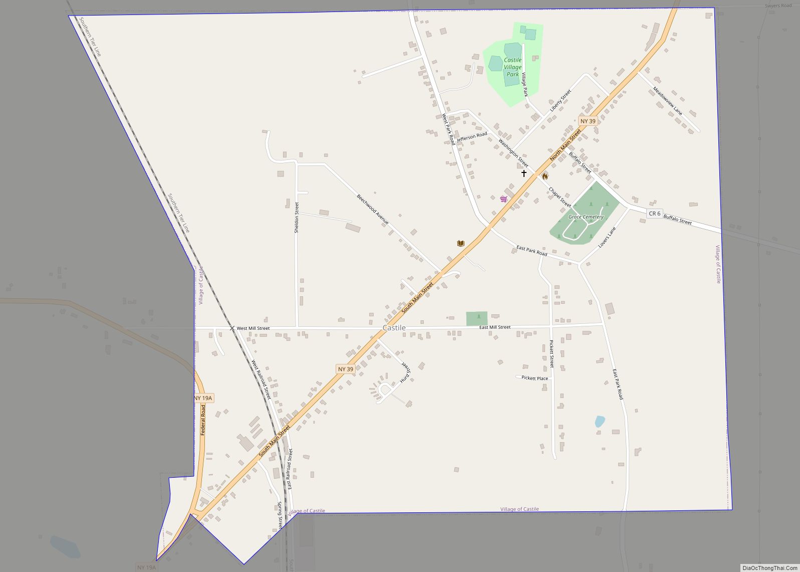
Finally, in 1841, Wyoming County was created from the southern half of Genesee County, the northwest corner of Allegany County, and a small portion of the northeast corner of Cattaraugus County.
Wyoming County Road Map
Geography
According to the U.S. Census Bureau, the county has a total area of 596 square miles (1,540 km), of which 593 square miles (1,540 km) is land and 3.5 square miles (9.1 km) (0.6%) is water.
Wyoming County is in the western part of New York State, east of Buffalo and slightly west of due south of Rochester. The county is in the Holland Purchase Region.
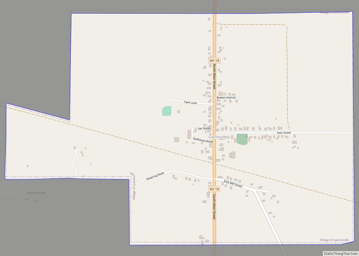
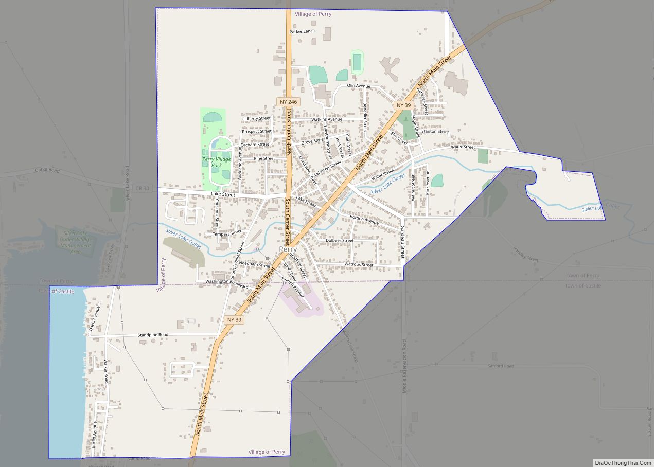
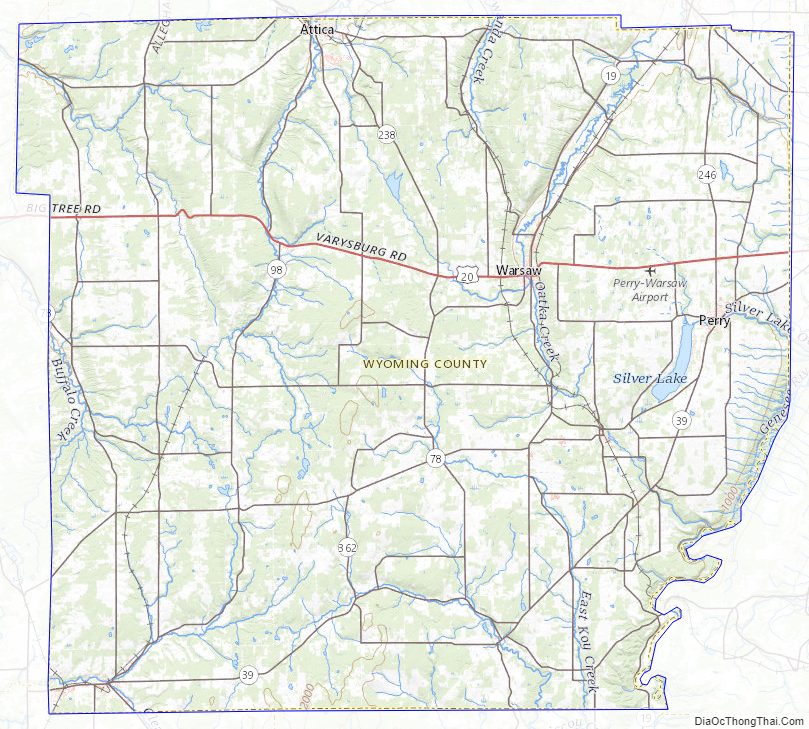
The county is largely rural, dotted with small towns. Even the county seat, Warsaw is quite small. The land surface is generally broken and hilly, and the soil fertile. Much of the area is wooded, used for timber. Some that are predominantly maple are tapped each spring for the production of maple syrup. Agriculture dominates the county economy. Apple orchards were once a major agricultural endeavor, but only a few are left. The area is also well known for outdoor sports, being an excellent area for fishing, hunting, and snowmobiling.
An active geologic fault runs down the Dale valley through Linden, to the east of Batavia and into Lake Ontario. Movement of the fault is an occasional source of minor earthquakes, which, at most, have toppled a couple chimneys. The Dale Valley has been developed as a source of salt by way of brine wells, for the chemical industry. A pipeline moves the brine to Niagara Falls.
The county is bounded on the southeast by the Genesee River, and drained by tributaries of that stream, as well as Tonawanda, Buffalo, and other creeks. An important tributary of the Genesee River, Oatka Creek, has its source in the Town of Gainesville within the county.
Adjacent counties
- Genesee County – north
- Livingston County – east
- Allegany County – south
- Cattaraugus County – southwest
- Erie County – west
Major highways
- U.S. Route 20A
- New York State Route 19
- New York State Route 19A
- New York State Route 39
- New York State Route 63
- New York State Route 77
- New York State Route 78
- New York State Route 98
- New York State Route 238
- New York State Route 246
- New York State Route 354
- New York State Route 362
- New York State Route 436
Wyoming County Topographic Map
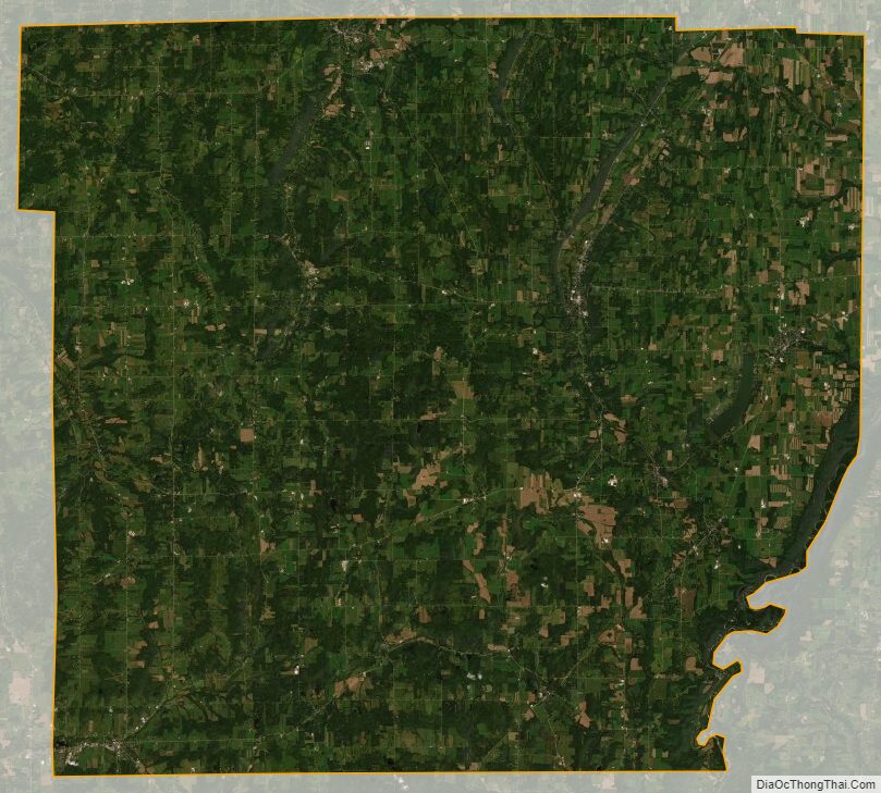
Wyoming County Satellite Map
Wyoming County Outline Map