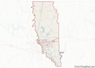
Map of Franklin Parish, Louisiana
Franklin Parish overview: Name: Franklin Parish FIPS code: 22-041 State: Louisiana Founded: 1843 Named for: Benjamin Franklin Seat: Winnsboro Largest city: Winnsboro Total Area: 635 sq mi (1,640 km²) Land Area: 625 sq mi (1,620 km²) Total Population: 19,774 Population Density: 31/sq mi (12/km²) Time zone: UTC−6 (Central) Summer Time Zone (DST): UTC−5 (CDT) Franklin Parish location map. Where is Franklin Parish? ... Read more
Map of Franklin Parish, Louisiana
Map of Ouachita Parish, Louisiana
Ouachita Parish overview: Name: Ouachita Parish FIPS code: 22-073 State: Louisiana Founded: March 31, 1807 Named for: Ouachita people Seat: Monroe Total Area: 1,640 km² (632 sq mi) Land Area: 1,600 km² (610 sq mi) Total Population: 160,368 Population Density: 98/km² (250/sq mi) Time zone: UTC-6 (CST) Summer Time Zone (DST): UTC-5 (CDT) Website: Ouachita Parish Police Jury Ouachita Parish location map. ... Read more
Map of Ouachita Parish, Louisiana
Map of Tangipahoa Parish, Louisiana
Tangipahoa Parish overview: Name: Tangipahoa Parish FIPS code: 22-105 State: Louisiana Founded: March 6, 1869 Named for: Acolapissa word meaning ear of corn or those who gather corn Seat: Amite City Largest city: Hammond Total Area: 823 sq mi (2,130 km²) Land Area: 791 sq mi (2,050 km²) Total Population: 133,157 Population Density: 160/sq mi (62/km²) Time zone: UTC−6 (Central) Summer Time ... Read more
Map of Tangipahoa Parish, Louisiana
Map of Hancock County, Maine
Hancock County overview: Name: Hancock County FIPS code: 23-009 State: Maine Founded: June 25, 1789 Named for: John Hancock Seat: Ellsworth Largest city: Ellsworth Total Area: 2,345 sq mi (6,070 km²) Land Area: 1,587 sq mi (4,110 km²) Total Population: 55,478 Population Density: 24/sq mi (9.1/km²) Time zone: UTC−5 (Eastern) Summer Time Zone (DST): UTC−4 (EDT) Website: www.co.hancock.me.us Hancock County location map. ... Read more
Map of Hancock County, Maine
Map of Caroline County, Maryland
Caroline County is a rural county located in the U.S. state of Maryland on its Eastern Shore. As of the 2020 census, the population was 33,293. Its county seat is Denton. Caroline County is bordered by Queen Anne’s County to the north, Talbot County to the west, Dorchester County to the south, Kent County, Delaware, ... Read more
Map of Caroline County, Maryland
Map of Washington County, Maryland
Washington County is located in the western part of the U.S. state of Maryland. As of the 2020 census, the population was 154,705. Its county seat is Hagerstown. Washington County was the first county in the United States to be named for the Revolutionary War general (and later President) George Washington. Washington County is one ... Read more
Map of Washington County, Maryland
Map of Worcester County, Massachusetts
Worcester County overview: Name: Worcester County FIPS code: 25-027 State: Massachusetts Founded: April 2, 1731 Named for: Worcester, Massachusetts Seat: Worcester Largest city: Worcester Total Area: 1,579 sq mi (4,090 km²) Land Area: 1,511 sq mi (3,910 km²) Total Population: 862,111 Population Density: 570.7/sq mi (220.3/km²) Time zone: UTC−5 (Eastern) Summer Time Zone (DST): UTC−4 (EDT) Worcester County location map. Where is ... Read more
Map of Worcester County, Massachusetts
Map of Cheboygan County, Michigan
Cheboygan County (/ʃəˈbɔɪɡən/ shə-BOY-gən) is a county in the U.S. state of Michigan. As of the 2020 Census, the population was 25,579. The county seat is Cheboygan. The county boundaries were set off in 1840, with land partitioned from Mackinac County. The Cheboygan County government was organized in 1853. Cheboygan County overview: Name: Cheboygan County ... Read more
Map of Cheboygan County, Michigan
Map of Huron County, Michigan
Huron County (/ˈhjʊərɒn, -ən/ HURE-on, -⁠ən) is a county in the U.S. state of Michigan. As of the 2020 Census, the population was 31,407. The county seat is Bad Axe. Huron County is at the northern tip of the Thumb, which is a sub region of Mid Michigan. It is a peninsula, bordered by Saginaw ... Read more
Map of Huron County, Michigan
Map of Lapeer County, Michigan
Lapeer County (/ləpir/ lə-PEER) is a county located in the U.S. state of Michigan. As of the 2020 Census, the population was 88,619. The county seat is Lapeer. The county was created on September 18, 1822, and was fully organized on February 2, 1835. The name is a corruption of the French la pierre, which ... Read more
Map of Lapeer County, Michigan
Map of Montmorency County, Michigan
Montmorency County overview: Name: Montmorency County FIPS code: 26-119 State: Michigan Founded: 1840 Named for: House of Montmorency Seat: Atlanta Total Area: 563 sq mi (1,460 km²) Land Area: 547 sq mi (1,420 km²) Total Population: 9,153 Population Density: 18/sq mi (7/km²) Time zone: UTC−5 (Eastern) Summer Time Zone (DST): UTC−4 (EDT) Montmorency County location map. Where is Montmorency County? History The ... Read more
Map of Montmorency County, Michigan
Map of Sanilac County, Michigan
Sanilac County (/sænəlæk/ SAN-ə-lack) is a county located in the Thumb region of the U.S. state of Michigan. As of the 2020 Census, the population was 40,611. The county seat is Sandusky. The county was created on September 10, 1822, and was fully organized on December 31, 1849. Sanilac County is considered to be part ... Read more
Map of Sanilac County, Michigan