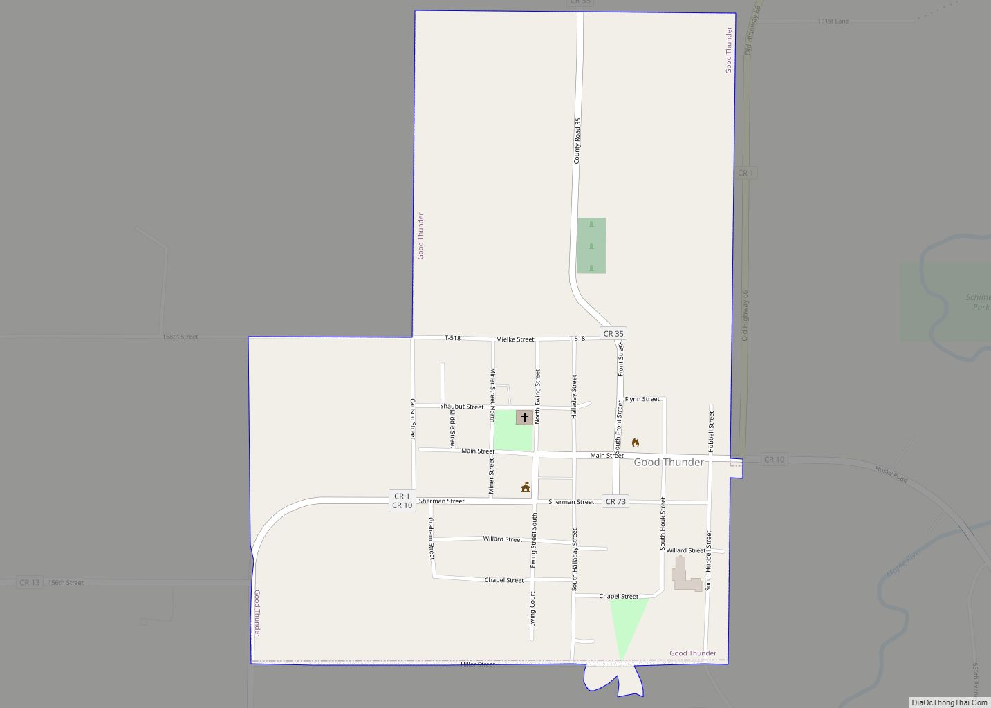
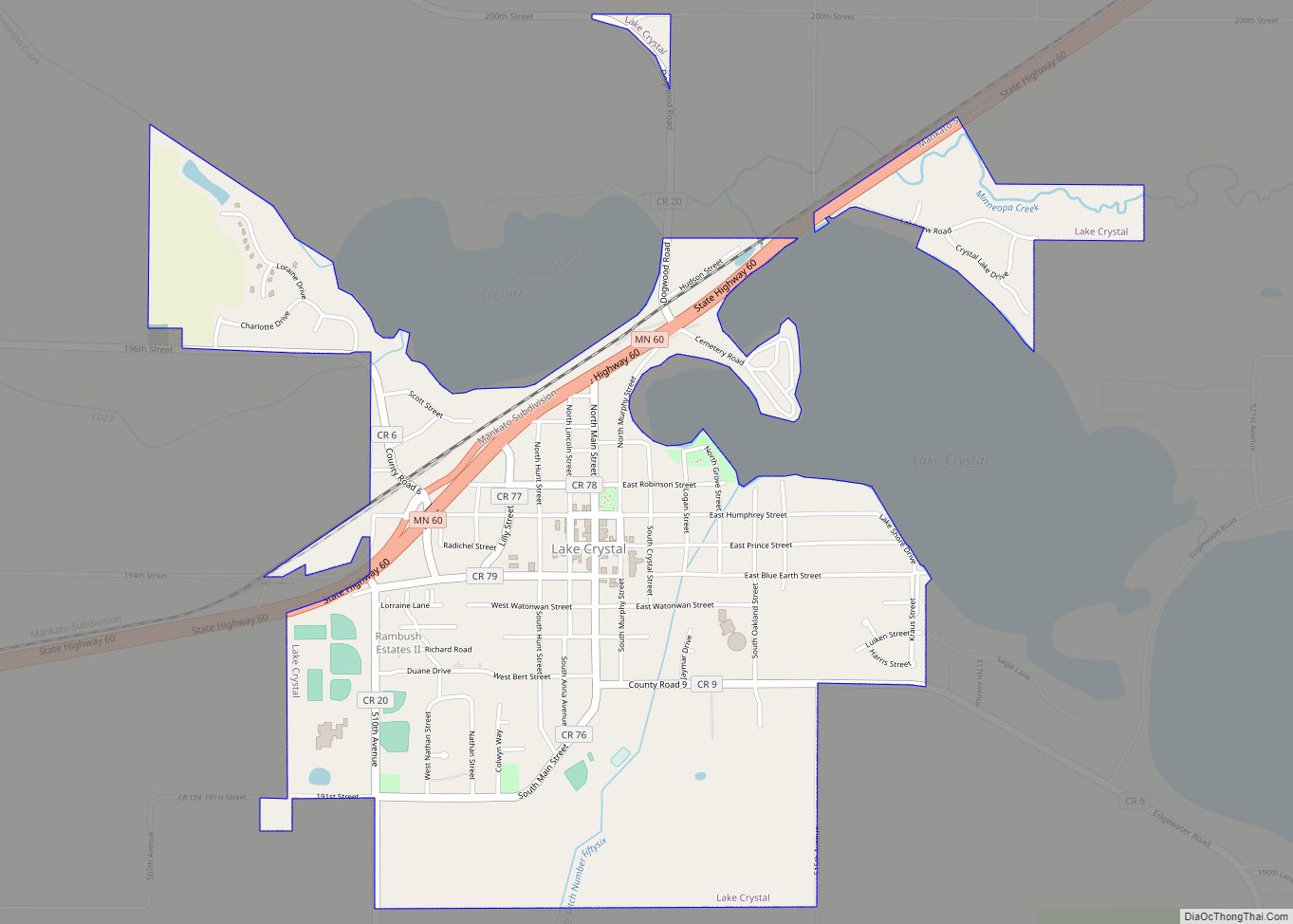
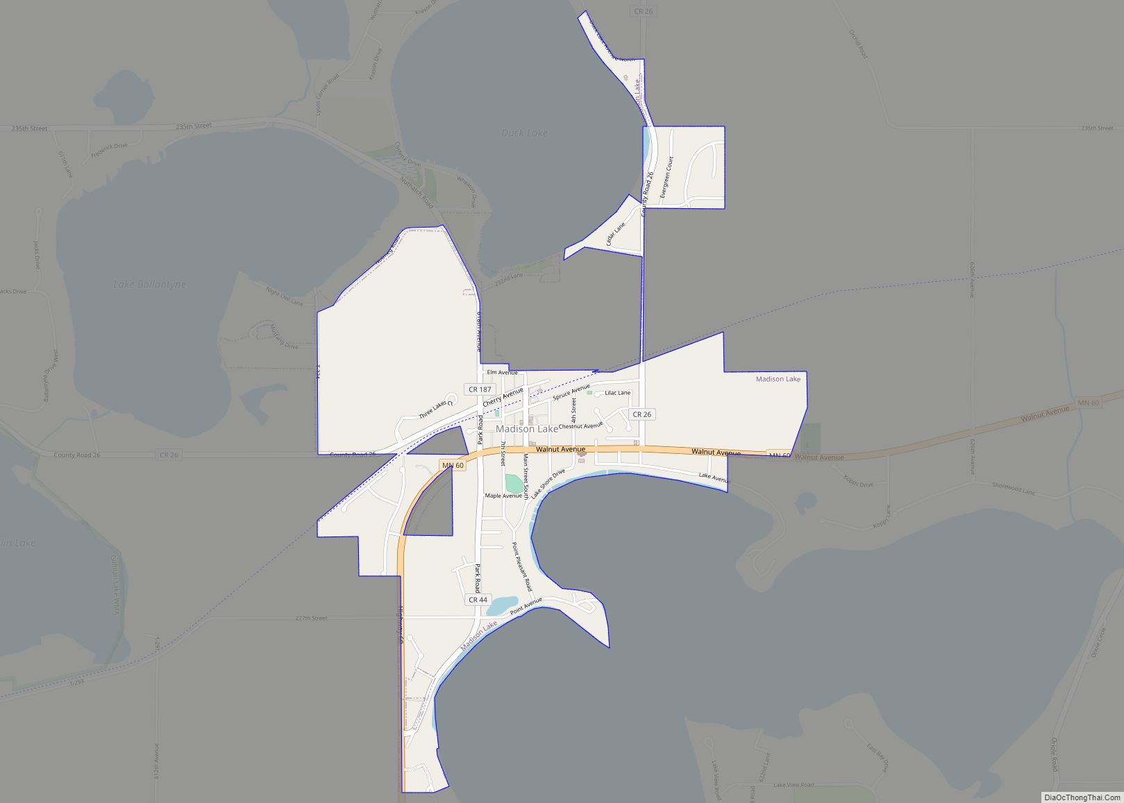
Blue Earth County is a county in the State of Minnesota. As of the 2020 census, the population was 69,112. Its county seat is Mankato. The county is named for the Blue Earth River and for the deposits of blue-green clay once evident along the banks of the Blue Earth River.
Blue Earth County is part of the Mankato-North Mankato metropolitan area.
| Name: | Blue Earth County |
|---|---|
| FIPS code: | 27-013 |
| State: | Minnesota |
| Founded: | March 5, 1853 |
| Named for: | Blue Earth River |
| Seat: | Mankato |
| Largest city: | Mankato |
| Total Area: | 766 sq mi (1,980 km²) |
| Land Area: | 748 sq mi (1,940 km²) |
| Total Population: | 69,112 |
| Population Density: | 90.2/sq mi (34.8/km²) |
| Time zone: | UTC−6 (Central) |
| Summer Time Zone (DST): | UTC−5 (CDT) |
| Website: | www.co.blue-earth.mn.us |
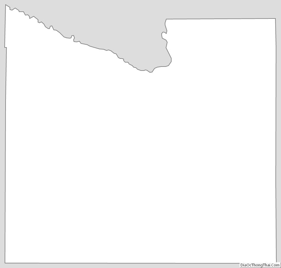
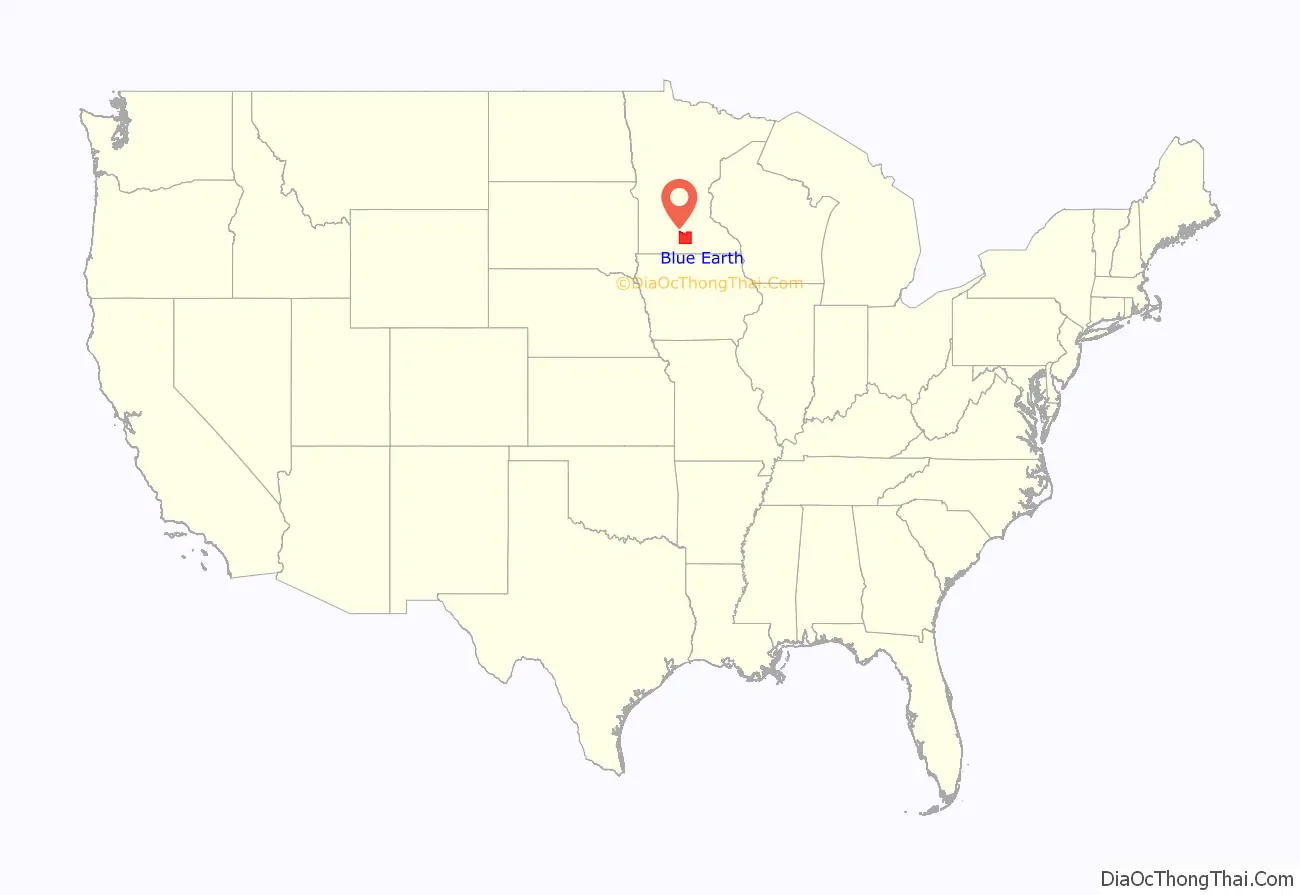
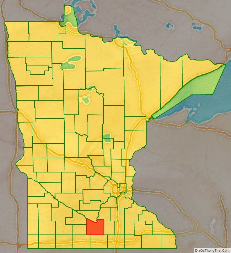
Blue Earth County location map. Where is Blue Earth County?
History
The area of Blue Earth County was once occupied by the Dakota Indians. French explorer Pierre-Charles Le Sueur was an early explorer in this area, arriving where the Minnesota and Blue Earth rivers meet. He made an unsuccessful attempt to mine copper from the blue earth. The area remained under French control until 1803 when it passed to the United States in the Louisiana Purchase.
When Minnesota became a territory in 1849, the territorial government became interested in settling the river valley. In 1850 the first steamboat trip, starting in St. Paul, traveled on the Minnesota River and came to the Blue Earth River. The first Euro-American settlers, P. K. Johnson and Henry Jackson, debarked and settled in present-day Mankato. The ratification of the Mendota and Traverse des Sioux treaties in 1851 effectively forced the eastern Dakota to move to nearby reservations.
The county of Blue Earth was created after a division of the Minnesota Territory on March 5, 1853, from portions of Dakota County and free territory. It was named for the Blue Earth River. The first government officials were appointed by Alexander Ramsey, the territorial governor. That October the first election was held, with 22 ballots being taken.
On February 27, 1855, the Winnebago (Ho-Chunk) ceded 897,900 acres of their reservation near Long Prairie in exchange for 200,000 acres on the Blue Earth River. On May 24, 1855, they relocated and became so successful at farming that neighboring American settlers coveted their land.
Blue Earth County is near the Lower Sioux reservation, which was created in 1858. Starvation on the reservation and the lack of timely arrival of government annuities led to the Dakota War of 1862, followed by removal of all Native Americans from the county. In 1868 the railroad’s arrival promoted the county’s growth and development by bringing immigrants and goods to the area.
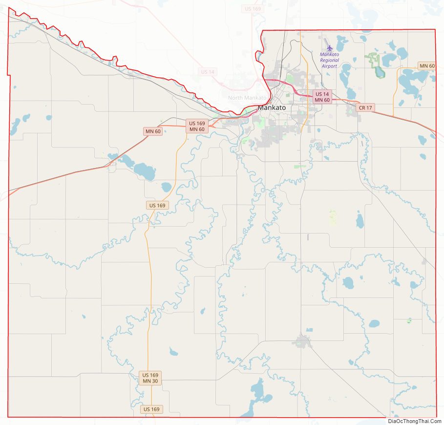
Blue Earth County Road Map
Geography
The Minnesota River flows southeasterly along the western part of the county’s northern boundary line. It is joined by the Blue Earth River, which flows northerly through the western central part of the county. The Watonwan River flows northwesterly through the northeastern part of the county, discharging into the Blue Earth. The Little Cobb River flows northwesterly through the southeastern part of the county, meeting with the Cobb River which flows northerly through the lower part of the county into the Blue Earth River. The Le Sueur River also flows west-northwesterly through the SE part of the county, discharging into the Blue Earth River.
The county terrain consists of low rolling hills, with the area (except around built-up zones, and in areas carved by runoff) devoted to agriculture. It slopes generally to the north. Its southwest corner is 1,086′ (331m) above sea level.
The county has an area of 766 square miles (1,980 km), of which 748 square miles (1,940 km) is land and 18 square miles (47 km) (2.3%) is water. The Blue Earth River and Le Sueur River flow through a part of the county. The land surface is relatively flat with over 30 lakes in the county. There are many “closed forest savannas” that some call the big woods in the county’s northeast. The rivers that flow out of the northeast are surrounded by these big woods. Most of the county is grassland prairie but scattered parts are wet prairie. Some spots that surround the rivers are oak openings and barren brushland.
Major highways
- U.S. Highway 14
- U.S. Highway 169
- Minnesota State Highway 22
- Minnesota State Highway 30
- Minnesota State Highway 60
- Minnesota State Highway 68
- Minnesota State Highway 83
Lakes
- Crystal Lake
- Albert Lake
- Alice Lake
- Armstrong Lake
- Ballantyne Lake
- Born Lake
- Cottonwood Lake
- Duck Lake
- Eagle Lake
- George Lake
- Gilfillin Lake
- Ida Lake
- Indian Lake
- Knights Lake
- Lake Crystal
- Lieberg Lake
- Lily Lake
- Long Lake
- Loon Lake
- Lura Lake (part)
- Madison Lake
- Mennenga Lake
- Mills Lake
- Minnesota Lake (part)
- Mud Lake
- Perch Lake
- Porter Lake
- Rice Lake
- Severson Lake
- Strom Lake
- Wita Lake
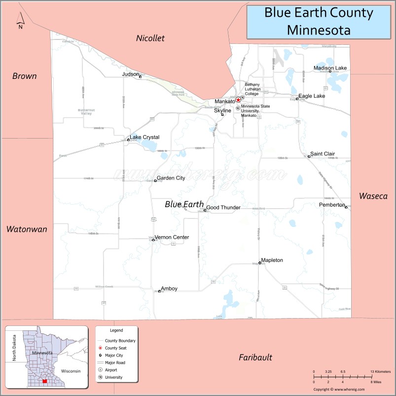
Adjacent counties
- Nicollet County – north
- Le Sueur County – northeast
- Waseca County – east
- Faribault County – south
- Martin County – southwest
- Watonwan County – west
- Brown County – northwest
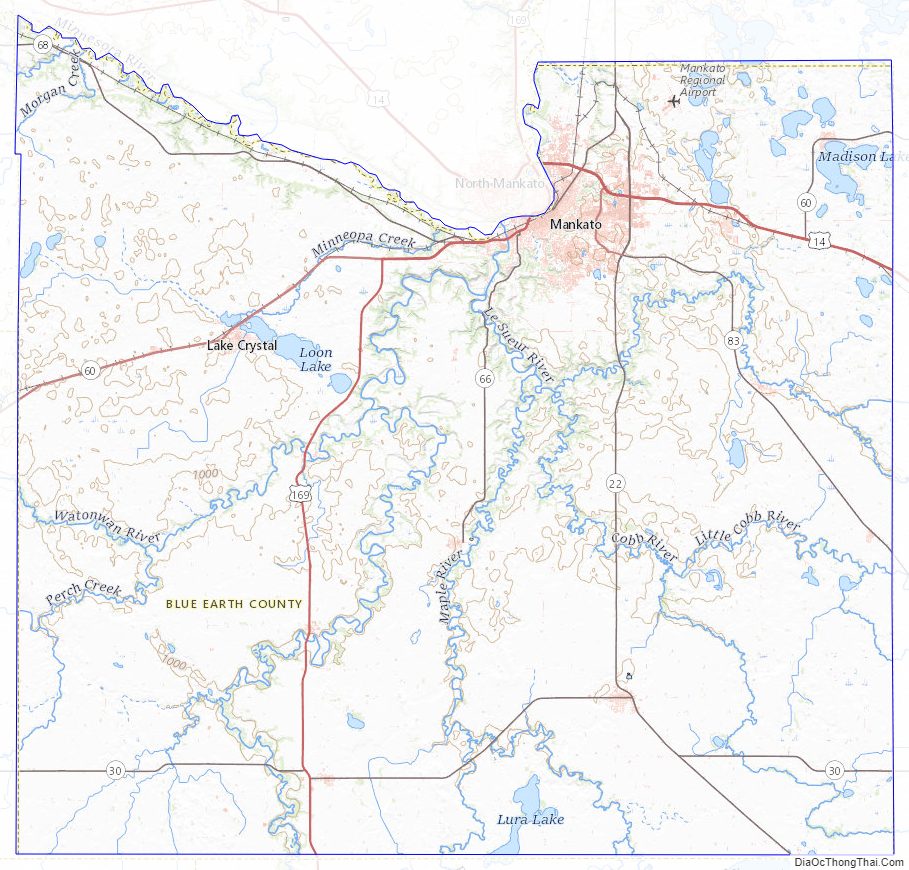
Blue Earth County Topographic Map
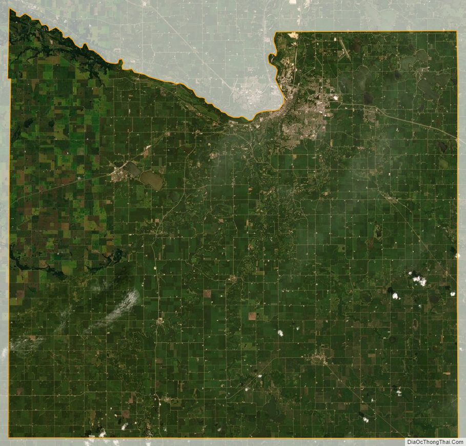
Blue Earth County Satellite Map
Blue Earth County Outline Map