Fillmore County is a county in the U.S. state of Minnesota. As of the 2020 census, the population was 21,228. Its county seat is Preston. Fillmore County is included in the Rochester metropolitan area.
| Name: | Fillmore County |
|---|---|
| FIPS code: | 27-045 |
| State: | Minnesota |
| Founded: | March 5, 1853 |
| Named for: | Millard Fillmore |
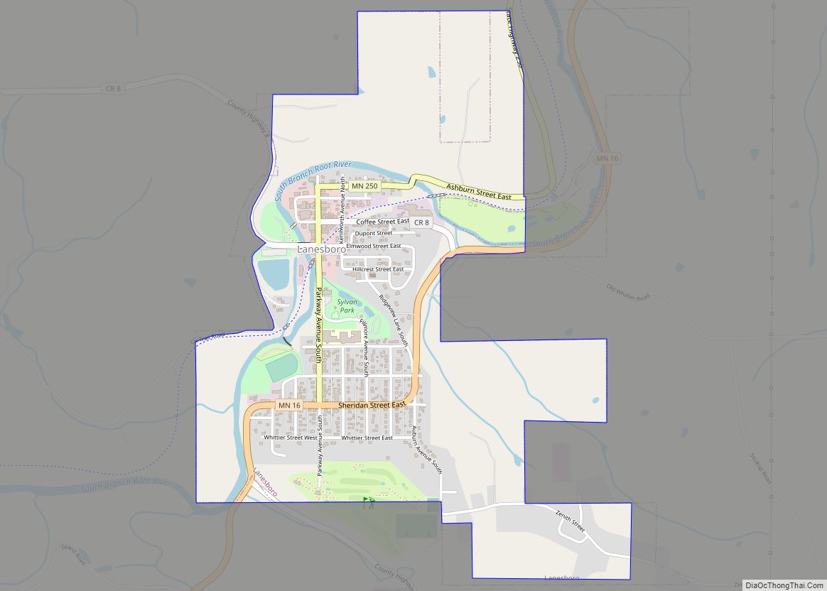
| Seat: | Preston |
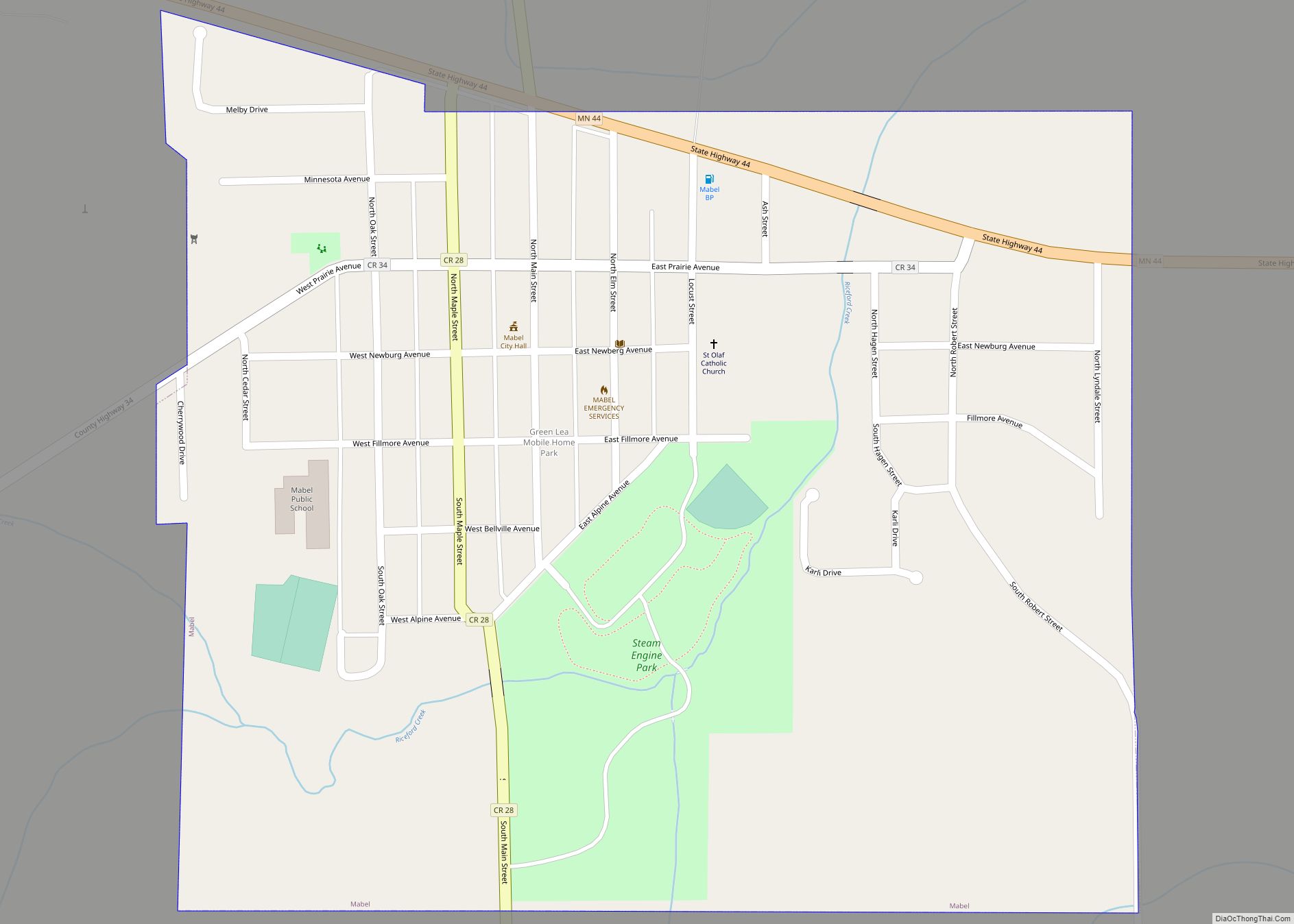
| Largest city: | Spring Valley |
| Total Area: | 862 sq mi (2,230 km²) |
| Land Area: | 861 sq mi (2,230 km²) |
| Total Population: | 21,228 |
| Population Density: | 24.6/sq mi (9.5/km²) |
| Time zone: | UTC−6 (Central) |
| Summer Time Zone (DST): | UTC−5 (CDT) |
| Website: | www.co.fillmore.mn.us |
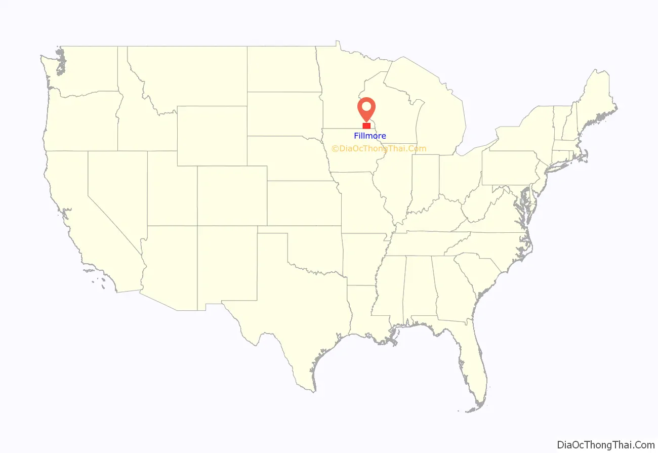
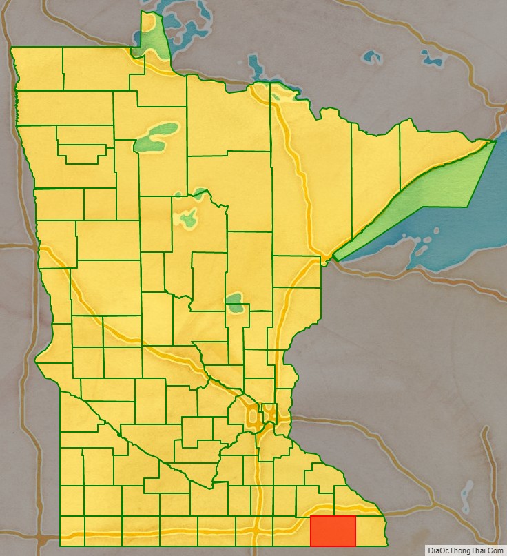
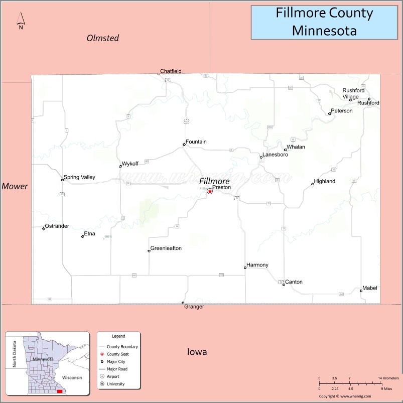
Fillmore County location map. Where is Fillmore County?
History
Fillmore County was created on March 5, 1853. It is named for Millard Fillmore, the 13th president of the United States. Fillmore County was an early destination for Euro-American settlement following the United States’ 1851 treaties with the Dakota nations. Norwegian immigrants were particularly numerous. In 1860 Fillmore was Minnesota’s most populous county.
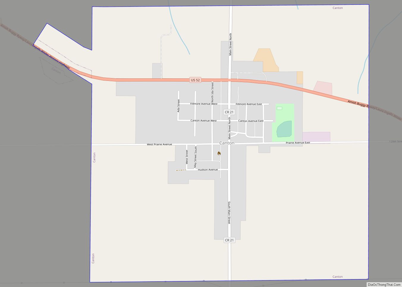
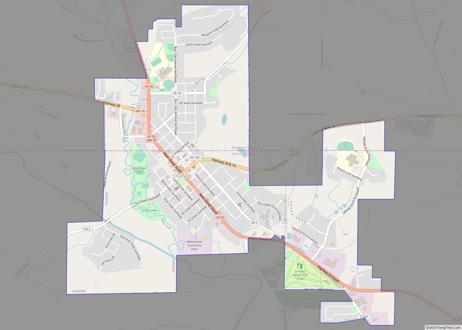
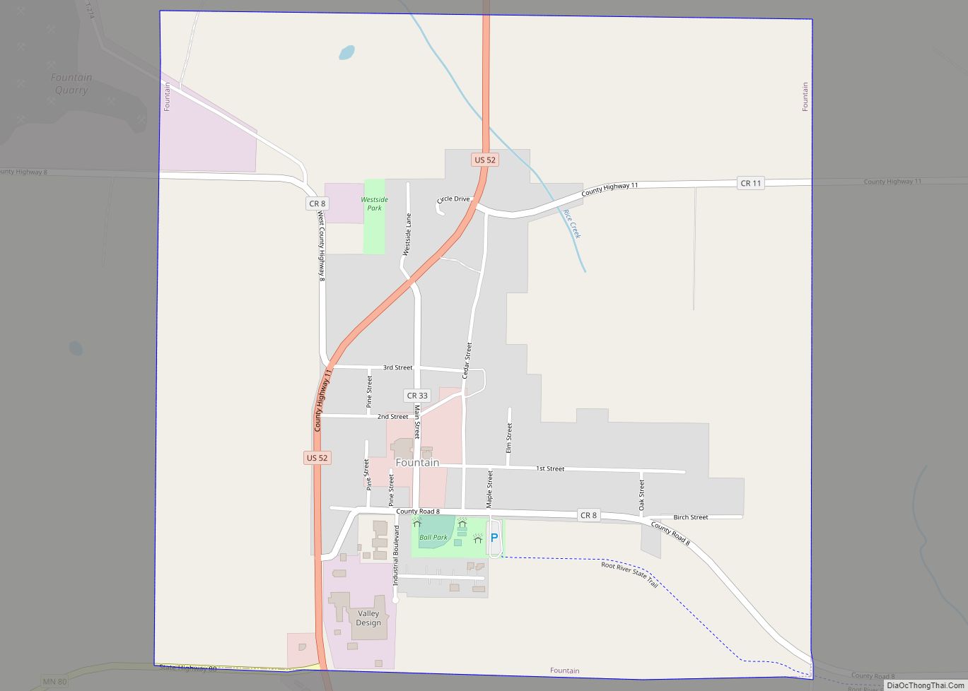
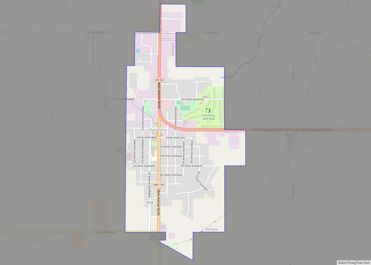
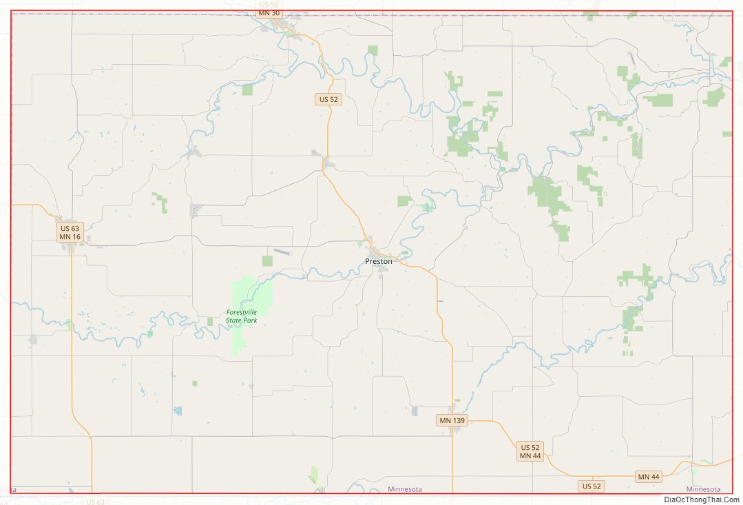
Fillmore County Road Map
Geography
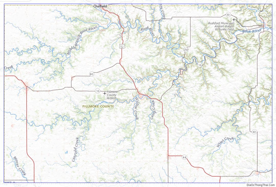
Fillmore County is on Minnesota’s border with Iowa. The Root River drains the county, flowing eastward. The North Branch and the Middle Branch combine east of Shady Creek, while the South Branch meets their combined flow at Preston. Bear Creek drains the lower part of the county, discharging into the Root in the eastern part of the county. Willow Creek also drains a portion of the lower county, discharging into the Root at Preston. The Upper Iowa River flows eastward, mostly in adjoining Iowa counties, but briefly enters Fillmore County near the midpoint of its southern border.
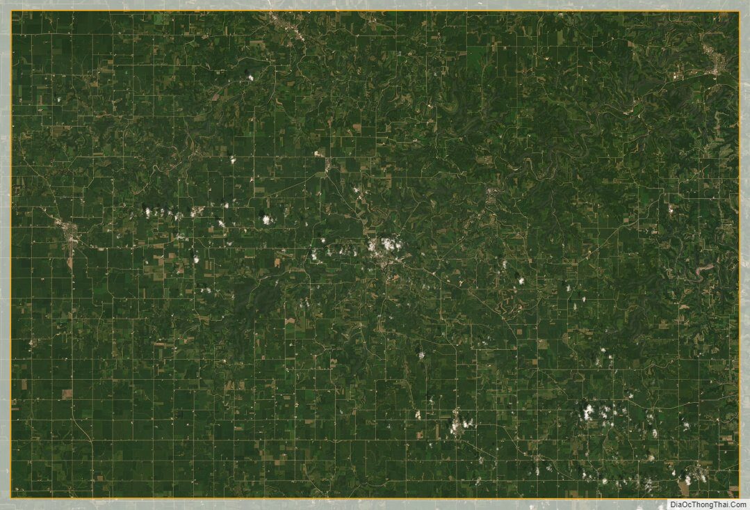
The county’s terrain consists of rolling hills, carved by gullies and drainages, with the available area dedicated to agriculture. The terrain slopes to the east; its highest point is on the lower western border, at 1,378′ (420m) ASL. The county has a total area of 862 square miles (2,230 km), of which 861 square miles (2,230 km) is land and 0.8 square miles (2.1 km) (0.09%) is water.
The county is part of the Driftless Area or Paleozoic plateau. This part of Minnesota was ice-free during the last ice age. Fillmore County also displays a karst topography.
Major highways
- U.S. Highway 52
- U.S. Highway 63
- Minnesota State Highway 16
- Minnesota State Highway 30
- Minnesota State Highway 43
- Minnesota State Highway 44
- Minnesota State Highway 56
- Minnesota State Highway 74
- Minnesota State Highway 80
- Minnesota State Highway 139
- Minnesota State Highway 250
- List of county roads
Adjacent counties
- Winona County – northeast
- Houston County – east
- Winneshiek County, Iowa – southeast
- Howard County, Iowa – southwest
- Mower County – west
- Olmsted County – northwest
Protected areas
- Forestville/Mystery Cave State Park
- Mystery Cave State Park
- Pin Oak Prairie Scientific and Natural Area
- Rushford Sand Barrens Scientific and Natural Area
- Wycoff Balsam Fir Scientific and Natural Area
Fillmore County Topographic Map
Fillmore County Satellite Map
Fillmore County Outline Map