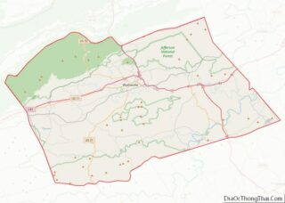
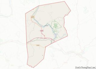
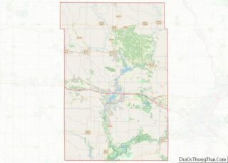
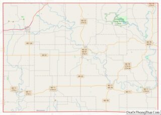
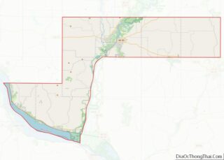
Map of Bell County, Texas
Bell County is a county in the U.S. state of Texas. It is in Central Texas and its county seat is Belton. As of the 2020 census, its population was 370,647. Bell County is part of the Killeen–Temple, Texas, Metropolitan Statistical Area. The county was founded in 1850 and is named for Peter Hansborough Bell, ... Read more
Map of Bell County, Texas
Map of Callahan County, Texas
Callahan County is a county located in the U.S. state of Texas. As of the 2020 census, the population was 13,708. Its county seat is Baird. The county was founded in 1858 and later organized in 1877. It is named for James Hughes Callahan, an American soldier in the Texas Revolution. Callahan County is included ... Read more
Map of Callahan County, Texas
Map of Comal County, Texas
Comal County (/ˈkoʊmæl/ KOH-mal) is a county located on the Edwards Plateau in the U.S. state of Texas. As of the 2020 census, its population was 161,501. Comal County is known for its rich German-Texan and European history. Its county seat is New Braunfels. Comal County is part of the San Antonio-New Braunfels, TX metropolitan ... Read more
Map of Comal County, Texas
Map of Dewitt County, Texas
DeWitt County is a county located in the U.S. state of Texas. As of the 2020 census, its population was 19,824. The county seat is Cuero. The county was founded in 1846 and is named for Green DeWitt, who founded an early colony in Texas. Dewitt County overview: Name: Dewitt County FIPS code: 48-123 State: ... Read more
Map of Dewitt County, Texas
Map of Foard County, Texas
Foard County is a county located in the U.S. state of Texas. As of the 2020 census, its population was 1,095. Its county seat is Crowell, which is also the county’s only incorporated community. The county is named for Robert Levi Foard, an attorney who served as a major with the Confederate Army, in the ... Read more
Map of Foard County, Texas
Map of Guadalupe County, Texas
Guadalupe County overview: Name: Guadalupe County FIPS code: 48-187 State: Texas Founded: 1846 Named for: Guadalupe River Seat: Seguin Largest city: New Braunfels Total Area: 715 sq mi (1,850 km²) Land Area: 711 sq mi (1,840 km²) Total Population: 172,706 Population Density: 240/sq mi (93/km²) Time zone: UTC−6 (Central) Summer Time Zone (DST): UTC−5 (CDT) Website: www.co.guadalupe.tx.us Guadalupe County location map. Where ... Read more
Map of Guadalupe County, Texas
Map of Hockley County, Texas
Hockley County is a county located in the U.S. state of Texas. As of the 2020 census, its population was 21,537. Its county seat is Levelland. The county was created in 1876, but not organized until 1921. It is named for George Washington Hockley, a secretary of war of the Republic of Texas. Hockley County ... Read more
Map of Hockley County, Texas
Map of Johnson County, Texas
Johnson County is a county located in the U.S. state of Texas. As of the 2020 census, its population was 179,927. Its county seat is Cleburne. Johnson County is named for Middleton Johnson, a Texas Ranger, soldier, and politician. Johnson County is included in the Dallas–Fort Worth–Arlington metropolitan statistical area. Johnson County overview: Name: Johnson ... Read more
Map of Johnson County, Texas
Map of Lampasas County, Texas
Lampasas County (/læmˈpæsəs/ lam-PASS-əs) is a county located on the Edwards Plateau in the U.S. state of Texas. As of the 2020 census, its population was 21,627. Its county seat is Lampasas. The county is named for the Lampasas River. Lampasas County is part of the Killeen–Temple metropolitan statistical area. Lampasas County overview: Name: Lampasas ... Read more
Map of Lampasas County, Texas
Map of Matagorda County, Texas
Matagorda County overview: Name: Matagorda County FIPS code: 48-321 State: Texas Founded: 1836 Seat: Bay City Largest city: Bay City Total Area: 1,613 sq mi (4,180 km²) Land Area: 1,100 sq mi (3,000 km²) Total Population: 36,255 Population Density: 22/sq mi (8.7/km²) Time zone: UTC−6 (Central) Summer Time Zone (DST): UTC−5 (CDT) Website: www.co.matagorda.tx.us Matagorda County location map. Where is Matagorda County? ... Read more
Map of Matagorda County, Texas
Map of Nacogdoches County, Texas
Nacogdoches County (/ˌnækəˈdoʊtʃɪs/ NAK-ə-DOH-chiss) is a county located in the U.S. state of Texas. As of the 2010 census, its population was 64,653. Its county seat is Nacogdoches. The Nacogdoches, Texas micropolitan statistical area includes all of Nacogdoches County. Nacogdoches hosts the Blueberry Festival in June. The county is the top blueberry producer in Texas ... Read more
Map of Nacogdoches County, Texas
Map of Rains County, Texas
Rains County is a county located in the U.S. state of Texas. As of the 2020 census, its population was 12,164. Its seat is Emory. The county (and county seat) are named for Emory Rains, a Texas state legislator. In 1970, Recorded Texas Historic Landmark Number 10860 was placed in the county courthouse lawn. Rains ... Read more
Map of Rains County, Texas