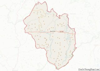
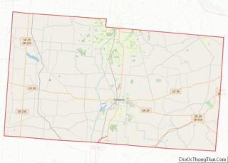
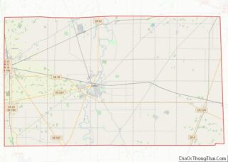
Map of Ellis County

Map of Ellis County, Texas

Ellis County overview: Name: Ellis County FIPS code: 48-139 State: Texas Founded: 1850 Named for: Richard Ellis Seat: Waxahachie Largest city: Waxahachie Total Area: 952 sq mi (2,470 km²) Land Area: 936 sq mi (2,420 km²) Total Population: 192,455 Population Density: 200/sq mi (80/km²) Time zone: UTC−6 (Central) Summer Time Zone (DST): UTC−5 (CDT) Website: www.co.ellis.tx.us Ellis County location map. Where is … Read more

Map of Glasscock County

Map of Glasscock County, Texas

Glasscock County is a county located in the U.S. state of Texas. As of the 2020 census, its population was 1,116. Its county seat is Garden City. The county was created in 1887 and later organized in 1893. It is named for George Washington Glasscock, an early settler of the Austin, Texas area and the … Read more

Map of Hartley County

Map of Hartley County, Texas

Hartley County is a county located in the U.S. state of Texas. As of the 2020 census, its population was 5,382. The county seat is Channing. The county was created in 1876 and later organized in 1891. It is named for Oliver C. Hartley and his brother, Rufus K. Hartley, two early Texas legislators and … Read more

Map of Jack County

Map of Jack County, Texas

Jack County is a county located in the north central part of the U.S. state of Texas. As of the 2020 census, its population was 8,472. Its county seat is Jacksboro. The county was created in 1856 and organized the next year. It is named for Patrick Churchill Jack and his brother William Houston Jack, … Read more

Map of King County

Map of King County, Texas

King County is a county located in the U.S. state of Texas. As of the 2020 Census, its population was 265, making it the second-smallest county in Texas and the third-smallest county in the United States. King County has no incorporated communities. Its county seat is the census-designated place (CDP) of Guthrie. The county was … Read more

Map of Loving County

Map of Loving County, Texas

Loving County is a county in the U.S. state of Texas. With a population of 64 per the 2020 census, it is the least-populous county in the United States. Its county seat and only community is Mentone. The county was originally created in 1887, and after being disorganized in 1897, was reorganized in 1931. Loving … Read more

Map of Mills County

Map of Mills County, Texas

Mills County is a county located in Central Texas. It was created on March 15, 1887, from parts of four existing counties—Brown, Comanche, Hamilton, and Lampasas. The 2020 census reported a population of 4,456. The county seat is Goldthwaite. Mills County overview: Name: Mills County FIPS code: 48-333 State: Texas Founded: March 15, 1887 Named … Read more

Map of Panola County

Map of Panola County, Texas

Panola County is a county located in the U.S. state of Texas. As of the 2020 census, its population was 22,491. The county seat is Carthage. Located in East Texas and originally developed for cotton plantations, the county’s name is derived from a Choctaw word for cotton. Until 2013, Panola County was one of about … Read more

Map of Rockwall County

Map of Rockwall County, Texas

Rockwall County is a county in the U.S. state of Texas. At 149 square miles, Rockwall County has the smallest area of any Texas county. Per the 2020 Census, its population was 107,819. Its county seat is Rockwall. The county and city are named for a wall-like subterranean rock formation that runs throughout the county. … Read more

Map of Stephens County

Map of Stephens County, Texas

Stephens County is a county located in the U.S. state of Texas. As of the 2020 census, its population was 9,101. Its county seat is Breckenridge. The county was created in 1858 and organized in 1876. It was originally named Buchanan County, after U.S. President James Buchanan, but was renamed in 1861 for Alexander H. … Read more

Map of Upton County

Map of Upton County, Texas

Upton County is a county located on the Edwards Plateau in the U.S. state of Texas. As of the 2020 census, its population was 3,308. Its county seat is Rankin. The county was created in 1887 and later organized in 1910. It is named for two brothers: John C. and William F. Upton, both colonels … Read more

Map of Wilson County

Map of Wilson County, Texas

Wilson County is a county located in the U.S. state of Texas. As of the 2020 census, its population was 49,753. Its county seat is Floresville. The county is named after James Charles Wilson. Wilson County is part of the San Antonio–New Braunfels, Texas, metropolitan statistical area. Wilson County overview: Name: Wilson County FIPS code: … Read more