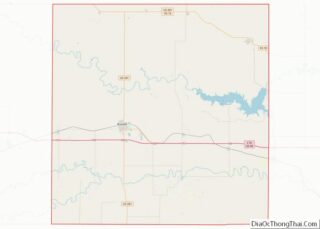
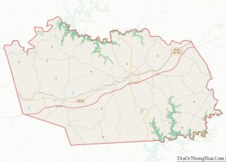
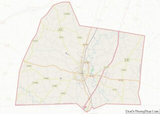
Map of Boulder County

Map of Boulder County, Colorado

Boulder County is a county located in the U.S. state of Colorado of the United States. As of the 2020 census, the population was 330,758. The most populous municipality in the county and the county seat is Boulder. Boulder County comprises the Boulder, Colorado Metropolitan Statistical Area, which is included in the Denver–Aurora, Colorado Combined … Read more

Map of Fremont County

Map of Fremont County, Colorado

Fremont County is a county located in the U.S. state of Colorado. As of the 2020 census, the population was 48,939. The county seat is Cañon City. The county is named for 19th-century explorer and presidential candidate John C. Frémont. Fremont County comprises the Cañon City, CO Micropolitan Statistical Area, which is also included in … Read more

Map of Logan County

Map of Logan County, Colorado

Logan County is a county located in the U.S. state of Colorado. As of the 2020 census, the population was 21,528. The county seat is Sterling. The county was named for General John A. Logan. Logan County comprises the Sterling, CO Micropolitan Statistical Area. Logan County overview: Name: Logan County FIPS code: 08-075 State: Colorado … Read more

Map of Routt County

Map of Routt County, Colorado

Routt County is a county located in the U.S. state of Colorado. As of the 2020 census, the population was 24,829. The county seat is Steamboat Springs. Routt County comprises the Steamboat Springs, CO Micropolitan Statistical Area. Routt County overview: Name: Routt County FIPS code: 08-107 State: Colorado Founded: January 29, 1877 Named for: John … Read more

Map of Tolland County

Map of Tolland County, Connecticut

Tolland County overview: Name: Tolland County FIPS code: 09-013 State: Connecticut Founded: 1785 Named for: Tolland, Somerset Seat: none (since 1960)Tolland (1785-1889)Rockville (1889-1960) Largest town: Vernon Total Area: 417 sq mi (1,080 km²) Land Area: 410 sq mi (1,100 km²) Total Population: 149,788 Population Density: 359.2/sq mi (138.7/km²) Time zone: UTC−5 (Eastern) Summer Time Zone (DST): UTC−4 (EDT) Tolland County location map. … Read more

Map of Collier County

Map of Collier County, Florida

Collier County overview: Name: Collier County FIPS code: 12-021 State: Florida Founded: May 8, 1923 Named for: Barron Collier Seat: East Naples Largest city: Naples Total Area: 2,305 sq mi (5,970 km²) Land Area: 1,998 sq mi (5,170 km²) Total Population: 375,752 Population Density: 188/sq mi (73/km²) Time zone: UTC−5 (Eastern) Summer Time Zone (DST): UTC−4 (EDT) Website: www.colliergov.net Collier County location … Read more

Map of Highlands County

Map of Highlands County, Florida

Highlands County is a county located in the Florida Heartland region of the U.S. state of Florida. As of the 2020 census, the population was 101,235. Its county seat is Sebring. Highlands County comprises the Sebring-Avon Park, FL Metropolitan Statistical Area. Highlands County overview: Name: Highlands County FIPS code: 12-055 State: Florida Founded: April 23, … Read more

Map of Miami-Dade County

Map of Miami-Dade County, Florida

Miami-Dade County (Spanish: Condado de Miami-Dade) is a county located in the southeastern part of the U.S. state of Florida. The county had a population of 2,701,767 as of the 2020 census, making it the most populous county in Florida and the seventh-most populous county in the United States. It is Florida’s third largest county … Read more

Map of Seminole County

Map of Seminole County, Florida

Seminole County (/ˈsɛmɪnoʊl/, SEM-i-nohl) is a county located in the central portion of the U.S. state of Florida. As of the 2020 census, the population was 470,856, making it the 13th-most populated county in Florida. Its county seat and largest city is Sanford. Seminole County is part of the Orlando-Kissimmee-Sanford, Florida Metropolitan Statistical Area. Seminole … Read more

Map of Bartow County

Map of Bartow County, Georgia

Bartow County is located in the eastern part of the U.S. state of Georgia. As of the 2020 census, the population was 108,901, up from 100,157 in 2010. The county seat is Cartersville. Traditionally considered part of northwest Georgia, Bartow County is now included in the Atlanta metropolitan area, mainly in the southeastern part near … Read more

Map of Charlton County

Map of Charlton County, Georgia

Charlton County is the southernmost county of the U.S. state of Georgia, located in the southeastern part of the state. As of the 2020 census, the population was 12,518. The county seat is Folkston. Charlton County overview: Name: Charlton County FIPS code: 13-049 State: Georgia Founded: 1854 Named for: Robert M. Charlton Seat: Folkston Largest … Read more

Map of Crisp County

Map of Crisp County, Georgia

Crisp County is a county located in the central portion of the U.S. state of Georgia. As of the 2020 census, the population was 20,128. The county seat is Cordele. The county was created on August 17, 1905, from Dooly County and named for Georgia Congressman Charles Frederick Crisp. Crisp County comprises the Cordele, GA … Read more