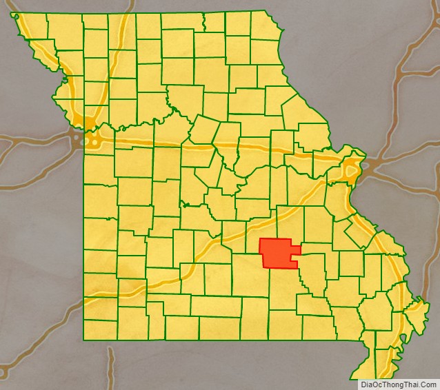
Dent County is a county in Missouri. As of the 2020 census, the population was 14,421. The largest city and county seat is Salem. The county was officially organized on February 10, 1851, and is named after state representative Lewis Dent, a pioneer settler who arrived in Missouri from Virginia in 1835.
| Name: | Dent County |
|---|---|
| FIPS code: | 29-065 |
| State: | Missouri |
| Founded: | February 10, 1851 |
| Named for: | Lewis Dent, a pioneer settler |
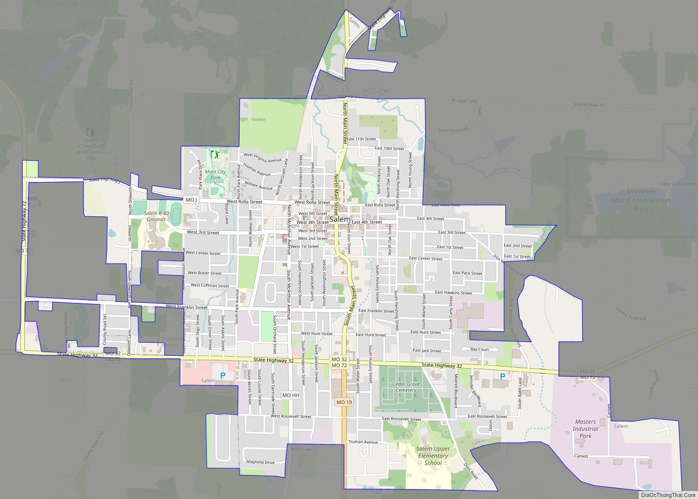
| Seat: | Salem |
| Largest city: | Salem |
| Total Area: | 755 sq mi (1,960 km²) |
| Land Area: | 753 sq mi (1,950 km²) |
| Total Population: | 14,421 |
| Population Density: | 19/sq mi (7.4/km²) |
| Time zone: | UTC−6 (Central) |
| Summer Time Zone (DST): | UTC−5 (CDT) |
| Website: | www.salemmo.com/dent/ |
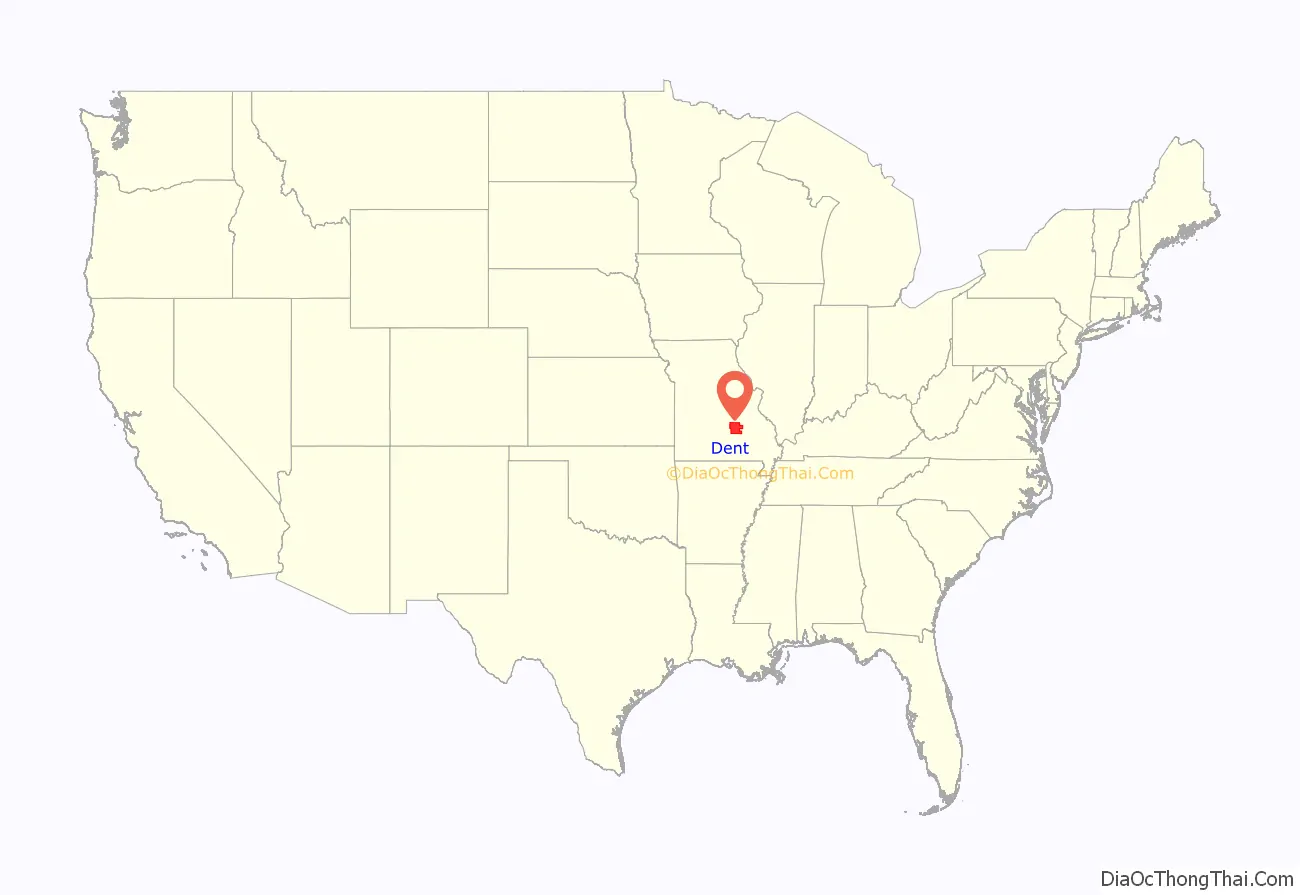
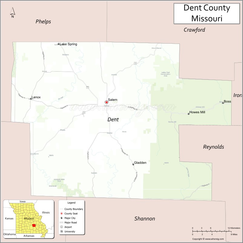
Dent County location map. Where is Dent County?
History
Exploration and settlement
Henry Rowe Schoolcraft was one of the earliest visitors to the area that would become Dent County, which was then unmapped and unknown. In 1818, Schoolcraft and Levi Pettibone left Potosi, Missouri on an adventure that often left them hungry, lost, lonely and in danger. They started headed west from Potosi on a trail that is now followed by Highway 8, then turned south through southern Dent and Shannon counties, where Schoolcraft found the Current River, “a fine stream with fertile banks and clear, sparkling water.” Today the river attracts tourists who launch canoes by the thousands during the summer to enjoy the fast-moving water of the Current and Jack’s Fork Rivers in the Ozark National Scenic Riverways. Schoolcraft traveled to the area of today’s Springfield, Missouri, then went east on White River and finally back to Potosi, completing a journey of 89 days.
The White River trail had long been used by Native Americans in Dent County. It later became one of the branches of the Trail of Tears, which saw many Cherokees pass through on their forced trek to Oklahoma. Some stopped in Dent County and many old families take pride in their Cherokee heritage. The “trace” wound from Sligo southwest to the Ephraim Bressie Farm on Spring Creek north of Salem. It left the county about the present town of Maples.
The first white settler was George Cole, who cleared a farm on the Meramec near Short Bend. It was later the site of the Nelson Mill. An abundance of waterpower and difficulty of transportation made mills important in the settling of the new land. Some of the first settlers came in 1829, mostly to the Meramec, Spring Creek and Dry Fork valleys. Land could be purchased for five cents or less an acre. William Thornton, Daniel Troutman and Daniel W. Wooliver were among the 1829 settlers, followed by William Blackwell, Nicholas Berardy, Elisha Nelson, Jerry Potts, Ephraim Bressie, Robert Leonard, Abner Wingfield, Lewis Dent, Wilson Craddock, Thomas Higginbotham, Jack Berry, Silas Hamby, Smith Wofford, Turquill McNeill, Dr. John Hyer, Samuel Hyer and David Lenox.
County formation
In 1851, the Missouri Assembly created Dent County from Crawford and Shannon counties. It was named for early settler Lewis Dent, who served as the first representative. G.D. Breckenridge, Samuel Hyer, Jr., and Jotham Clark were the first elected county officials. Joseph Millsap served as sheriff and David Henderson as clerk. They met at the Bressie Farm.
The first mayor of Salem was appointed or elected just after the Missouri state legislature passed the laws relating to village government in 1860. He was W.P. Williams, often referred to as “Rip” from the positive and often violent expression of his feelings and opinions. He lived in Dent County a long time and was a prominent citizen throughout his long life. He became mayor in 1860, but how long he served is unknown. The American Civil War came about in 1861 and city governments were suspended. After Williams, records show that O.A. Kenemore, a prominent farmer with a home in Salem, became mayor. E.T. Wingo, a lawyer and representative, was next, followed by C.L. Allen, who was also a lawyer but never practiced law. He did, however, serve as Deputy Circuit Clerk and Probate Judge. Allen was succeeded by Samuel Sachs. No dates are available listing terms of office for these mayors, but it is likely they served from 1870 to 1881.
Courthouse
An earlier log courthouse, built about 1851 or 1852, was Dent County’s first, on the Wingfield farm northeast of Salem. In 1852-53 a courthouse was built south of the present courthouse. The building measured about 20 by 40 feet (12 m) and was built by J.T. Garvin for $800. It was burned during the Civil War. The next courthouse, built in 1864, also fell victim to fire in May 1866. The beautiful Victorian courthouse—which is listed in the National Register of Historic Places—was built in 1870 for $15,500. A.E. Dye came to Dent County to build this courthouse. His son, E.L. Dye, assisted him and was to become the leading builder in the county. W.P. Elmer in his history reports that when the courthouse was finished, pictures of it were published in McClure’s Magazine and newspapers in the East to show the development of the West.
Resources
Minerals have greatly influenced the Dent County economy. The iron furnace, built at Sligo, was the greatest, starting in 1880 and active until 1923 (43 years). Sligo was the fourth iron works built in the state, following Meramec, Midland and Nova Scotia. There was plenty of iron ore—Simmons Hill in Salem, Orchard and Cherry Valley, Millsap, Pomeroy, Hawkins Banks, Red Hill and Scotia. Elmer writes in his history that the Sligo furnace was the most successful and continued longer than any other iron furnace in Missouri. The Sligo furnace was built on Crooked Creek and produced 60 to 80 tons of pig iron a day with some runs of up to 100 tons. E.B. Sankey came from New Castle, Pennsylvania in 1870 to survey the St. Louis-Salem and Little Rock Railroad from Cuba to Salem. The Sligo & Eastern Railroad ran a branch to East End to gather wood for the kilns producing charcoal for the furnace. Sligo’s population in its big years reached 1,000.
In recent times, the largest mining and milling operations were in the “New Lead Belt” some 30 miles (48 km) east of Salem. St. Joe Lead started the mining boom at Viburnum in neighboring Iron County and soon other major mining companies bought land and mineral rights. The mines brought new families and well-paying jobs with many choosing to live in Salem. Doe Run in nearby St. Francois County continues mining and battery reclamation in the area today.
Electrification
In 1909, a band of 23 pioneers realized the dream of bringing electric lights to Salem with the formation of the Salem Light & Power Co. The city eventually took over the electric system and produced electricity with two big diesel generators. When the generators could no longer meet the demand and were costly to operate the city contracted with Show-Me-Power Cooperative.
Mrs. Thomas A. Bruce organized the first telephone system. Charlie Jeffries joined the Bruces to install the system around 1900. Homes paid $1 and stores $1.25 per month. Mrs. Bruce suffered agony from her eyes and was blind for 30 years until her death on May 8, 1942. The telephone system was sold to United Telephone, now Sprint.
Industry
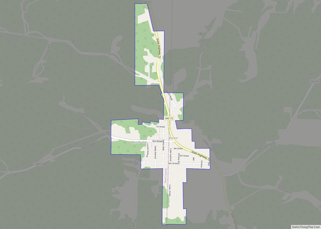
Salem led the world in the production and shipping of railroad ties for a time. While the early lumber companies cut the vast Ozark pine forests, timber has remained a major asset, with white oak staves for barrels, oak flooring, pallets, charcoal briquettes and lumber. The Bunker-Cul1er Lumber Co. in Bunker was one of the area’s biggest industries, and like the mines which hauled wood for the kilns from a large area, Bunker-Cul1er used rails to bring in logs.
Dent County has had its ups and downs economically, but is proud of its record of having five banks during the Great Depression without a failure. The Great Depression years brought many changes. The Civilian Conservation Corps (CCC) brought young men to the area, many of whom stayed. There were CCC camps at Boss and Indian Trail. In the 13,503 acres (54.64 km) of the Indian Trail Conservation Area, crews built most of the area’s 55 miles (89 km) of access roads. The Conservation Department purchased much of the cut-over land for $2.50/acre.
Dent County’s skilled labor force made needlework industries a natural. Ely & Walker’s four-story factory (now the Fourth Street Mall) was the first. After World War II the Industrial Building Corporation raised funds for the International Shoe Factory. Other factories followed, including Salem Sportswear, Barad Lingerie, Paramount Cap and Hagale. Today, foreign competition has all but wiped out the local needlework industry.
After World War II and through the 1950s, 60s and 70s, Dent County underwent changes. There were 60 one-room schools in 1950 and consolidation reduced this number to five districts/plus high schools in Salem and Bunker. Roads were built and improved. Salem Memorial District Hospital was built and became a major industry and health provider.
Economy
Today’s largest employer in Dent County, U.S. Foodservice, is an institutional food business and began in Salem as Craig Distributing. After World War II, Farris Craig started with a panel truck and peanut vending machines. In 1986, the Craigs sold their business to Kraft Foods, which later sold to Alliant, and is now owned by U.S. Foodservice. The Craigs have left their imprint on Salem with Craig Plaza, the Alice Lou Craig Municipal Swimming Pool, the Salem Visitor Center, and the Ozark Natural and Cultural Resource Center.
With guidance from University of Missouri Extension, the county became the Feeder Pig & Calf Capitol of Missouri, with huge sales in spring and fall auctioning large numbers of livestock graded into pens for size and quality. Loss of farm population often due to the aging of farm owners ended these sales.
Dent County Road Map
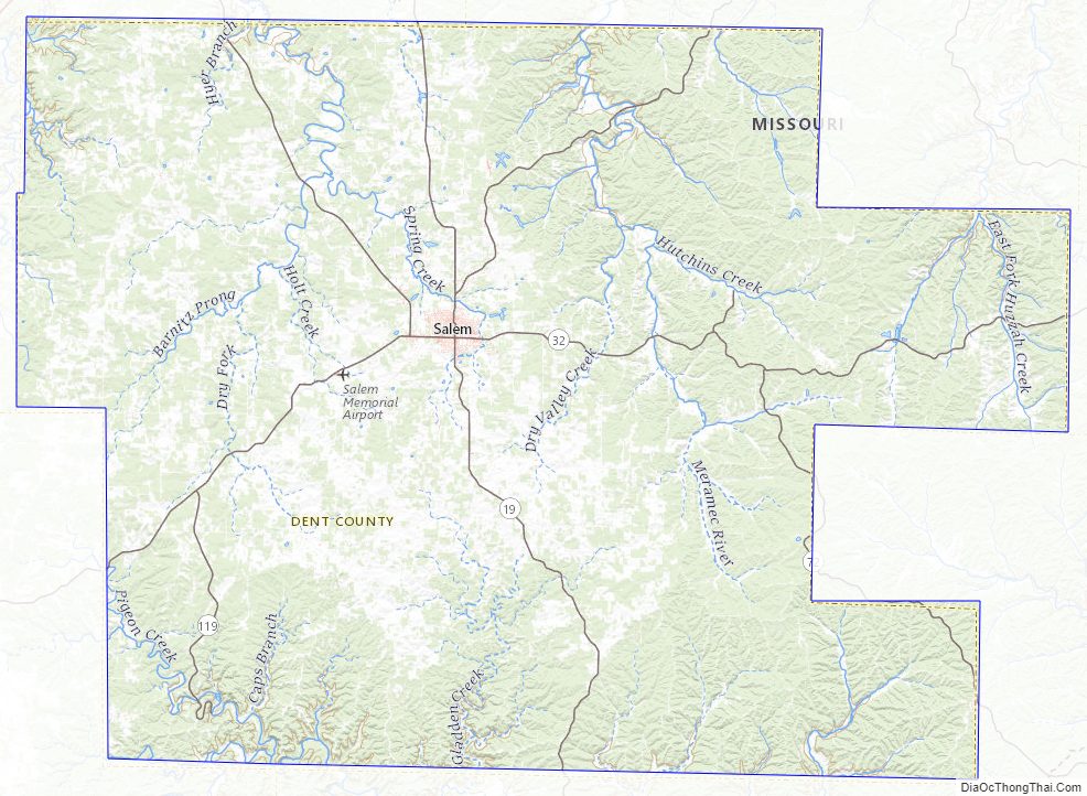
Geography
According to the U.S. Census Bureau, the county has a total area of 755 square miles (1,960 km), of which 753 square miles (1,950 km) is land and 1.7 square miles (4.4 km) (0.2%) is water.
Adjacent counties
- Crawford County (northeast)
- Iron County (southeast)
- Reynolds County (southeast)
- Shannon County (south)
- Texas County (southwest)
- Phelps County (northwest)
National protected areas
- Mark Twain National Forest (part)
- Ozark National Scenic Riverways (part)
Dent County Topographic Map
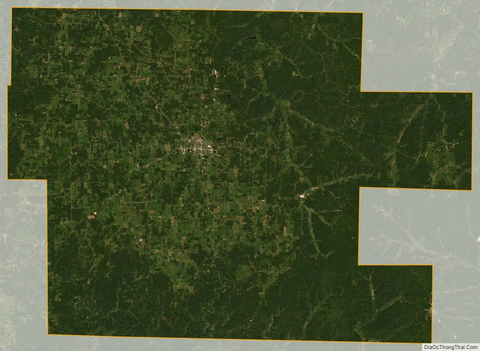
Dent County Satellite Map
Dent County Outline Map