Coordinates: 37°12′N 94°20′W / 37.20°N 94.34°W / 37.20; -94.34
Jasper County is located in the southwest portion of the U.S. state of Missouri. As of the 2020 census, the population was 122,761. Its county seat is Carthage, and its largest city is Joplin. The county was organized in 1841 and named for William Jasper, a hero of the American Revolutionary War.
Jasper County is included in the Joplin Metropolitan Statistical Area. The Jasper County Sheriff’s Office has legal jurisdiction throughout the county.
| Name: | Jasper County |
|---|---|
| FIPS code: | 29-097 |
| State: | Missouri |
| Founded: | January 2, 1841 |
| Named for: | William Jasper |
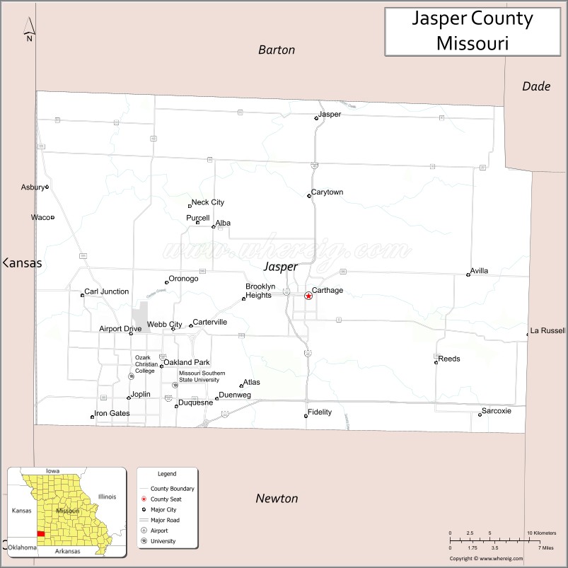
| Seat: | Carthage |
| Largest city: | Joplin |
| Total Area: | 641 sq mi (1,660 km²) |
| Land Area: | 638 sq mi (1,650 km²) |
| Total Population: | 122,761 |
| Population Density: | 192.3/sq mi (74.2/km²) |
| Time zone: | UTC−6 (Central) |
| Summer Time Zone (DST): | UTC−5 (CDT) |
| Website: | www.jaspercounty.org |
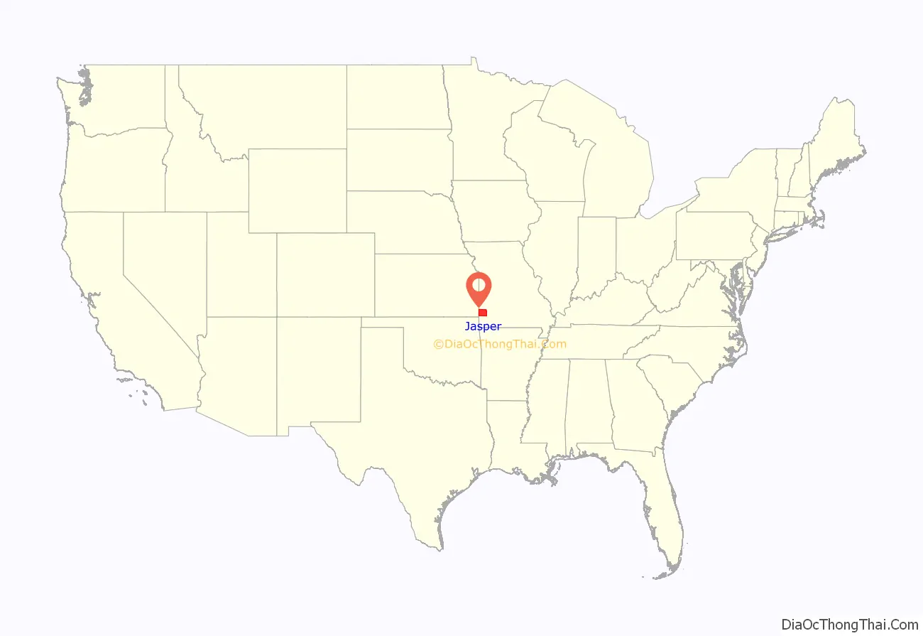
Jasper County location map. Where is Jasper County?

History
Osage Nation
Before European contact, the area that today makes up Jasper County was the domain of the Osage Native Americans, who called themselves the “Children of the Middle Waters” (Ni-U-Kon-Ska). A Siouan language tribe, they had migrated west and south centuries before from the Ohio Valley.
They were powerful and dominated a large territory encompassed the land between the Missouri and Osage rivers to the north, the Mississippi River to the east, and the Arkansas River to the south. To the west were the Great Plains, where they hunted buffalo. By the late 17th century, the Osage were calling themselves Wah-Zha-Zhe.
The earliest record of European-Osage contact is a 1673 map by French Jesuit priest and explorer Jacques Marquette. He noted the people he encountered as the Ouchage, his way of pronouncing the sound of the name with French spelling conventions. A few years after the Marquette expedition, French explorers discovered a Little Osage village and called it Ouazhigi. French transliterations of the tribe’s name settled on a spelling of Osage, which was later adopted by English-speaking European Americans.
In 1682 Robert de La Salle canoed down the length of the Mississippi River to the Gulf of Mexico, claiming and naming the entire Mississippi basin as “La Louisiane” in honor of King Louis XIV. In 1699 Louisiana was designated as an administrative district of New France. The European colonists and nationals (France, England and Spain) considered this to be French territory. The French divided the Louisiana district into upper and lower parts, with the Arkansas River as the dividing line.
After France and Spain’s defeat by Great Britain in the Seven Years’ War in 1763, France ceded Louisiana to Spain and most of the rest of New France, on the east side of the Mississippi River, to the British. They exchanged Cuba with Spain and took over east Florida. For a few decades, the Spanish District of New Madrid, containing present-day Jasper County, was the southernmost of the five Spanish districts comprising Upper Louisiana. France regained control of Louisiana through the secret Treaty of San Ildefonso in 1800, but in 1803, following defeat of his troops in an effort to retake the colony of Saint Domingue in the Caribbean, Napoleon Bonaparte I decided to sell his North American territory to the United States in what is known as the Louisiana Purchase.
The Osage began treaty-making with the United States in 1808 with the first cession of lands in Missouri in the (Osage Treaty). The Osage moved from their homelands on the Osage River in 1808 to the Jasper County area of southwest Missouri. In 1825, the Osages ceded their traditional lands across present-day Missouri, Arkansas, and Oklahoma (then known as Indian Territory). They were first moved onto a southeastern Kansas reservation in the Cherokee Strip, on which the city of Independence, Kansas developed. In 1872 they were forced to move again, south to Indian Territory.
Missouri Territory
The Upper Louisiana Territory, including the Jasper County area, was renamed as the Missouri Territory on June 4, 1812, to avoid confusion with the state of Louisiana. This had joined the Union in 1812. The new New Madrid District became New Madrid County, Missouri Territory. Old Lawrence County was established in 1815 from New Madrid County west of the St. Francis River and north of Arkansas County. It originally consisted of all of present-day southwestern Missouri and part of northwestern Arkansas.
Three years later (1818), Lawrence County was combined with part of Cape Girardeau County and renamed as Wayne County. By 1819, Arkansas Territory had been created; Wayne County lost some of its area but still consisted of most of southern Missouri: from present-day Wayne County west to the Kansas State Line and bordered on the south by the Arkansas State Line.
In 1820, all of Missouri Territory was admitted to the Union as the state of Missouri. In 1831, with increased population in the region, Crawford County was carved from the original Wayne. This new division covered all of the southern part of Missouri and included Jasper County in its boundaries. This alignment was also short-lived; in 1833 Greene County was organized from Crawford County, and extended from the Niangua River west to the Kansas State Line.
On January 5, 1835, a big piece was cut out of Greene County and organized as Barry County. In 1838 Barry County was divided into four parts called Barry, Dade, Newton and Jasper counties. At this time Jasper was not a full-fledged county but was attached to Newton County and it would remain so until 1841.
County organization
On January 29, 1841, the Missouri Legislature enacted a bill authorizing formation of Jasper County; it was named in honor of Sergeant William Jasper, a hero in the American Revolutionary War. The Jasper County Court initially divided the area into three townships: North Fork, Center Creek and Marion. Later it was organized as 15 townships, which continue as unincorporated jurisdictions.
The county court, as a temporary seat of justice, was established on February 25, 1841, in the home of George Hornback. It was a 12×16 foot log cabin, one and a half miles northwest of Carthage on Spring River. The officers of the court were Charles S. Yancey, judge, and Elwood B. James, clerk. Mount Vernon attorney Robert W. Crawford was appointed circuit attorney pro tem. John P. Osborn, the first sheriff, gave public notice that the county court of Jasper County would meet in the home of George Hornback until the permanent seat of justice was established. The first session of the court was two days; the proceedings covered four pages of record.
A permanent county seat was chosen in March 1842 and designated by the name of Carthage. The courthouse, a one-story single-room wooden structure with a large door in the south, was completed on June 29, 1842. It was located on the north side of the present public square in Carthage. This courthouse was later replaced by a larger two-story brick-and-stone structure that was completed in 1854; it also had facilities in the building for the county jail. At the second term of the court held in October of the same year, attorneys Robert W. Crawford and John R. Chenault were cited for contempt and fined the sum of ten dollars for “fighting in the presence and view of said court during the said sitting.”
At the March 1861 Secession Convention held in Jefferson City, Chenault represented Jasper County while Crawford represented Lawrence County. Possibly for their own self-preservation, and to buy time to make preparations in Southwest Missouri for the war, the two former adversaries voted in favor of keeping Missouri in the Union. Missouri was the only state whose secession convention resulted in voting to stay in the Union.
At the outset of the war Chenault, by then a circuit court judge, moved with his family to Texas. Following the Battle of Carthage, on July 12, 1861, Crawford was elected Lieutenant Colonel of the 13th Missouri Cavalry Regiment and 5th Missouri Infantry, both of the 8th Division, Missouri State Guard. They were part of the Confederate States Army (CSA), although Missouri remained with the Union. After leading the 13th Cavalry Regiment into numerous battles, in a command that included two of his sons in first lieutenant and quartermaster ranks, Crawford moved his noncombatant family to Texas for safety.
He served as a recruiter for the Confederate Army in Missouri, a post he was nominated for by Waldo P. Johnson, formerly a United States Senator from Missouri in a letter to Missouri governor-in-exile Claiborne Fox Jackson dated October 24, 1862.
By the start of the American Civil War in 1861, there were several small river mill settlements, some mining camps, and about nine or ten towns (seven platted) in Jasper County, Missouri. The county seat of Carthage, Missouri had an estimated population of between four and five hundred at that time. The newer brick courthouse was used as a hospital during the American Civil War and was destroyed by fire during fighting in October 1863. By the end of the war, Carthage had been evacuated and completely destroyed, and much of Jasper County laid in ruins. Other than military tribunals, no courts were held in Jasper County between May 11, 1861, and October 10, 1865.
By order of the Governor in 1865, the courthouse was relocated to the pioneer schoolhouse at Cave Springs (near present-day La Russell, Missouri), with John C. Price of Mount Vernon appointed as the circuit court judge. Price later (before?) served as treasurer of the United States under President James Buchanan. The county court operated in other temporary locations within the county until the current Jasper County Courthouse was constructed on Carthage square in the mid-1890s.
The county adopted an official flag in 2001, which was unveiled during the county’s 160th birthday celebration. The flag depicts the county courthouse surrounded by 15 stars, representing Jasper County’s 15 townships. The center blue and red stars memorialize the struggle in Jasper County during the Civil War years, including the Battle of Carthage in 1861 and second battle in 1863.
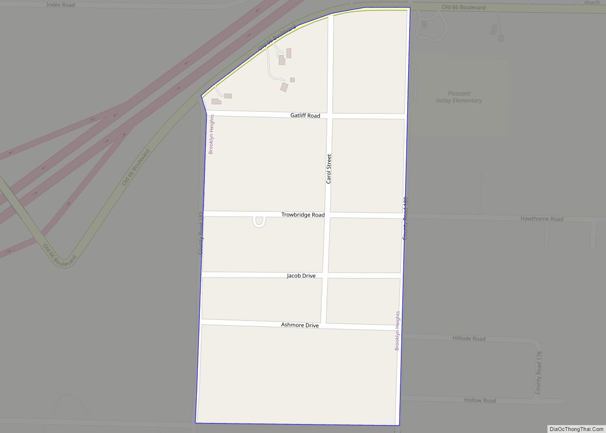
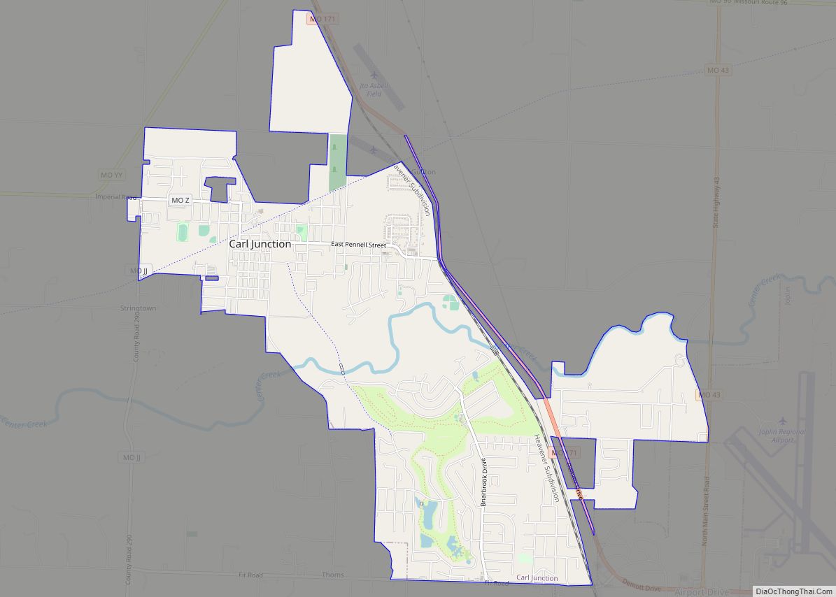
Towns established prior to the Civil War
,
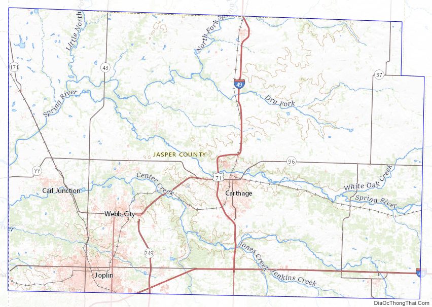
Jasper County Road Map
Geography
According to the U.S. Census Bureau, the county has a total area of 641 square miles (1,660 km), of which 638 square miles (1,650 km) is land and 2.8 square miles (7.3 km) (0.4%) is water.
On Sunday, May 22, 2011, Jasper County was struck in Joplin with a catastrophic EF5 multiple-vortex tornado. The 2011 Joplin tornado ranked as the seventh deadliest in America’s history.
Adjacent counties
- Barton County (north)
- Dade County (northeast)
- Lawrence County (east)
- Newton County (south)
- Cherokee County, Kansas (west)
- Crawford County, Kansas (northwest)
Major highways
- Interstate 44
- Interstate 49
- U.S. Route 66 (1926–1985)
- U.S. Route 71
- Route 37
- Route 43
- Route 66
- Route 96
- Route 171
- Route 249
Jasper County Topographic Map
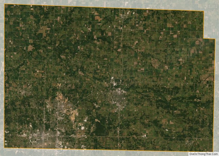
Jasper County Satellite Map
Jasper County Outline Map