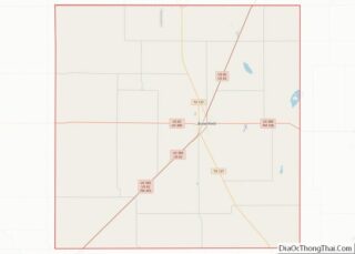
Map of Potter County

Map of Potter County, Pennsylvania

Potter County is a county in the Commonwealth of Pennsylvania. As of the 2020 census, its population was 16,396, making it the fifth-least populous county in Pennsylvania. Its county seat is Coudersport. The county was created in 1804 and later organized in 1836. It is named after James Potter, who was a general from Pennsylvania … Read more

Map of Kent County

Map of Kent County, Rhode Island

Kent County is a county located in the U.S. state of Rhode Island. As of the 2020 census, the population was 170,363, making it the second-most populous county in Rhode Island. The county was formed in 1750 from the southern third of Providence County. It was named after the county of Kent, England. Kent County, … Read more

Map of Chesterfield County

Map of Chesterfield County, South Carolina

Chesterfield County is a county located in the U.S. state of South Carolina. As of the 2020 census, its population was 43,273. Its county seat is Chesterfield. The largest city in the county is Cheraw. Chesterfield County is part of the Charlotte Metropolitan Area. It is located north of the Midlands, on its border with … Read more

Map of Lancaster County

Map of Lancaster County, South Carolina

Lancaster County /ˈlæŋkəstər/ is a county located in the U.S. state of South Carolina. As of the 2020 census, its population was 96,016, Its county seat is Lancaster, which has an urban population of 23,979. The county was created in 1785. Lancaster County is included in the Charlotte–Concord–Gastonia, NC-SC Metropolitan Statistical Area. It is located … Read more

Map of Williamsburg County

Map of Williamsburg County, South Carolina

Williamsburg County is a county located in the U.S. state of South Carolina. As of the 2020 census its population was 31,026. The county seat and largest city is Kingstree. After a previous incarnation of Williamsburg County, the current county was created in 1804. Williamsburg County overview: Name: Williamsburg County FIPS code: 45-089 State: South … Read more

Map of Corson County

Map of Corson County, South Dakota

Corson County overview: Name: Corson County FIPS code: 46-031 State: South Dakota Founded: 1909 Named for: Dighton Corson Seat: McIntosh Largest city: McLaughlin Total Area: 2,530 sq mi (6,600 km²) Land Area: 2,470 sq mi (6,400 km²) Total Population: 3,902 Population Density: 1.5/sq mi (0.60/km²) Time zone: UTC−7 (Mountain) Summer Time Zone (DST): UTC−6 (MDT) Website: corson.sdcounties.org Corson County location map. Where … Read more

Map of Harding County

Map of Harding County, South Dakota

Harding County is a county in the U.S. state of South Dakota. As of the 2020 census, the population was 1,311, making it the third-least populous county in South Dakota. Its county seat is Buffalo. Harding County was established as a county in the Dakota Territory on 5 March 1881, but was not organized at … Read more

Map of Mellette County

Map of Mellette County, South Dakota

Mellette County is a county in the U.S. state of South Dakota. As of the 2020 census, the population was 1,918. Its county seat is White River. The county was created in 1909, and was organized in 1911. It was named for Arthur C. Mellette, the last Governor of the Dakota Territory and the first … Read more

Map of Union County

Map of Union County, South Dakota

Union County is the southernmost county in the U.S. state of South Dakota. As of the 2020 United States Census, the population was 16,811, making it the 13th most populous county in South Dakota. Its county seat has been Elk Point since April 30, 1865. Originally named Cole County, its name was changed to Union … Read more

Map of Claiborne County

Map of Claiborne County, Tennessee

Claiborne County is a county located in the U.S. state of Tennessee. As of the 2020 census, the population was 32,043. Its county seat is Tazewell. Claiborne County overview: Name: Claiborne County FIPS code: 47-025 State: Tennessee Founded: October 29, 1801 Named for: William C. C. Claiborne Seat: Tazewell Largest city: Harrogate Total Area: 442 sq mi … Read more

Map of Grainger County

Map of Grainger County, Tennessee

Grainger County is a county located in the U.S. state of Tennessee. As of the 2020 census, the population was 23,527. Its county seat is Rutledge. Grainger County is a part of both the Knoxville Metropolitan Statistical Area and Morristown Metropolitan Statistical Area. Grainger County overview: Name: Grainger County FIPS code: 47-057 State: Tennessee Founded: … Read more

Map of Jefferson County

Map of Jefferson County, Tennessee

Jefferson County is an exurban county located in the U.S. state of Tennessee. As of the 2020 census, the population was 54,683. Its county seat is Dandridge. Jefferson County is part of the Morristown Metropolitan Statistical Area with neighboring Grainger and Hamblen counties. The county, along with the Morristown MSA, is included in the Knoxville-Morristown-Sevierville … Read more