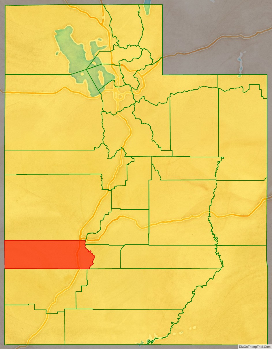
Beaver County is a county in west central Utah, United States. As of the 2020 United States Census, the population was 7,072, up from the 2010 figure of 6,629. Its county seat and largest city is Beaver. The county was named for the abundance of beaver in the area.
| Name: | Beaver County |
|---|---|
| FIPS code: | 49-001 |
| State: | Utah |
| Founded: | 1856 |
| Named for: | North American beaver |
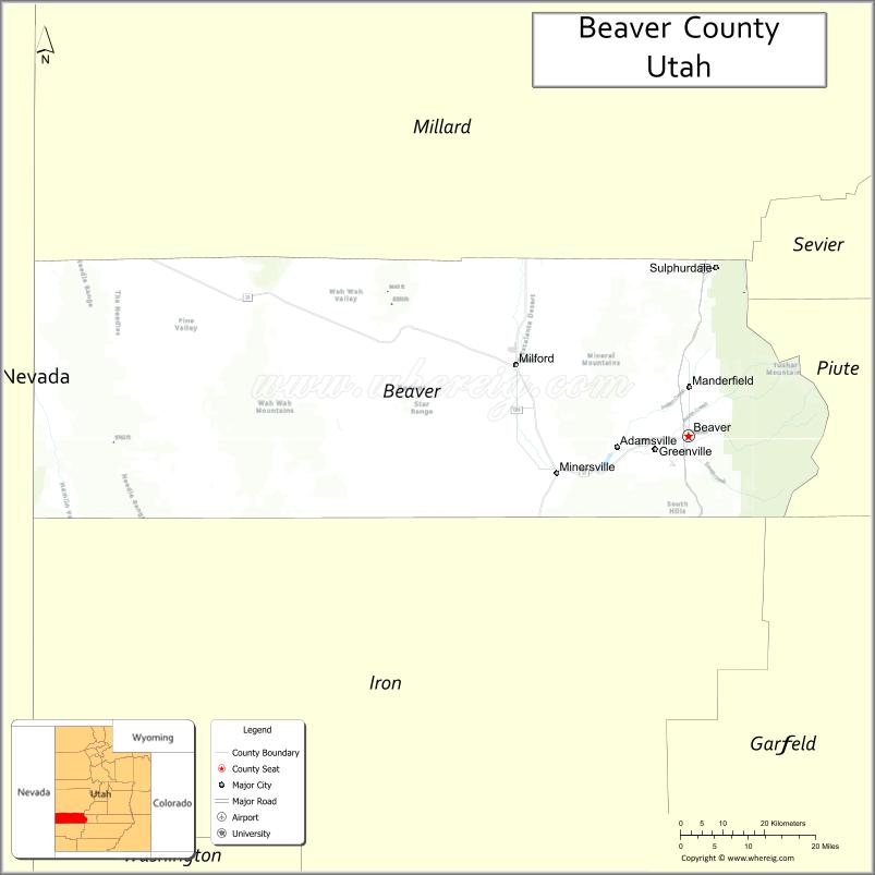
| Seat: | Beaver |
| Largest city: | Beaver |
| Total Area: | 2,592 sq mi (6,710 km²) |
| Land Area: | 2,590 sq mi (6,700 km²) |
| Total Population: | 7,072 |
| Population Density: | 2.7/sq mi (1.1/km²) |
| Time zone: | UTC−7 (Mountain) |
| Summer Time Zone (DST): | UTC−6 (MDT) |
| Website: | beaver.utah.gov |
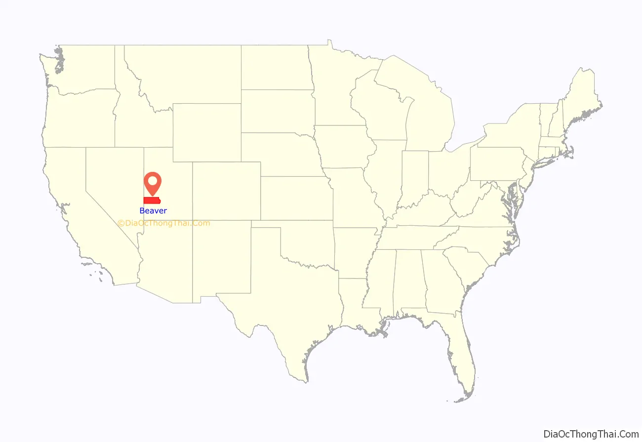
Beaver County location map. Where is Beaver County?
History
Explorers of European descent first visited present-day Beaver County in the 1776 Domínguez-Escalante Expedition. The proposed territory of Deseret (soon changed to Utah Territory) began with the arrival of Mormon pioneers in 1847. After the immediate Great Salt Lake City area was settled, settlers moved into more outlying areas, including the future Beaver County area. The county was created by the Utah territorial legislature from a section of Iron County on January 5, 1856, before the settlement of Beaver town was founded later that year. The county was named for the animal, which was plentiful there. The county boundary as delineated by that act included areas in present-day Colorado and Nevada. The defined boundary was altered on January 16, 1861, by the creation of two counties in present Nevada. The county area was effectively reduced on February 28, 1861, by the US Congress when it created Colorado Territory, taking all of the Beaver County areas east of 109 degrees longitude. The county’s boundary was enlarged on January 17, 1861, by the addition of parcels from Millard, Sanpete, and St. Mary’s counties. However, its west area was reduced by the creation of the Nevada Territory on July 14, 1862 (this adjustment was altered on May 5, 1866, by the action of the US Congress, effectively ceding all Beaver County area west of 114 degrees longitude to Nevada counties). The county area was also reduced on January 16, 1865, when Piute County was created from Beaver territory.
A quarter of the county’s workers are employed by hog processor Smithfield Foods.
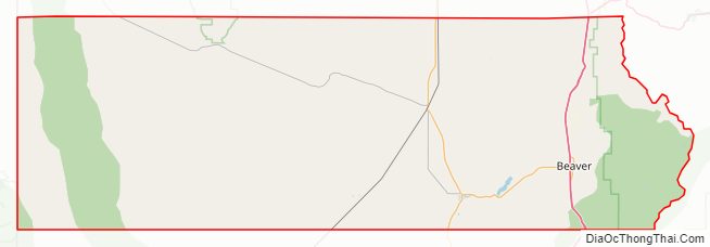
Beaver County Road Map
Geography
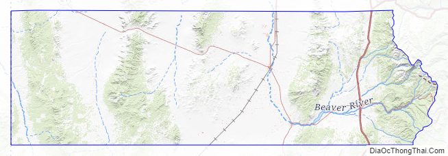
Beaver County lies on the west side of Utah. Its west border abuts the east border of the state of Nevada. The west part of the county consists of low rolling hills punctuated by isolated mountains. The east edge of the county runs to the crest of a north–south-running mountain ridge. The terrain slopes to the west and north; its highest point is a mountain crest on its east border, at 12,011′ (3661m) ASL. The county has a total area of 2,592 square miles (6,710 km), of which 2,590 square miles (6,700 km) is land and 2.1 square miles (5.4 km) (0.08%) is water.
The Tushar Mountains lies on the eastern boundary of the county, reaching to 12,000 feet (3,700 m) in elevation and providing water for the farming communities of Beaver and Manderfield. To the west, barren desert valleys typify the scenery, separated by mountains lightly forested with junipers.
Adjacent counties
- Lincoln County, Nevada – west
- Millard County – north
- Sevier County – northeast
- Piute County – east
- Garfield County – southeast
- Iron County – south
Protected areas
- Fishlake National Forest (part)
- Indian Peak State Game Management Area
- Minersville National Forest (part)
Beaver County Topographic Map
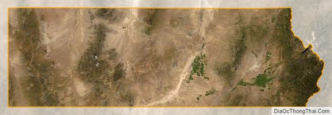
Beaver County Satellite Map
Beaver County Outline Map