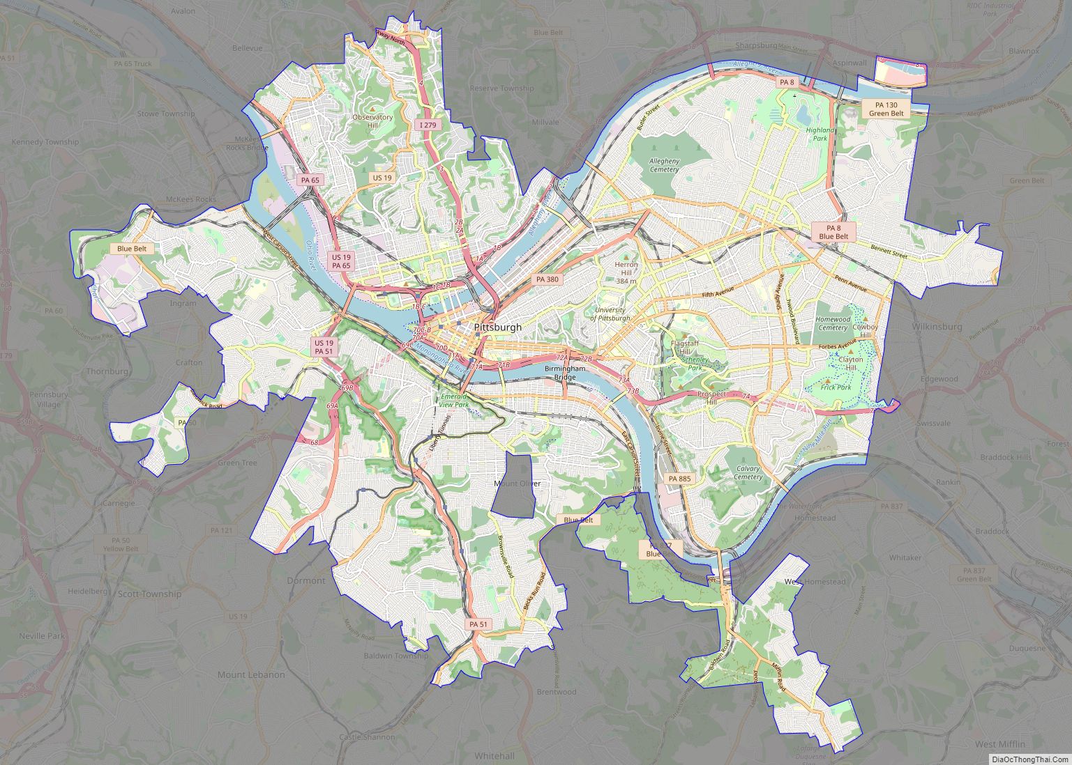
Map of St. Paul city, Minnesota

Map of St. Paul city, Minnesota

Saint Paul (abbreviated St. Paul) is the capital of the U.S. state of Minnesota and the county seat of Ramsey County. Situated on high bluffs overlooking a bend in the Mississippi River, Saint Paul is a regional business hub and the center of Minnesota’s government. The Minnesota State Capitol and the state government offices all … Read more

Map of Plano city, Texas

Map of Plano city, Texas

Plano (/ˈpleɪnoʊ/ PLAY-noh) is a city in Collin County and Denton County, Texas. It had a population of 285,494 at the 2020 census. It is a principal city of the Dallas–Fort Worth metroplex, and the headquarters of Frito-Lay. Plano city overview: Name: Plano city LSAD Code: 25 LSAD Description: city (suffix) State: Texas County: Collin … Read more

Map of Lincoln city, Nebraska

Map of Lincoln city, Nebraska

Lincoln is the capital city of the U.S. state of Nebraska and the county seat of Lancaster County. The city covers 100.4 square miles (260.035 km) with a population of 292,657 in 2021. It is Nebraska’s second-most populous city and the 73rd-largest in the United States. Lincoln is the economic and cultural anchor of a substantially … Read more

Map of Greensboro city, North Carolina

Map of Greensboro city, North Carolina

Greensboro city overview: Name: Greensboro city LSAD Code: 25 LSAD Description: city (suffix) State: North Carolina County: Guilford County Elevation: 897 ft (272 m) Land Area: 131.41 sq mi (340.35 km²) Water Area: 5.24 sq mi (13.57 km²) Population Density: 2,275.59/sq mi (878.61/km²) ZIP code: 27401, 27402, 27403, 27404, 27405, 27406, 27407, 27408, 27409, 27410, 27411, 27412, 27413, 27415, 27420, 27429, 27435, 27438, 27455, … Read more

Map of Chandler city

Map of Chandler city, Arizona

Chandler is a city in Maricopa County, Arizona, United States, and a suburb in the Phoenix-Mesa-Chandler Metropolitan Statistical Area (MSA). It is bordered to the north and west by Tempe, to the north by Mesa, to the west by Phoenix, to the south by the Gila River Indian Community, and to the east by Gilbert. … Read more

Map of Jersey City city

Map of Jersey City

Jersey City is the second-most populous city in the U.S. state of New Jersey, after Newark. It is the largest city and county seat of Hudson County As of the 2020 United States census, the city’s population was 292,449, an increase of 44,852 (+18.1%) from the 2010 census count of 247,597, in turn an increase … Read more

Map of Chula Vista city

Map of Chula Vista city, California

Chula Vista (Spanish for ‘Beautiful View’; /ˌtʃuːlə ˈvɪstə/) is the second-largest city in the San Diego metropolitan area, the seventh largest city in Southern California, the fifteenth largest city in the state of California, and the 78th-largest city in the United States. The population was 275,487 as of the 2020 census, up from 243,916 as … Read more

Map of Reno city

Map of Reno city, Nevada

Reno (/ˈriːnoʊ/ REE-noh) is a city in the northwest section of the U.S. state of Nevada, along the Nevada-California border, about 22 miles (35 km) north from Lake Tahoe, known as “The Biggest Little City in the World”. Known for its casino and tourism industry, Reno is the county seat and largest city of Washoe County … Read more