Bamberg County is a county located in the southwestern portion of U.S. state of South Carolina. As of the 2020 census, the population was 13,311, making the rural county the fourth-least populous of any in South Carolina. Its county seat is Bamberg.
Voorhees College, a historically black college, was established here in the late nineteenth century. It was long affiliated with the Episcopal Church (U.S.).
| Name: | Bamberg County |
|---|---|
| FIPS code: | 45-009 |
| State: | South Carolina |
| Founded: | 1897 |
| Named for: | Francis Marion Bamberg |
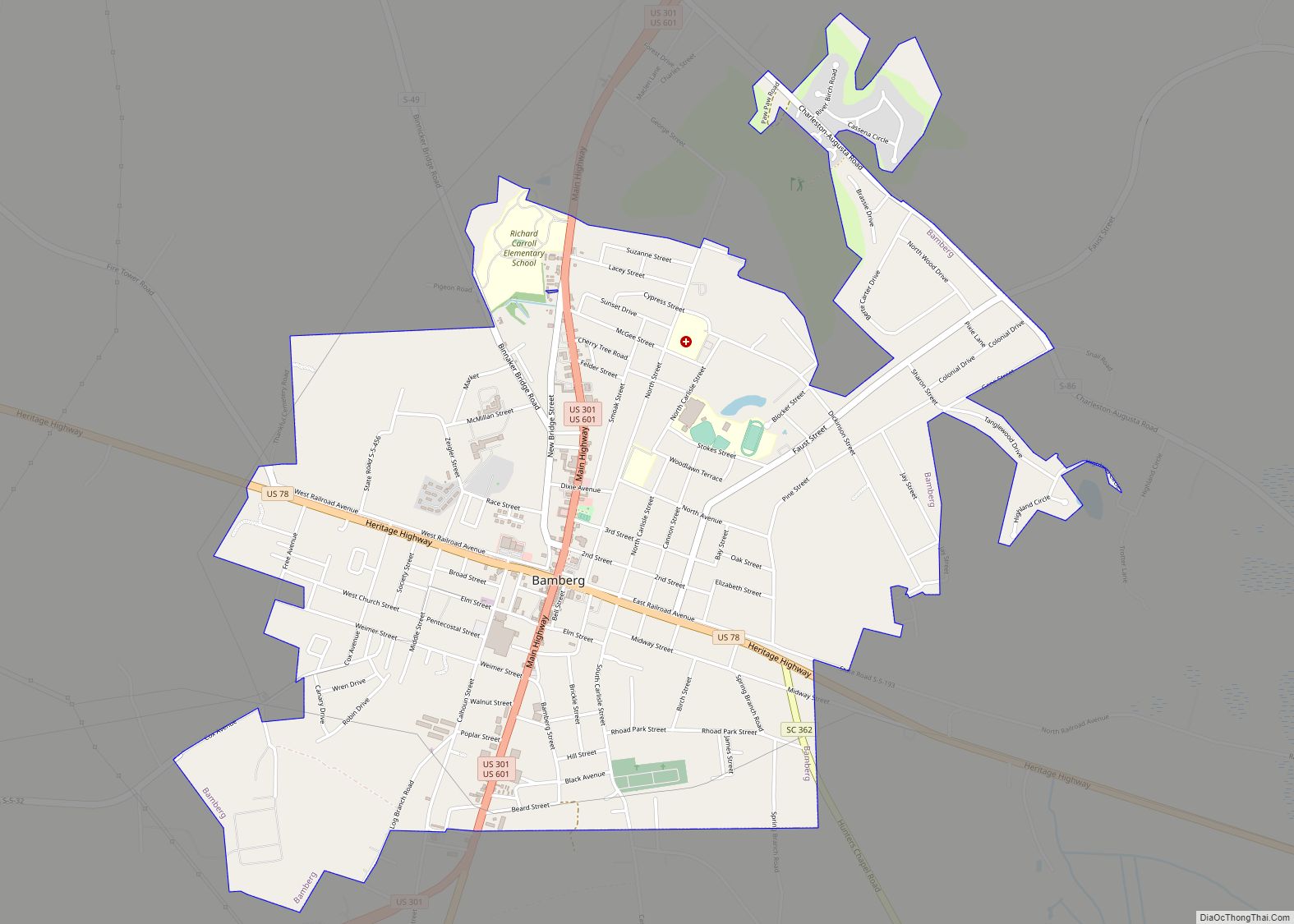
| Seat: | Bamberg |
| Largest city: | Bamberg |
| Total Area: | 396 sq mi (1,030 km²) |
| Land Area: | 393 sq mi (1,020 km²) |
| Total Population: | 13,189 |
| Population Density: | 33.6/sq mi (13.0/km²) |
| Time zone: | UTC−5 (Eastern) |
| Summer Time Zone (DST): | UTC−4 (EDT) |
| Website: | www.bambergcountysc.gov |
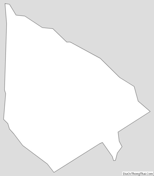
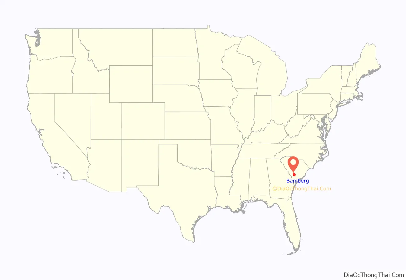
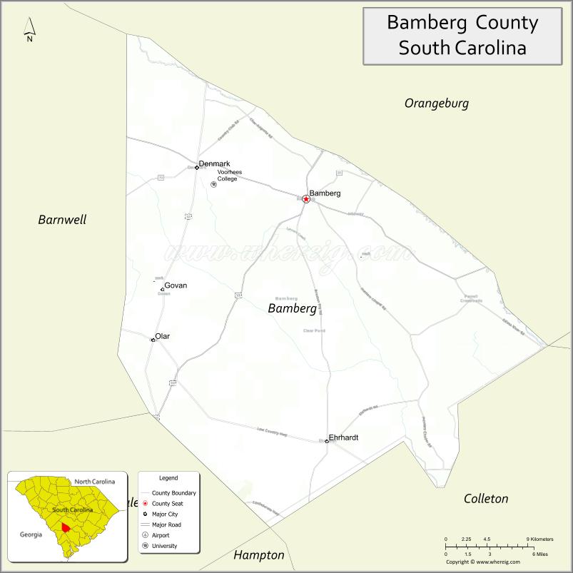
Bamberg County location map. Where is Bamberg County?

History
Part of an agricultural area since the antebellum years, this upland area was developed for the cultivation of short-staple cotton. As a result, African Americans have comprised a large portion of the workers and population for much of the county’s history.
The rural county was created from the eastern portion of Barnwell County, under the new South Carolina Constitution adopted in 1895; it included an article prescribing the process to establish new counties. The referendum on creating Bamberg County was held on January 19, 1897. The name Bamberg was selected to honor General Francis Marion Bamberg. In 1919 and again in 1920, tiny portions of northwestern Colleton County were annexed to Bamberg County.
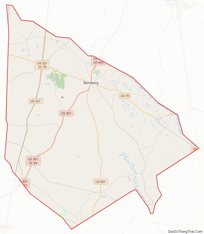
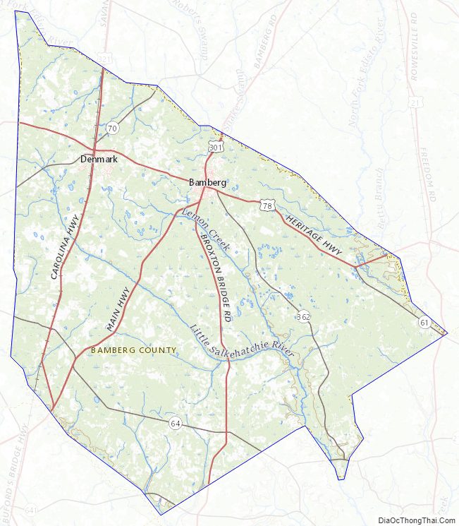
Bamberg County Road Map
Geography
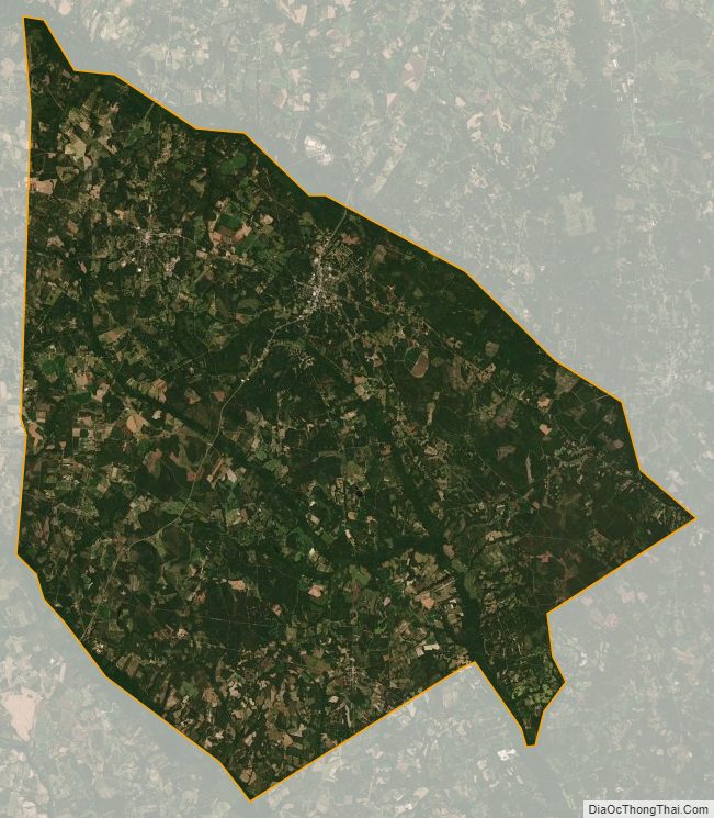
According to the U.S. Census Bureau, the county has a total area of 396 square miles (1,030 km), of which 393 square miles (1,020 km) is land and 2.2 square miles (5.7 km) (0.6%) is water. It is the fourth-smallest county in South Carolina by land area and third-smallest by total area.
State and local protected areas
- Cathedral Bay Heritage Preserve
- Rivers Bridge State Park
Major water bodies
- Edisto River
- Lemon Creek
- Little Salkehatchie River
- Salkehatchie River
Adjacent counties
- Orangeburg County – north
- Dorchester County – east
- Colleton County – southeast
- Hampton County – south
- Allendale County – southwest
- Barnwell County – west
Major highways
- US 21
- US 78
- US 78 Conn.
- US 301
- US 321
- US 601
- SC 61
- SC 64
- SC 70
- SC 217
- SC 362
Major infrastructure
- Bamberg County Airport
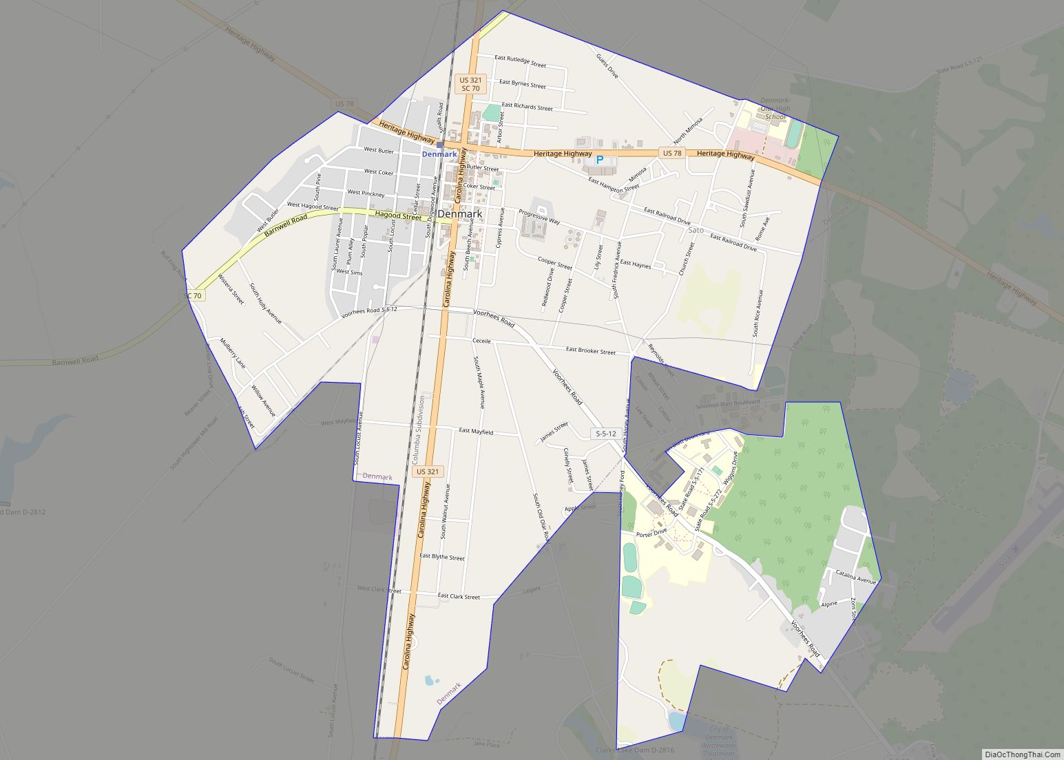
- Denmark Station
Bamberg County Topographic Map
Bamberg County Satellite Map
Bamberg County Outline Map