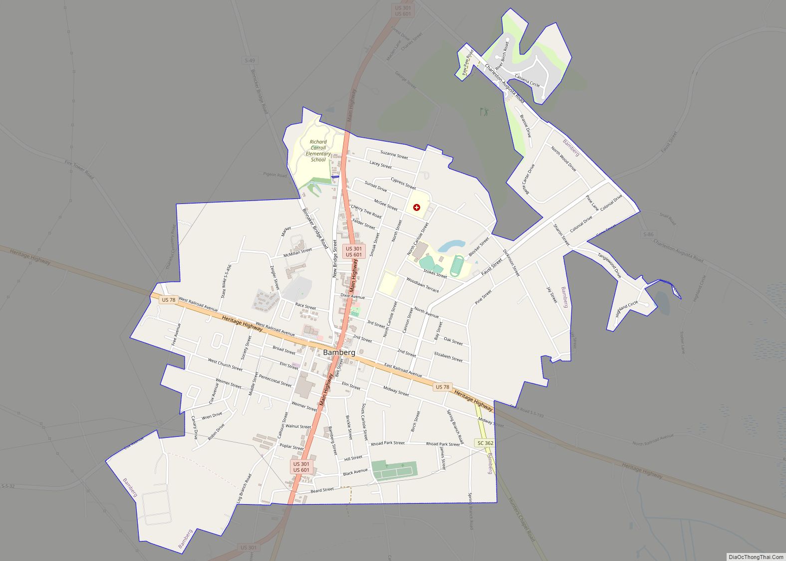
Bamberg is a city in and the county seat of Bamberg County, South Carolina, United States. The population was 3,607 at the 2010 census.
| Name: | Bamberg town |
|---|---|
| LSAD Code: | 43 |
| LSAD Description: | town (suffix) |
| State: | South Carolina |
| County: | Bamberg County |
| Elevation: | 164 ft (50 m) |
| Total Area: | 3.60 sq mi (9.31 km²) |
| Land Area: | 3.58 sq mi (9.26 km²) |
| Water Area: | 0.02 sq mi (0.05 km²) |
| Total Population: | 3,076 |
| Population Density: | 860.42/sq mi (332.23/km²) |
| ZIP code: | 29003 |
| FIPS code: | 4503790 |
| GNISfeature ID: | 1244955 |
| Website: | bambergsc.com |
Online Interactive Map
Click on ![]() to view map in "full screen" mode.
to view map in "full screen" mode.
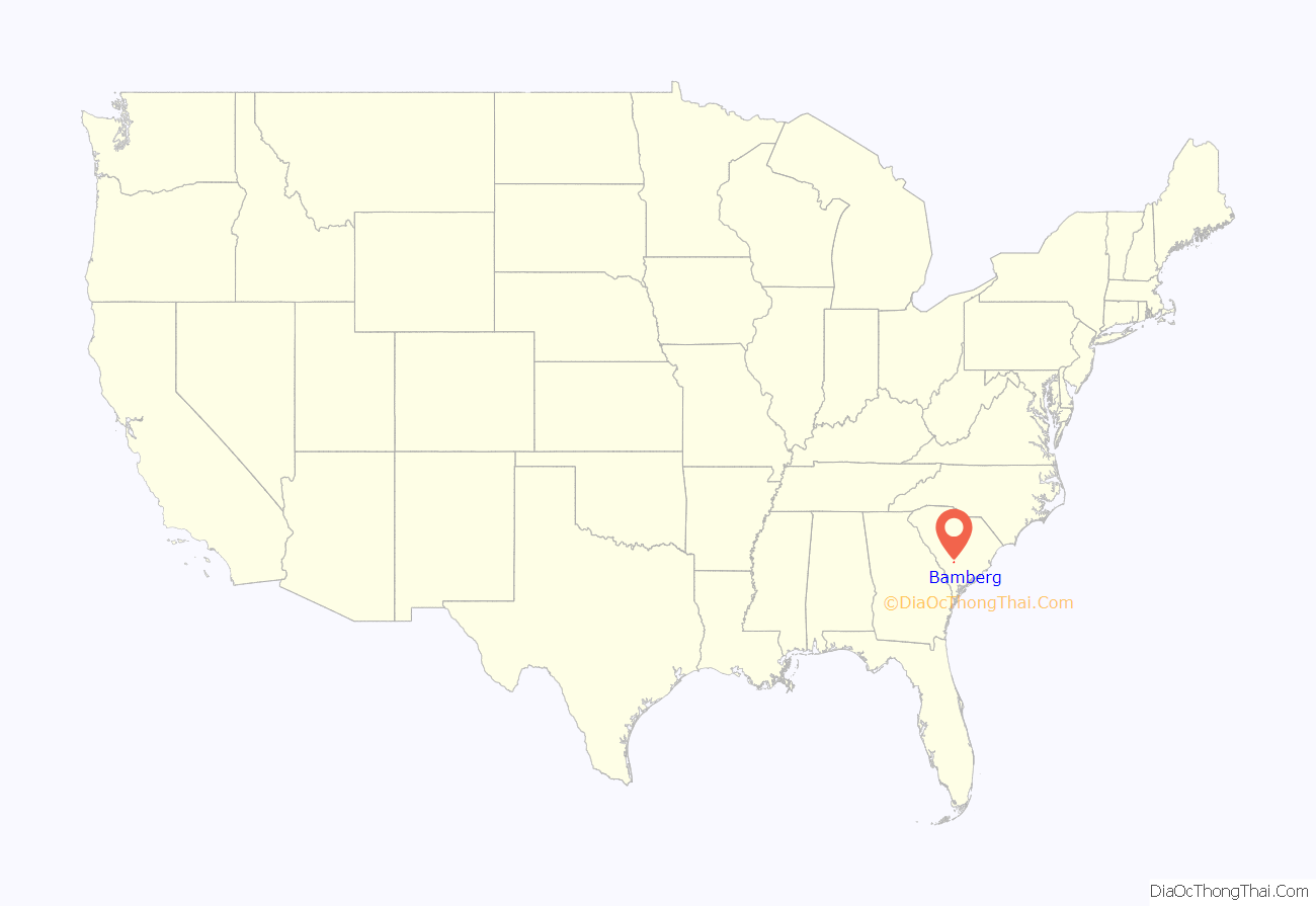
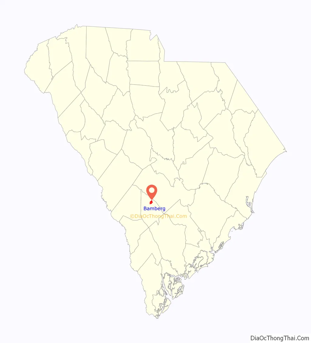
Bamberg location map. Where is Bamberg town?
History
Bamberg is named after early resident William Seaborn Bamberg. Members of the Bamberg family continue to live in the county to this day. The Bamberg City Hall, Bamberg Historic District, Bamberg Post Office, Gen. Francis Marion Bamberg House, Cal Smoak Site, and Woodlands are listed on the National Register of Historic Places.
Bamberg Road Map
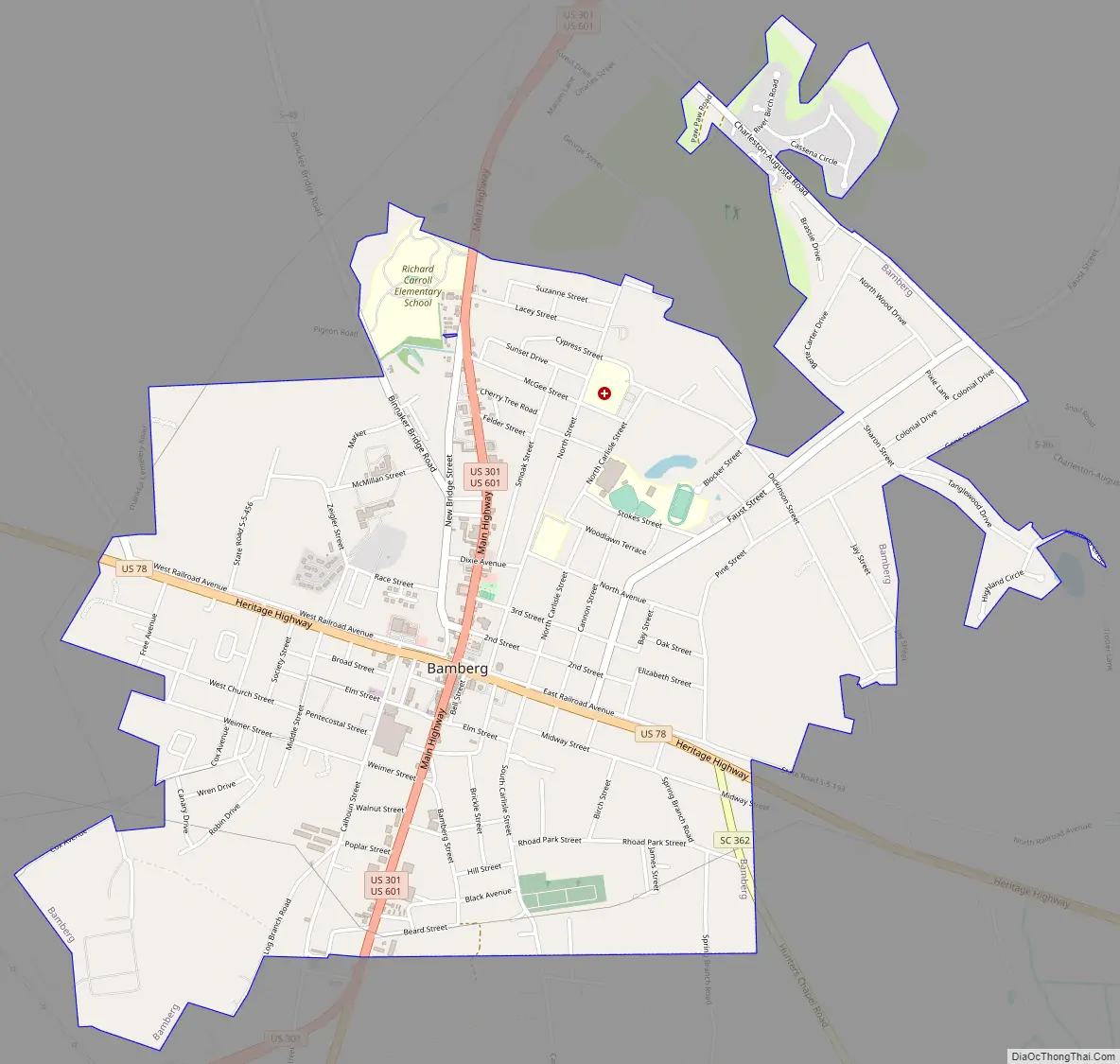
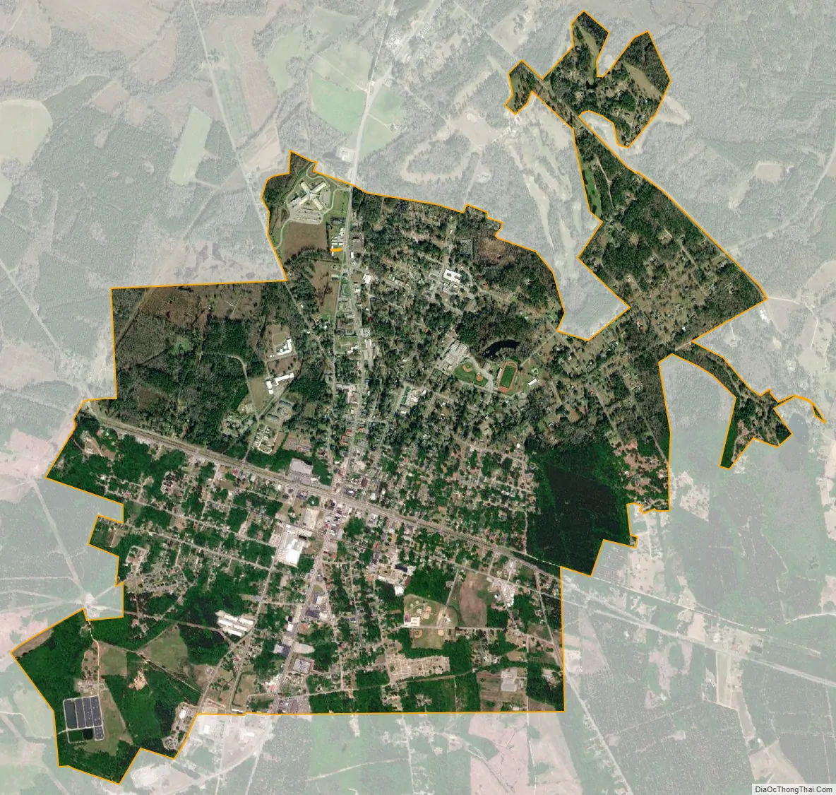
Bamberg city Satellite Map
Geography
Bamberg is located at 33°17′54″N 81°1′55″W / 33.29833°N 81.03194°W / 33.29833; -81.03194 (33.298440, -81.031903).
According to the United States Census Bureau, the city has a total area of 3.6 square miles (9.3 km), of which 0.012 square miles (0.03 km), or 0.34%, is water.
See also
Map of South Carolina State and its subdivision:- Abbeville
- Aiken
- Allendale
- Anderson
- Bamberg
- Barnwell
- Beaufort
- Berkeley
- Calhoun
- Charleston
- Cherokee
- Chester
- Chesterfield
- Clarendon
- Colleton
- Darlington
- Dillon
- Dorchester
- Edgefield
- Fairfield
- Florence
- Georgetown
- Greenville
- Greenwood
- Hampton
- Horry
- Jasper
- Kershaw
- Lancaster
- Laurens
- Lee
- Lexington
- Marion
- Marlboro
- McCormick
- Newberry
- Oconee
- Orangeburg
- Pickens
- Richland
- Saluda
- Spartanburg
- Sumter
- Union
- Williamsburg
- York
- Alabama
- Alaska
- Arizona
- Arkansas
- California
- Colorado
- Connecticut
- Delaware
- District of Columbia
- Florida
- Georgia
- Hawaii
- Idaho
- Illinois
- Indiana
- Iowa
- Kansas
- Kentucky
- Louisiana
- Maine
- Maryland
- Massachusetts
- Michigan
- Minnesota
- Mississippi
- Missouri
- Montana
- Nebraska
- Nevada
- New Hampshire
- New Jersey
- New Mexico
- New York
- North Carolina
- North Dakota
- Ohio
- Oklahoma
- Oregon
- Pennsylvania
- Rhode Island
- South Carolina
- South Dakota
- Tennessee
- Texas
- Utah
- Vermont
- Virginia
- Washington
- West Virginia
- Wisconsin
- Wyoming