Bossier Parish (/ˈboʊʒər/ BOH-zhər; French: Paroisse de Bossier) is a parish located in the northwestern part of the U.S. state of Louisiana. At the 2020 census, the population was 128,746.
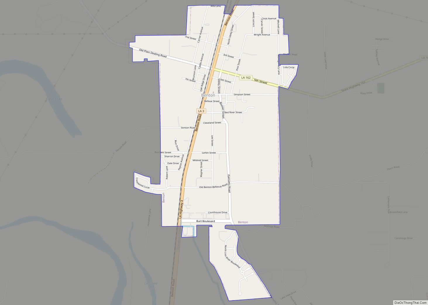
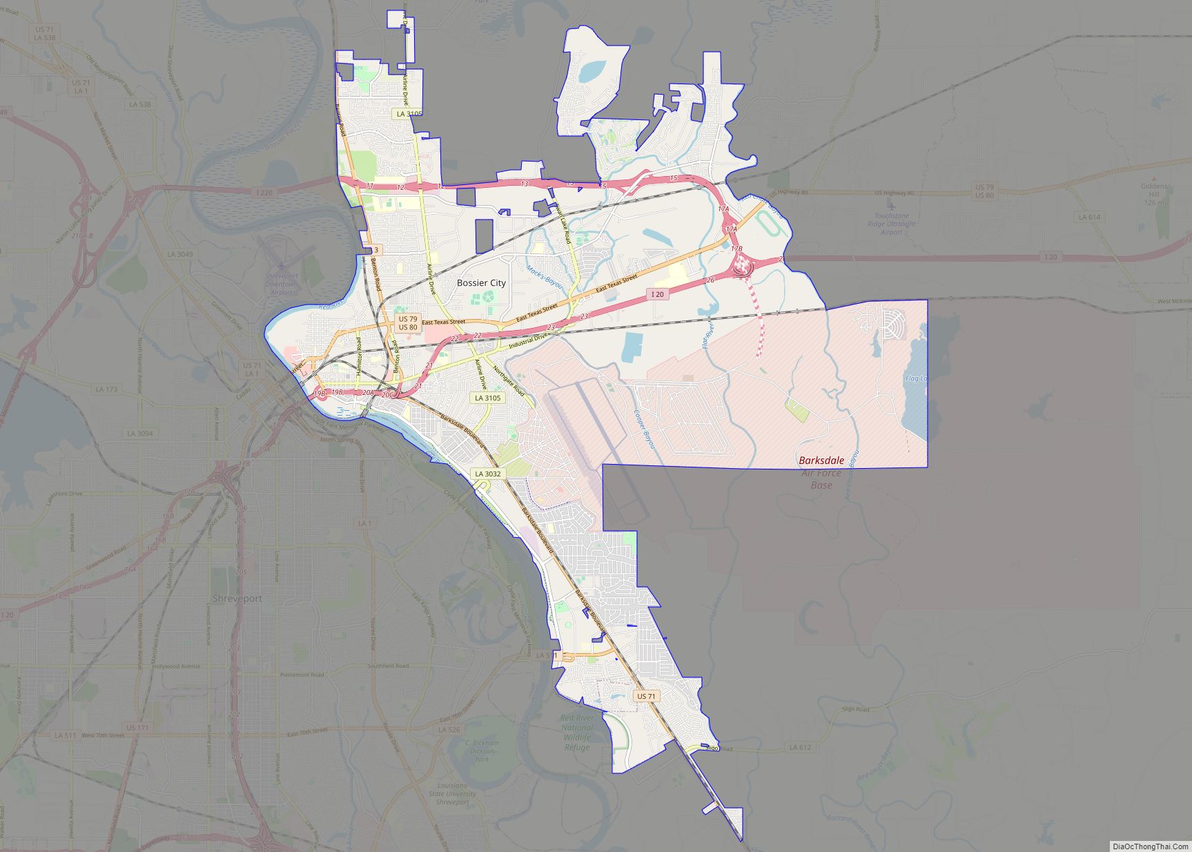
The parish seat is Benton. The principal city is Bossier City, which is located east of the Red River and across from the larger city of Shreveport, the seat of Caddo Parish. The parish was formed in 1843 from the western portion of Claiborne Parish. Bossier Parish is part of the Shreveport–Bossier City metropolitan statistical area, the largest metropolitan area in North Louisiana.
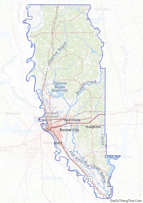
Lake Bistineau and Lake Bistineau State Park are included in parts of Bossier and neighboring Webster and Bienville parishes. Loggy Bayou flows south from Lake Bistineau in southern Bossier Parish, traverses western Bienville Parish, and in Red River Parish joins the Red River.
| Name: | Bossier Parish |
|---|---|
| FIPS code: | 22-015 |
| State: | Louisiana |
| Founded: | February 24, 1843 |
| Named for: | Pierre Bossier |
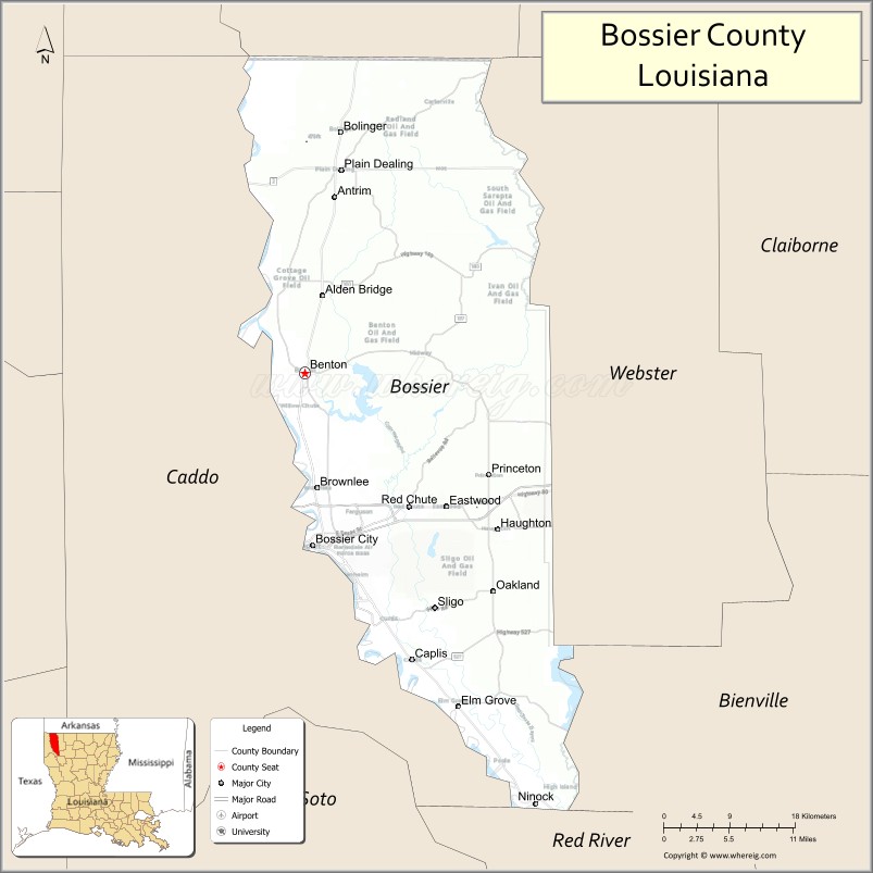
| Seat: | Benton |
| Largest city: | Bossier City |
| Total Area: | 2,250 km² (867 sq mi) |
| Land Area: | 2,200 km² (840 sq mi) |
| Total Population: | 128,746 |
| Population Density: | 57/km² (150/sq mi) |
| Time zone: | UTC-6 (CST) |
| Summer Time Zone (DST): | UTC-5 (CDT) |
| Website: | Official website |
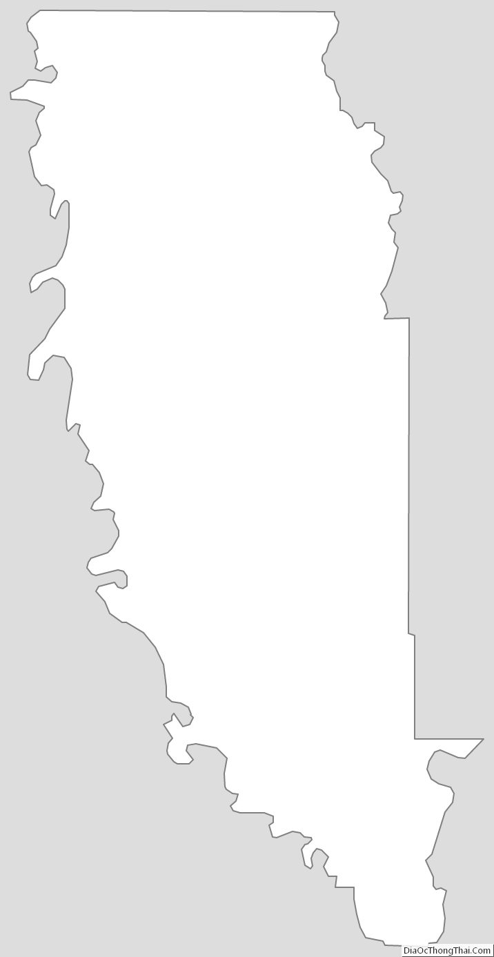
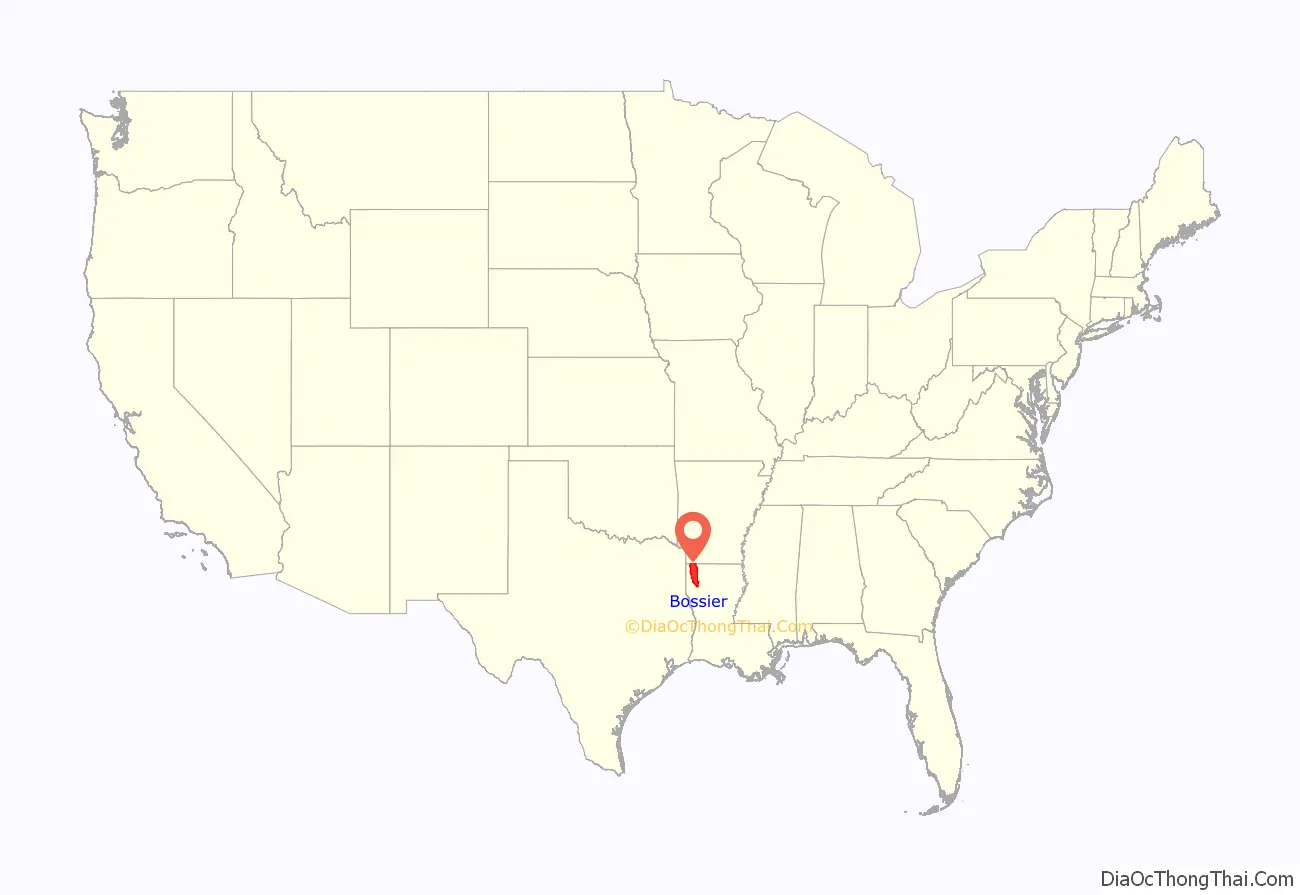
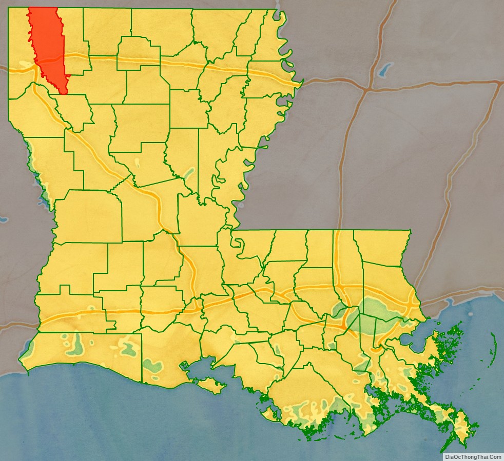
Bossier Parish location map. Where is Bossier Parish?
History
Bossier Parish is named for Pierre Bossier, an ethnic French, 19th-century Louisiana state senator and U.S. representative from Natchitoches Parish.
Bossier Parish was spared fighting on its soil during the American Civil War. In July 1861, at the start of the war, the Bossier Parish Police Jury appropriated $35,000 for the benefit of Confederate volunteers and their family members left behind, an amount then considered generous.
After the war, whites used violence and intimidation to maintain dominance over the newly emancipated freedmen. From the end of Reconstruction into the 20th century, violence increased as conservative white Democrats struggled to maintain power over the state. In this period, Bossier Parish had 26 lynchings of African Americans by whites, part of racial terrorism. This was the fifth-highest total of any parish in Louisiana, tied with the total in Iberia Parish in the South of the state. Overall, parishes in northwest Louisiana had the highest rates of lynchings.
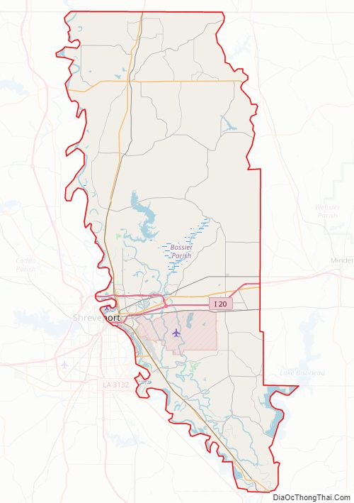
Bossier Parish Road Map
Geography
According to the U.S. Census Bureau, the parish has a total area of 867 square miles (2,250 km), of which 840 square miles (2,200 km) is land and 27 square miles (70 km) (3.1%) is water. Four miles east of Bossier City is Barksdale Air Force Base.
Major highways
- Interstate 20
- Interstate 220
- Future Interstate 69
- U.S. Highway 71
- U.S. Highway 79
- U.S. Highway 80
- Louisiana Highway 2
- Louisiana Highway 3
Adjacent counties and parishes
- Miller County, Arkansas (northwest)
- Lafayette County, Arkansas (north)
- Webster Parish (east)
- Bienville Parish (southeast)
- Red River Parish (south)
- Caddo Parish (west)
National protected area
- Red River National Wildlife Refuge (part)
Bossier Parish Topographic Map
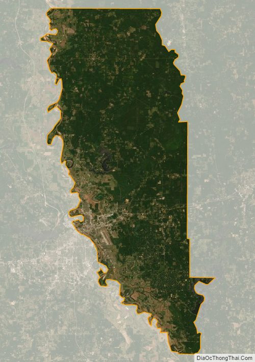
Bossier Parish Satellite Map
Bossier Parish Outline Map