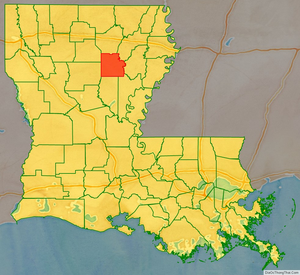
| Name: | Caldwell Parish |
|---|---|
| FIPS code: | 22-021 |
| State: | Louisiana |
| Founded: | 1838 |
| Named for: | Local Caldwell family |
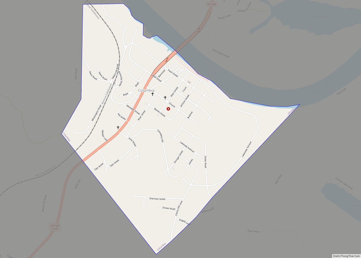
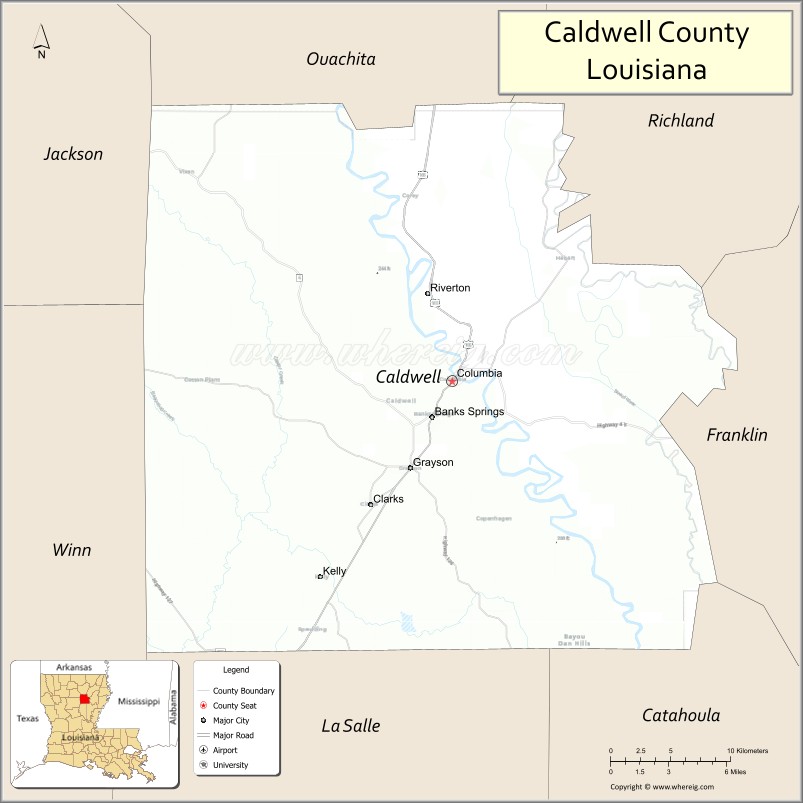
| Seat: | Columbia |
| Total Area: | 541 sq mi (1,400 km²) |
| Land Area: | 529 sq mi (1,370 km²) |
| Total Population: | 9,645 |
| Population Density: | 18/sq mi (6.9/km²) |
| Time zone: | UTC−6 (Central) |
| Summer Time Zone (DST): | UTC−5 (CDT) |
| Website: | www.caldwellparish.org |
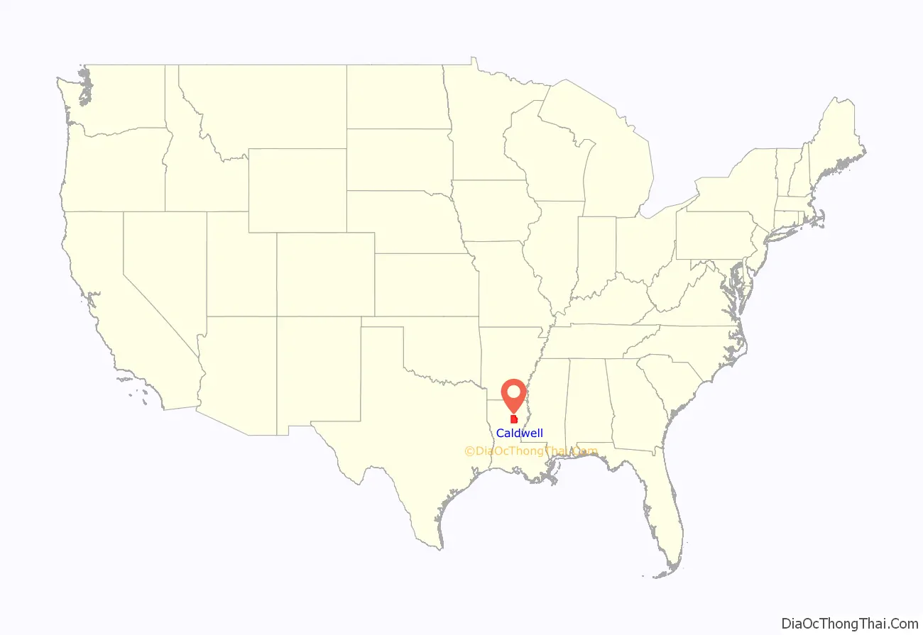
Caldwell Parish location map. Where is Caldwell Parish?
History
Caldwell Parish was formed in 1838 from part of Ouachita & Catahoula Parishes. The prominent geographical feature is the Ouachita River which divides the parish into alluvial farmland on the east bank and pineland hill country on the west. The area was originally occupied by Native Americans as evidenced by the Indian mounds built along the Ouachita & Boeuf Rivers 3500 B.C. – 1500 A.D.
In the late 1700s the Spanish government began issuing land grants on the east bank farmland to settlers who were all French. Their French names such as Ferrand, Hebert, Duchesne and Oliveaux are still common to the parish. The first community in the parish was Copenhagen, which was settled by Scandinavians circa 1800 on the west bank downriver from the French. This community and its Danish names all disappeared except for its tombstones. In 1827, Daniel Humphreys founded “New Kentucky” which became Columbia and the parish seat when the parish was founded. These families were predominantly Scotch-Irish & English who made the trek from the Carolinas, bringing with them the town name; however, some of the earlier ones came from Kentucky and Tennessee, bringing with them their bear hunting and moonshine making skills. Along with the plantations came slavery. Their descendants make up about one-fifth of the parish, being a major impact in shaping Caldwell Parish, well known for individual successes through a strong educational program prior to and after integration.
The site of Columbia was chosen primarily for being at the natural crossing of the Ouachita River by the major trail crossing the parish. This made it the logical location for a riverport for cotton and timber. Columbia was a major provider of staves in the 1800s. The Blanks family became the largest steamboat operator on the Ouachita. In the middle of the steamboat era came the Civil War. Caldwell Parish was generally not in favor of secession but soon sent most of its young men to military service in the Confederacy, evidenced by confederate tombstones throughout the parish. The aftermath of the war resulted in an impoverished parish. The steamboat era continued strong into the early 1900s but the competition from the St. Louis and Iron Mountain Railroad, built in 1888 eventually overtook the steamboat.
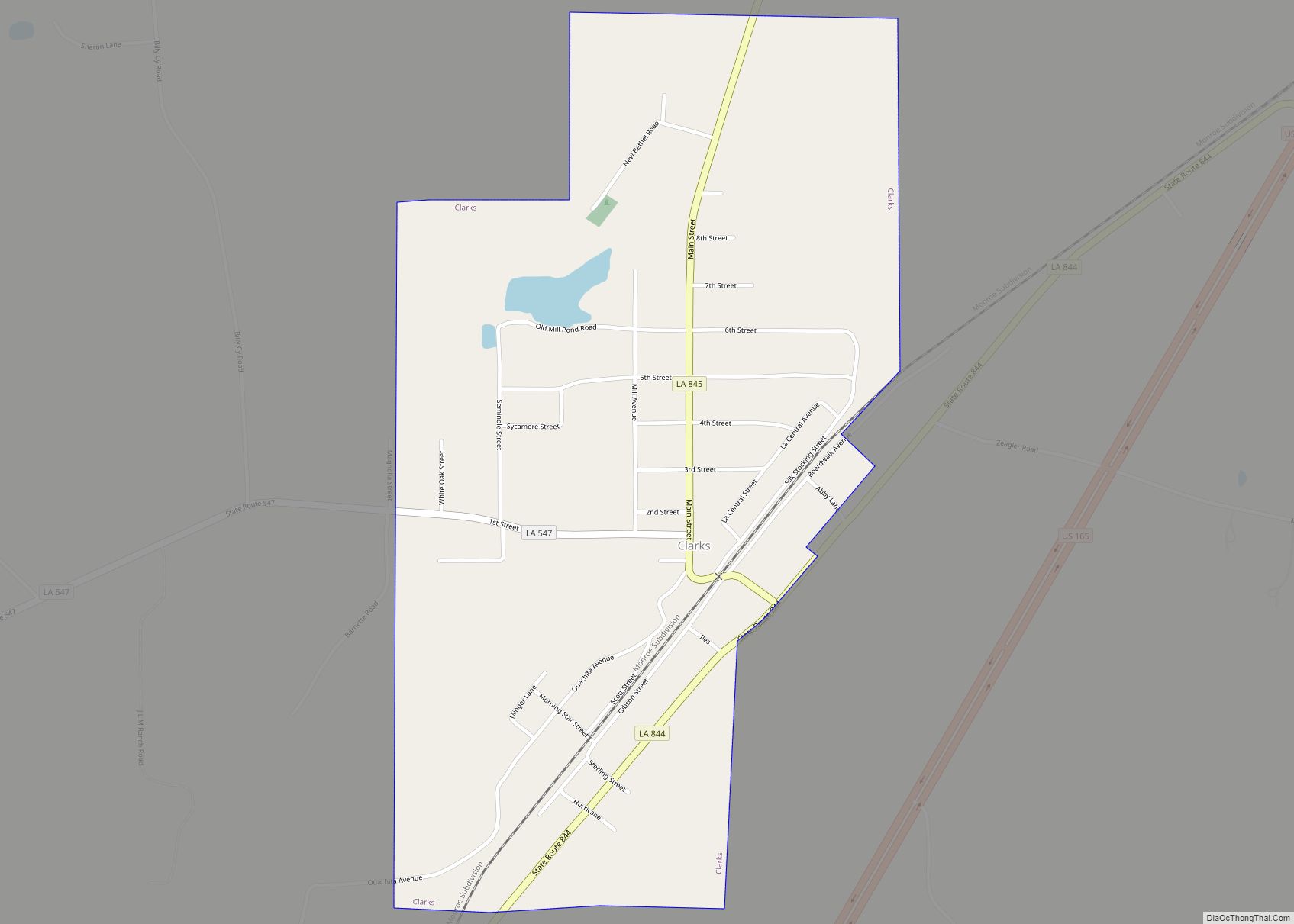
In the early 1900s, La. Central Lumber Co. was formed and built a major sawmill, headquarters, commissary, hotel, swimming pool and complete town of large frame homes – the town of Clarks. It was such a major supplier of lumber, it received a priority status by the government during World War II. The mill is gone, but the mill whistle still blows at noon.
Caldwell Parish was well represented with veterans in all the American wars as well as currently in Iraq and Afghanistan. Our fallen heroes are proudly remembered on a granite monument at courthouse square. Our soldiers service has and continues to be a major unifying factor for our parish.
Though the American Indians were basically removed from Northeast Louisiana in the early 1800s, their heritage is found in many Caldwell Parish family histories. Circa 1900, there was a small group of Italian families that moved to Caldwell Parish from Sicily who built most of buildings on the 100 block of Main Street at the riverfront in Columbia; which includes the Louisiana Artist Museum building named the “Schepis” after its Italian architect, builder and proprietor.
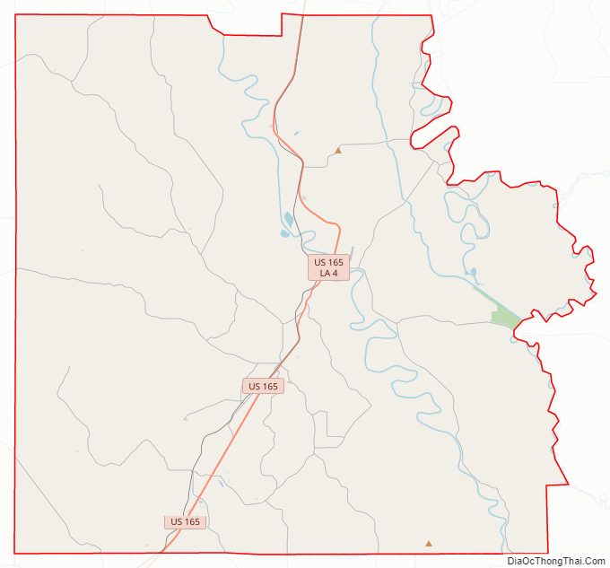
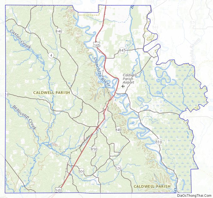
Caldwell Parish Road Map
Geography
According to the U.S. Census Bureau, the parish has a total area of 541 square miles (1,400 km), of which 529 square miles (1,370 km) is land and 11 square miles (28 km) (2.1%) is water.
Major highways
- U.S. Highway 165
- Louisiana Highway 4
Adjacent parishes
- Jackson Parish (northwest)
- Ouachita Parish (north)
- Richland Parish (northeast)
- Franklin Parish (east)
- Catahoula Parish (southeast)
- La Salle Parish (south)
- Winn Parish (southwest)
Caldwell Parish Topographic Map
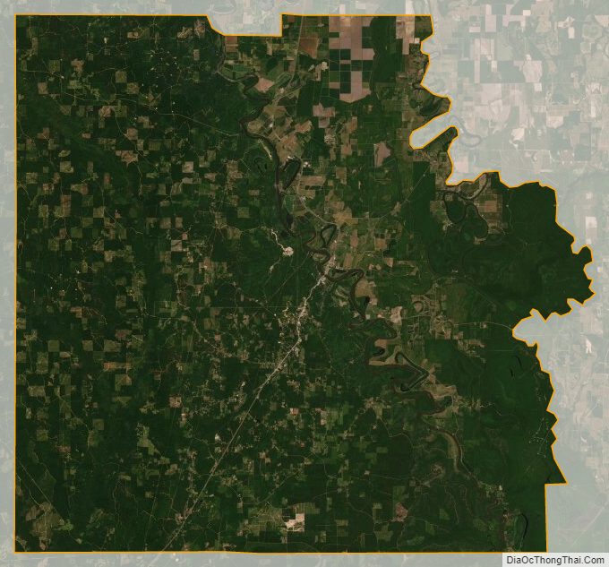
Caldwell Parish Satellite Map
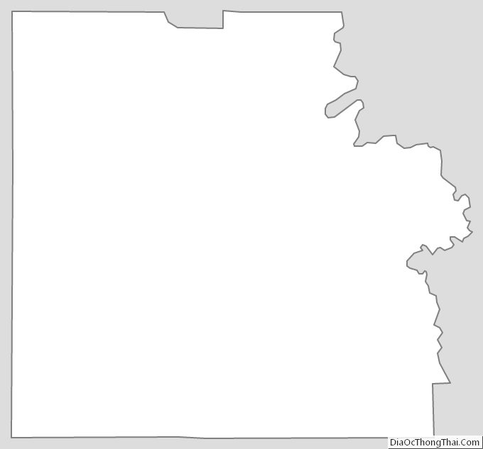
Caldwell Parish Outline Map