Catahoula Parish (French: Paroisse de Catahoula) is a parish in the U.S. state of Louisiana. As of the 2020 census, the population was 8,906. Its seat is Harrisonburg, on the Ouachita River. The parish was formed in 1808, shortly after the United States acquired this territory in the Louisiana Purchase of 1803.
| Name: | Catahoula Parish |
|---|---|
| FIPS code: | 22-025 |
| State: | Louisiana |
| Founded: | March 23, 1808 |
| Named for: | Tensas word for big, clear lake |
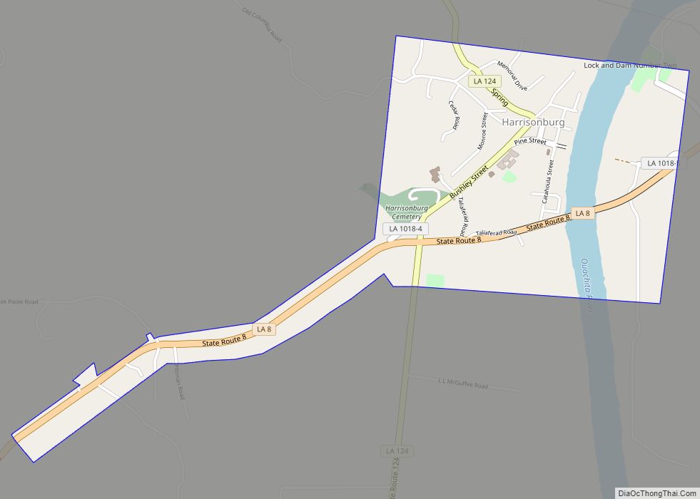
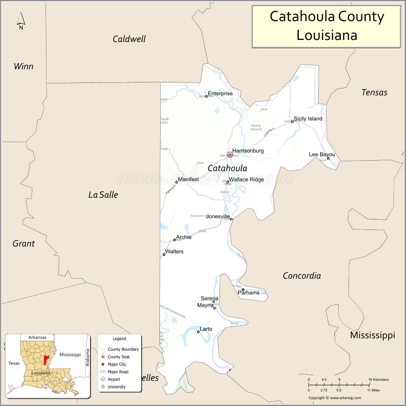
| Seat: | Harrisonburg |
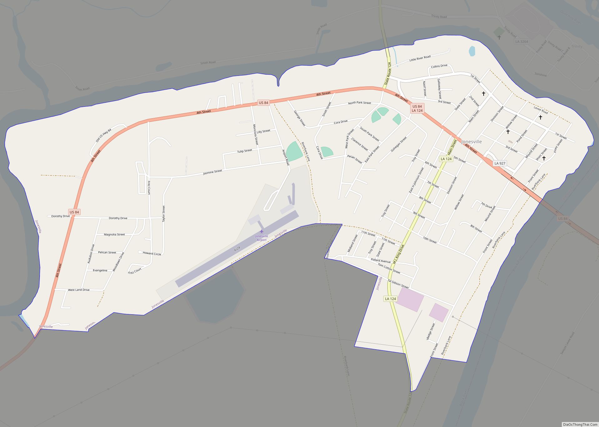
| Largest town: | Jonesville |
| Total Area: | 739 sq mi (1,910 km²) |
| Land Area: | 708 sq mi (1,830 km²) |
| Total Population: | 8,906 |
| Population Density: | 12/sq mi (4.7/km²) |
| Time zone: | UTC−6 (Central) |
| Summer Time Zone (DST): | UTC−5 (CDT) |
| Website: | www.discovercatahoula.com |
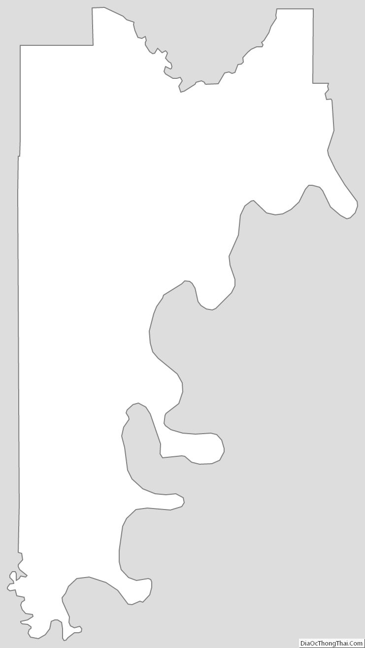
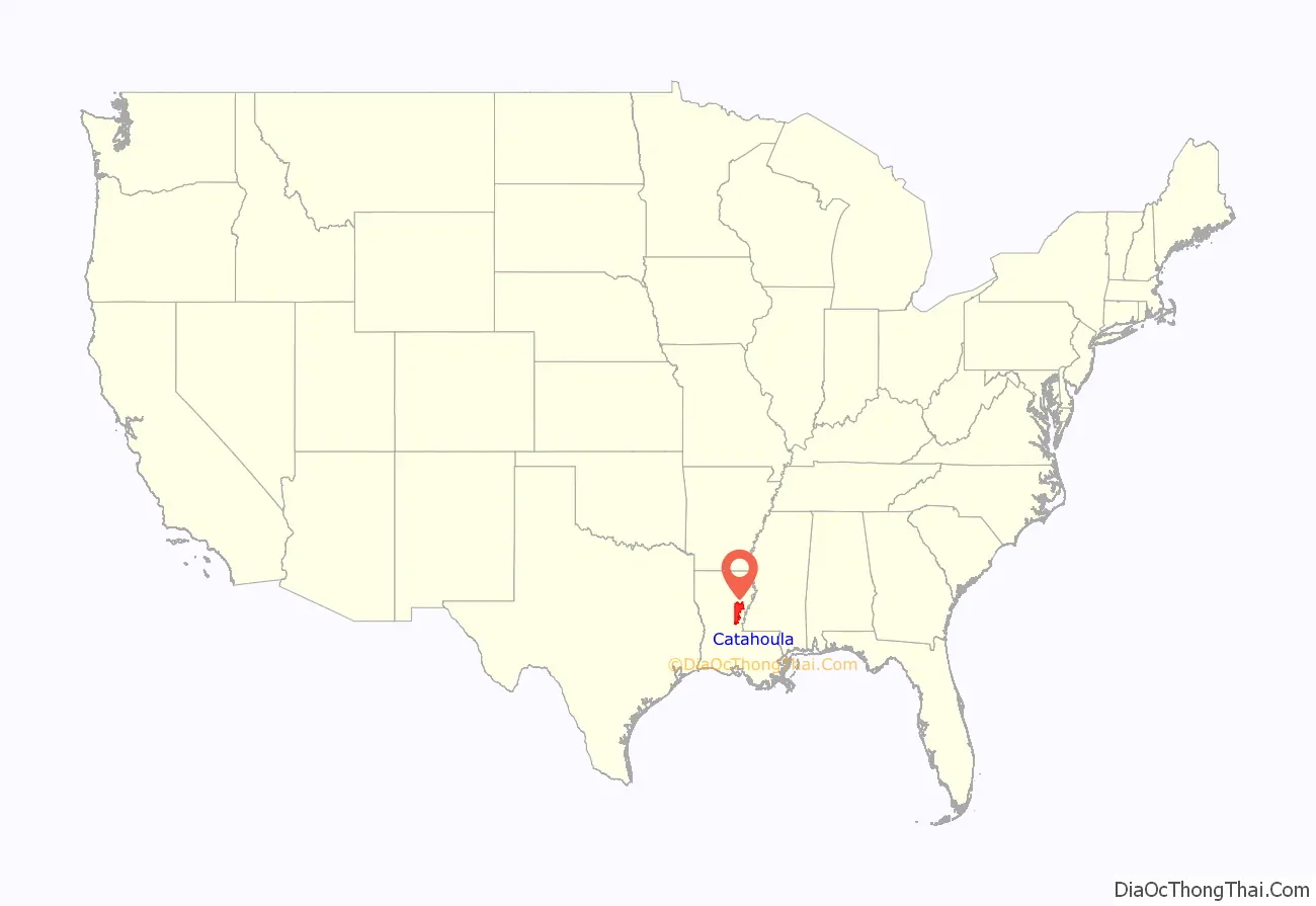
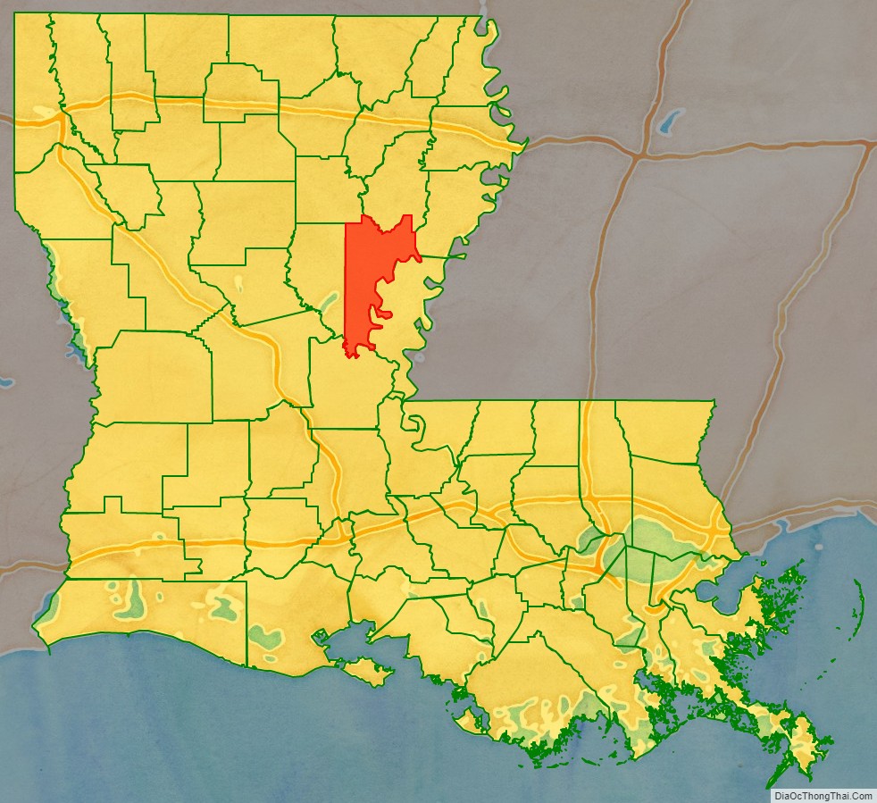
Catahoula Parish location map. Where is Catahoula Parish?
History
Prehistory
Catahoula Parish was the home to many succeeding Native American groups in the thousands of years before European settlements began. Peoples of the Marksville culture, Troyville culture, Coles Creek culture and Plaquemine culture built villages and mound sites throughout the area. Notable examples include Peck Mounds, and the Troyville Earthworks. The Troyville Earthworks have components dating from 100 BCE to 700 CE during the Baytown to the Troyville-Coles Creek periods.
It once had the tallest mound in Louisiana at 82 feet (25 m) in height; it was the second-tallest mound in North America (after Monk’s Mound at Cahokia Mounds). This mound was destroyed to make way for the Jonesville bridge over the Black River.
Historic era
This area was settled primarily by migrants from the southern United States after the Louisiana Purchase, when the US acquired the vast, former French-claimed territory west of the Mississippi River. White migrants to north and central Louisiana were from the South, and were mainly of British descent and Protestant religions. They brought a new influence into Louisiana. Some also brought or purchased African-American slaves to work on larger plantations. Many of these were from the Upper South, which sold slaves through the domestic market. They brought their own cultural influences as well.
The parish was founded in 1808 and originally incorporated a very large area. As population increased in the region, new parishes were organized from the territory first included in Catahoula Parish. The parish was divided by the state in 1910, when La Salle Parish was formed from its old western section. As one of the new parishes organized during early United States settlement of this part of the state, it has had the third most boundary changes since that time. Only Natchitoches and Ouachita parishes have had more revisions of boundaries.
Catahoula Parish Road Map
Geography
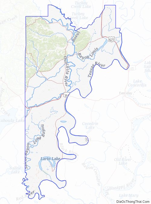
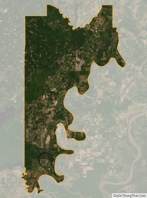
According to the U.S. Census Bureau, the parish has a total area of 739 square miles (1,910 km), of which 708 square miles (1,830 km) is land and 31 square miles (80 km) (4.2%) is water. It is home to Sandy Lake.
Major highways
- US 84
- US 425 / LA 15
- LA 8
- LA 28
- LA 124
- LA 126
Adjacent parishes
- Franklin Parish (north)
- Tensas Parish (northeast)
- Concordia Parish (east)
- Avoyelles Parish (south)
- La Salle Parish (west)
- Caldwell Parish (northwest)
National protected area
- Catahoula National Wildlife Refuge (part)
Catahoula Parish Topographic Map
Catahoula Parish Satellite Map
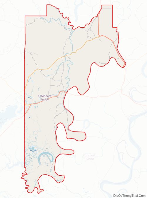
Catahoula Parish Outline Map