Cerro Gordo County (/ˈsɛroʊ ˈɡɔːrdoʊ/; Spanish: [ˈsero ˈɣoɾðo]) is a county located in the U.S. state of Iowa. As of the 2020 census, the population was 43,127. Its county seat is Mason City. The county is named for the Battle of Cerro Gordo, which took place during the Mexican–American War.
Cerro Gordo County is part of the Mason City, IA Micropolitan Statistical Area.
| Name: | Cerro Gordo County |
|---|---|
| FIPS code: | 19-033 |
| State: | Iowa |
| Founded: | 1851 |
| Named for: | Battle of Cerro Gordo |
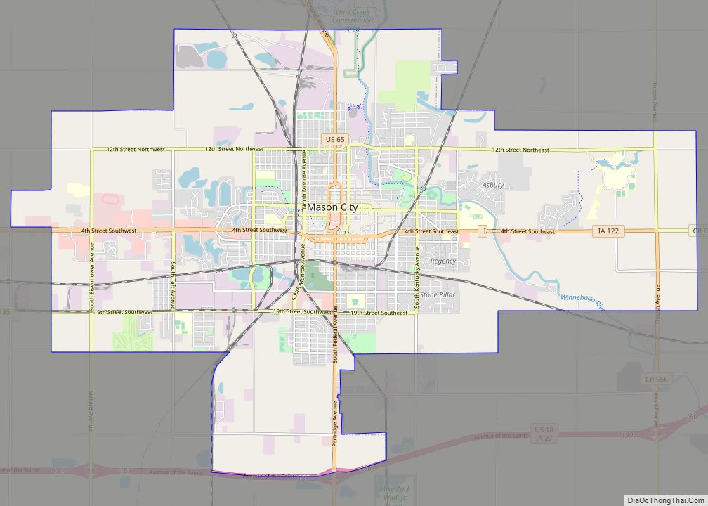
| Seat: | Mason City |
| Largest city: | Mason City |
| Total Area: | 575 sq mi (1,490 km²) |
| Land Area: | 568 sq mi (1,470 km²) |
| Total Population: | 43,127 |
| Population Density: | 75/sq mi (29/km²) |
| Time zone: | UTC−6 (Central) |
| Summer Time Zone (DST): | UTC−5 (CDT) |
| Website: | www.cgcounty.org |
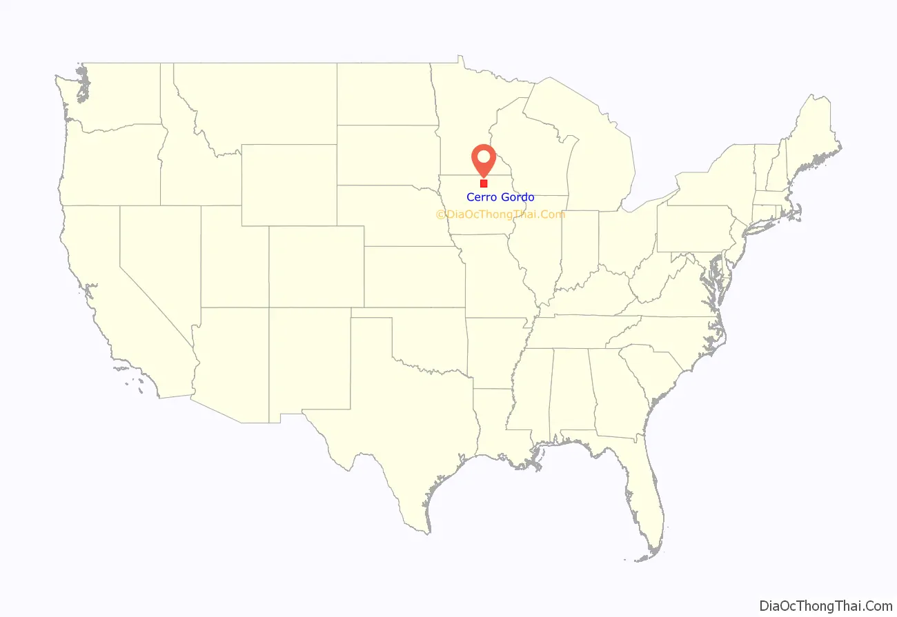
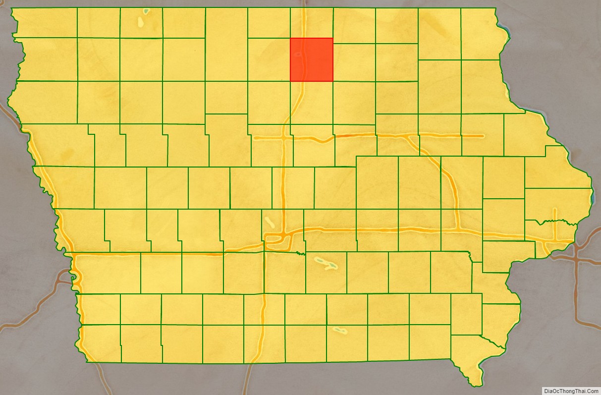
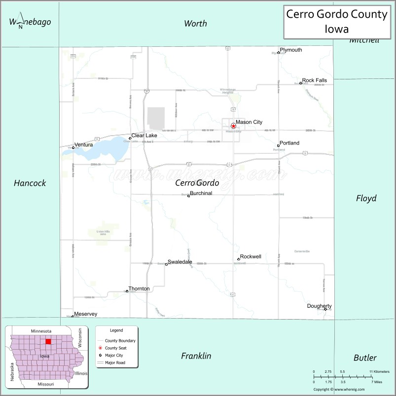
Cerro Gordo County location map. Where is Cerro Gordo County?
History
Cerro Gordo County was formed in 1851 and takes its name from the Battle of Cerro Gordo in the Mexican–American War, where General Winfield Scott defeated the Mexican General Santa Anna on April 18, 1847.
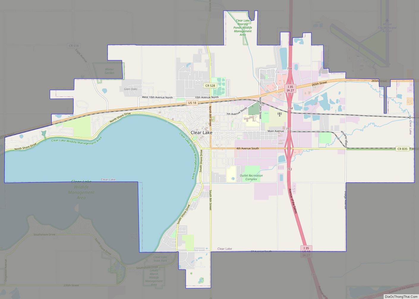
In 1851 the first white settlers came into the area of the present county and settled on Clear Lake. Four years later, on August 7, 1855, the first elections were held and the first legal proceedings occurred in 1857. In the summer of the same year, Livonia was chosen as the new county seat. In 1858, the seat was returned to Mason City. In 1866, the first courthouse was erected, which was used until 1900. The courthouse still used today opened on November 17, 1960.
Cerro Gordo County was the site of the airplane crash north of the city of Clear Lake, in which rock and roll stars Buddy Holly, Ritchie Valens, and J.P. “The Big Bopper” Richardson, along with their pilot Roger A. Peterson, were killed on February 3, 1959. The site is in Grant Township, in the northwestern part of the county.
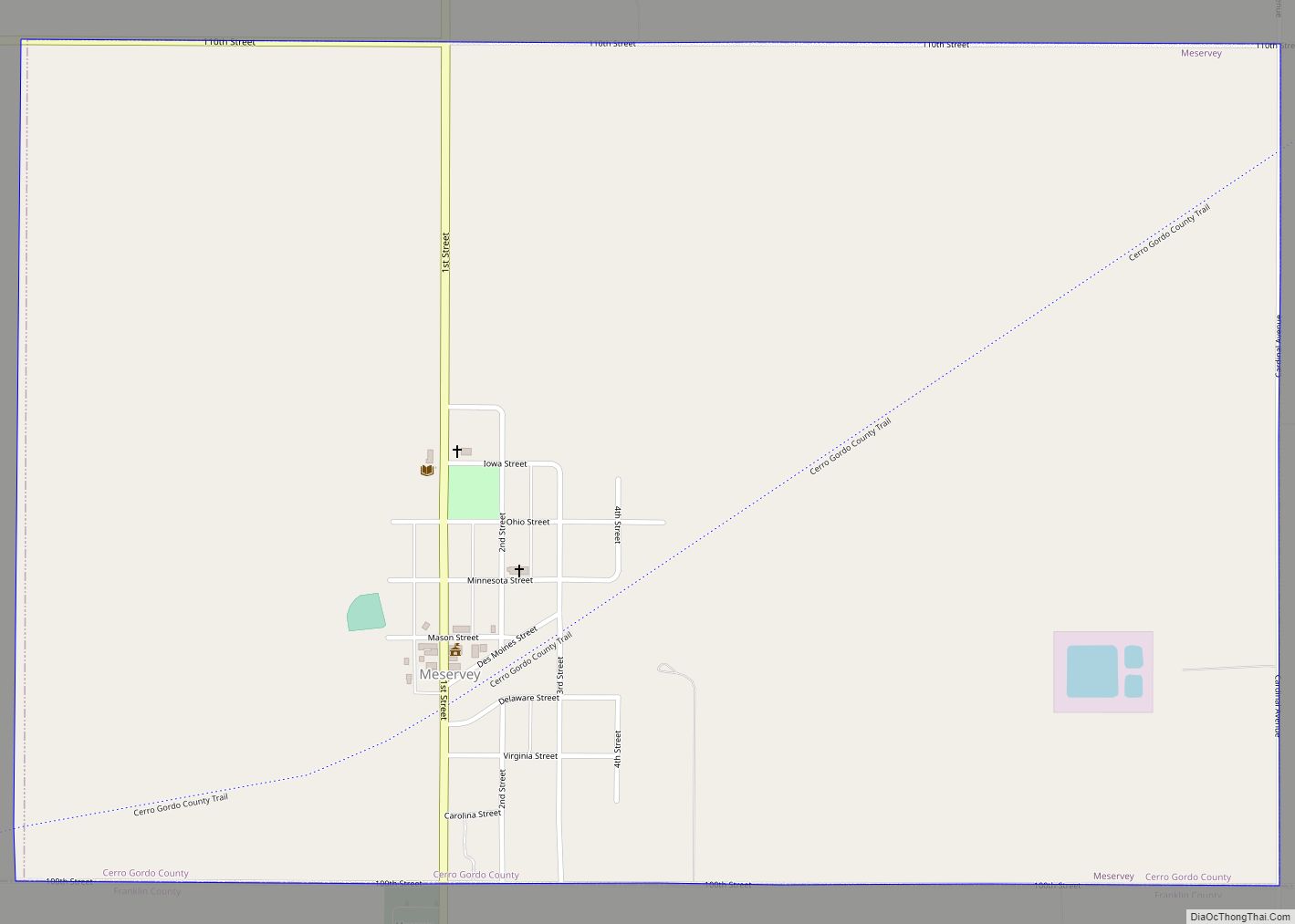
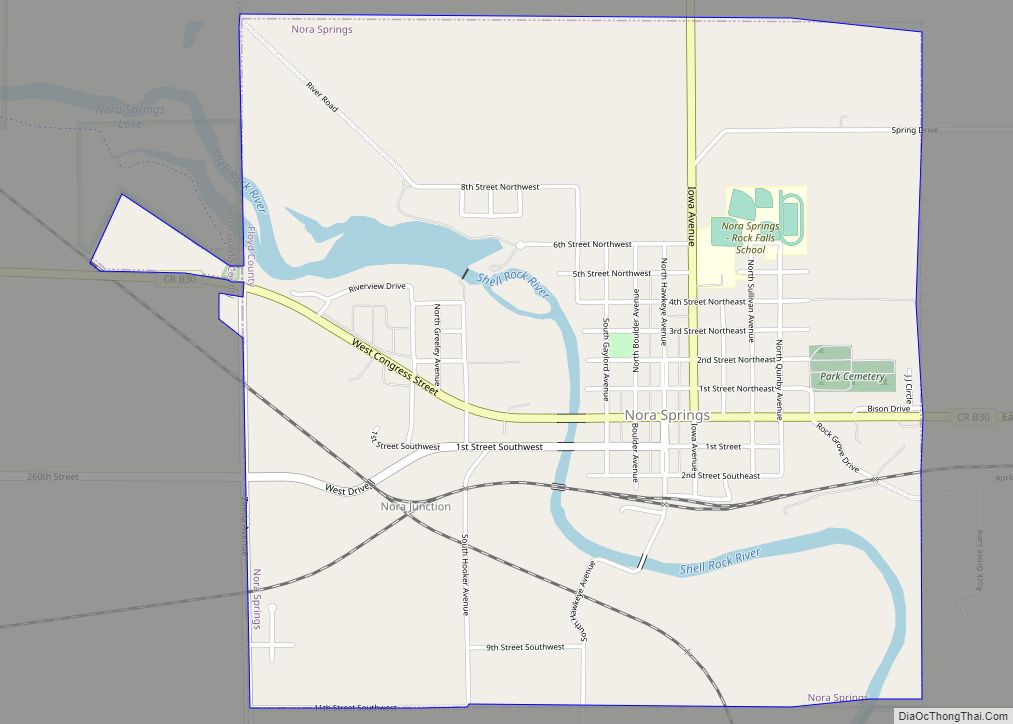
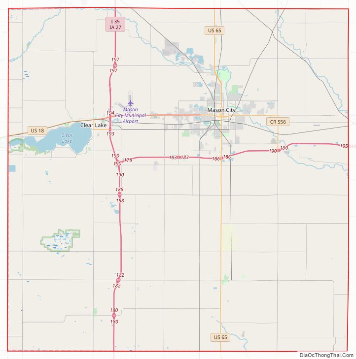
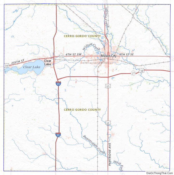
Cerro Gordo County Road Map
Geography
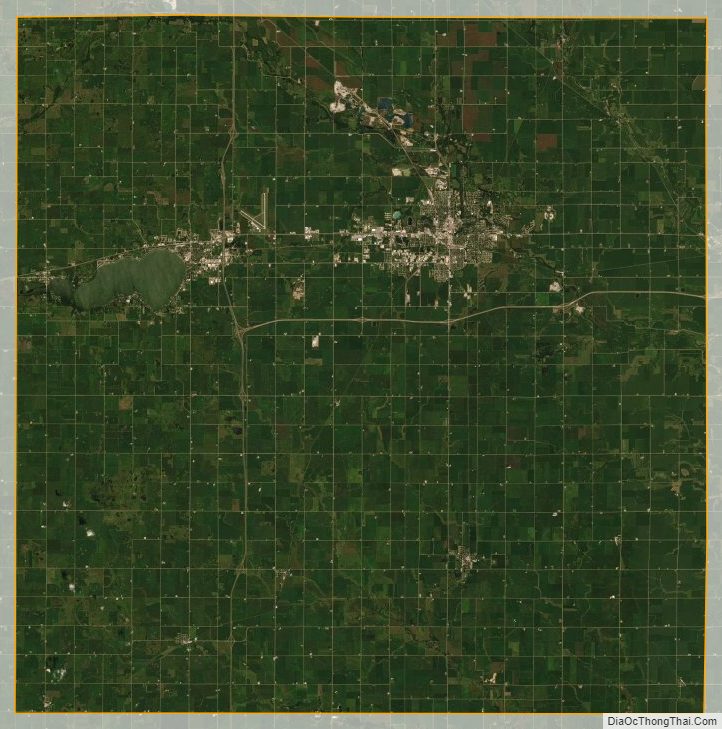
According to the U.S. Census Bureau, the county has a total area of 575 square miles (1,490 km), of which 568 square miles (1,470 km) is land and 6.8 square miles (18 km) (1.2%) is water.
Major highways
- Interstate 35
- U.S. Highway 18
- U.S. Highway 65
- Iowa Highway 27
- Iowa Highway 122
Transit
- List of intercity bus stops in Iowa
Airport
The county also has a municipal airport, Mason City Municipal Airport, (MCW).
Adjacent counties
- Worth County (north)
- Mitchell County (northeast)
- Floyd County (east)
- Franklin County (south)
- Hancock County (west)
Cerro Gordo County Topographic Map
Cerro Gordo County Satellite Map
Cerro Gordo County Outline Map