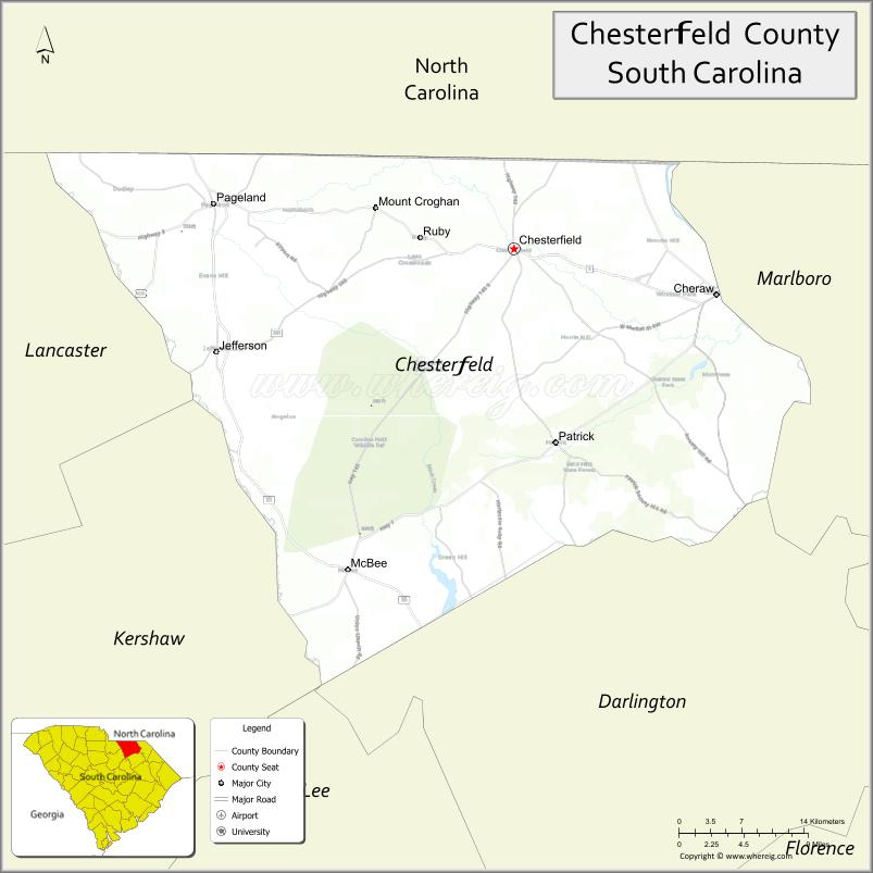
Chesterfield County is a county located in the U.S. state of South Carolina. As of the 2020 census, its population was 43,273. Its county seat is Chesterfield. The largest city in the county is Cheraw. Chesterfield County is part of the Charlotte Metropolitan Area. It is located north of the Midlands, on its border with North Carolina.
| Name: | Chesterfield County |
|---|---|
| FIPS code: | 45-025 |
| State: | South Carolina |
| Founded: | 1785 |
| Named for: | Philip Dormer Stanhope |
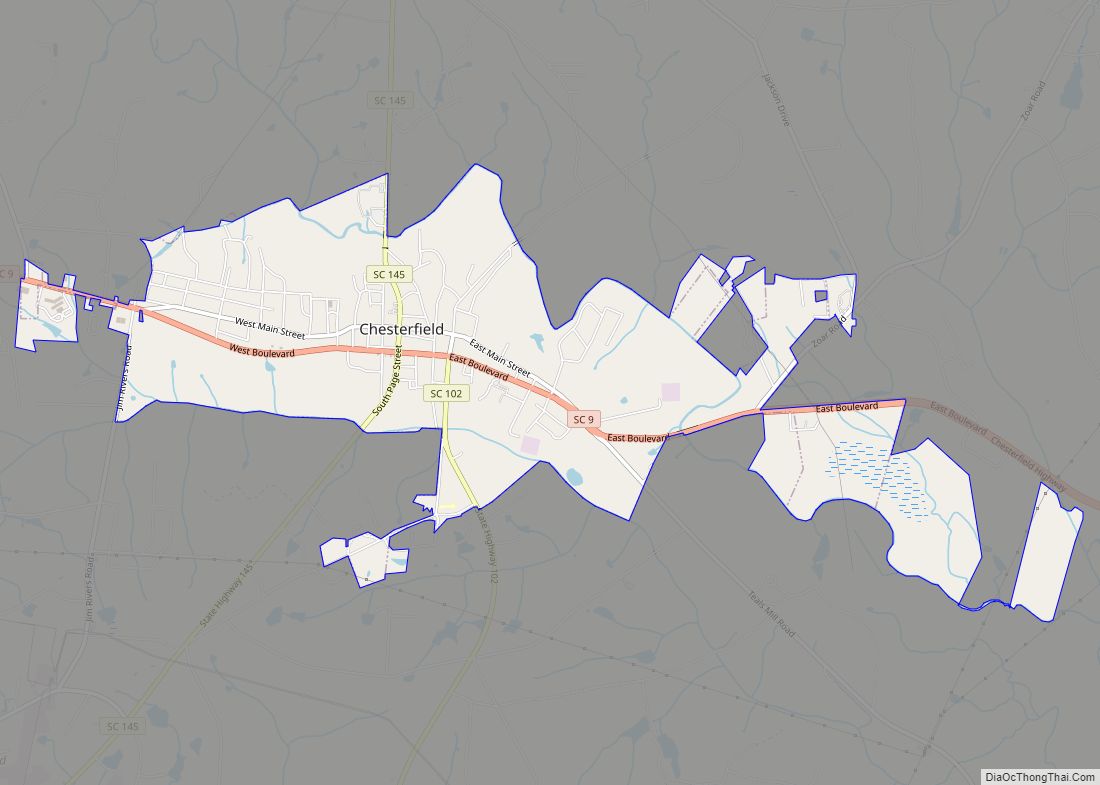
| Seat: | Chesterfield |
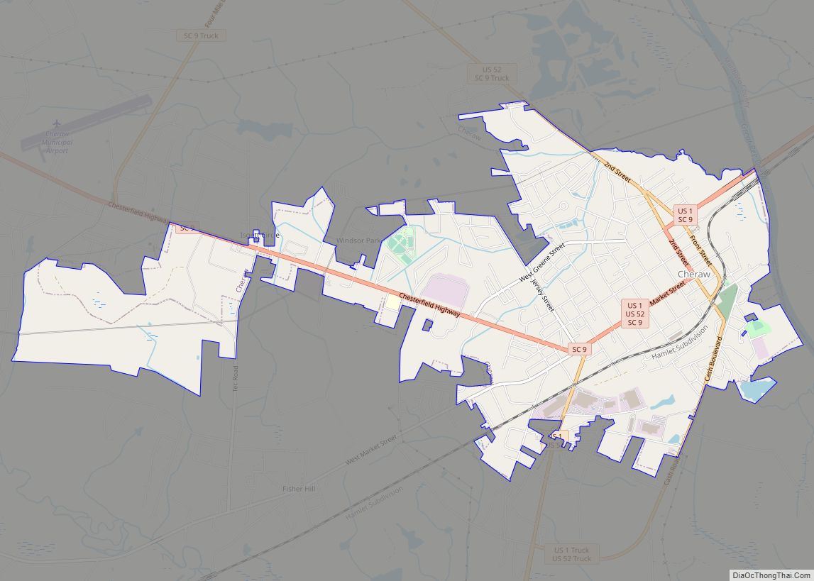
| Largest town: | Cheraw |
| Total Area: | 806 sq mi (2,090 km²) |
| Land Area: | 799 sq mi (2,070 km²) |
| Total Population: | 43,268 |
| Population Density: | 54.2/sq mi (20.9/km²) |
| Time zone: | UTC−5 (Eastern) |
| Summer Time Zone (DST): | UTC−4 (EDT) |
| Website: | www.chesterfieldcountysc.com |
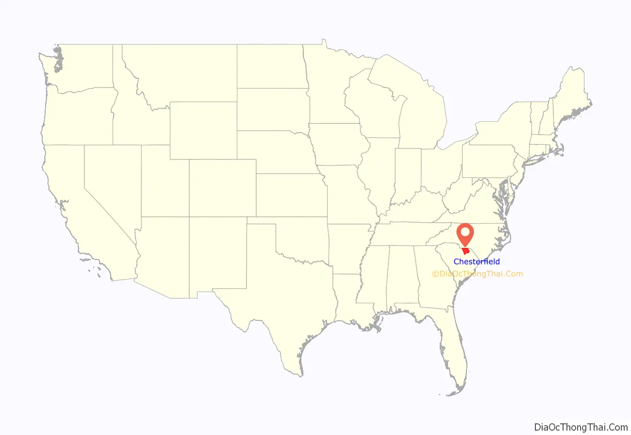
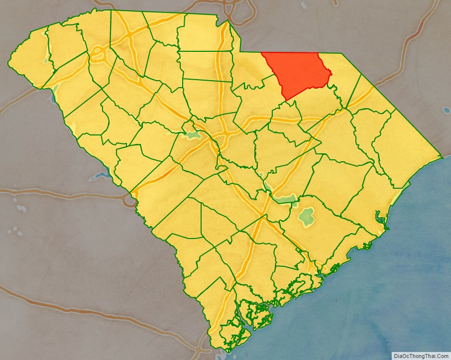
Chesterfield County location map. Where is Chesterfield County?
History
The county is named for Philip Stanhope, 4th Earl of Chesterfield, a British politician who opposed the Stamp Act of 1765, which was deeply unpopular in South Carolina, and who was known for always speaking up for the rights of the colonists while he was serving in the British Parliament and when he served as British Secretary of State.
The county was formed in 1785, but was part of what was then known as Cheraws District until 1800, at which time Chesterfield became a district itself. In the 1700s, the area that would become Chesterfield County was settled primarily by immigrants from England and Wales, as well as by smaller numbers of immigrants from County Antrim, Ireland, in what has since become Northern Ireland. Northern Irish immigrants were overwhelmingly Presbyterians of Scottish descent, due to the fact that they were from Ireland but were of Scottish origins. They were referred to by the rest of colonial society as “Scotch-Irish” however this was not a term they self-applied, preferring to refer to themselves as “Ulstermen” or “Irish Presbyterians.” Under the post-American Civil War (1861–1865) state constitution of 1867, passed during the Reconstruction era, South Carolina districts became counties with home rule.
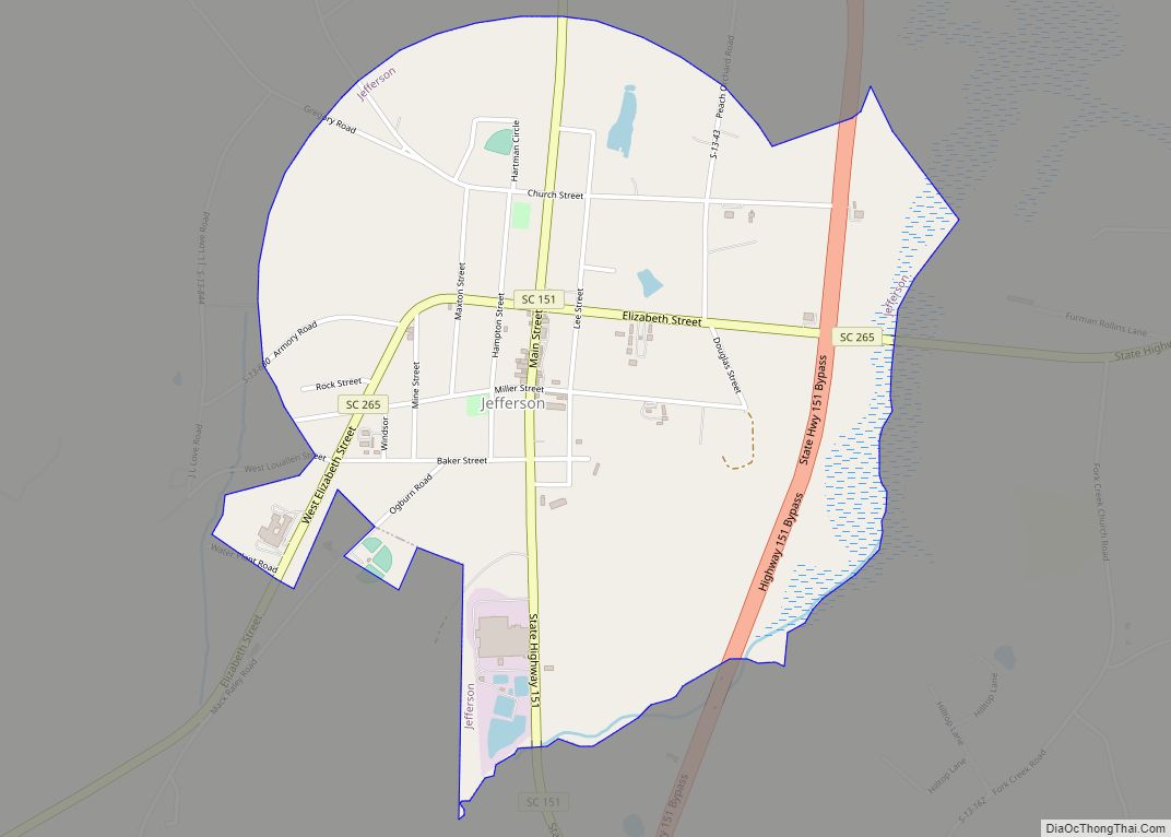
On April 10, 2020, a case of Influenza A virus subtype H7N3 was confirmed in what The Post and Courier described as “a commercial turkey flock” which resulted in the disinfecting & quarantine of the farm. This is the 1st confirmed case of H7N3 in the United States since another case was found in Lincoln County, Tennessee on March 5, 2017. Four days later on April 14, a second case was confirmed at a turkey farm in Jefferson, South Carolina resulting in the euthanization of 32,000 turkeys. Clemson University released the map of the control area for the first turkey farm infected by the virus on May 4.
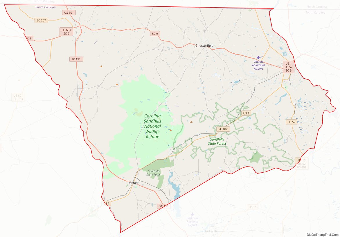
Chesterfield County Road Map
Geography
According to the U.S. Census Bureau, the county has a total area of 806 square miles (2,090 km), of which 799 square miles (2,070 km) is land and 6.7 square miles (17 km) (0.8%) is water.
National protected area
- Carolina Sandhills National Wildlife Refuge
State and local protected areas
- Cheraw State Park
- H. Cooper Black Jr. Memorial Field Trial and Recreation Area
- McBee Wildlife Management Area
- Sand Hills State Forest
- Sugarloaf Mountain Recreation Area
Major water bodies
- Black Creek
- Great Pee Dee River
- Lake Juniper
- Lake Robinson
- Little Carr Creek
- Lynches River
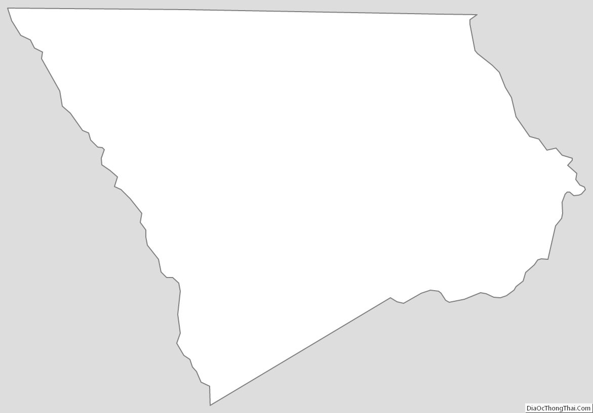
Adjacent counties
- Anson County, North Carolina – north
- Richmond County, North Carolina – northeast
- Union County, North Carolina – northwest
- Marlboro County – east
- Darlington County – southeast
- Kershaw County – southwest
- Lancaster County – west
Major highways
- US 1
- US 52
- US 52 Truck
- US 601
- SC 9
- SC 9 Truck
- SC 102
- SC 109
- SC 145
- SC 151
- SC 151 Bus. (Jefferson)
- SC 151 Bus. (Pageland)
- SC 207
- SC 265
- SC 268
- SC 903
Major infrastructure
- Cheraw Municipal Airport
- Pageland Municipal airport
Chesterfield County Topographic Map
Chesterfield County Satellite Map
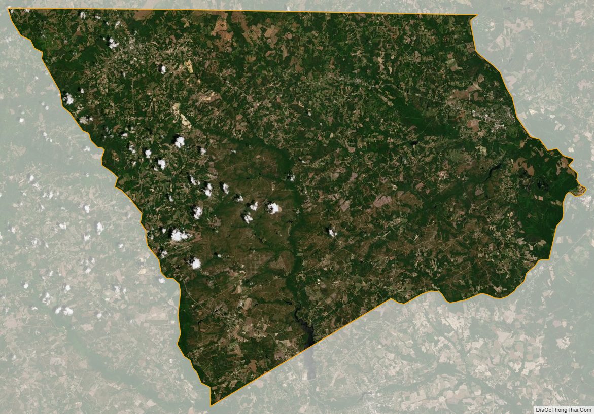
Chesterfield County Outline Map