Dare County is the easternmost county in the U.S. state of North Carolina. As of the 2020 census, the population was 36,915. Its county seat is Manteo. Dare County is named after Virginia Dare, the first child born in the Americas to English parents, who was born within the county’s current borders. Founded in 1870 from parts of Tyrrell, Currituck and Hyde counties, it consists of a large segment of the Outer Banks of North Carolina, along with Roanoke Island and a peninsula of land attached to the mainland. Most of the county consists of a string of resort communities along the Outer Banks. While lightly populated by year-round residents, the population swells during the summer with vacationers.
Dare County is included in the Kill Devil Hills, NC Micropolitan Statistical Area, which is also included in the Virginia Beach-Norfolk, VA-NC Combined Statistical Area.
At one time, the now-abandoned town of Buffalo City was the largest community in the county. Because it includes much of Pamlico Sound, Dare County is the largest county in North Carolina by total area, although if one were to consider land area only, it drops down to 68th in size among the state’s 100 counties.
| Name: | Dare County |
|---|---|
| FIPS code: | 37-055 |
| State: | North Carolina |
| Founded: | 1870 |
| Named for: | Virginia Dare |
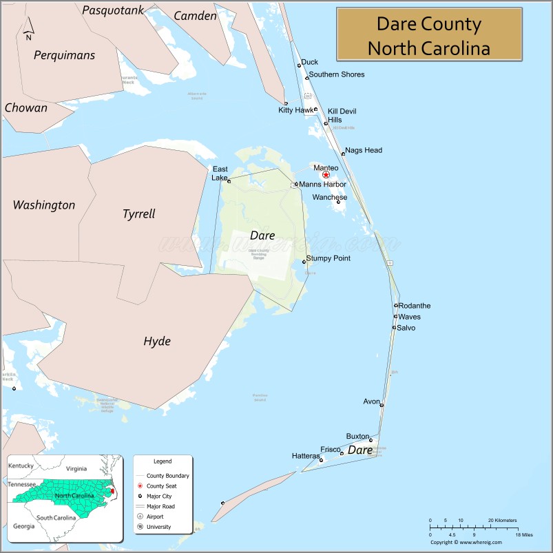
| Seat: | Manteo |
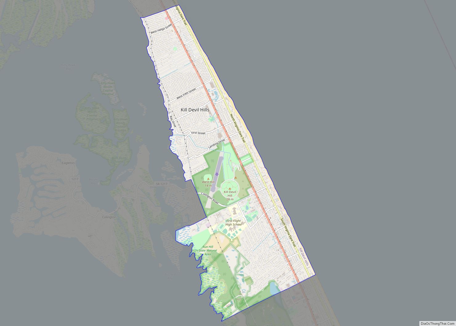
| Largest town: | Kill Devil Hills |
| Total Area: | 1,563 sq mi (4,050 km²) |
| Land Area: | 383 sq mi (990 km²) |
| Total Population: | 36,915 |
| Population Density: | 24/sq mi (9.1/km²) |
| Time zone: | UTC−5 (Eastern) |
| Summer Time Zone (DST): | UTC−4 (EDT) |
| Website: | www.darenc.com |
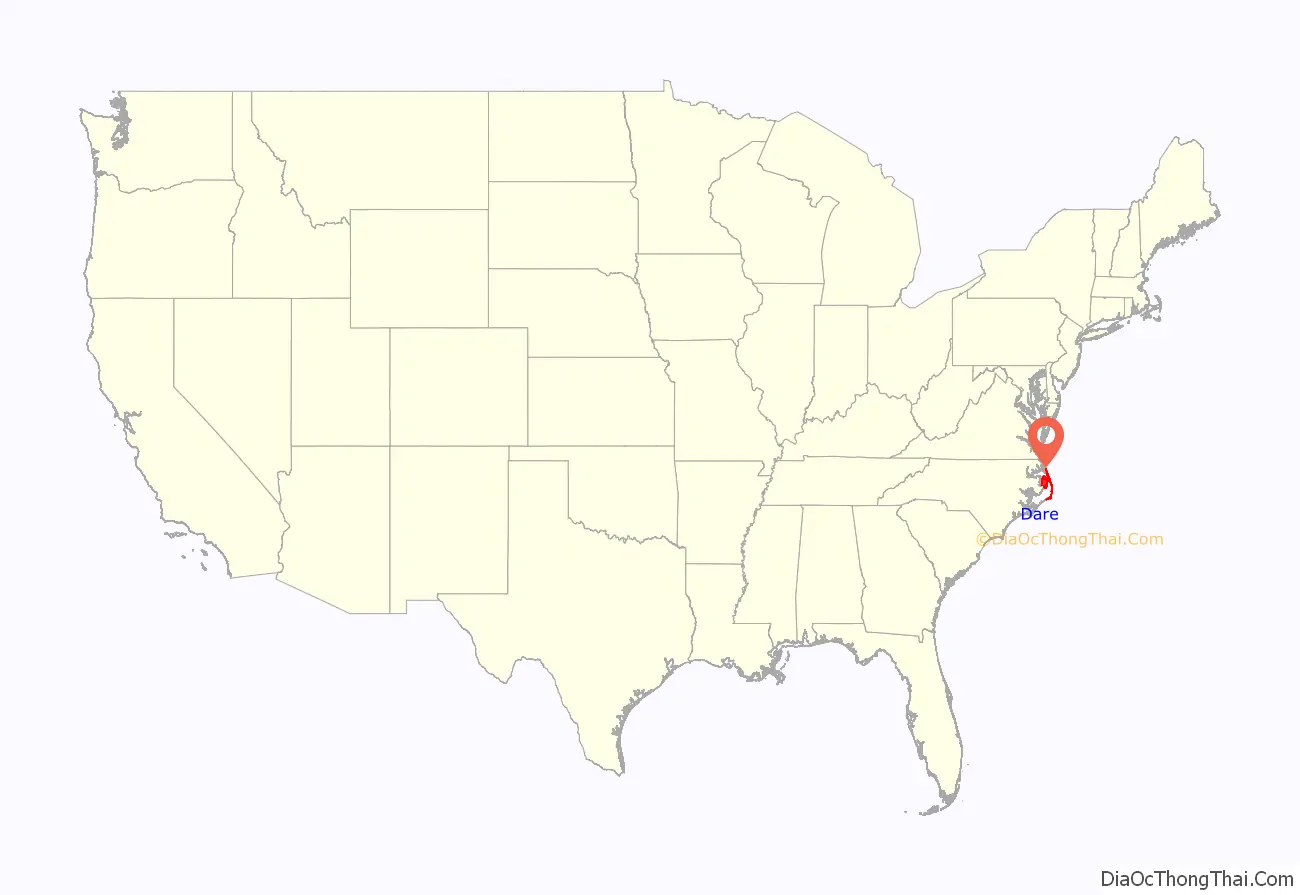
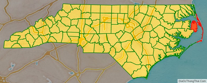
Dare County location map. Where is Dare County?
Dare County Road Map
Geography
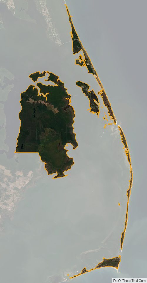
According to the U.S. Census Bureau, the county has a total area of 1,563 square miles (4,050 km), of which 383 square miles (990 km) is land and 1,179 square miles (3,050 km) (75%) is water. It is the largest county in North Carolina by area.
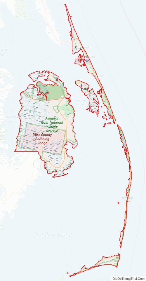
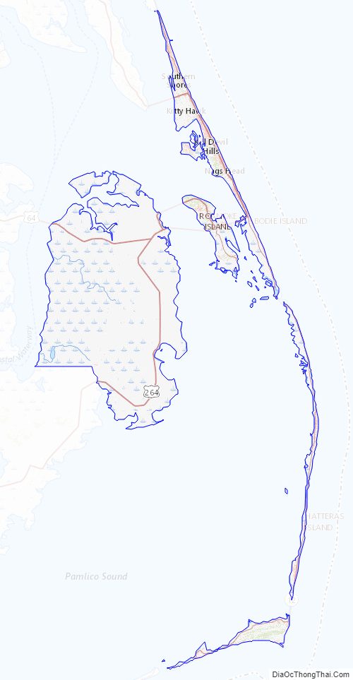
Dare County includes the middle part of the Outer Banks and contains Roanoke Island.
National protected areas
- Alligator River National Wildlife Refuge (part)
- Cape Hatteras National Seashore (part)
- Fort Raleigh National Historic Site
- Pea Island National Wildlife Refuge
- Wright Brothers National Memorial
State and local protected areas/sites
- Bodie Island Lighthouse
- Buxton Woods Coastal Reserve Dedicated Nature Preserve
- Cape Hatteras Lighthouse
- Dare Game Lands (part)
- Hatteras Inlet Crab Spawning Sanctuary (part)
- Jockey’s Ridge State Park
- Kitty Hawk Woods Coastal Reserve
- Kitty Hawk Woods Reserve
- Nags Head Woods Preserve Dedicated Nature Preserve
- Oregon Inlet Crab Spawning Sanctuary
- Pamlico Sound Mechanical Harvesting of Oysters Prohibited Area
- Roanoke Island Festival Park
- Roanoke Island Marshes Dedicated Nature Preserve
- Run Hill State Natural Area
- Run Hill State Natural Area Dedicated Nature Preserve
- Sandy Run Park
Major water bodies
- Albemarle Sound
- Alligator River
- Atlantic Ocean
- Broad Creek
- Croatan Sound
- Currituck Sound
- East Lake
- Hatteras Bight
- Hatteras Inlet
- Intracoastal Waterway
- Long Shoal River
- Oregon Inlet
- Pamlico Sound
- Raleigh Bay
- Roanoke Sound
- Shallowbag Bay
- South Lake
Adjacent counties
- Currituck County – north
- Hyde County – southwest
- Tyrrell County – west
Major highways
- US 64
- US 64 Byp.
- US 158
- US 264
- NC 12
- NC 345
- NC 400
Major Infrastructure
- Dare County Bombing Range, within Alligator River National Wildlife Refuge.
- Dare County Regional Airport, a general aviation airport, is located in Dare County.
- First Flight Airport, inside Wright Brothers National Memorial
- Hatteras – Ocracoke Ferry (To Hyde County)
- Stumpy Point – Rodanthe Ferry, emergency route to the mainland during evacuations.
Dare County Topographic Map
Dare County Satellite Map
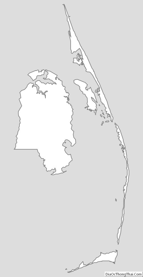
Dare County Outline Map