| Name: | Kearny County |
|---|---|
| FIPS code: | 20-093 |
| State: | Kansas |
| Founded: | March 20, 1873 |
| Named for: | Philip Kearny |
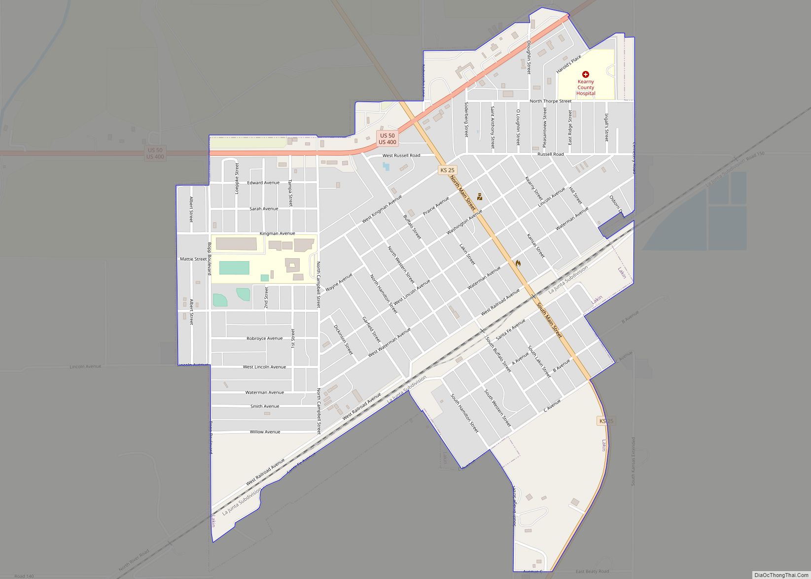
| Seat: | Lakin |
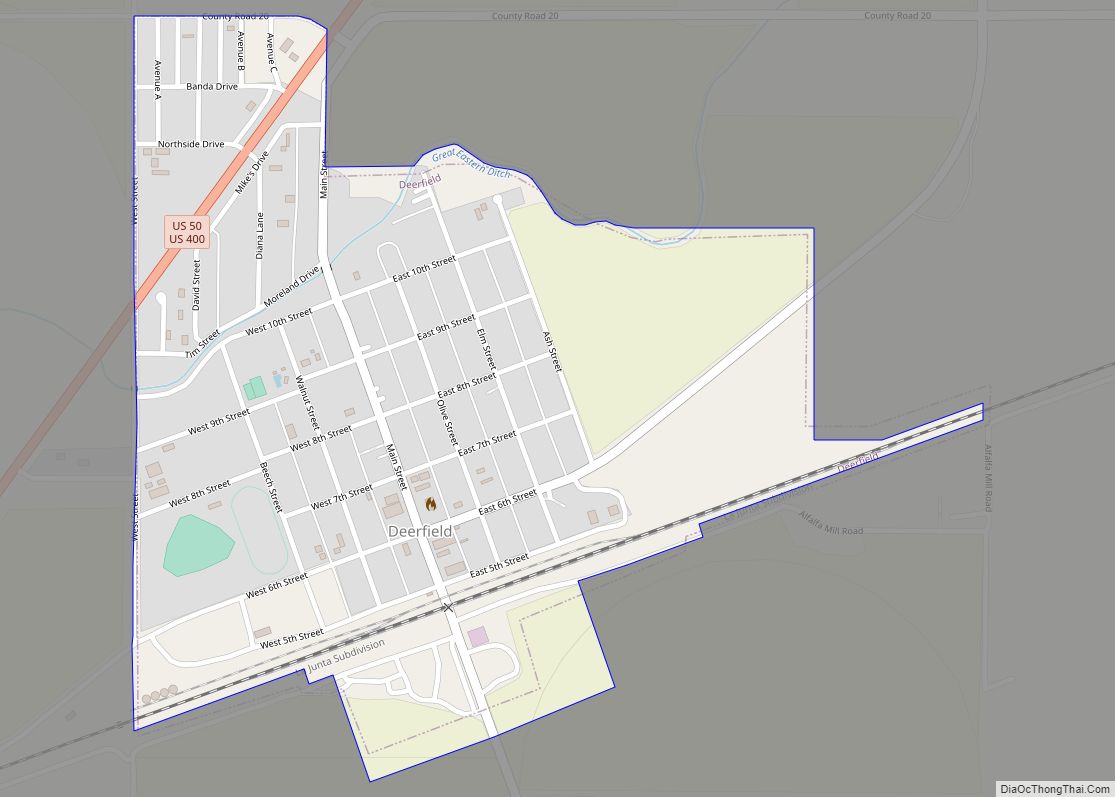
| Largest city: | Lakin |
| Total Area: | 871 sq mi (2,260 km²) |
| Land Area: | 871 sq mi (2,260 km²) |
| Total Population: | 3,983 |
| Population Density: | 4.6/sq mi (1.8/km²) |
| Time zone: | UTC−6 (Central) |
| Summer Time Zone (DST): | UTC−5 (CDT) |
| Website: | KearnyCountyKansas.com |
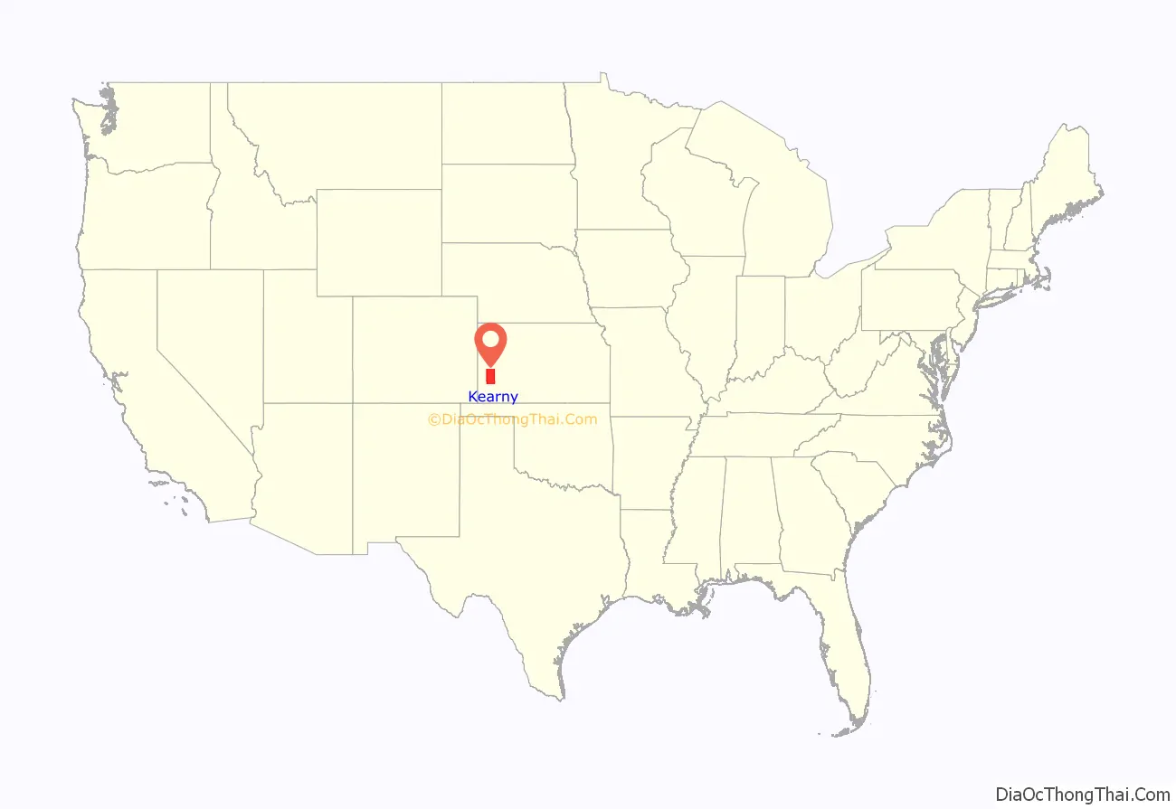
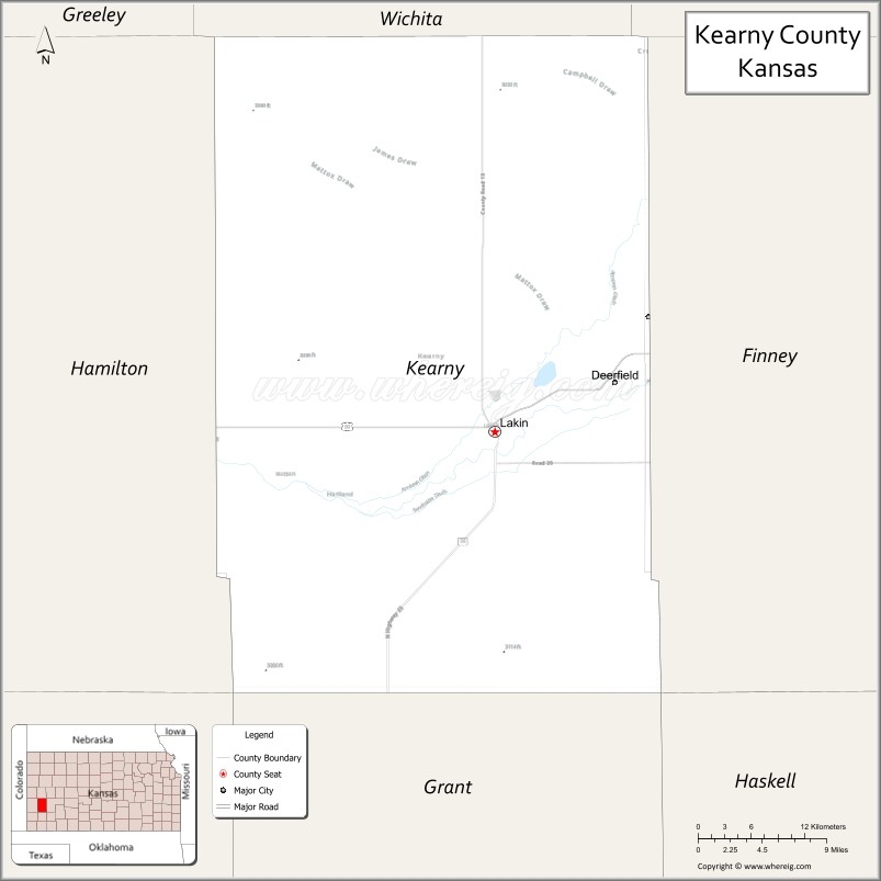
Kearny County location map. Where is Kearny County?
History
The original Kearney County was established on March 6, 1873, and was dissolved in 1883, with the land area being split between Hamilton and Finney counties. It was reestablished with its original borders in 1887, and organized on March 27, 1888. The county is named in honor of Philip Kearny, a U.S. Army officer in the Mexican–American War and a Union army general in the American Civil War. In 1889, the name was corrected to Kearny County.
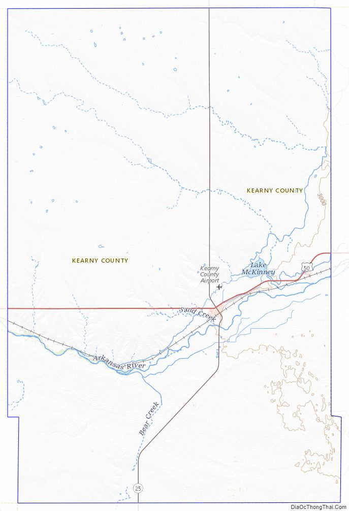
Kearny County Road Map
Geography
According to the U.S. Census Bureau, the county has a total area of 871 square miles (2,260 km), of which 871 square miles (2,260 km) is land and 0.4 square miles (1.0 km) (0.05%) is water.
Major highways
- U.S. Highway 50
- U.S. Highway 400
- K-25
Time zones
The west half of Kearny County observed Mountain Standard Time until October 28, 1990, when the Kansas Department of Transportation moved the entire county into the Central Time Zone, which 100 of the state’s other 104 counties observe. Only four counties (Hamilton, Greeley, Wallace, and Sherman), all of which border Colorado, observe Mountain Time.
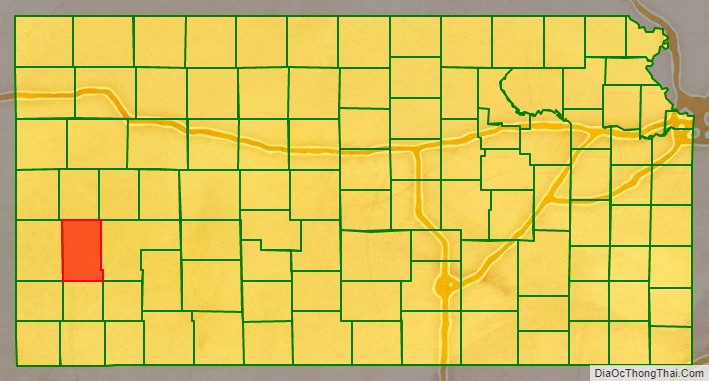
Adjacent counties
- Wichita County (north)
- Scott County (northeast)
- Finney County (east)
- Grant County (south)
- Stanton County (southwest)
- Hamilton County (west/Mountain Time border)
Kearny County Topographic Map
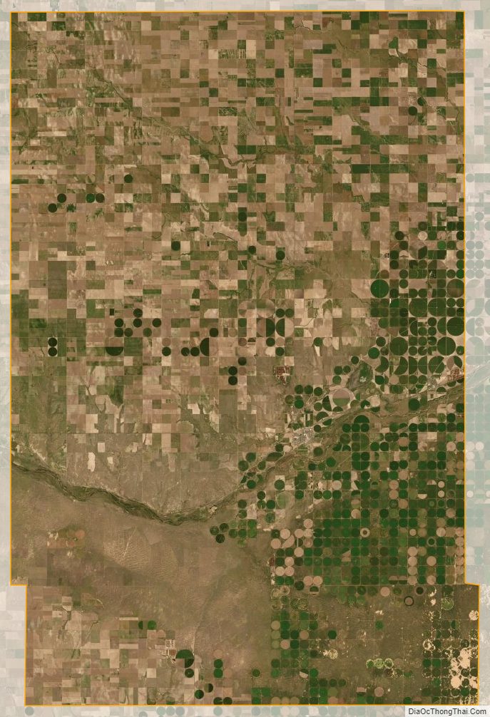
Kearny County Satellite Map
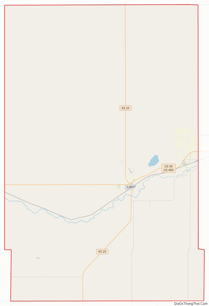
Kearny County Outline Map