Barton County (standard abbreviation: BT) is a county located in the U.S. state of Kansas. As of the 2020 census, the county population was 25,493. Its county seat and most populous city is Great Bend. The county is named in honor of Clara Barton, responsible for the founding of the American Red Cross. It is the only one of Kansas’ 105 counties to be named for a woman.
| Name: | Barton County |
|---|---|
| FIPS code: | 20-009 |
| State: | Kansas |
| Founded: | February 26, 1867 |
| Named for: | Clara Barton |
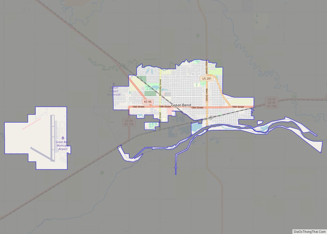
| Seat: | Great Bend |
| Largest city: | Great Bend |
| Total Area: | 901 sq mi (2,330 km²) |
| Land Area: | 895 sq mi (2,320 km²) |
| Total Population: | 25,493 |
| Population Density: | 28.5/sq mi (11.0/km²) |
| Time zone: | UTC−6 (Central) |
| Summer Time Zone (DST): | UTC−5 (CDT) |
| Website: | BartonCounty.org |
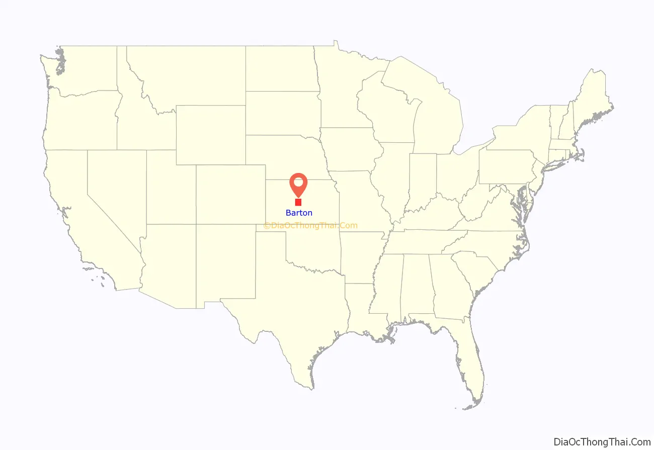
Barton County location map. Where is Barton County?
History
Early history
For many millennia, the Great Plains of North America was inhabited by nomadic Native Americans. From the 16th century to 18th century, the Kingdom of France claimed ownership of large parts of North America. In 1762, after the French and Indian War, France secretly ceded New France to Spain, per the Treaty of Fontainebleau.
19th century
In 1802, Spain returned most of the land to France, but keeping title to about 7,500 square miles. In 1803, most of the land for modern day Kansas was acquired by the United States from France as part of the 828,000 square mile Louisiana Purchase for 2.83 cents per acre.
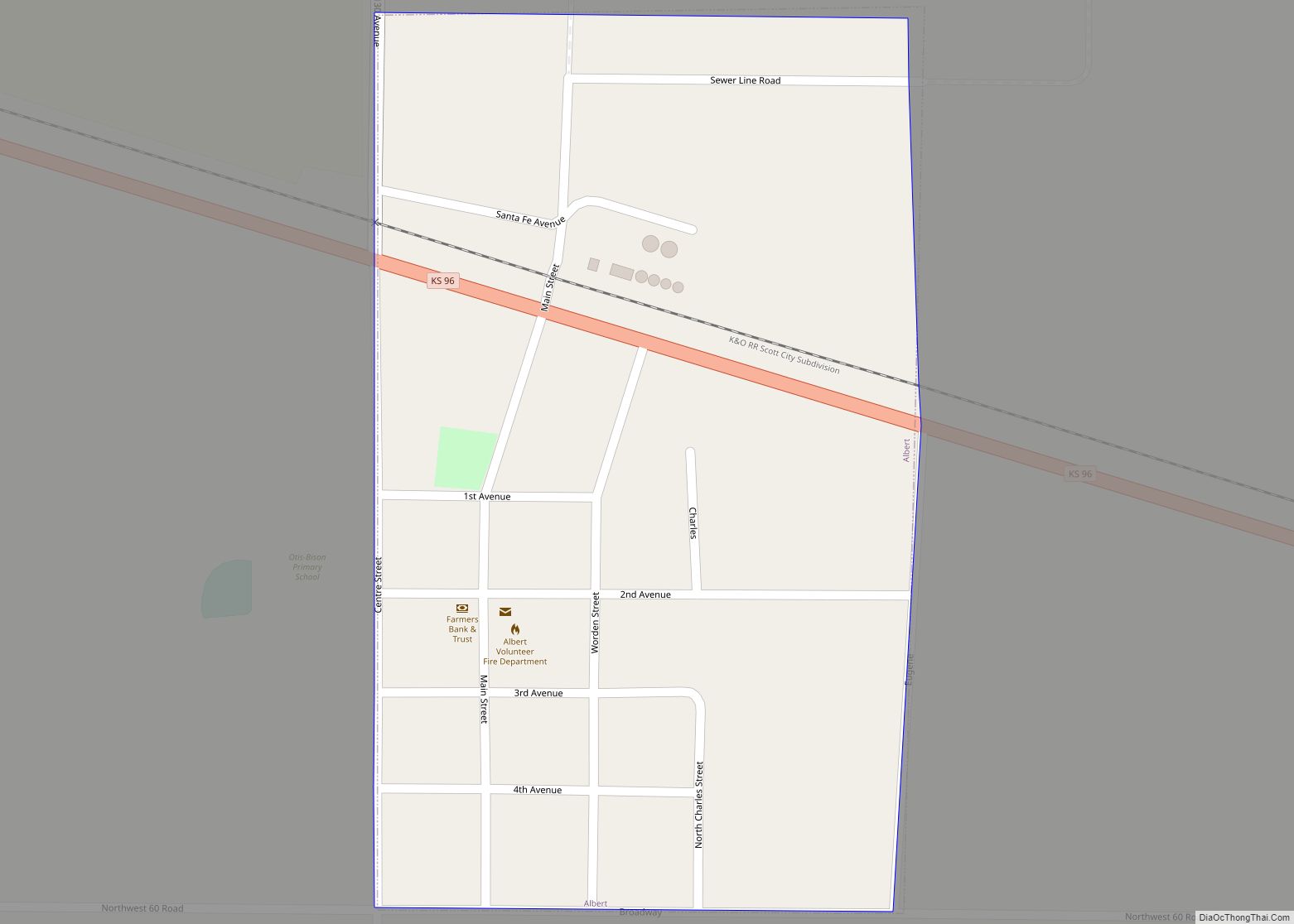
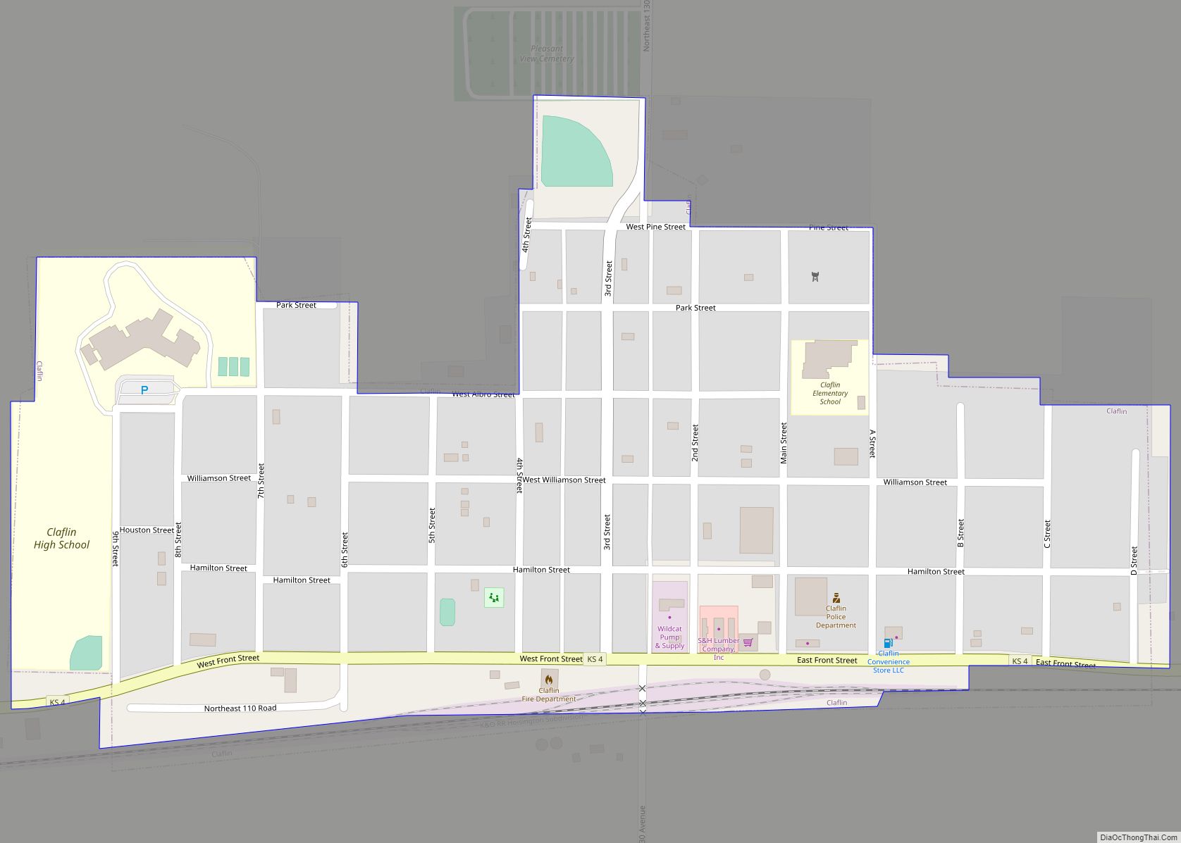
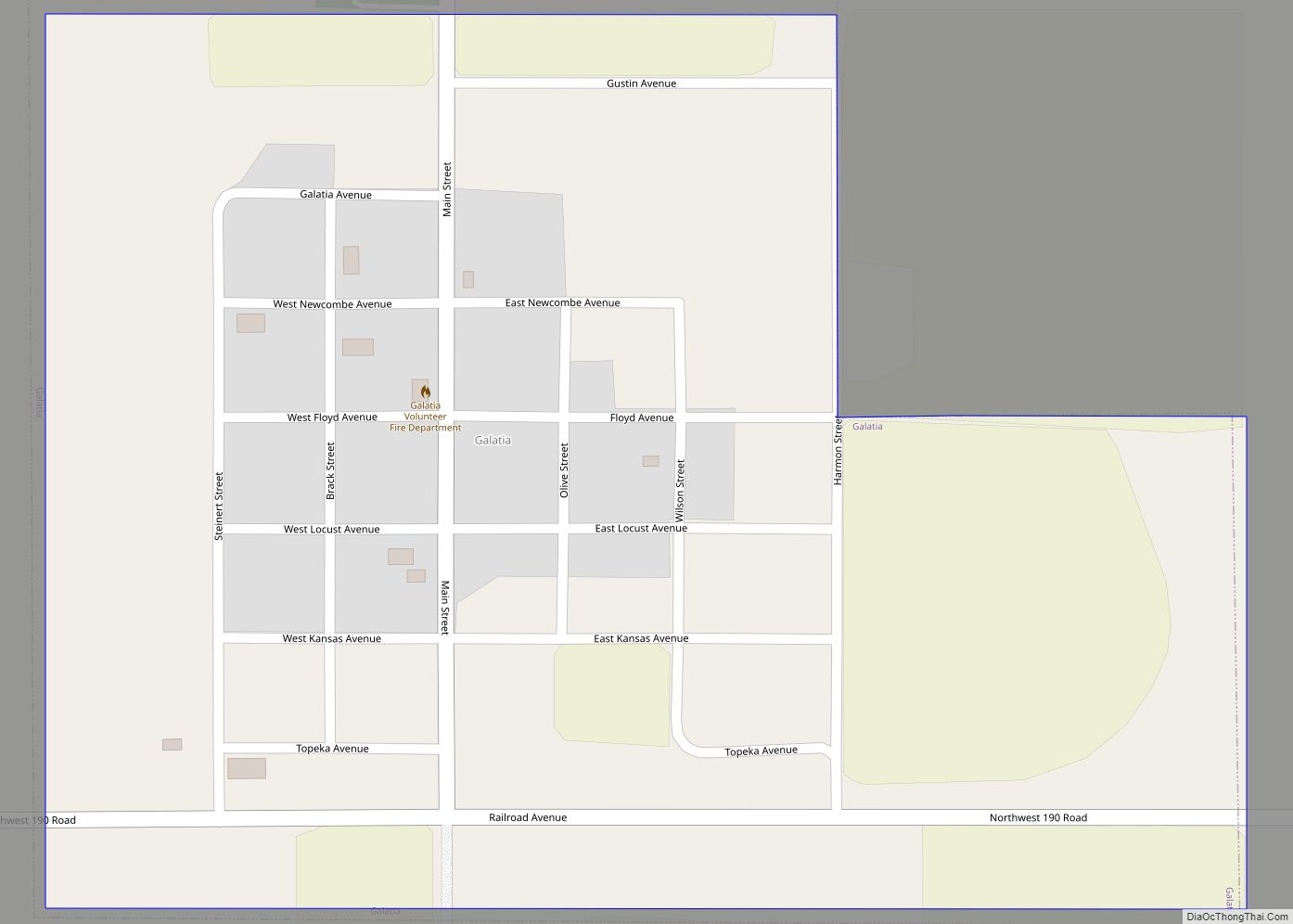
In 1854, the Kansas Territory was organized, then in 1861 Kansas became the 34th U.S. state. In 1867, Barton County was established and named for Clara Barton. It is the only Kansas county named for a woman.
In 1878, Atchison, Topeka and Santa Fe Railway and parties from Marion County and McPherson County chartered the Marion and McPherson Railway Company. In 1879, a branch line was built from Florence to McPherson, in 1880 it was extended to Lyons, in 1881 it was extended to Ellinwood. The line was leased and operated by the Atchison, Topeka and Santa Fe Railway. The line from Florence to Marion, was abandoned in 1968. In 1992, the line from Marion to McPherson was sold to Central Kansas Railway. In 1993, after heavy flood damage, the line from Marion to McPherson was abandoned. The original branch line connected Florence, Marion, Canada, Hillsboro, Lehigh, Canton, Galva, McPherson, Conway, Windom, Little River, Mitchell, Lyons, Chase, Ellinwood.
21st century
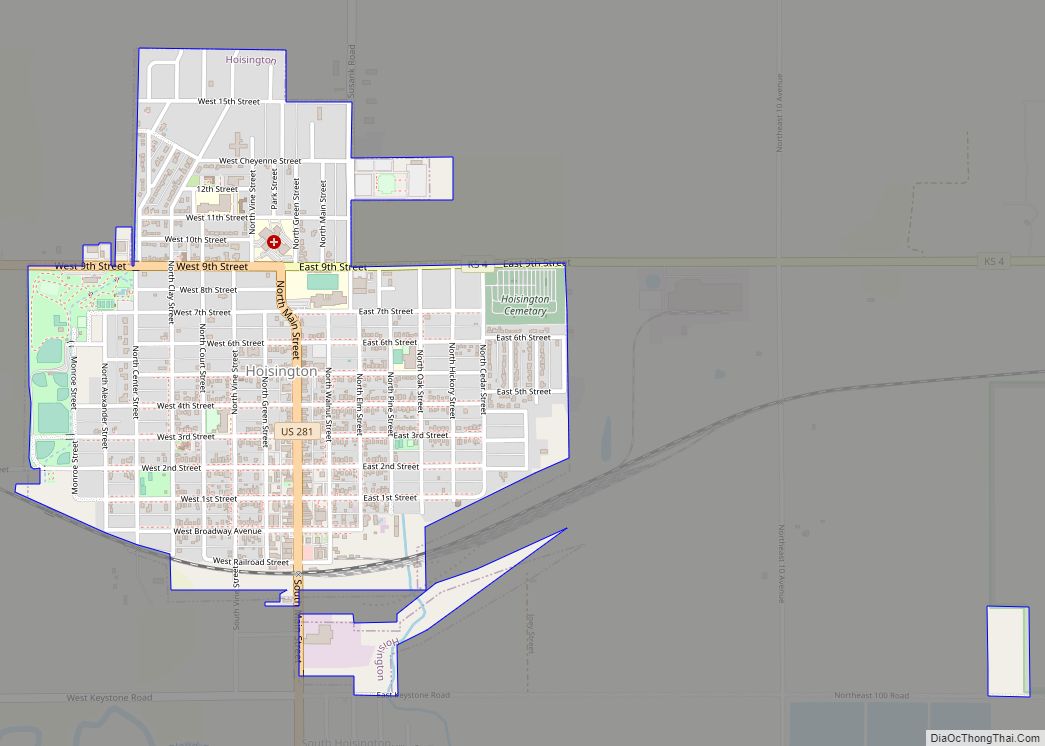
In 2001, an F4 tornado hit Hoisington during Hoisington High School’s prom.
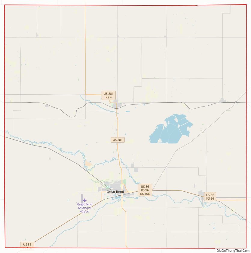
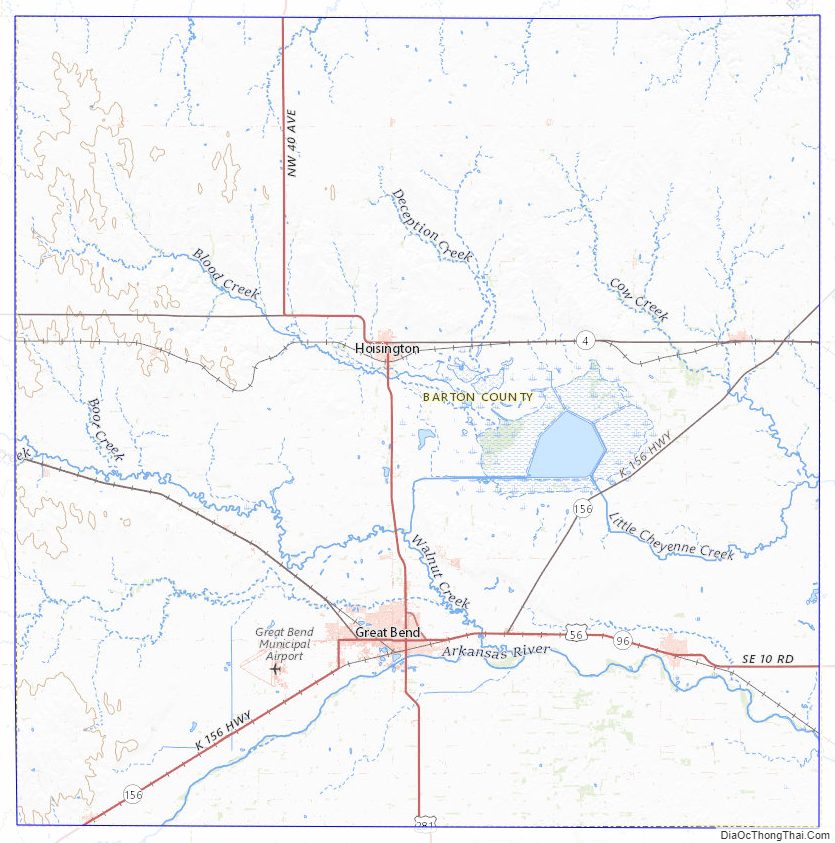
Barton County Road Map

Geography
Barton County was drawn in the shape of a 30-by-30-mile (48 by 48 km) square. According to the U.S. Census Bureau, the county has a total area of 901 square miles (2,330 km), of which 895 square miles (2,320 km) is land and 5.2 square miles (13 km) (0.6%) is water. The geographic center of Kansas is located in Barton County.
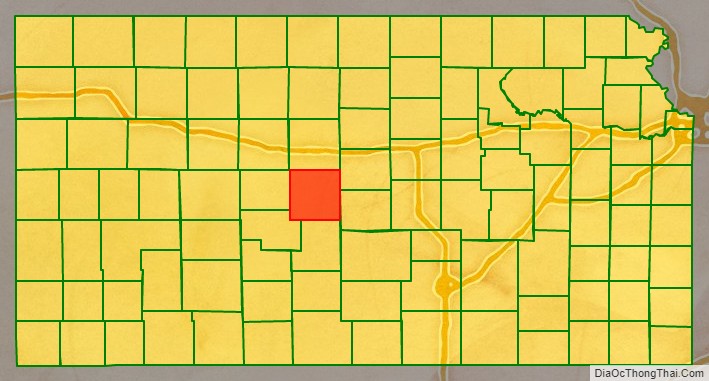
Adjacent counties
- Ellis County (northwest)
- Russell County (north)
- Ellsworth County (northeast)
- Rice County (southeast)
- Stafford County (south)
- Pawnee County (southwest)
- Rush County (west)
Major highways
Sources: National Atlas, U.S. Census Bureau
- U.S. Route 56
- U.S. Route 281
- Kansas Highway 4
- Kansas Highway 96
- Kansas Highway 156
Barton County Topographic Map
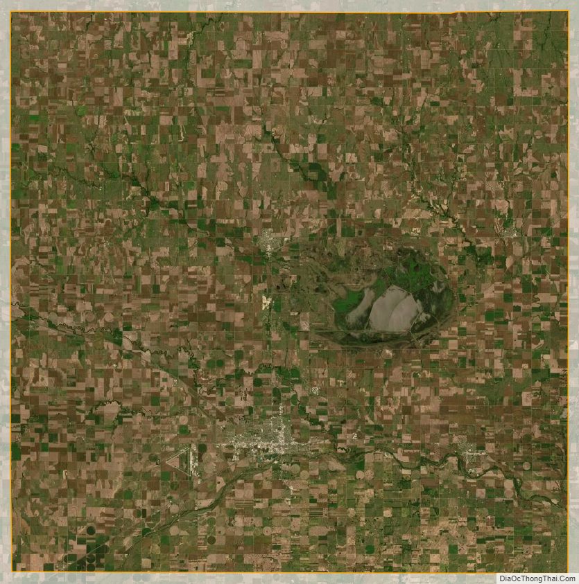
Barton County Satellite Map
Barton County Outline Map