Lake County is a county in the U.S. state of Ohio. As of the 2020 census, the population was 232,603. The county seat is Painesville. The county was established on March 6, 1840, from land given by Cuyahoga and Geauga Counties. Its name is derived from its location on the southern shore of Lake Erie. Lake County is part of the Cleveland-Elyria, OH Metropolitan Statistical Area.
| Name: | Lake County |
|---|---|
| FIPS code: | 39-085 |
| State: | Ohio |
| Founded: | March 6, 1840 |
| Named for: | Lake Erie |
| Seat: | Painesville |
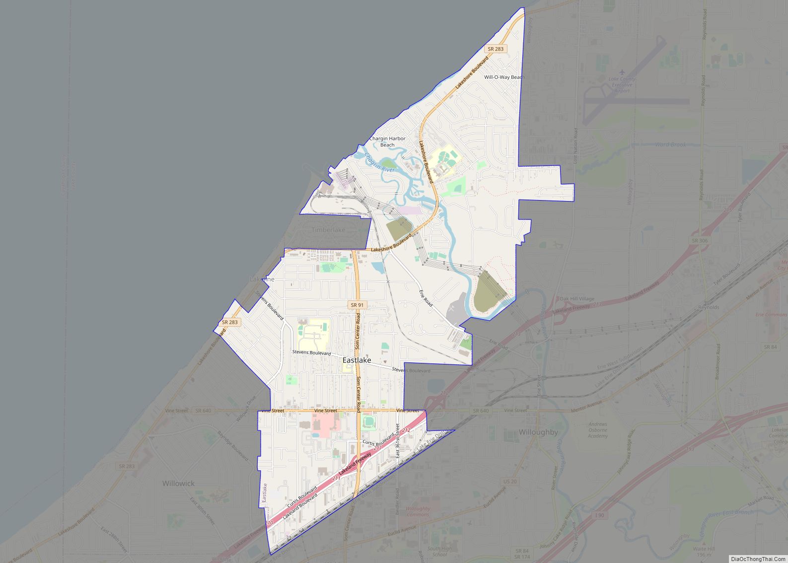
| Largest city: | Mentor |
| Total Area: | 979 sq mi (2,540 km²) |
| Land Area: | 227 sq mi (590 km²) |
| Total Population: | 232,603 |
| Population Density: | 240/sq mi (92/km²) |
| Time zone: | UTC−5 (Eastern) |
| Summer Time Zone (DST): | UTC−4 (EDT) |
| Website: | www.lakecountyohio.gov |
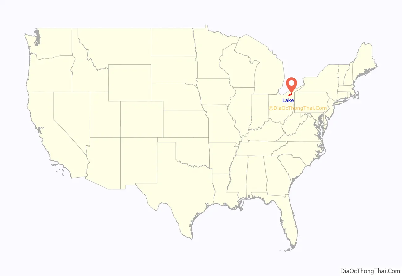
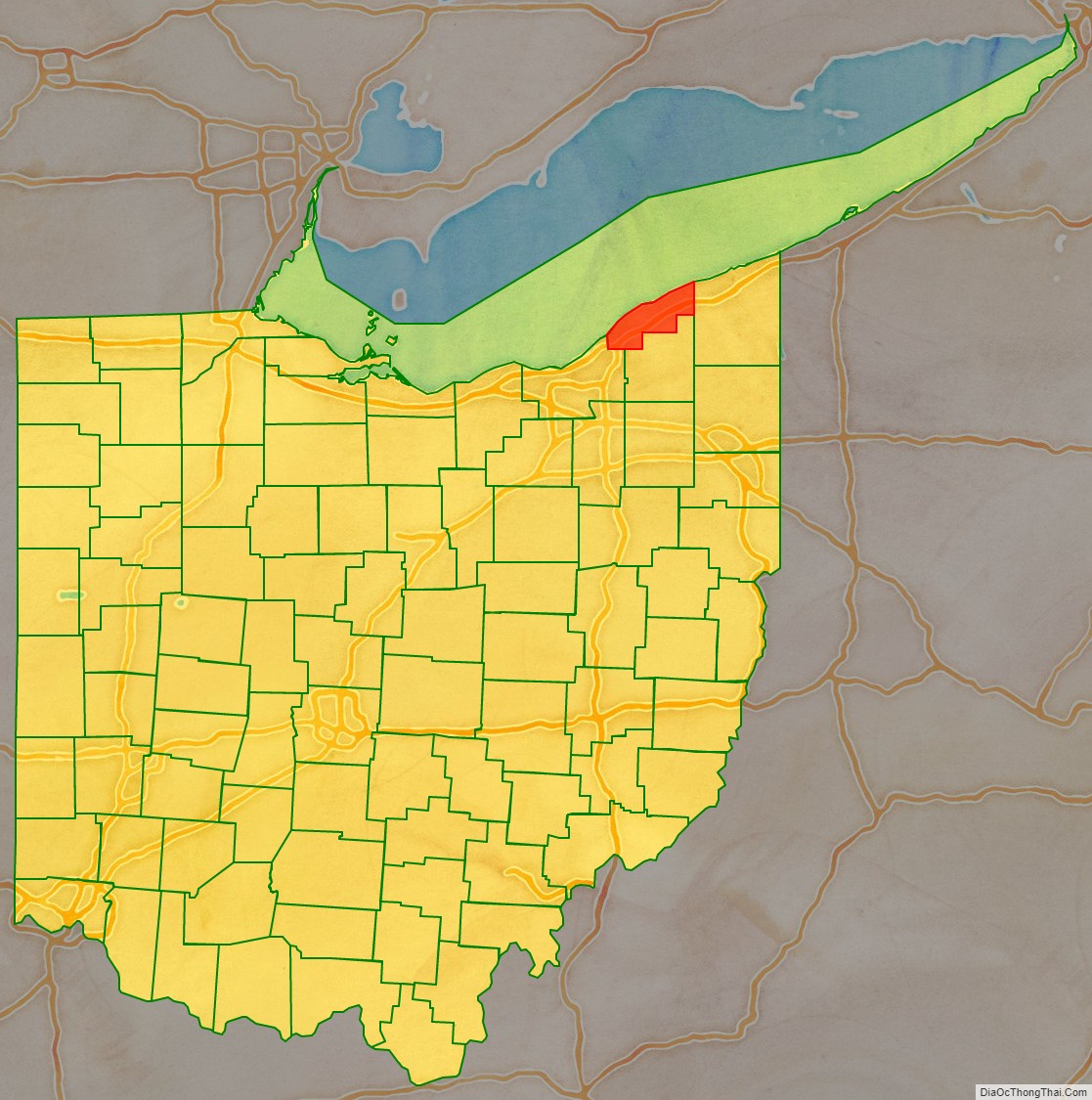
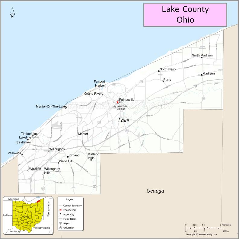
Lake County location map. Where is Lake County?
History
The land that became Lake County was home to the indigenous Erie people prior to the arrival of the French in the region during the early 1600s, and considered by the French to be part of their Colony of New France. Ceded to Great Britain in 1763, the area became part of the Province of Quebec through the Quebec Act of 1774. Following the American Revolutionary War, it became part of the Connecticut Western Reserve in the Northwest Territory, then was purchased by the Connecticut Land Company in 1795. It was separated out of Geauga County in 1808.
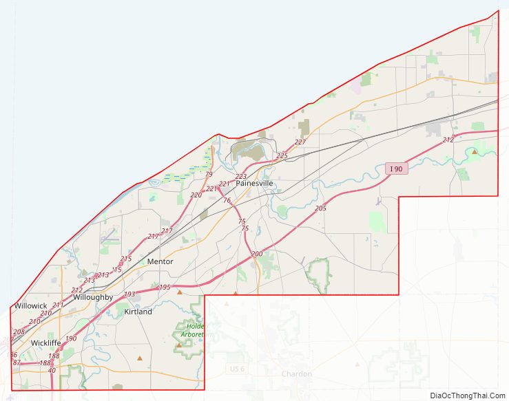
Lake County Road Map
Geography
According to the United States Census Bureau, the county has an area of 979 square miles (2,540 km), of which 227 square miles (590 km) is land and 752 square miles (1,950 km) (77%) is water. It is Ohio’s smallest county by land area but the third-largest by total area. It borders Ontario across Lake Erie.
Adjacent counties
- Ashtabula County (east)
- Geauga County (south)
- Cuyahoga County (south and west)
Major highways
- I-90
- I-271
- US 6
- US 20
- SR 2
- SR 44
- SR 84
- SR 86
- SR 91
- SR 174
- SR 283
- SR 306
- SR 307
- SR 528
- SR 535
- SR 608
- SR 615
- SR 633
- SR 640
National protected area
- James A. Garfield National Historic Site
Physical geography
Ridges on the Lake Plain physiographic region, and on which some roads are laid, are beaches formed by the various glacial lakes which occurred as the glaciers receded. Lake Maumee was the highest glacial lake at about 760 feet, and left Maumee II beach. Whittlesey beach, formed by Lake Whittlesey at 740 feet, is known as South Ridge. Arkona beach (Lake Arkona) is Middle Ridge, and occurs at about 690 feet. North Ridge is the remnant of Warren beach (Lake Warren), at an elevation of 685 feet. Elkton beach is the northernmost ridge, at 625 feet, an occurred at the time of Lake Elkton. Lake Shore Boulevard follows Elkton beach in Mentor Township.
Mentor Marsh is an Ohio State Nature Preserve. Mentor Marsh is an abandoned channel of the Grand River.
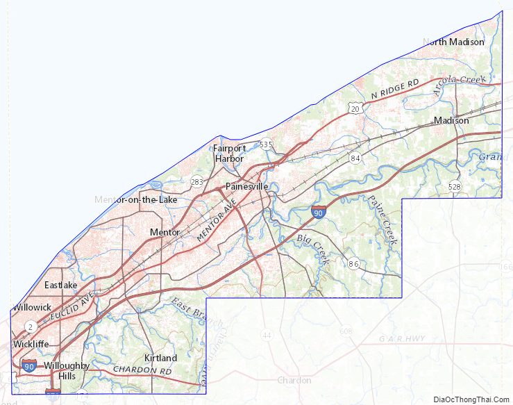
Lake County Topographic Map
Lake County Satellite Map
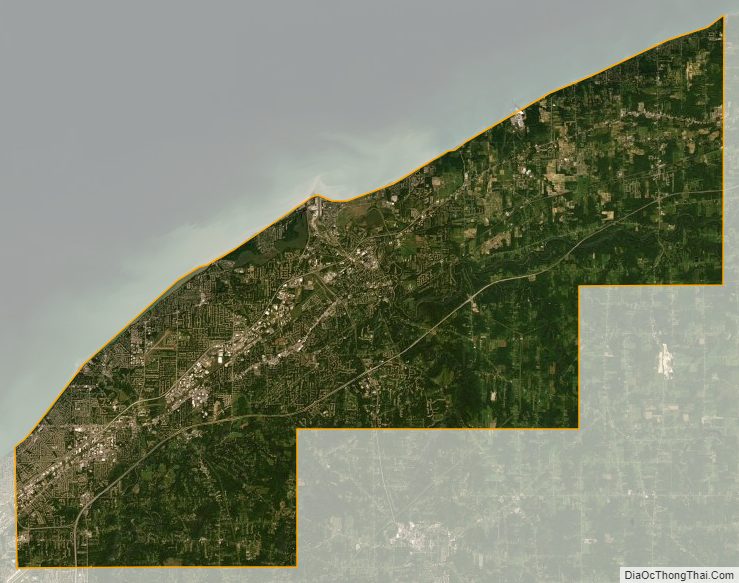
Lake County Outline Map